Storm Chase Log 22 May 2019
Chasers: Dorian J. Burnette, Preston Bradley, Jeff House, and Bryan Wade
Preliminary Destination: Coffeyville, KS
Note: Images have been decreased in size. Click on an image to view a larger version.
This turned out to be a very interesting day. Several days prior to this event, we thought the 22nd might be our off-day in the four-day chase sequence in the Plains. Little tweaks in timing, less height rises leading to a breakable cap, and the ideal placement of surface boundaries though resulted in this day becoming the most destructive day of the four-day long sequence. A complex surface setup with a cold front in place over KS and OK and warm front/residual outflow boundary moving northward from eastern OK and AR into southeastern KS and southern MO increased uncertainty in how far east thunderstorms might develop during the mid- to late-afternoon. Thus, we chose a spot far enough downstream that would allow us to intercept any cells developing well in advance of the cold front. My friend, Bryan Wade, from the Kansas Highway Patrol was able to join us on this chase, so we picked him up on our way to Coffeyville, KS.
At 3:32 p.m. CDT, PDS (particularly dangerous situation) tornado watch number 212 was issued, but development in our area struggled for about another hour. We watched visible satellite like a hawk, and it became increasingly clear that while some thunderstorms would fire along the cold front to our west, more serious activity would develop much farther downstream. As 5:30 p.m. approached, new development was spotted to our south, and it was time to move.
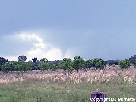
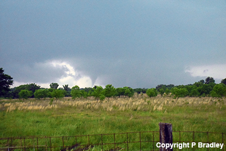
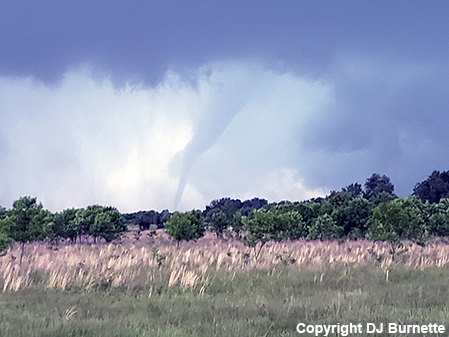
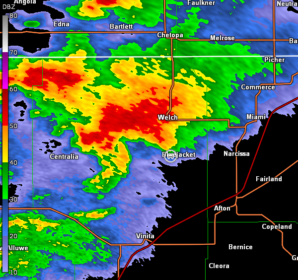
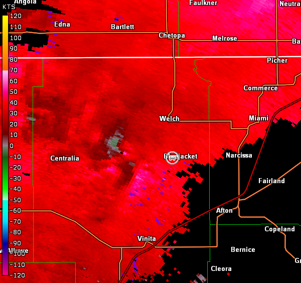
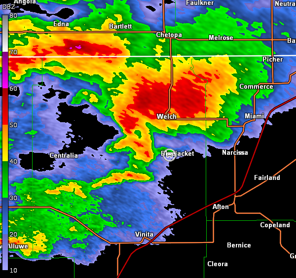
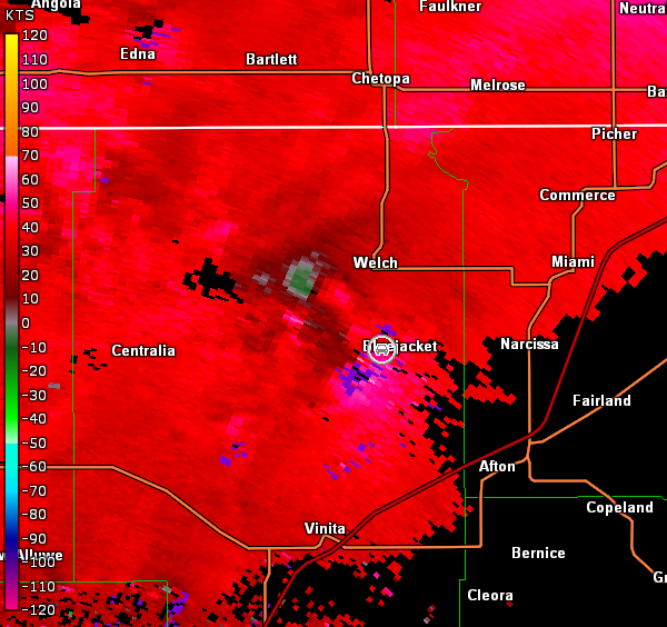
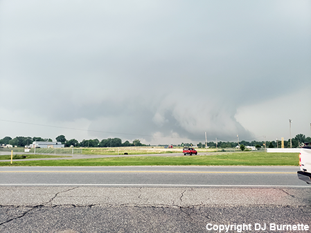
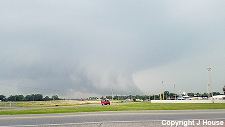
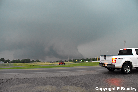
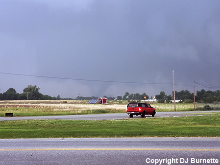
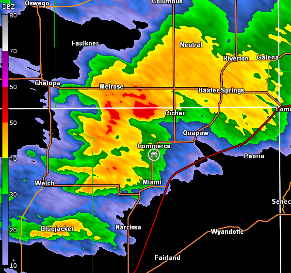
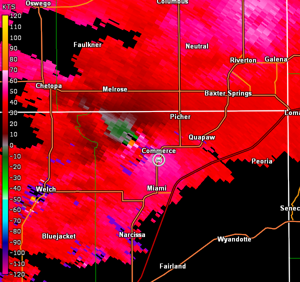
We moved east on U.S. 166 to U.S. 69 and then took that south into Miami, OK. What happened next was one of the easiest tornado intercepts I have ever had (or perhaps it just seemed that way after the struggle to intercept tornadoes not wrapped in rain back on the 20th). We continued south on U.S. 69 out of Miami and noted a tornadic supercell to our southwest. As we approached Narcissa, OK, it was noted that OK-25 would easily take us over to the correct area of the storm provided no flood waters were encountered (in May 2019 flooding had closed portions of many roads and highways which complicated chasing), so we moved west on OK-25 through Bluejacket, OK, where tornado sirens were sounding. As we cleared the town and crested a hill, a tornado was observed to our west-northwest (images below; view is west of Bluejacket, looking west-northwest). Radar imagery are also below (car symbol denotes our location).
Tulsa, OK Storm Relative Velocity 2349Z
Tulsa, OK Base Reflectivity 2356Z
Tulsa, OK Storm Relative Velocity 2356Z
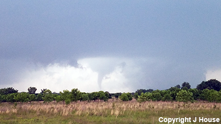
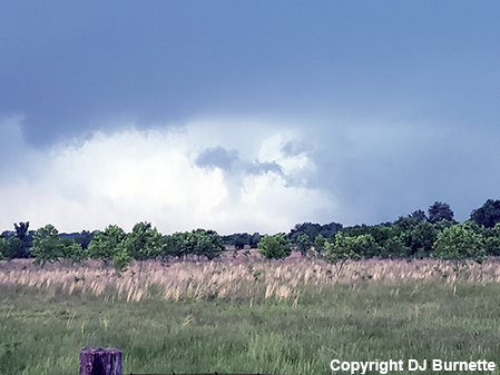
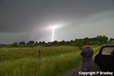
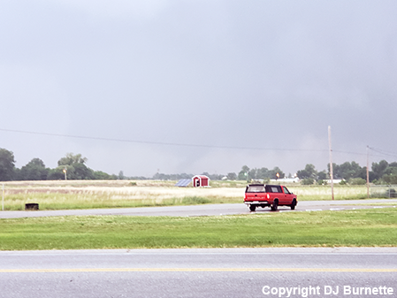
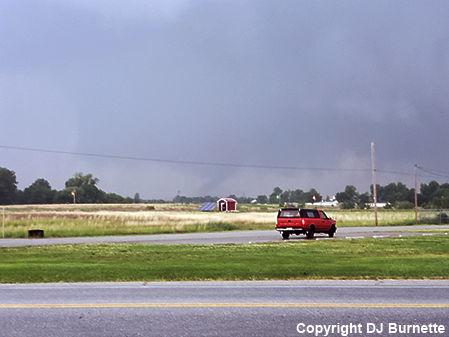
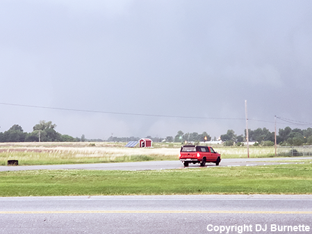
After the tornado dissipated, we moved back east on OK-25 through Bluejacket to Narcissa and then back north on U.S. 69 toward Miami to keep up with the storm. As we approached and moved through Miami, we observed the development of a very large wall cloud. Unfortunately, our view was obstructed due to the city buildings and trees, but as we cleared the town of North Miami, OK, we could easily see the wall cloud. We stopped to take pictures, and I was about to tweet out a report of the large wall cloud, when a new tornado developed and quickly grew in size (images below; view is north of North Miami and south of Commerce, looking northwest; note that the tornado images include an enhanced version). Radar showed rain wrapping around the circulation, which was obscuring our view (images below; car symbol denotes our location).
The quick development of the large tornado made us get a little farther behind the storm as we took pictures and I sent out a tweet to report it. This ultimately led to a problem as we attempted to continue north following the storm--a roadblock in Commerce. We had to spend about 10 minutes going around it. We then ran into another roadblock in Quapaw, OK, and once again had to spend time getting around it. Meanwhile, as the storm was crossing into southwestern MO, we heard the dreaded "tornado emergency" statement with a large tornado moving north of Joplin. Eventually, we got to the U.S. 400 and I-44 interchange, but by this time, the storm had run away from us and darkness was approaching. Thus, we headed back to Wichita for the night ahead of our last chase day of this sequence on the 23rd.