Storm Chase Log 20 May 2019
Chasers: Dorian J. Burnette, Preston Bradley, and Jeff House
Preliminary Destination: Shamrock, TX
Note: Images have been decreased in size. Click on an image to view a larger version.
This was the first of a four-day long storm chasing trip into the Plains. We started our morning in Elk City, OK, and happened to run into Reed Timmer as we were preparing to leave. After seeing him and his crew, we headed west on I-40 to Shamrock, TX. While we had considered dropping farther south toward Childress, TX, we decided to hold in Shamrock for a while. PDS (particularly dangerous situation) tornado watch number 197 was issued for western TX and much of the Panhandle at 12:35 p.m. CDT. Shortly after 1 p.m. CDT, we became more nervous about our position, which was right along the front and in poor visibility. Thus, we dropped south to Wellington, TX and watched thunderstorm development to our southwest.
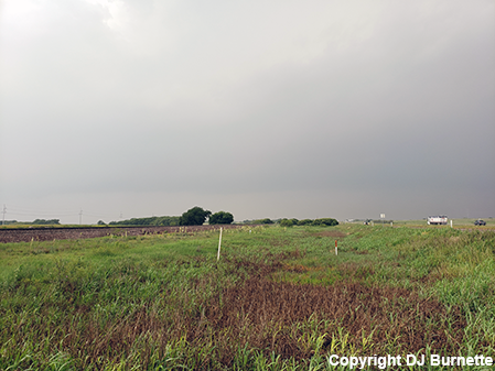
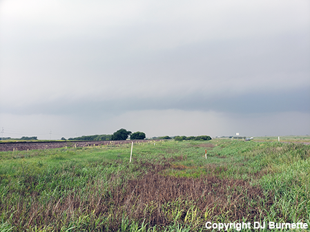
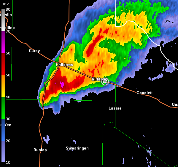
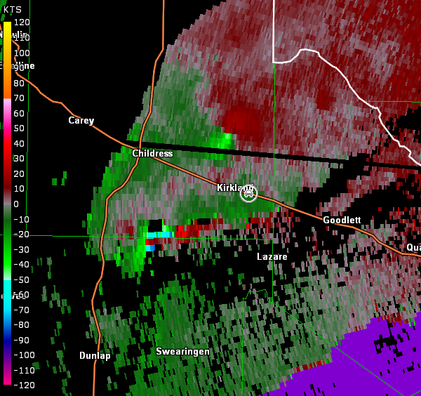
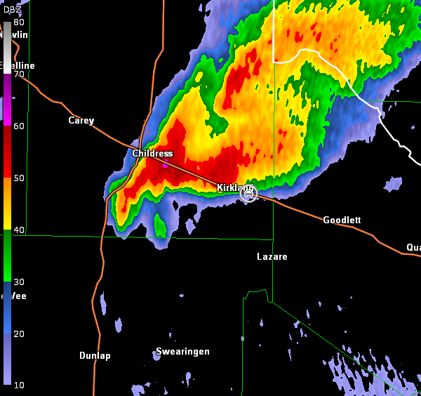
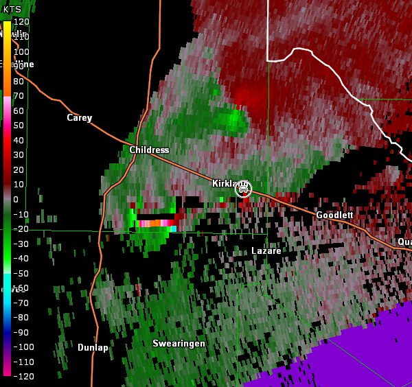
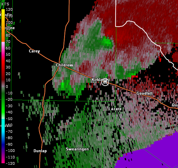
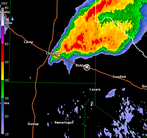
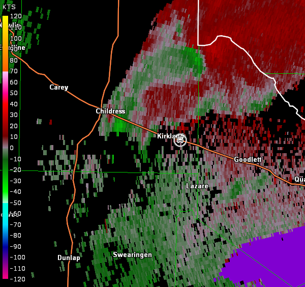
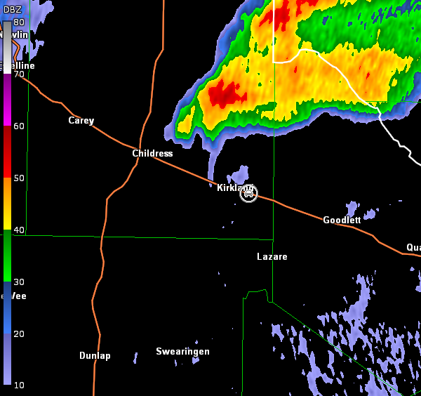
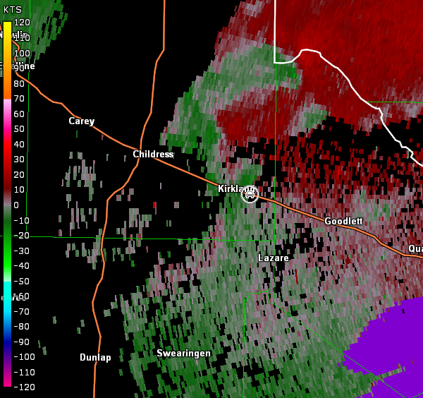
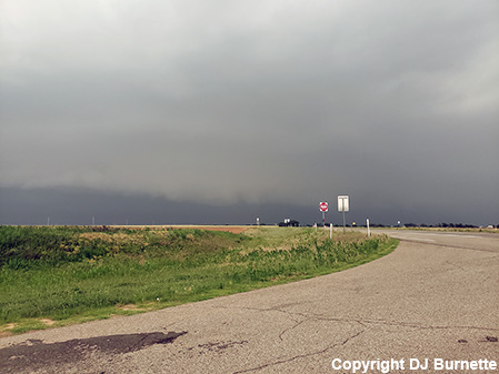
We continued farther on U.S. 83 into Childress and sat there for a little bit watching storms mature to our southwest. Unfortunately, we were out of position (northwest of the storms) and spent a lot of time swinging around the forward-flank on a road network that would not cooperate, before we could attack a tornadic storm from a better angle. This cost us to miss a confirmed tornado. By the time we caught up with the storm in vicinity of Kirkland, the first circulation was well off to our north, but the cell farther southwest continued to look interesting (radar images below; car symbol denotes our location). Complex cell interaction occurred, while we were watching, and we never saw anything more than a rain-free base (images below; view east-southeast of Kirkland, looking west).
Frederick, OK Storm Relative Velocity 2053Z
Frederick, OK Base Reflectivity 2059Z
Frederick, OK Storm Relative Velocity 2059Z
Frederick, OK Base Reflectivity 2104Z
Frederick, OK Storm Relative Velocity 2104Z
Frederick, OK Base Reflectivity 2109Z
Frederick, OK Storm Relative Velocity 2109Z
Frederick, OK Base Reflectivity 2114Z
Frederick, OK Storm Relative Velocity 2114Z
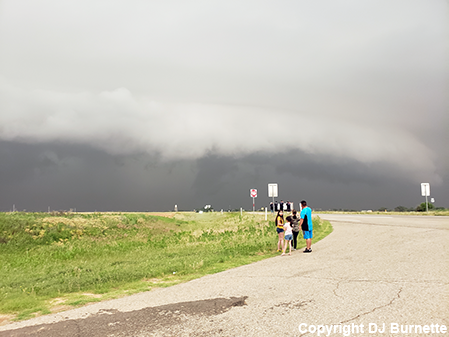
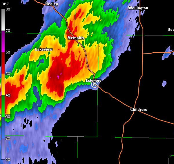
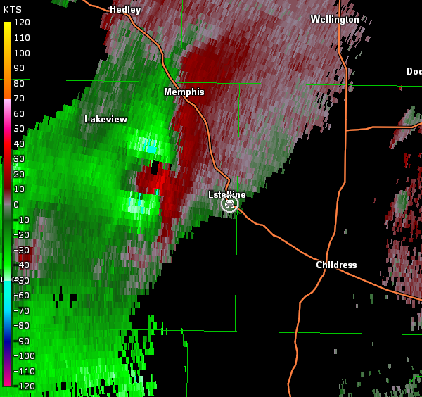
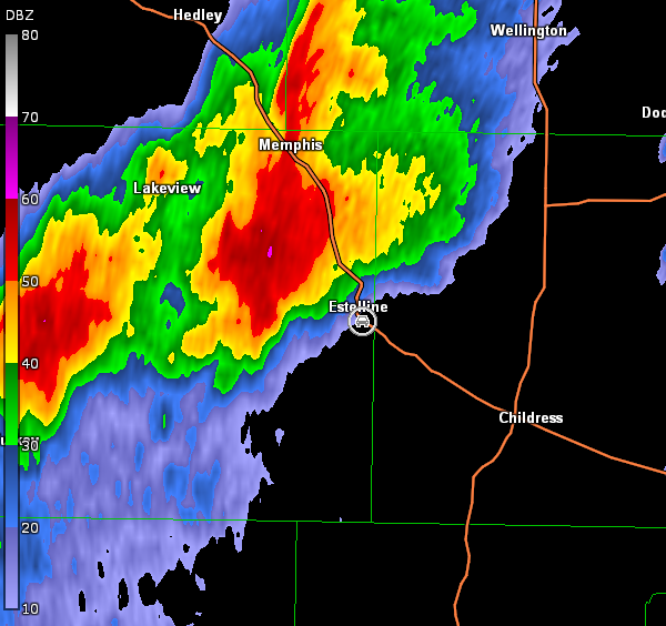
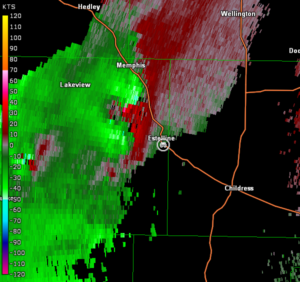
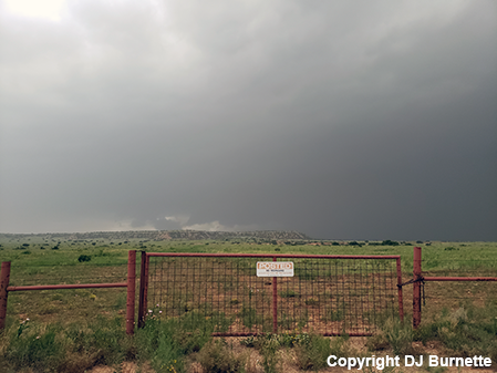
The storm continued moving to the northeast but crossed into an overall poor road network with limited Red River crossing options. The serious limitations of the road network discouraged us from continuing to chase it. Meanwhile, another storm southwest of Estelline, TX looked interesting on radar, so we moved west on U.S. 287 to intercept it. A tornado warning was issued on the storm as we approached Estelline. We stopped on U.S. 287 just south-southeast of Estelline to view the storm (images below; view south-southeast of Estelline, looking west). Unfortunately, the circulation was well wrapped-up in rain (radar images below; car symbol denotes our location).
Frederick, OK Storm Relative Velocity 2149Z
Frederick, OK Base Reflectivity 2155Z
Frederick, OK Storm Relative Velocity 2155Z
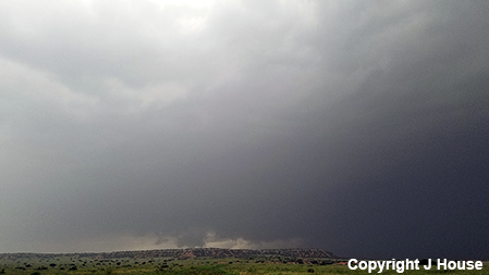
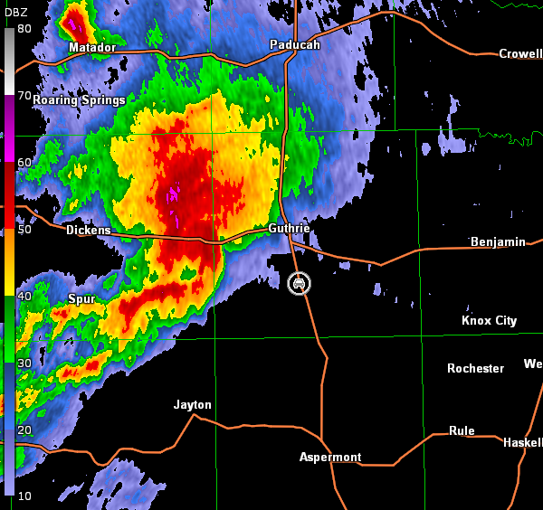
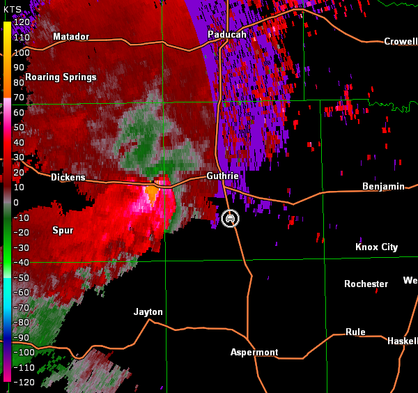
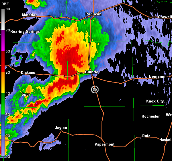
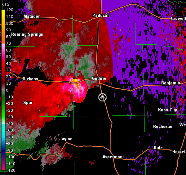
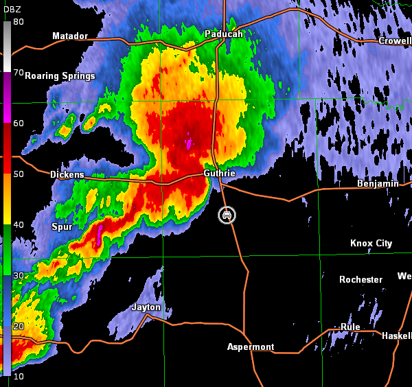
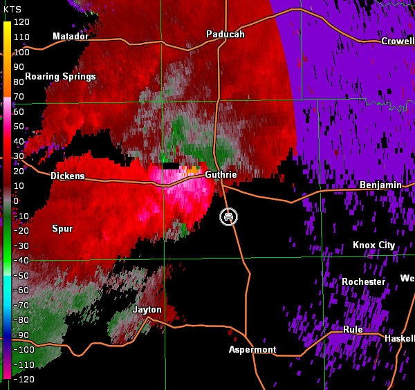
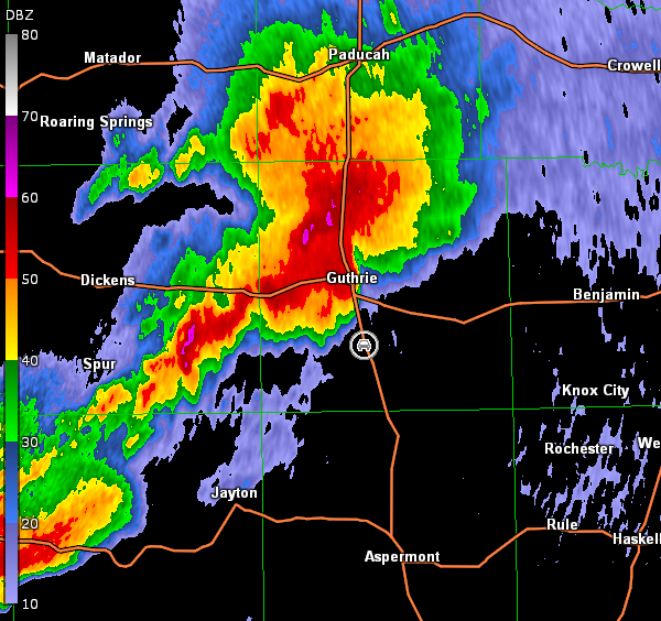
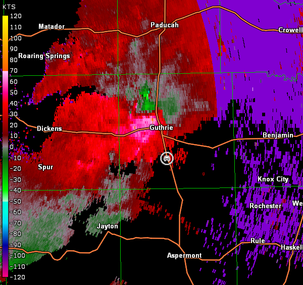
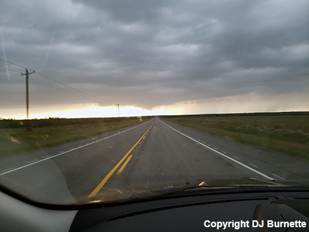
This messy situation forced us to retreat into Childress to reassess the situation. Additional scattered thunderstorms were noted farther to the south-southwest, so we decided to head south on U.S. 83 toward these storms. By the time we were halfway between Paducah, TX and Guthrie, TX, we heard a tornado warning had been issued on the storm to our southwest. We continued south into Guthrie and then moved west on U.S. 82 toward the storm. Unfortunately, we would never get a great intercept on the storm because it took a hard, right turn. We moved back east on U.S. 82, then south on U.S. 83, and finally stopped south of Guthrie to view the storm. We heard a report of a large and extremely dangerous tornado in progress, but radar data showed the circulation was all rain-wrapped once again (images below; car symbol denotes our location; note the switch to the Lubbock, TX radar). Therefore, we observed nothing other than low hanging scud well removed from the main circulation (images below; view south of Guthrie, looking west).
Lubbock, TX Storm Relative Velocity 2353Z
Lubbock, TX Base Reflectivity 2359Z
Lubbock, TX Storm Relative Velocity 2359Z
Lubbock, TX Base Reflectivity 0005Z
Lubbock, TX Storm Relative Velocity 0005Z
Lubbock, TX Base Reflectivity 0010Z
Lubbock, TX Storm Relative Velocity 0010Z
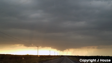
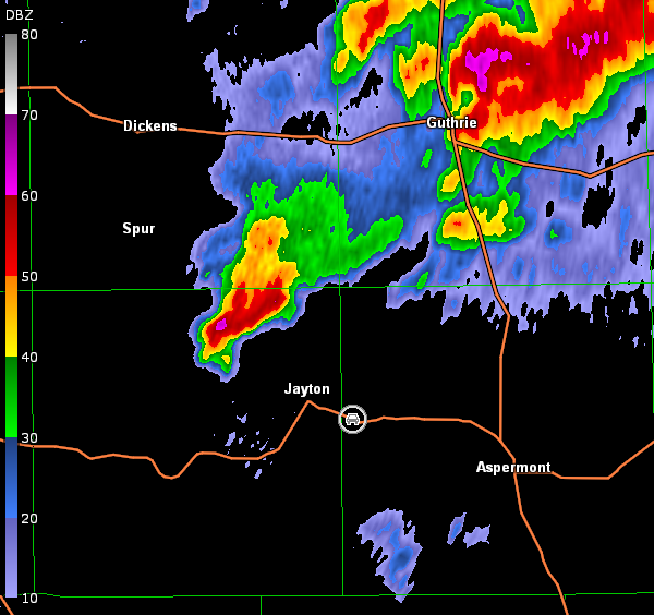
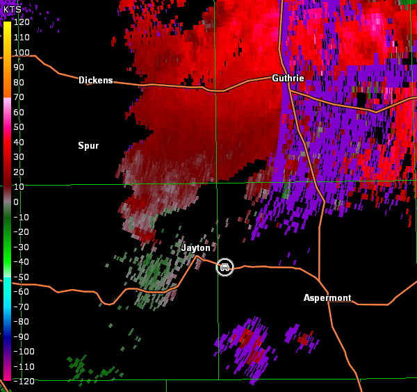
Another tornadic supercell was noted farther to our southwest, so we continued moving south on U.S. 83 and then west on U.S. 370. As we approached Jayton, TX from the southeast, we noted a modest lowering with the storm (images below), but no strong circulation was observed on radar (images below; car symbol denotes our location).
While additional severe thunderstorms were noted on radar farther to our south, odds were high that sunset would occur before we could get to them. Thus, we moved back west toward Lubbock, TX for the night. Our next day in the Plains, the 21st, was spent mainly getting into position for the next solid chase day on the 22nd. We did run into a few storms in southern KS though, but were out of position to get to the better setup farther to the north.