Storm Chase Log 23 May 2019
Chasers: Dorian J. Burnette, Preston Bradley, and Jeff House
Preliminary Destination: Canadian, TX
Note: Images have been decreased in size. Click on an image to view a larger version.
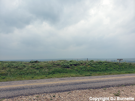
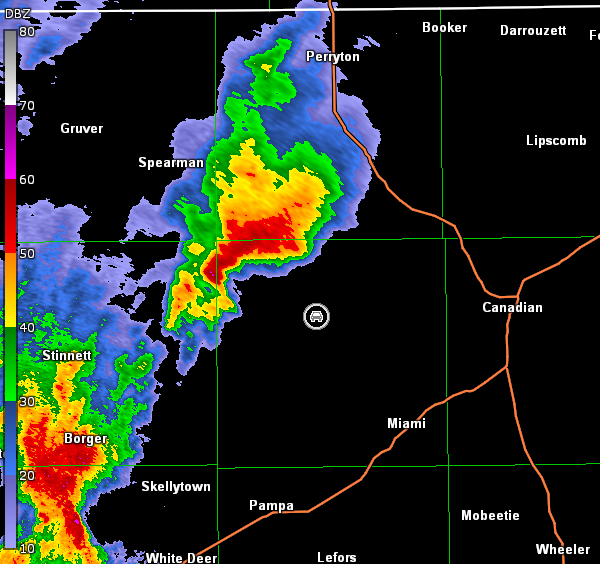
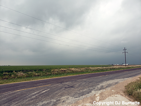
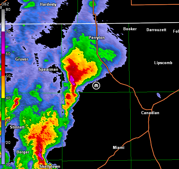
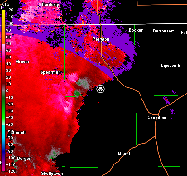
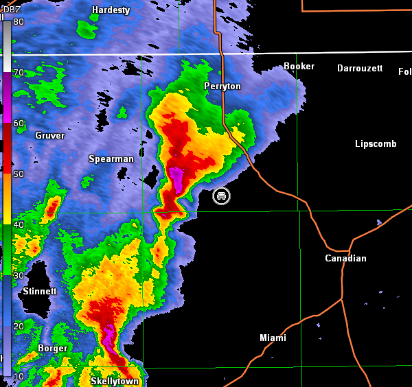
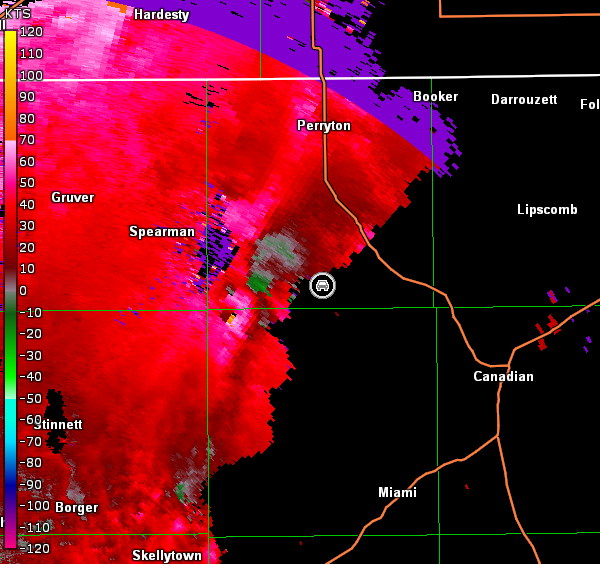
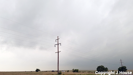
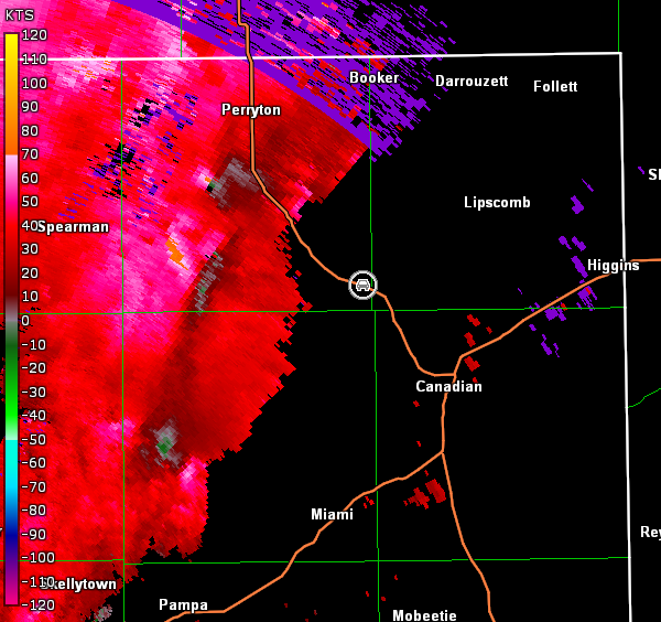
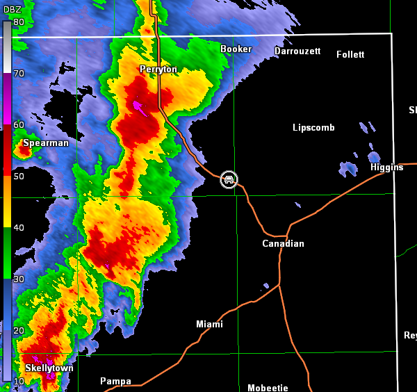
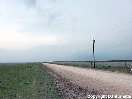
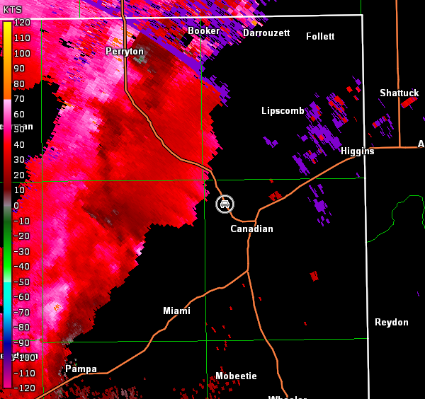
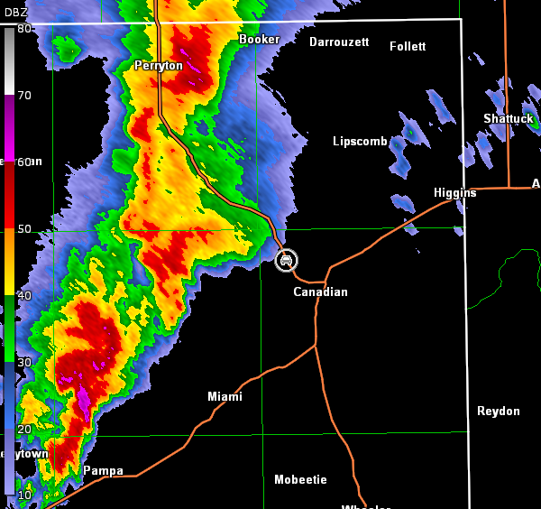
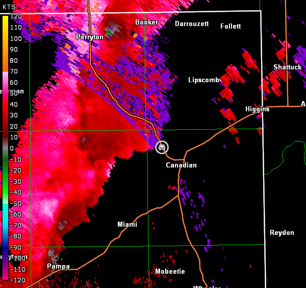
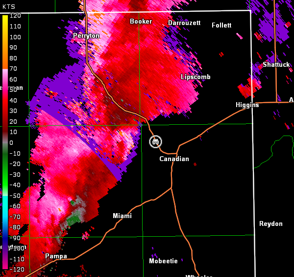
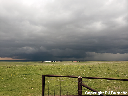
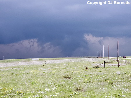
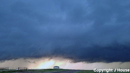
I was hoping that this final day of the storm chase sequence in the Plains would be in KS, but it was clear that overnight and early morning rainfall had reinforced the warm front farther to the south. Therefore, we were bound for the TX Panhandle. We arrived in Canadian, TX shortly after 4:30 p.m. and noted severe thunderstorms to our west. We decided to progress a bit farther south and then head west. As we arrived in Miami, TX, the storm to our west-northwest began to look even better, and we decided it was time to use farm roads to close in on the storm. A tornado warning was issued for the cell while we were still trying to catch up with it. Eventually, we made it TX-70 and stopped only briefly to reassess the situation. Nothing much was noted from our position (image below; view is from Farm Road 283/TX-70 interchange, looking west-northwest). Radar data showed the storm moving away from our position (images below; car symbol denotes our location), so there was no time to sit still.
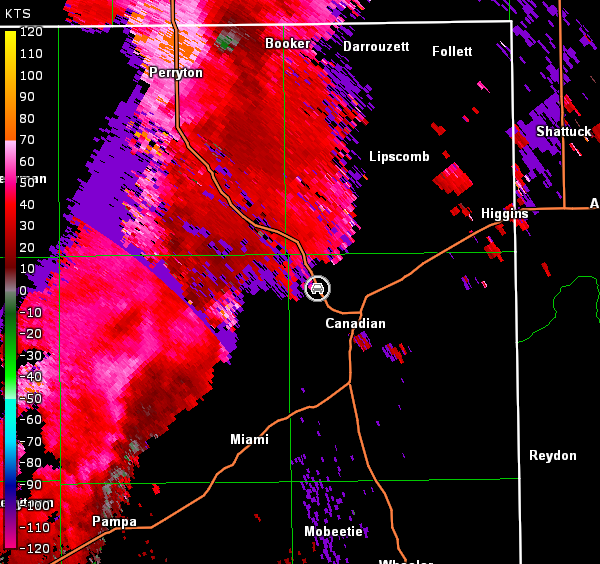
Amarillo, TX Storm Relative Velocity 2238Z
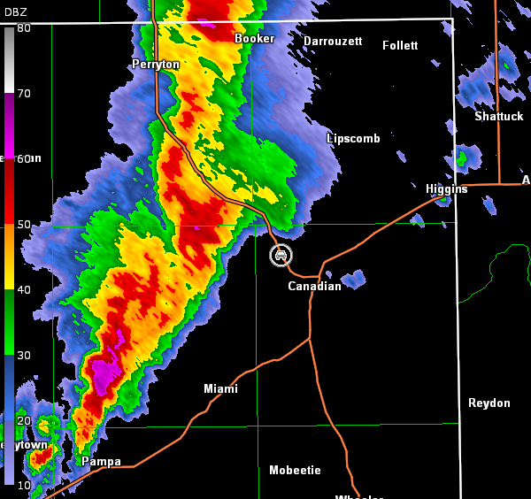
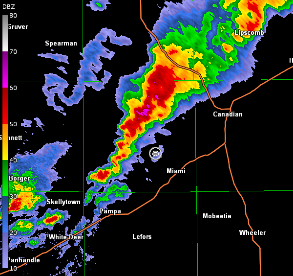
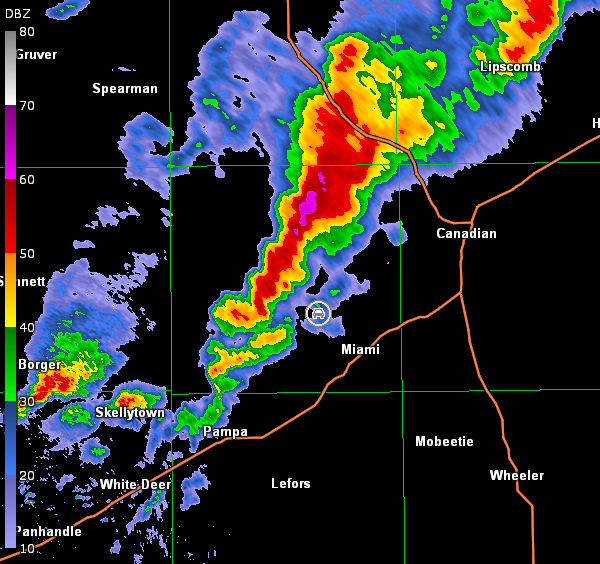
Amarillo, TX Base Reflectivity 2244Z
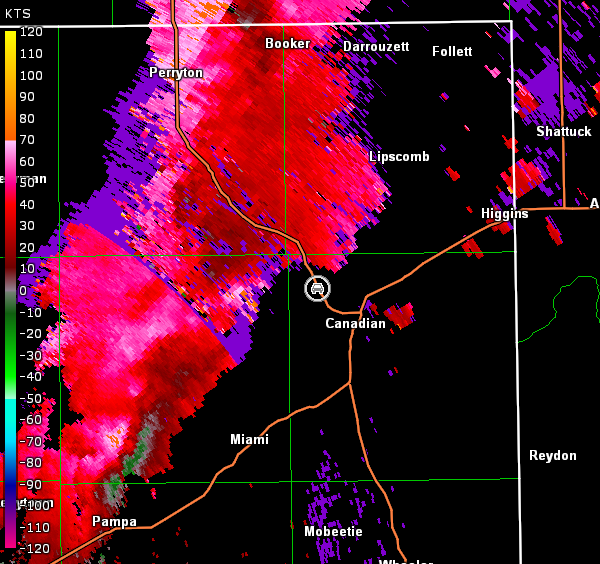
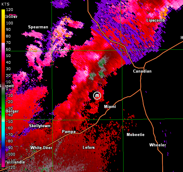
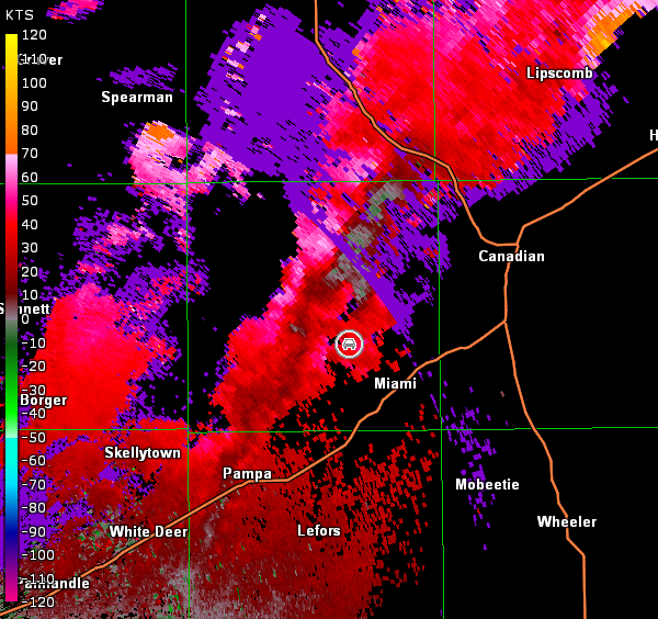
Amarillo, TX Storm Relative Velocity 2244Z
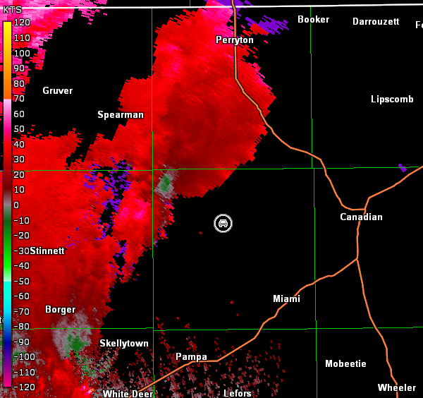
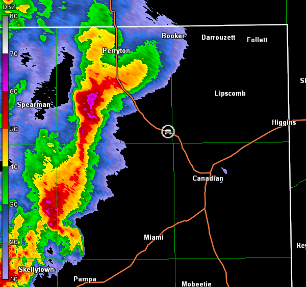
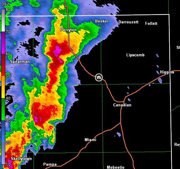
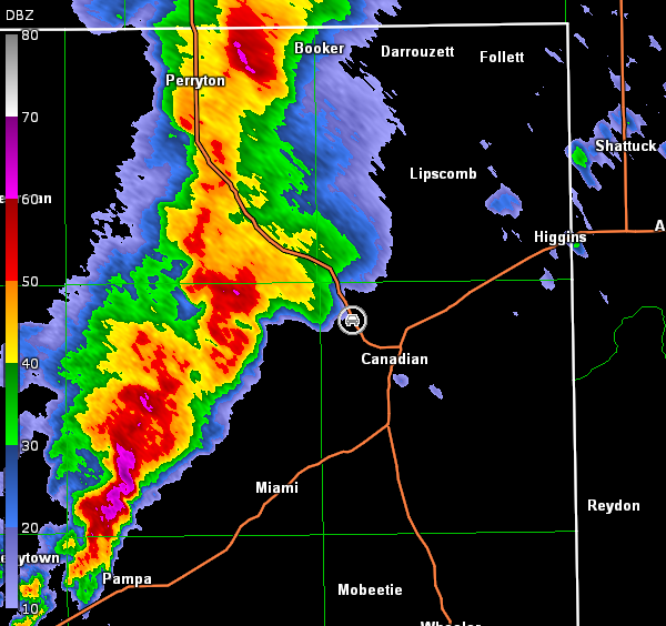
We continued north on TX-70, and ran into numerous chasers. We stopped again a little east of the TX-70/Farm Road 281 interchange to view the storm and plan out a route farther downstream of the numerous chasers. All we could see on the storm was a hint of a rain-free base given we were too far away (image below; view northwest of Canadian, looking west-southwest). Radar showed a hook echo with some rotation (images below; car symbol denotes our location).
Amarillo, TX Storm Relative Velocity 2256Z
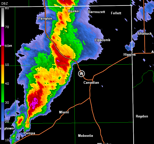
Amarillo, TX Base Reflectivity 2302Z
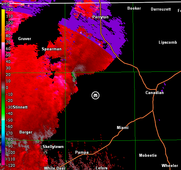
Amarillo, TX Storm Relative Velocity 2302Z
We decided to move east on Farm Road 281 to U.S. 83 and stopped again to reassess trends given the numerous chasers on the present storm and another tornado-warned storm moving up on our position from the southwest (radar images below; car symbol denotes our location). Once again, nothing of significance was observed from our location, since we were well away from the storm (images below; view northwest of Canadian, looking southwest).

Amarillo, TX Storm Relative Velocity 2314Z
Amarillo, TX Base Reflectivity 2320Z
Amarillo, TX Storm Relative Velocity 2320Z
Amarillo, TX Base Reflectivity 2326Z
Amarillo, TX Storm Relative Velocity 2326Z
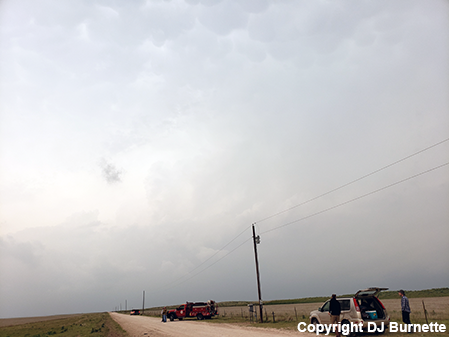
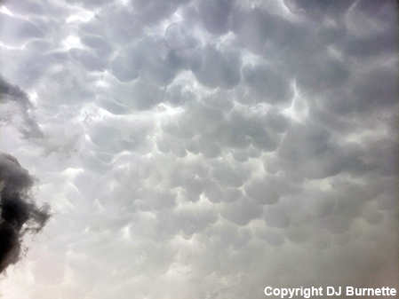
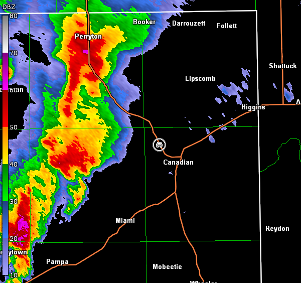
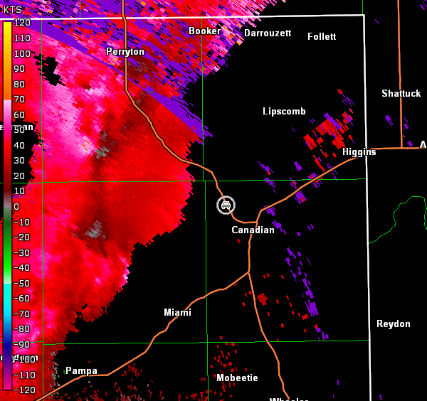
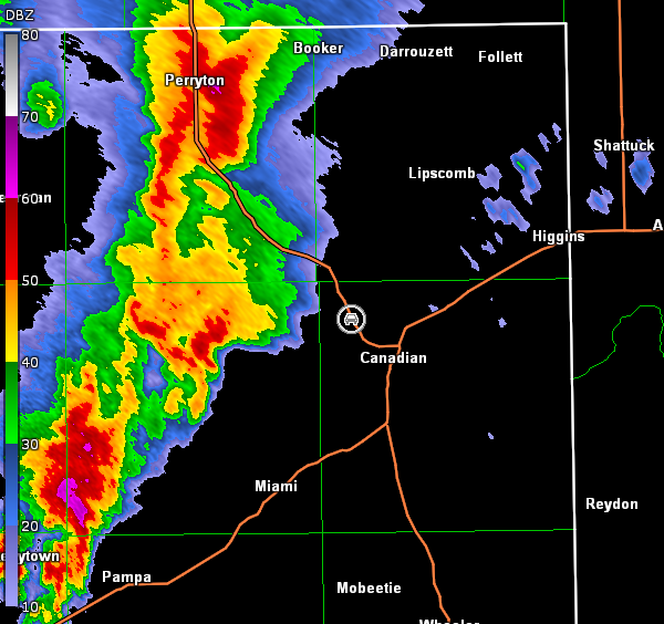
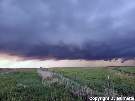
Given another tornadic thunderstorm was moving up on our location from the southwest, we decided to move a little farther south to improve our position. We took U.S. 83 a bit south toward Canadian, but then stopped on a dirt road to allow the storm to move closer to our position. Additional storm chasers/spotters joined us, as we sat in this location for about 30 minutes. Eventually, we observed mammatus clouds at our location (images below; view is northwest of Canadian, looking west), but that was all we observed. We also noted that the storm appeared to be becoming absorbed more into a line with time on the radar (images below; car symbol denotes our location).
Amarillo, TX Storm Relative Velocity 2332Z
Amarillo, TX Base Reflectivity 2339Z
Amarillo, TX Storm Relative Velocity 2339Z
Amarillo, TX Base Reflectivity 2345Z
Amarillo, TX Storm Relative Velocity 2345Z
Amarillo, TX Base Reflectivity 2351Z
Amarillo, TX Storm Relative Velocity 2351Z
Amarillo, TX Base Reflectivity 2356Z
Amarillo, TX Storm Relative Velocity 2356Z
Amarillo, TX Base Reflectivity 0002Z
Amarillo, TX Storm Relative Velocity 0002Z
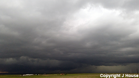
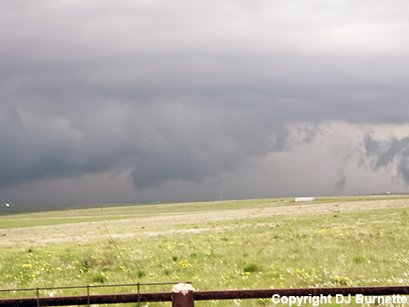
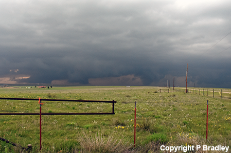
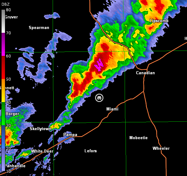
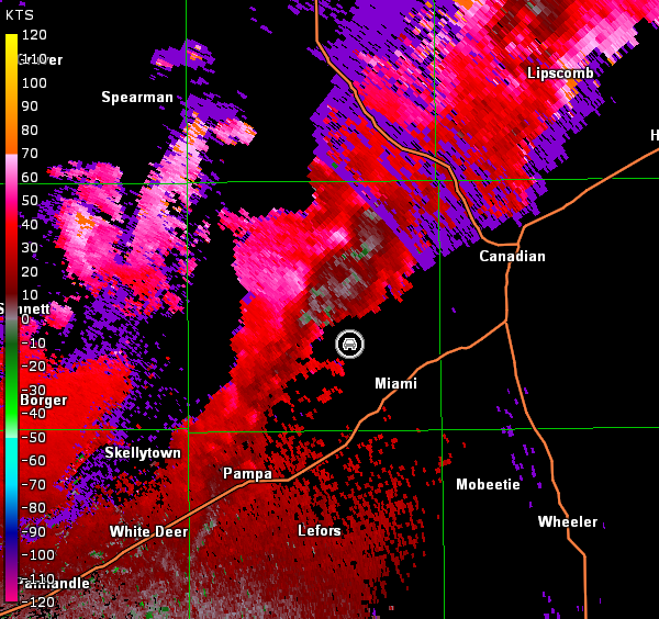
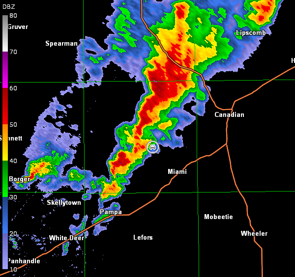
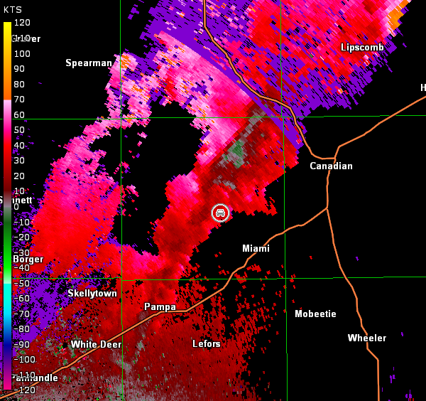
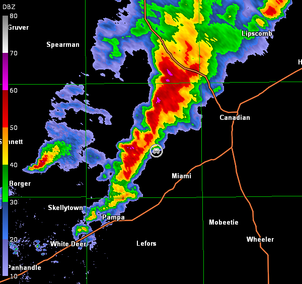
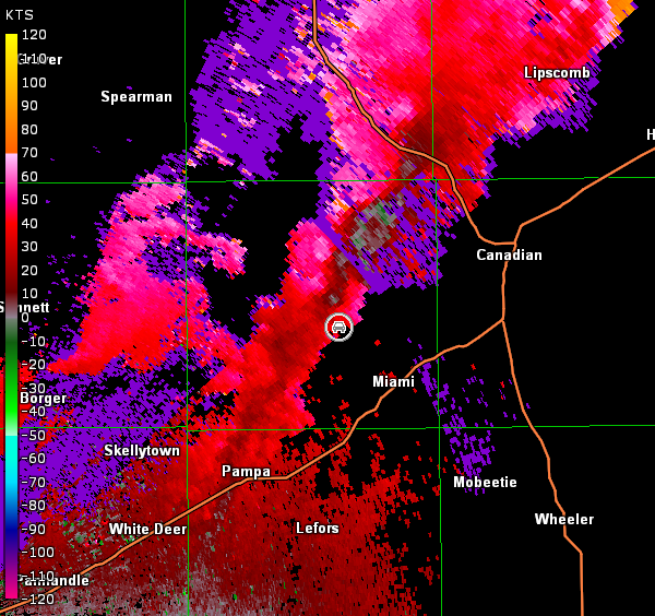
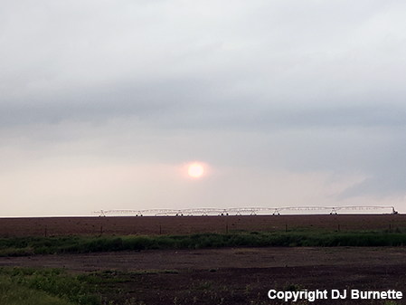
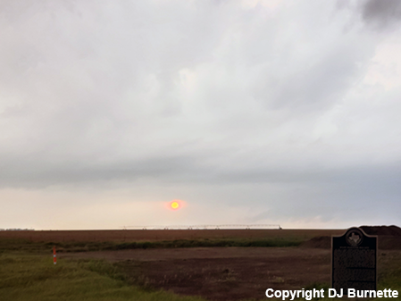
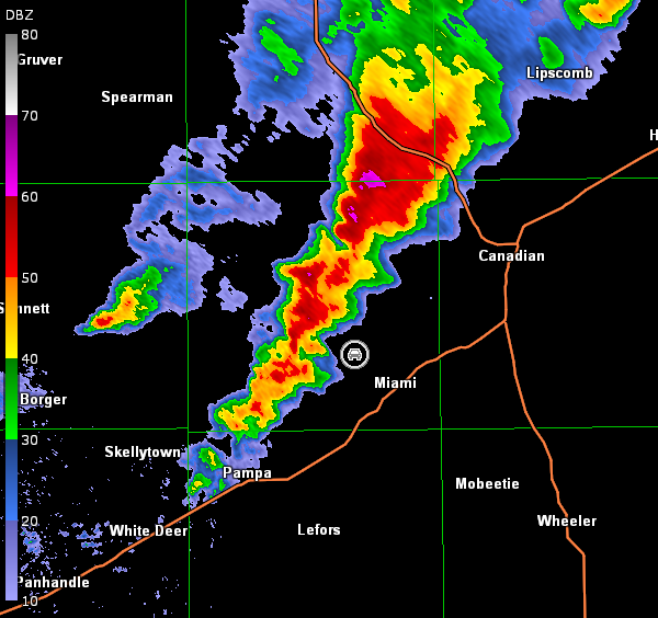
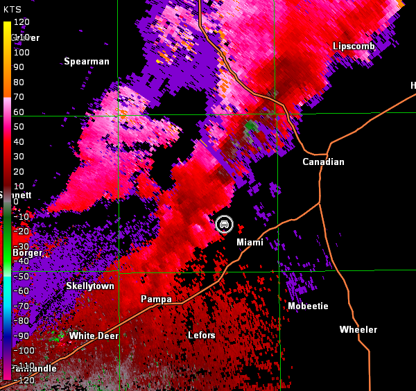
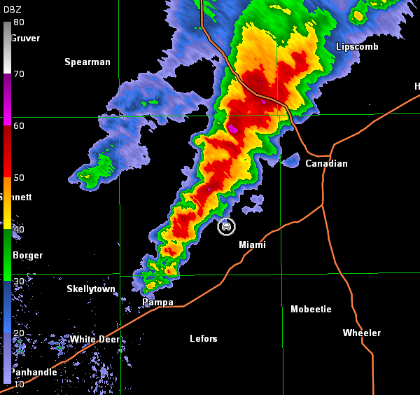
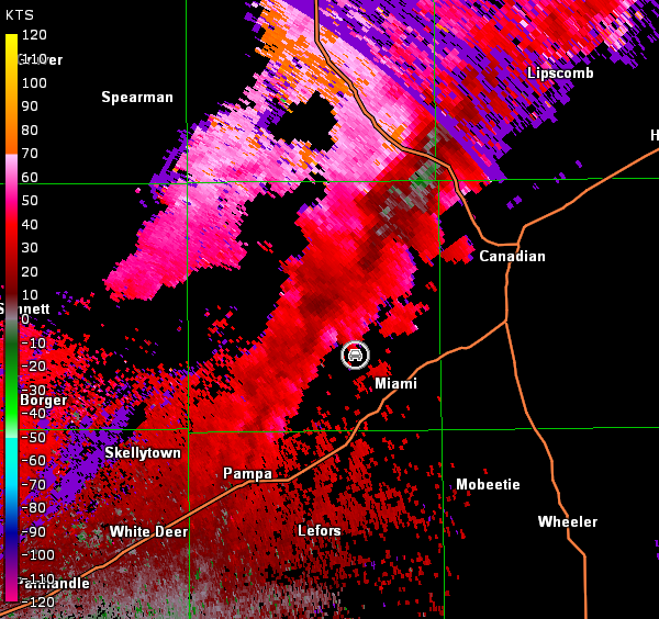
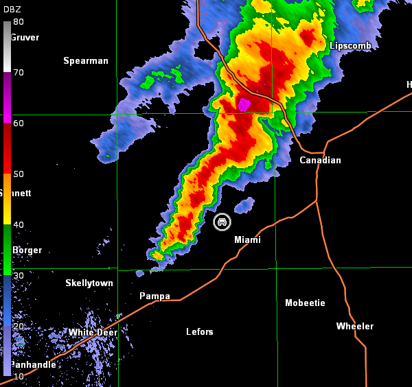
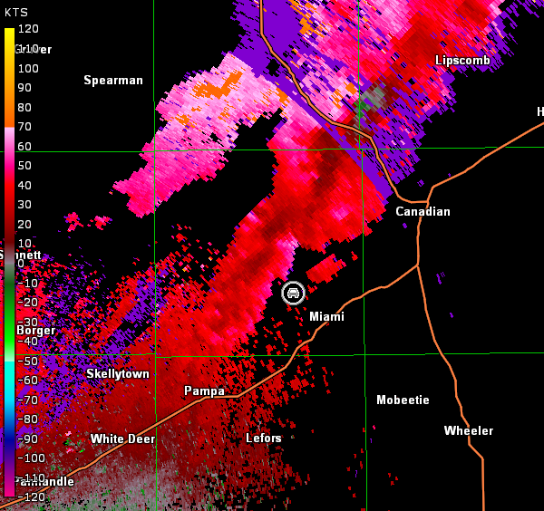
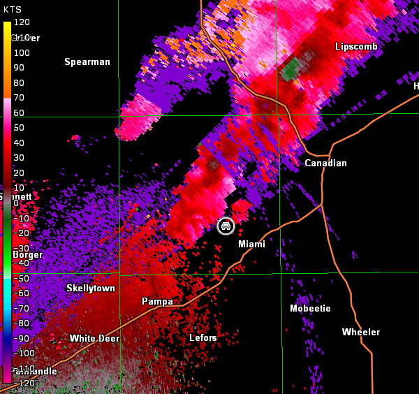
As the storm got closer to our location, we began to get concerned about our position with 1) a ridge to our northwest limiting visibility in a key direction, 2) the number of chasers and 3) potential issues with the road network farther to the northeast. Moreover, the tornado warning was allowed to expire with the storm showing signs of merging into a line. Was any circulation now going to get engulfed in rain associated with complex storm interaction? We thought that a storm to the southwest might be better, since it was now at the end of the line segment. Alas, we jumped a little too soon. As we moved south on U.S. 83 and then west on U.S. 60 toward the southern-most cell, the storm we left produced a tornado that was visible to chasers and became large. Meanwhile, the southern-most cell received a tornado warning while we were still en route. We intercepted the storm on Farm Road 283 northwest of Miami and observed some suspicious lowerings at times (images below; view northwest of Miami, looking northwest and north). The most suspicious lowering was observed to our north at 7:54 p.m. CDT (4th and 5th images below). It was very tempting to tweet out a tornado report given it was in the right location, but no solid circulation was observed on radar (radar data below; car symbol denotes our location). Moreover, clouds in the foreground of the tornado-like feature in the background didn't look right and I was unable to make out any rotation. Finally, there were other chasers closer to this feature than we were, and no official report had come out. Hence, I never tweeted out a tornado report, and it is likely that this feature was nothing more than a scud bomb (i.e., one of the "tornado look-alike" tricks the atmosphere can play on chasers and spotters).
Amarillo, TX Storm Relative Velocity 0048Z
Amarillo, TX Base Reflectivity 0054Z
Amarillo, TX Storm Relative Velocity 0054Z
Amarillo, TX Base Reflectivity 0100Z
Amarillo, TX Storm Relative Velocity 0100Z
Additional development continued to occur to our west and southwest, so we moved a little farther north and northwest to close the distance between us and the storms. All we observed was a developing shelf cloud as the convection became more linear (images below; view northwest of Miami, looking west). Radar data are also below (car symbol denotes our location).
Amarillo, TX Storm Relative Velocity 0105Z
Amarillo, TX Base Reflectivity 0111Z
Amarillo, TX Storm Relative Velocity 0111Z
The line of thunderstorms was slowly sinking east, so we had to move back to the south on Farm Road 283 to avoid the rain. We stopped to watch the far southern part of the line in case any intensification would occur, but the only highlight was the setting sun in the distance (images below; view northwest of Miami, looking west). Radar data showed nothing more than linear activity in our area (images below; car symbol denotes our location).
Amarillo, TX Storm Relative Velocity 0116Z
Amarillo, TX Base Reflectivity 0122Z
Amarillo, TX Storm Relative Velocity 0122Z
Amarillo, TX Base Reflectivity 0128Z
Amarillo, TX Storm Relative Velocity 0128Z
Amarillo, TX Base Reflectivity 0134Z
Amarillo, TX Storm Relative Velocity 0134Z
We followed the storms north a little bit longer but saw no further organization. Thus, we let them go and ended a rough chase day that bounced around between three separate supercell thunderstorms. Each was tornado-warned, but we gave up on the right storm at the wrong time. Nonetheless, we got a nice little lesson on tornado look-alikes.