Storm Chase Log 12 June 2018
Chasers: Dorian J. Burnette and Jeff House
Preliminary Destination: Medicine Lodge, KS
Note: Images have been decreased in size. Click on an image to view a larger version.
We expected a two-day storm chase in the Plains starting on the 12th. However, we did monitor conditions en route into northwestern OK on the 11th given there was some chance a few storms could develop. A few storms developed in our path over northwestern OK, but they were short-lived. Therefore, the real chase began on the 12th.
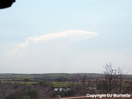
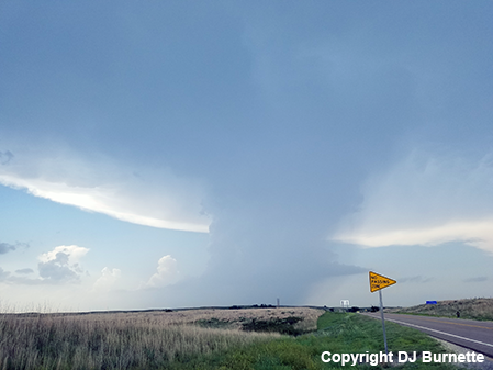
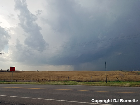
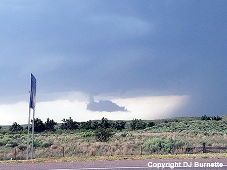
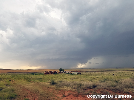
There were two potential chase destinations on this day--KS/OK border or northeastern NM. We chose to go to Medicine Lodge, KS and sit. By mid-afternoon cumulus clouds were becoming increasingly agitated on visible satellite imagery farther to our west toward Ashland, KS. We moved west on U.S. 160 and observed the development of a nice anvil, as we approached from the east (images below; view is from U.S. 160, looking west-southwest).
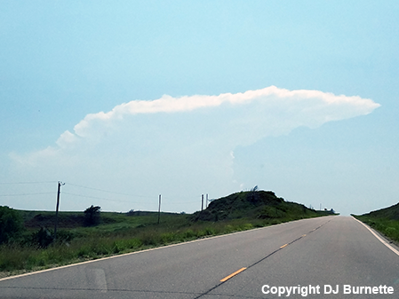
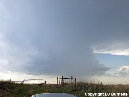
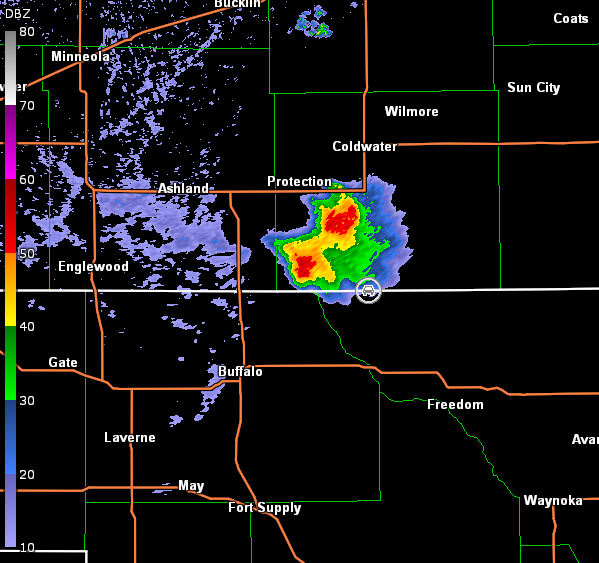
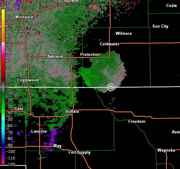
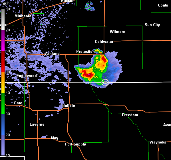
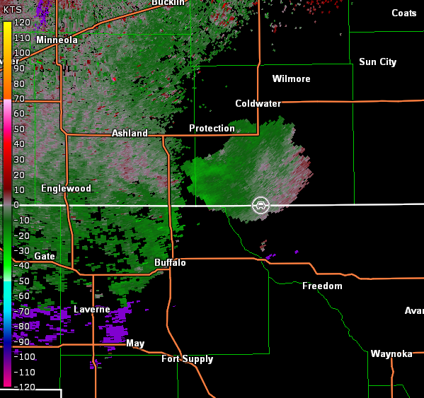
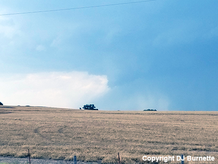
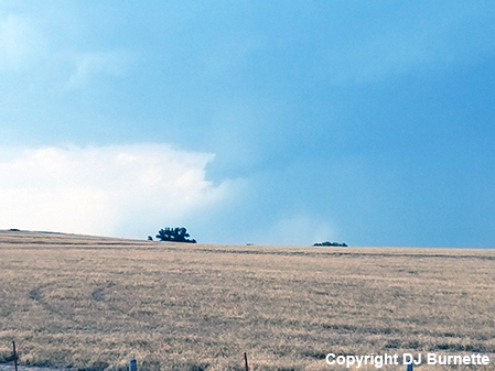
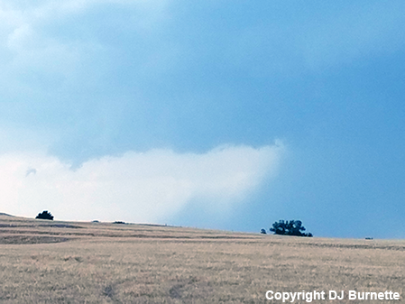
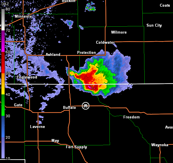
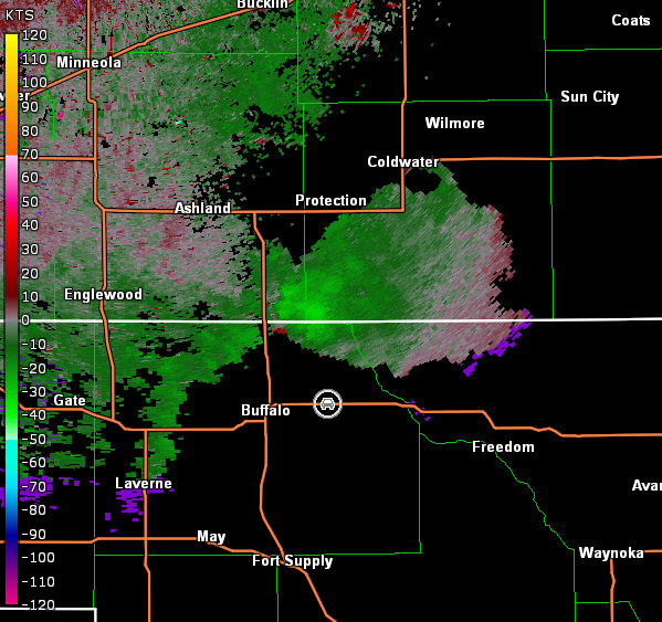
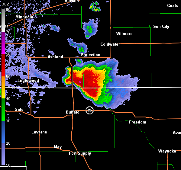
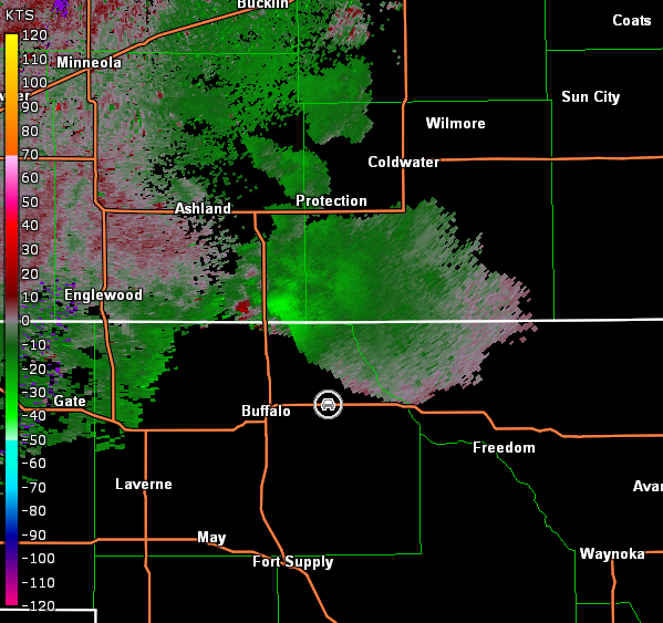
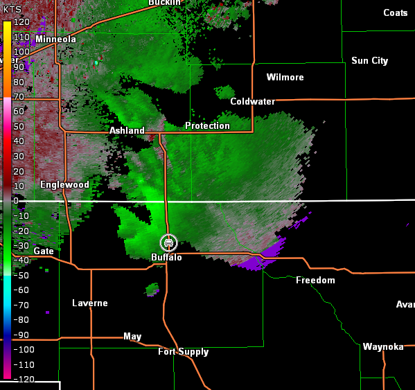
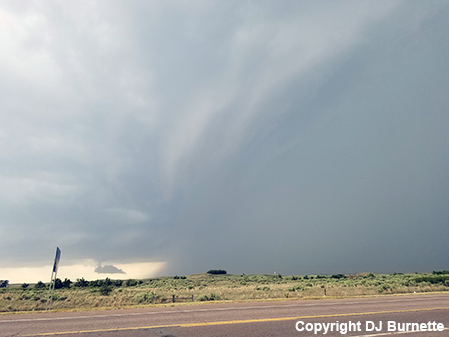
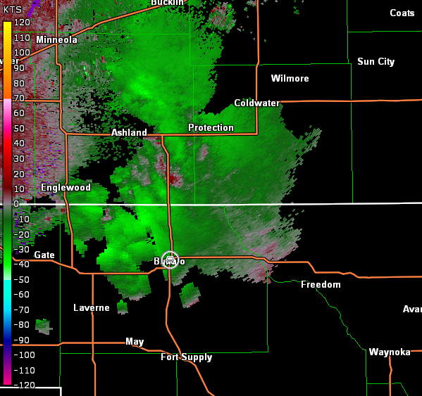
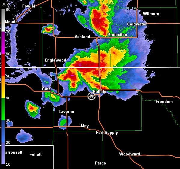
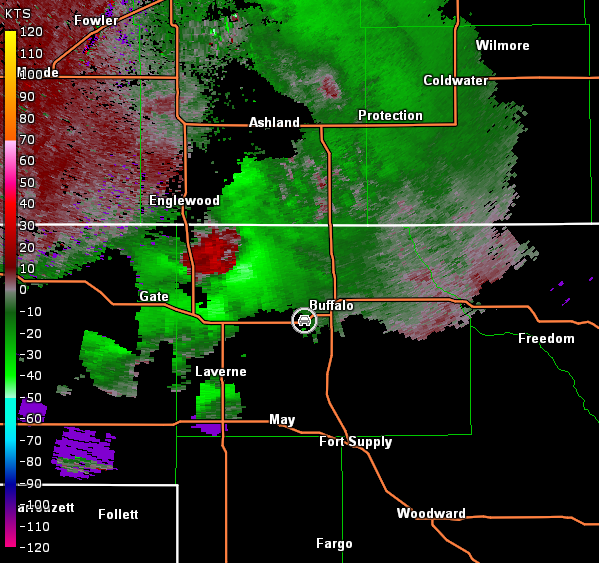
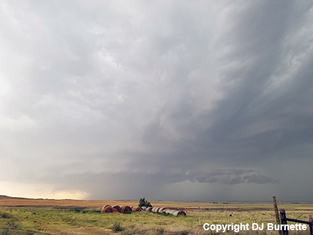
We got our first good look at the storm as we moved through Coldwater, KS and continued straight south on KS-1 toward the KS/OK line. Indications of the storm splitting were noted as we approached the KS/OK line. We stopped at the KS/OK border to monitor the storms (images below, view south of Coldwater, KS, looking northwest). Radar data showed the left-moving storm moving northeastward and dissipating. Meanwhile, the right-moving cell gained intensity (images below; car symbol denotes our location).
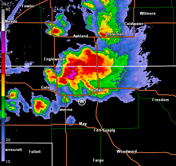
Dodge City, KS Storm Relative Velocity 2140Z
Dodge City, KS Base Reflectivity 2145Z
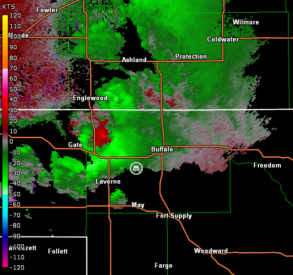
Dodge City, KS Storm Relative Velocity 2145Z
Dodge City, KS Base Reflectivity 2150Z
Dodge City, KS Storm Relative Velocity 2150Z
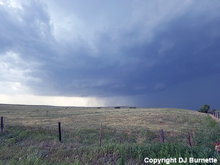
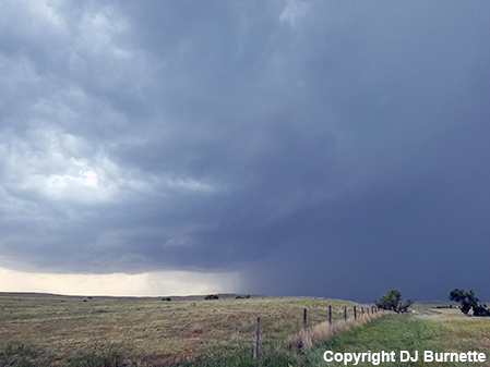
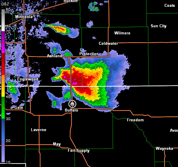
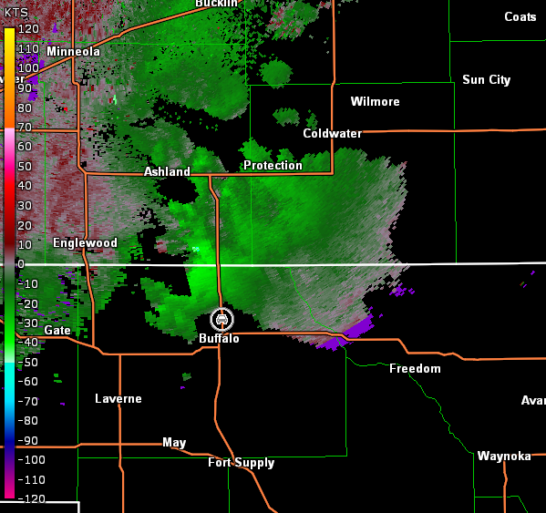
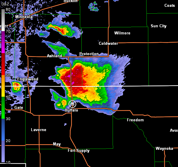
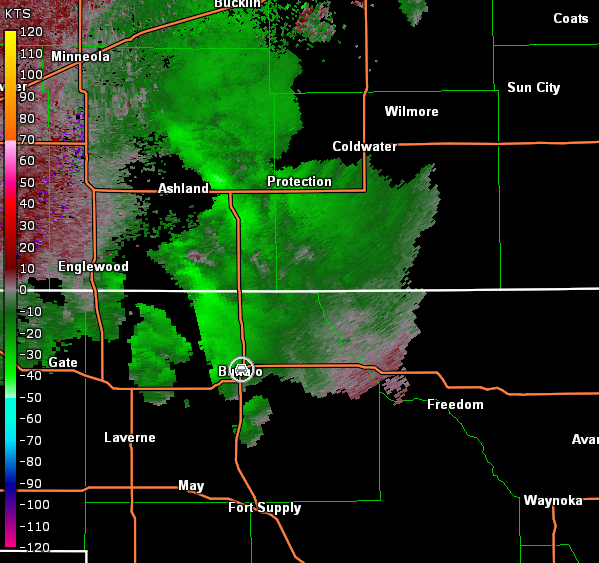
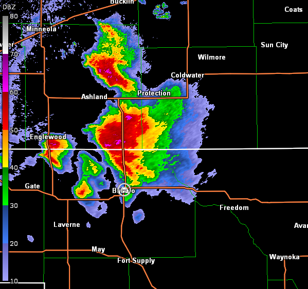
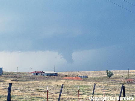
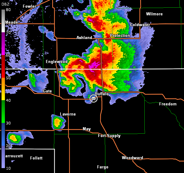
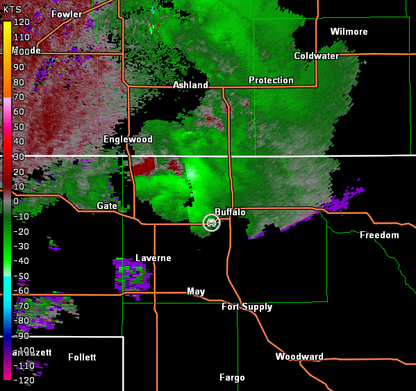
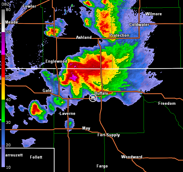
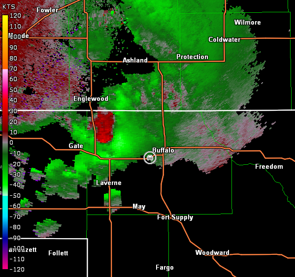
Eventually, raindrops began to fall at our location, so we stayed out ahead of the storm by continuing south into OK on OK-34 and then west on U.S. 64. We stopped again on U.S. 64 east of Buffalo, OK and observed strong inflow winds. The storm was unfortunately poor contrast from our location, but we began to see some interesting features at times including scud clouds rising and appearing to attach to the base along with the occasional rainfoot suggesting downburst winds were present (images below; view east of Buffalo, looking north). The storm also began to look more like a supercell on radar imagery and was clearly back-building to the west (images below; car symbol denotes our location).
Dodge City, KS Storm Relative Velocity 2211Z
Dodge City, KS Base Reflectivity 2217Z
Dodge City, KS Storm Relative Velocity 2217Z
Dodge City, KS Base Reflectivity 2222Z
Dodge City, KS Storm Relative Velocity 2222Z
Dodge City, KS Base Reflectivity 2228Z
Dodge City, KS Storm Relative Velocity 2228Z
Dodge City, KS Base Reflectivity 2233Z
Dodge City, KS Storm Relative Velocity 2233Z
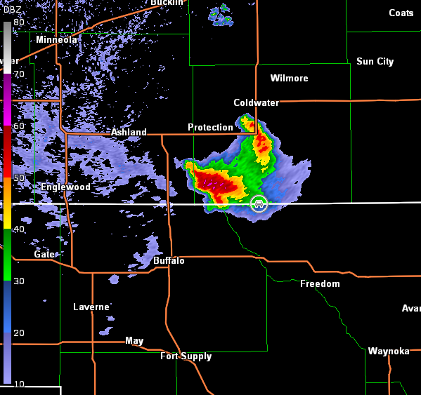
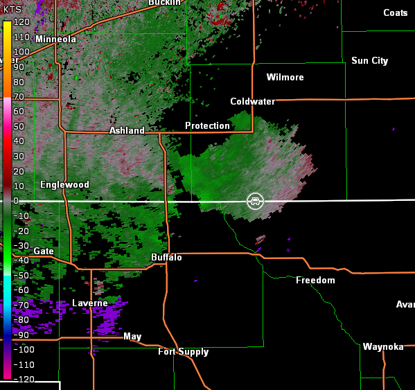
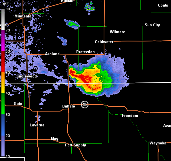
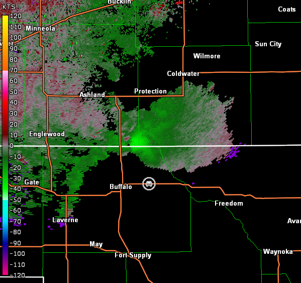
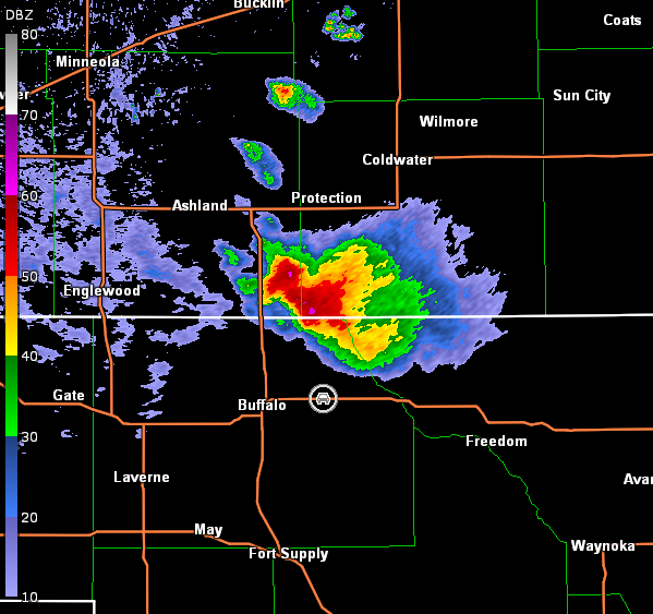
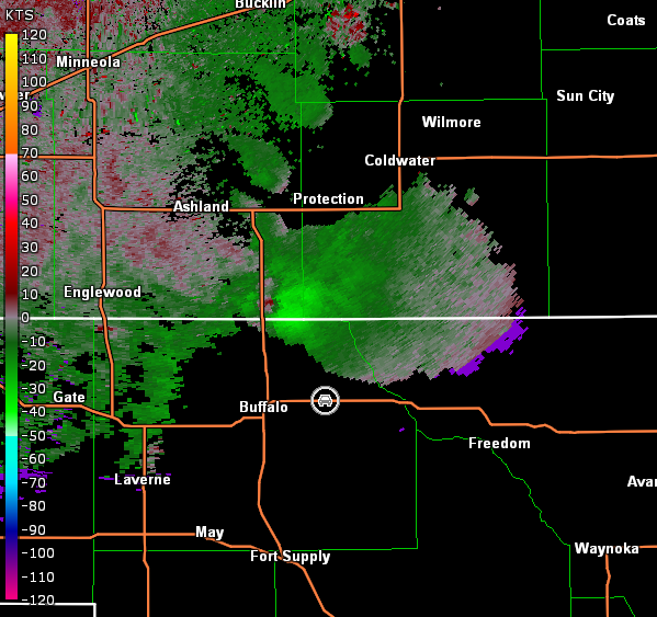
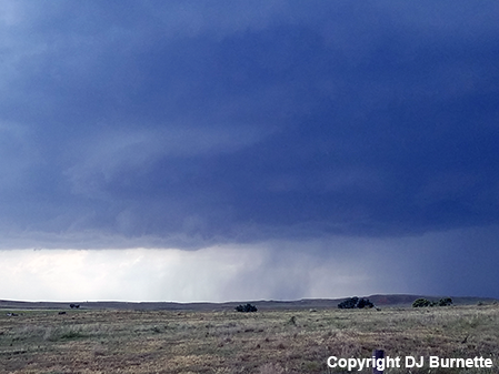
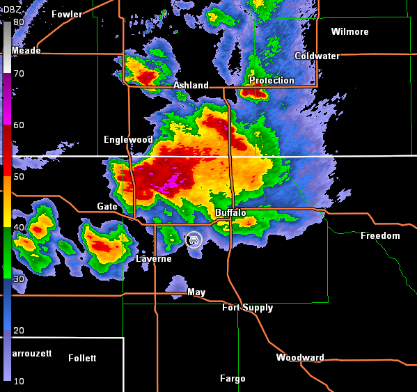
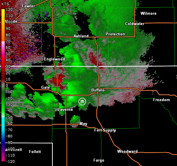
Given the back-building nature, we moved farther west on U.S. 64, then north on U.S. 183, and finally stopped again north of Buffalo to view the storm. An impressive rain-free base was noted (images below; view north of Buffalo, looking north). The storm continued to look impressive on radar, but complications quickly occurred with another cell developing in our general vicinity and interacting with the intense storm we were watching to the north (images below; car symbol denotes our location).
Dodge City, KS Storm Relative Velocity 2250Z
Dodge City, KS Base Reflectivity 2256Z
Dodge City, KS Storm Relative Velocity 2256Z
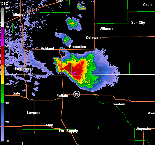
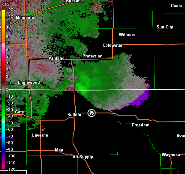
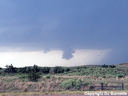
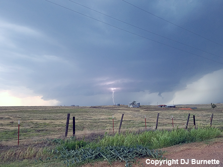
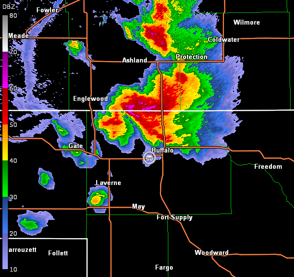
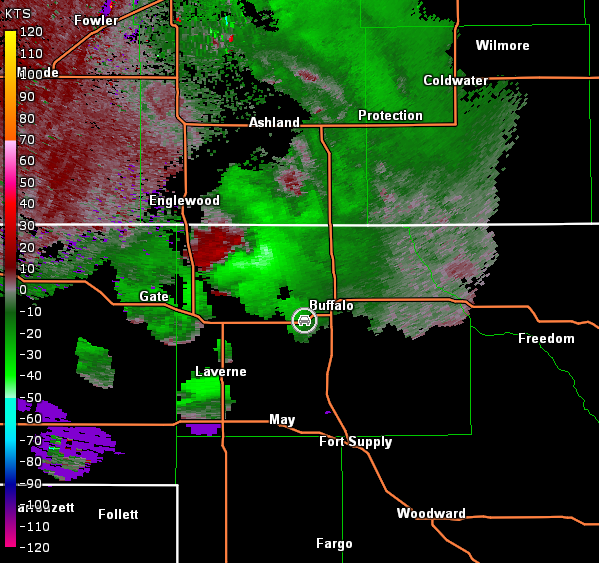
The additional cell forced us to backoff from our position, and we moved back south on U.S. 183 and then west on U.S. 64 to allow that new cell to move by or complete its merge with the main supercell farther north. We stopped just outside of Buffalo on U.S. 64 and continued to observe scud clouds attaching the base briefly before dissipating. This was becoming a common observation with this storm in addition to its slowly southward movement while also back-building to the west (images below; view just outside of the north end of Buffalo, looking north-northwest). Radar images continued to show an impressive storm (images below; car symbol denotes our location).
Dodge City, KS Storm Relative Velocity 2307Z
Dodge City, KS Base Reflectivity 2313Z
Dodge City, KS Storm Relative Velocity 2313Z
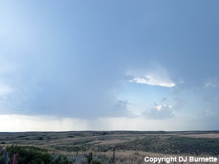
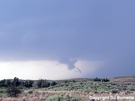
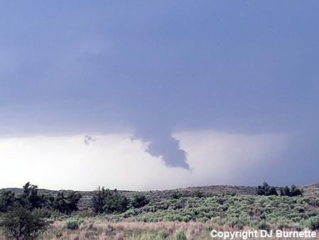
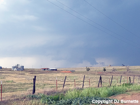
We continued farther west on U.S. 64 and stopped west of Buffalo. It was here that we got a good look at a healthy-looking wall cloud and observed strong inflow winds. No tornado was ever observed from the wall cloud though, and it quickly dissipated. Another scud cloud attached to the base a moment later looking ominous, but again nothing. The storm began to look more like a high-precipitation supercell with time (images below; view west of Buffalo, looking north). Radar continued to show a well-organized storm, but continued development to its west and southwest was complicating matters (images below; car symbol denotes our location).
Dodge City, KS Storm Relative Velocity 2325Z
Dodge City, KS Base Reflectivity 2331Z
Dodge City, KS Storm Relative Velocity 2331Z
Dodge City, KS Base Reflectivity 2337Z
Dodge City, KS Storm Relative Velocity 2337Z
Dodge City, KS Base Reflectivity 2342Z
Dodge City, KS Storm Relative Velocity 2342Z
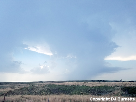
We were in an awkward position and had to move to the south to continue to stay ahead of the storm. We moved west on U.S. 64 and then south on OK-46. We stopped again to view the storm, which was showing high-precipitation supercell structure (images below; view southwest of Buffalo, looking northwest). Circulation on radar was clearly in the rain-wrapped region (images below; car symbol denotes our location).
Dodge City, KS Storm Relative Velocity 2348Z
Dodge City, KS Base Reflectivity 2354Z
Dodge City, KS Storm Relative Velocity 2354Z
We continued south on OK-46 and then west on U.S. 412 to follow the storm as it continued to back-build to the west. As we approached Liberal, KS, the storm looked more outflow-dominant. Of course, as we looked for a hotel, the storm shed the gust front and back-building occurred again over Liberal. Thus, we had to bail south while a new hail core and some circulation moved by. Eventually, the storm let us in, but it was a late night ahead of another storm chase.