Storm Chase Log 13 June 2018
Chasers: Dorian J. Burnette and Jeff House
Preliminary Destination: Limon, CO
Note: Images have been decreased in size. Click on an image to view a larger version.
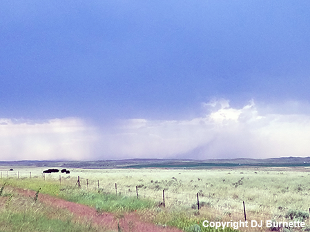
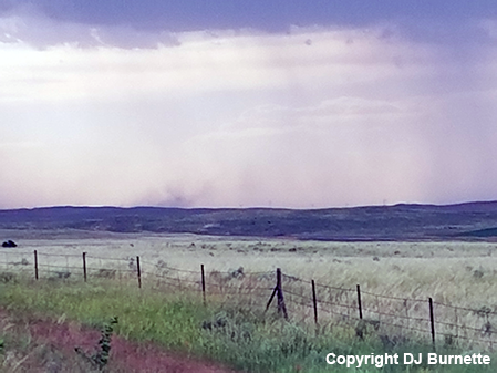
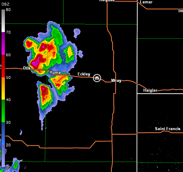
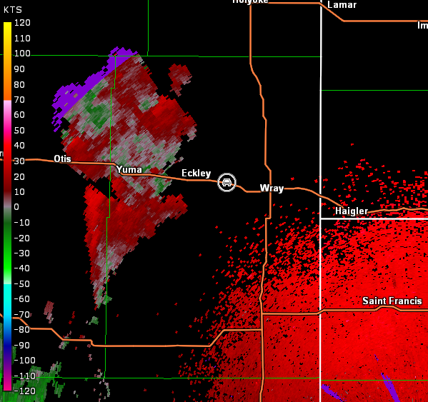
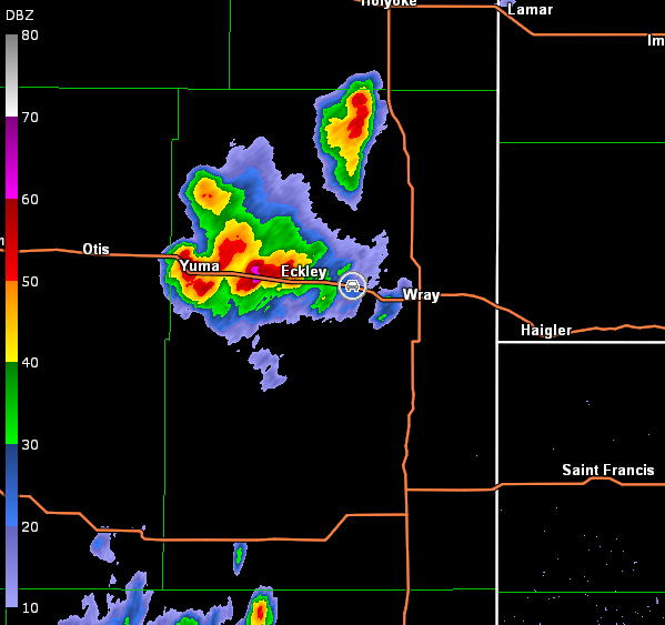
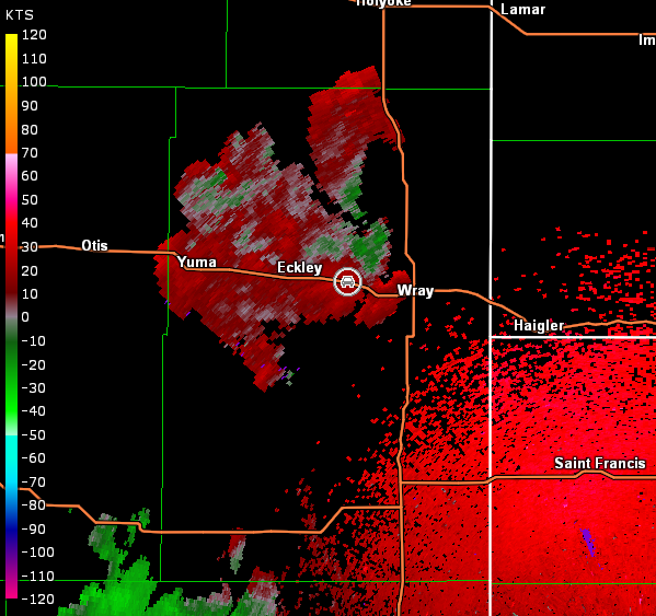
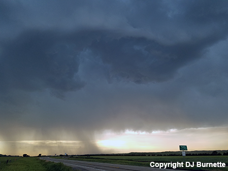
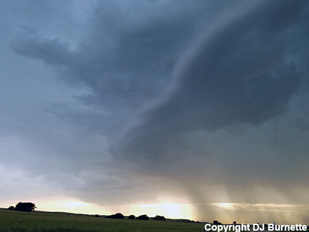
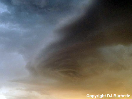
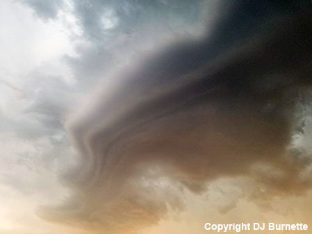
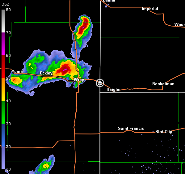
This was day two of a two-day storm chase in the Plains, and the destination on this day, like the day before it, showed two potential targets. As we drove north out of Liberal, the best target appeared to be over northeastern CO. Thus, we moved in the general direction of Limon, CO. As we crossed the CO line, surface observations suggested the better environment may set up north of Limon. Thus, we stopped in Burlington, CO to reassess the situation, and ultimately decided to work our way north on U.S. 385 toward Wray, CO. We eventually ended up in Holyoke, CO watching towering cumulus clouds. Shortly after 5 p.m. MDT, a decent storm appeared to be developing west of Wray, CO. We moved back south on U.S. 385, then west on U.S. 34, and ended up east of Eckley, CO to view the storm. We sat here and observed strong downburst winds at times (images below; view east of Eckley, looking west). Radar showed additional storm cells developing in the area with some attempt at congealing into one dominant storm (images below; car symbol denotes our location).
Goodland, KS Storm Relative Velocity 0001Z
Goodland, KS Base Reflectivity 0016Z
Goodland, KS Storm Relative Velocity 0016Z
Goodland, KS Base Reflectivity 0031Z
Goodland, KS Storm Relative Velocity 0031Z
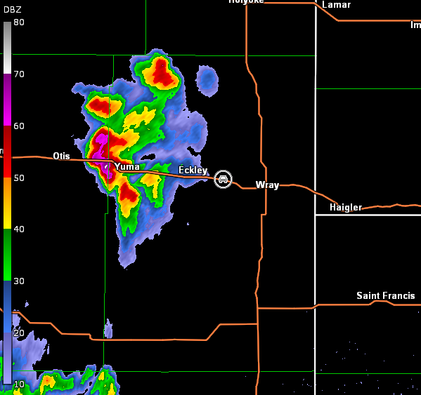
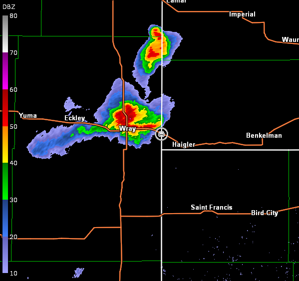
Goodland, KS Base Reflectivity 0042Z
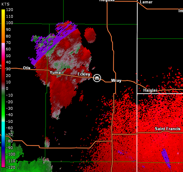
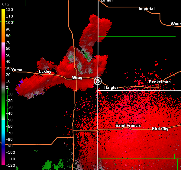
Goodland, KS Storm Relative Velocity 0042Z
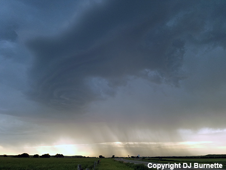
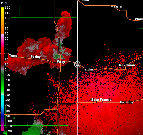
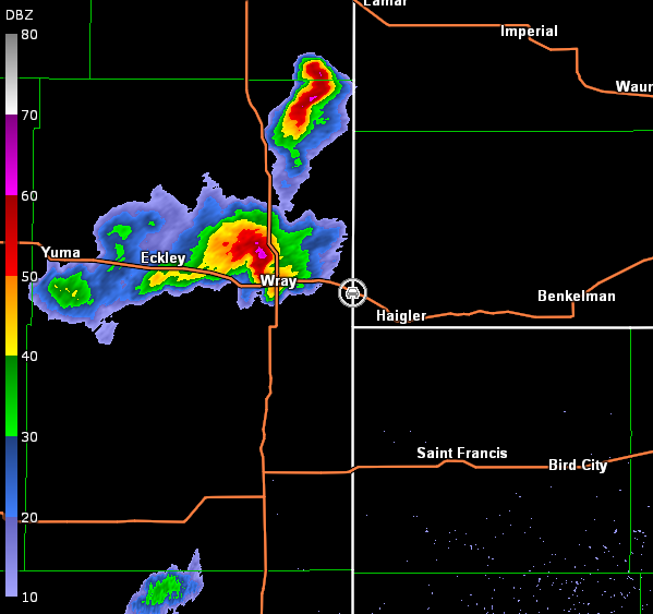
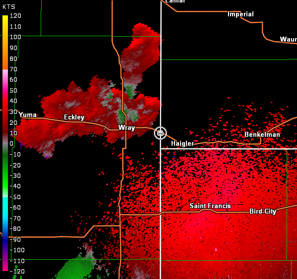
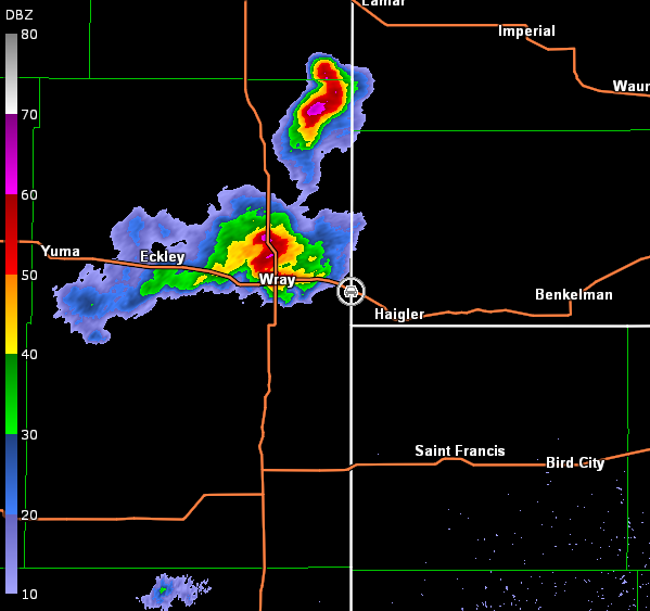
Rain began to approach our location, so we moved east to stay out ahead of the storm. We stopped at the CO/NE line east of Wray and continued to watch a generic thunderstorm. It did produce a localized area of striations though (images below; view east of Wray, looking west). Radar data are included below (car symbol denotes our location).
Goodland, KS Storm Relative Velocity 0104Z
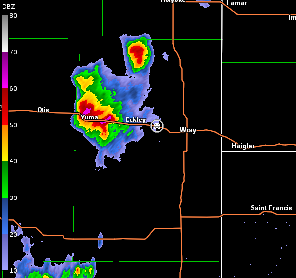
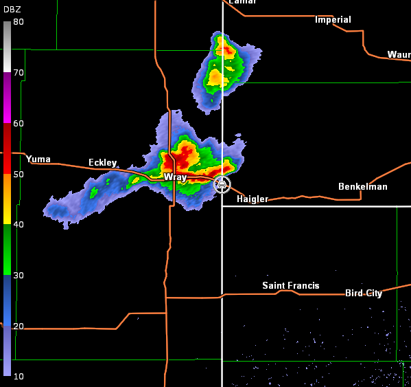
Goodland, KS Base Reflectivity 0109Z
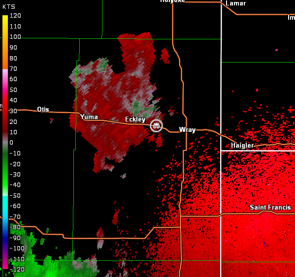
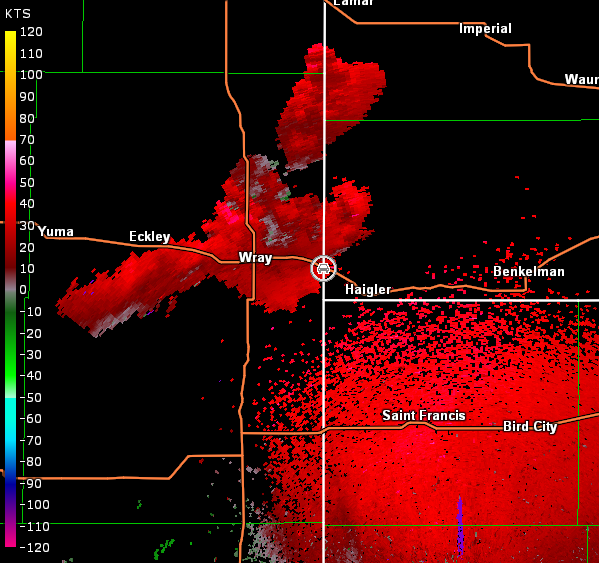
Goodland, KS Storm Relative Velocity 0109Z
Goodland, KS Base Reflectivity 0115Z
Goodland, KS Storm Relative Velocity 0115Z
Goodland, KS Base Reflectivity 0120Z
Goodland, KS Storm Relative Velocity 0120Z
Goodland, KS Base Reflectivity 0126Z
Goodland, KS Storm Relative Velocity 0126Z
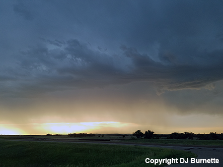
The storm eventually began to close in on our location and we were out of range of data, so we continued east on U.S. 34 into NE. We stopped again east of Haigler, NE to watch a dying storm at sunset (images below).
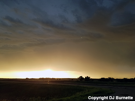
We continued east on U.S. 34 to make sure the trends continued. The storm took some time to dissipate, but the trends were clear as darkness approached. Therefore, we moved back south into Goodland, KS for the night.