Storm Chase Log 25 May 2016
Chasers: Dorian J. Burnette and Jeff House
Preliminary Destination: Hesston, KS
Note: Images have been decreased in size. Click on an image to view a larger version.
Day four of a five-day long storm chase in the Plains was complicated by the question of whether storms would develop at all in the afternoon. There were three outflow boundaries on visible satellite in the morning, but 12Z 850 mb data showed veered off winds to the southwest. That said, a dryline was expected to bulge into central KS with a triple point feature there. We hung out in Wichita much of the day and visited with friends at AccuWeather Enterprise Solutions while we continued to monitor trends.
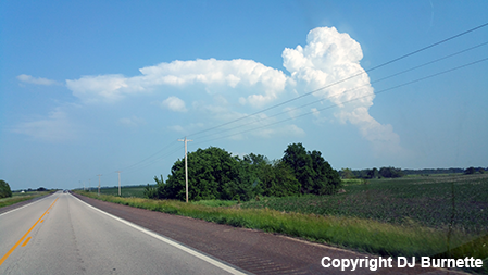
Towering cumulus clouds began to show up by early afternoon all over central KS, and we departed north out of Wichita and stopped in Hesston, KS, which would allow us to go north or south. While we waited on storm initiation, my friend Jon Davies popped up beside us. It was great to catch up with him again!
By late-afternoon, two spots for storm initiation were becoming clear--1) the triple point area to our north over northcentral KS and 2) an area of backed surface winds in southcentral KS. We got attracted to area two for a few reasons. One was the backed surface winds to the south-southeast. The others were non-meteorological. Watching social media, it became clear that everybody and their dog was likely to be chasing the storms farther to the north in vicinity of the triple point. Thus, while northcentral KS was the meteorological no-brainer, the probable insane numbers of chasers did not excite us. We had a career day at Dodge City the day before, and therefore were not desperate. Finally, we were hoping to get together with a buddy later that night. Thus, we were biased to the south, and as a storm began to develop east of Wichita, we made the decision to go after it.
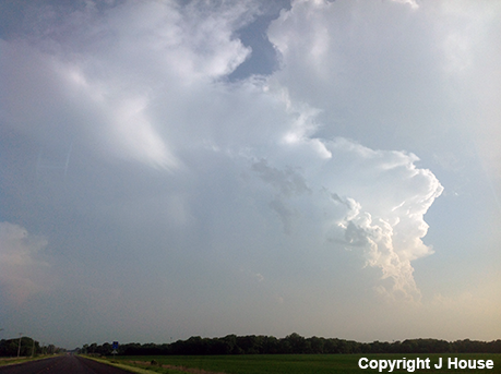
We moved south on I-135 and then east on KS-196 toward El Dorado, KS taking pictures of the cumulonimbus and new towering cumulus clouds along the way. The storm was clearly struggling though.
We bypassed much of El Dorado by moving south on Haverhill Rd and then east on U.S. 400. As we continued to follow the storm east of Beaumont, KS on U.S. 400, it gradually became clear that its demise was imminent. Meanwhile, a new storm had developed farther to the southwest, so we moved back to the west into Augusta, KS and then took U.S. 77 south toward the storm. Signs of the storm struggling were apparent though.
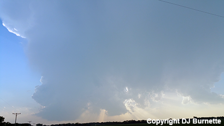
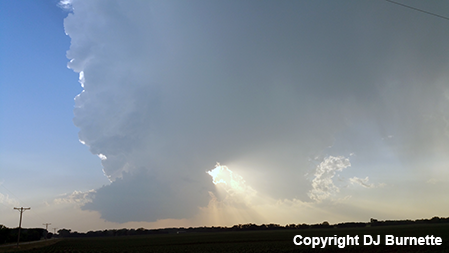
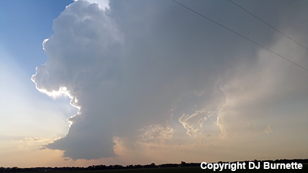
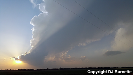
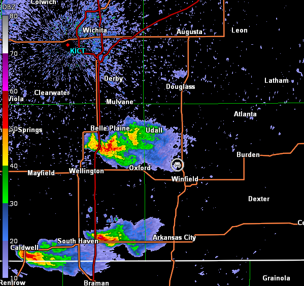
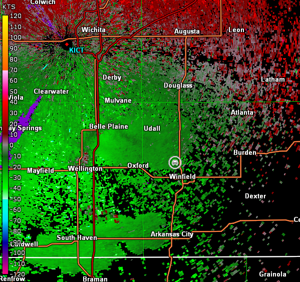
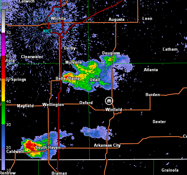
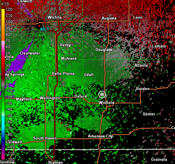
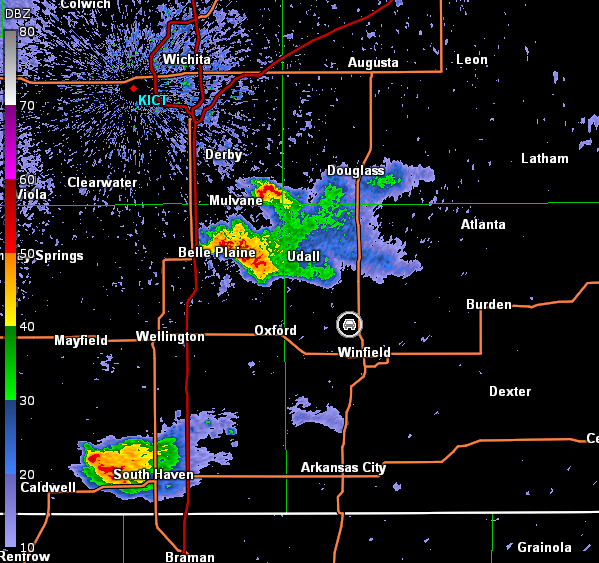
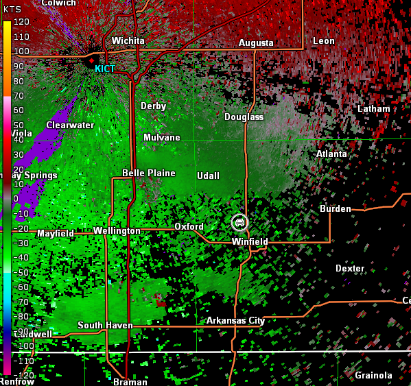
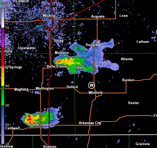
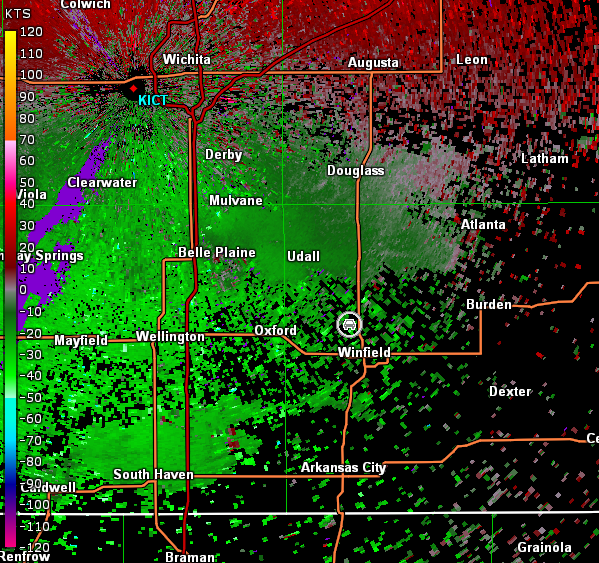
Nonetheless, this storm was the only game in town, and we stayed on it. We stopped northwest of Winfield, KS to continue watching the storm struggle (images below; view northwest of Winfield, looking west-northwest). Radar showed nothing more than a thunderstorm pulsing up and down in intensity (images below; car symbol denotes our location).
Wichita, KS Storm Relative Velocity 0037Z
Wichita, KS Base Reflectivity 0058Z
Wichita, KS Storm Relative Velocity 0058Z
Wichita, KS Base Reflectivity 0104Z
Wichita, KS Storm Relative Velocity 0104Z
Wichita, KS Base Reflectivity 0109Z
Wichita, KS Storm Relative Velocity 0109Z
Ultimately, this storm also failed to maintain itself. Meanwhile, the spot to be on this day was certainly northcentral KS. That was a no-brainer and a wedge tornado occurred up there. We had no regrets for missing it though due to the non-meteorological reasons stated above. We traveled back to Wichita for the night and met up with a friend for beers ahead of our fifth and final chase day.