Storm Chase Log 24 May 2016
Chasers: Dorian J. Burnette and Jeff House
Preliminary Destination: Coldwater, KS
Note: Images have been decreased in size. Click on an image to view a larger version.
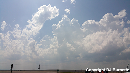
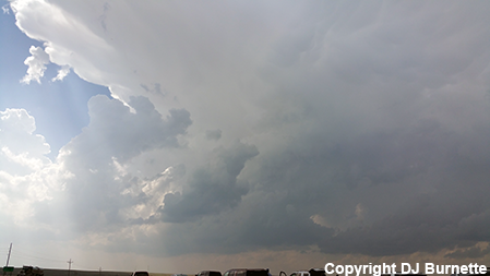
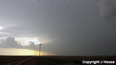
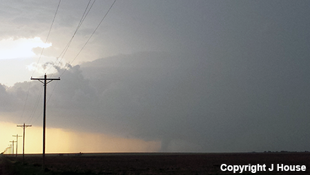
Day three of a five-day long storm chase in the Plains was a career day for us. We arrived in Coldwater, KS early in the afternoon and after consulting the latest data, we moved west on U.S. 160 through Ashland, KS, and sat at the U.S. 160/283 interchange west of Ashland to await storm development. By 4:30 p.m. CDT, healthy towering cumulus clouds were observed to our west and southwest (first image below), and shortly before 5 p.m. CDT, a thunderstorm had developed to our west (second image below).
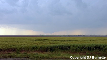
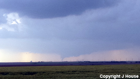
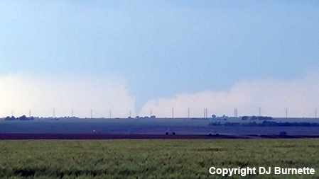
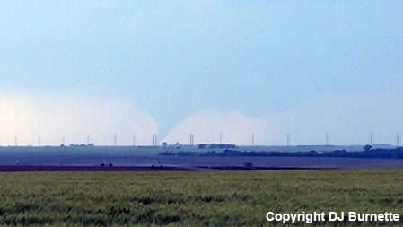
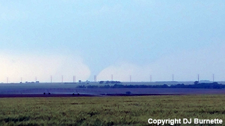
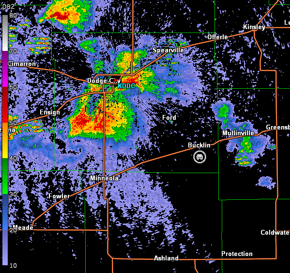
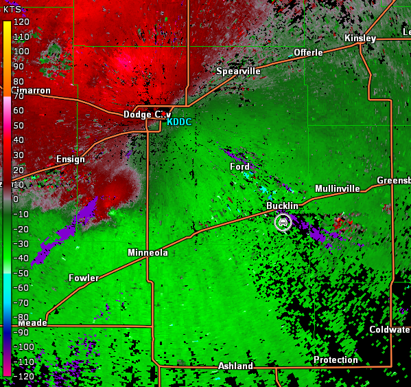
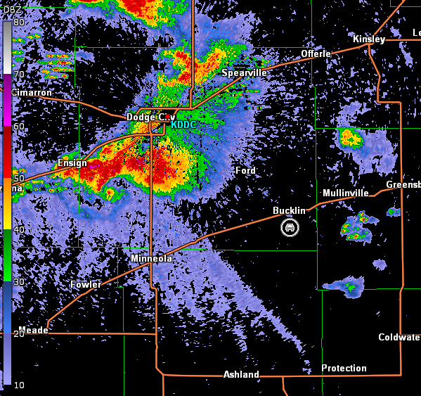
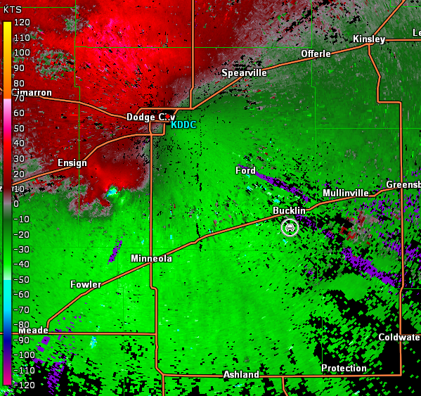
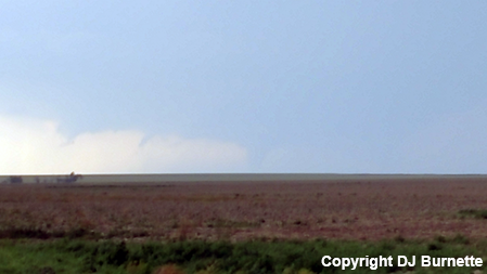
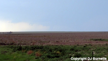
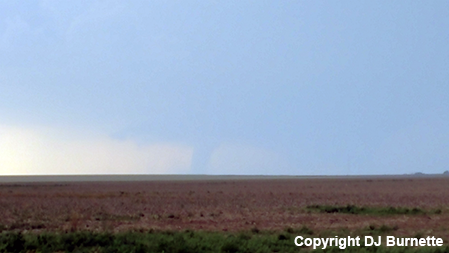
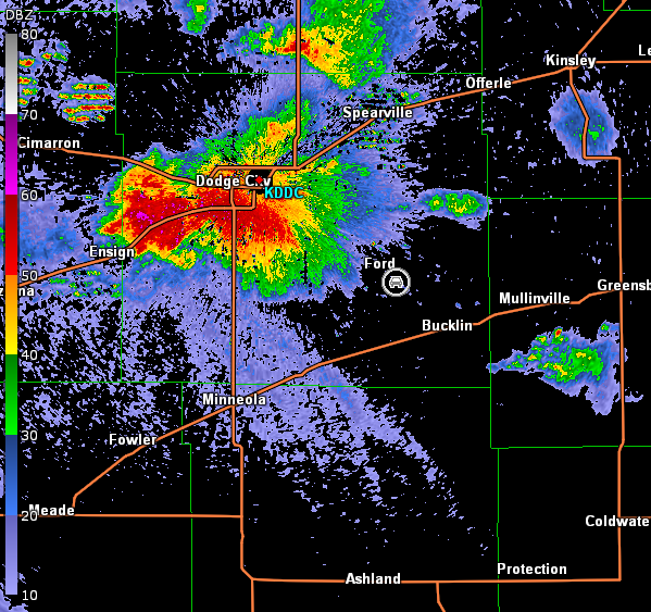
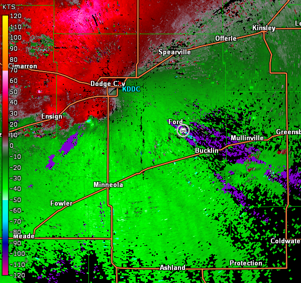
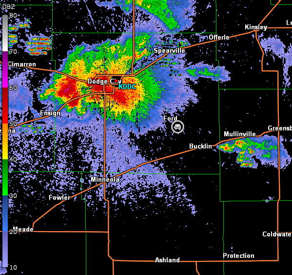
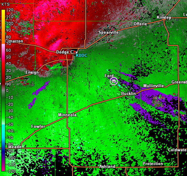
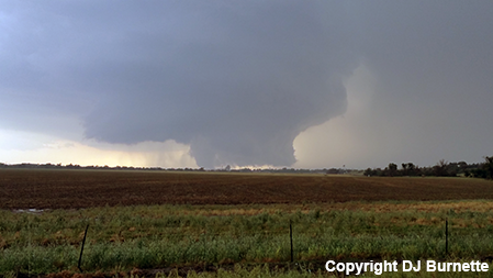
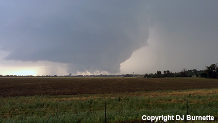
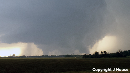
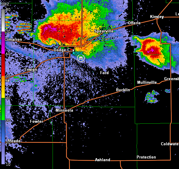
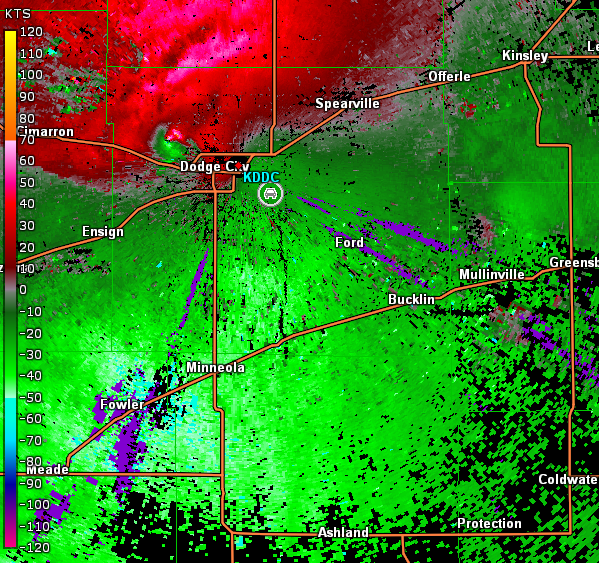
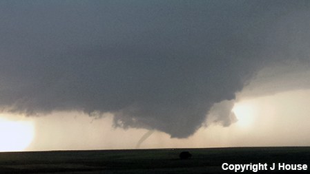
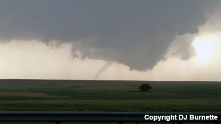
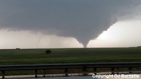
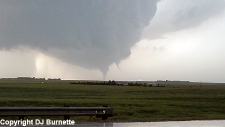
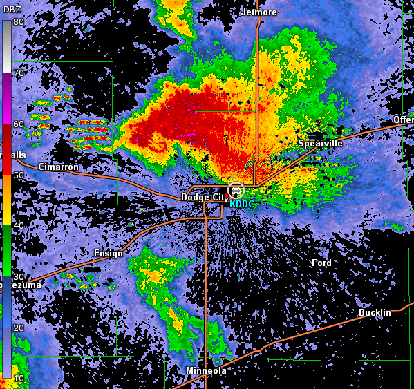
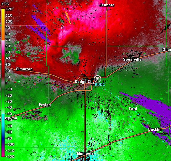
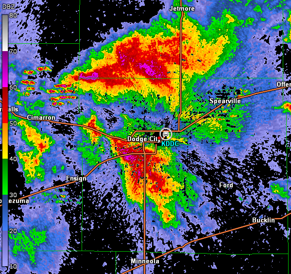
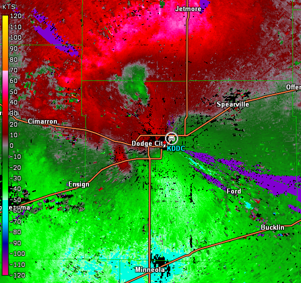
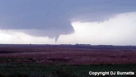
We mulled over our options. The big problem was a plethora of chasers were likely to head north on U.S. 283, and that could potentially lead to a traffic problem. Knowing the road network would allow us to attack the storm at an angle northwest of Bucklin, KS, we decided to go east U.S. 160 and then north on KS-34. South of Bucklin, we observed the formation of a wall cloud followed by the development of a tornado (images below; view south of Bucklin, looking west). Radar data showed a classic signature (images below; car symbol denotes our location).
Dodge City, KS Storm Relative Velocity 2255Z
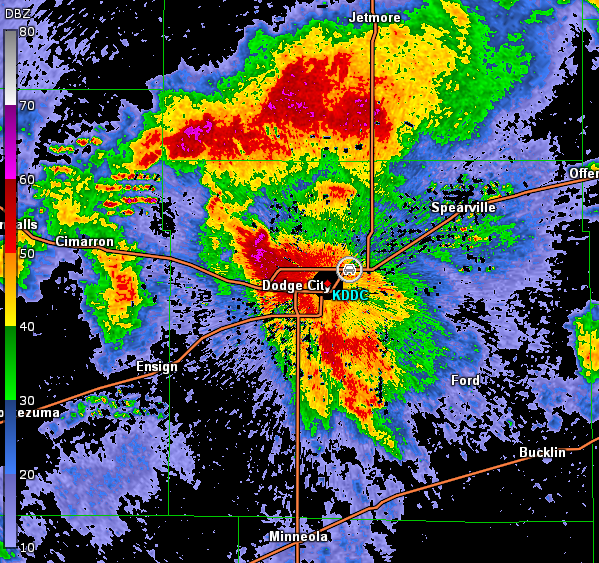
Dodge City, KS Base Reflectivity 2301Z
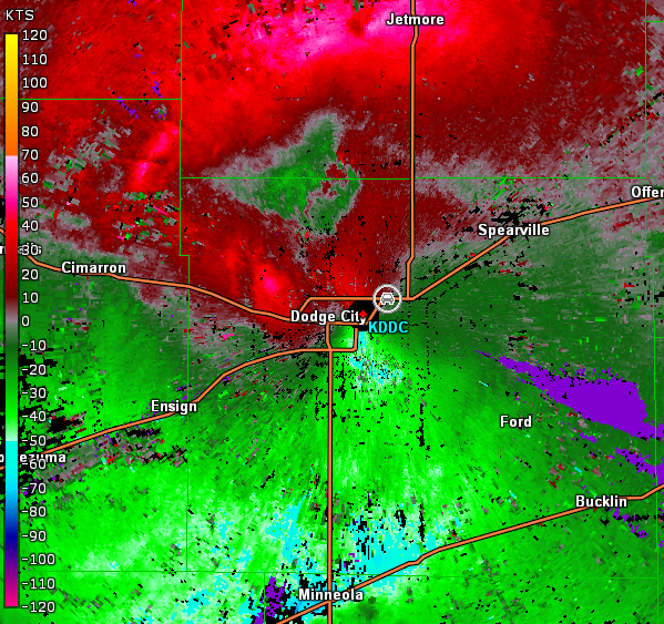
Dodge City, KS Storm Relative Velocity 2301Z
Dodge City, KS Base Reflectivity 2308Z
Dodge City, KS Storm Relative Velocity 2308Z
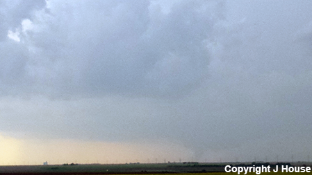
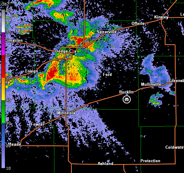
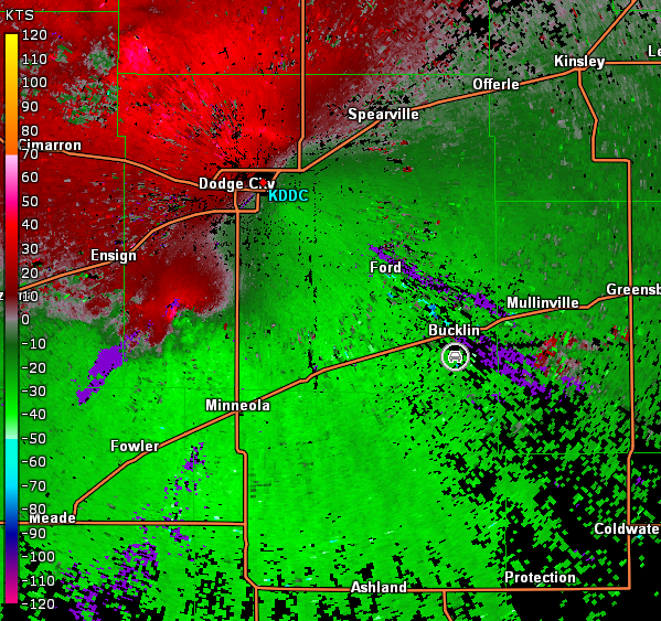
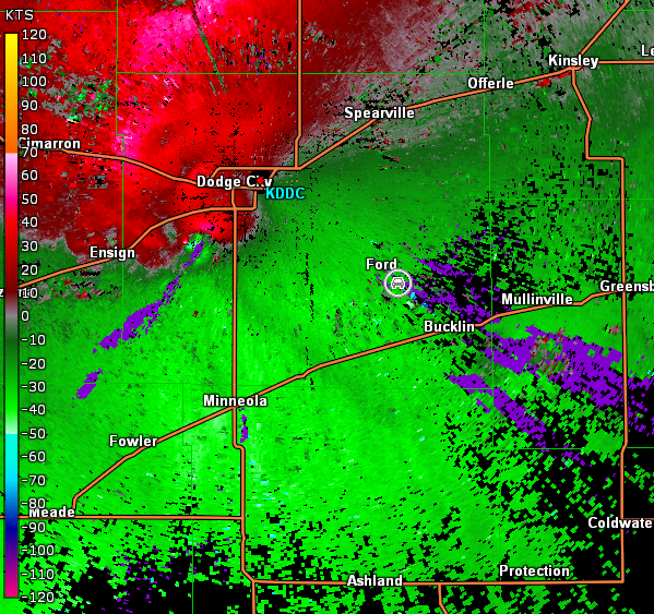
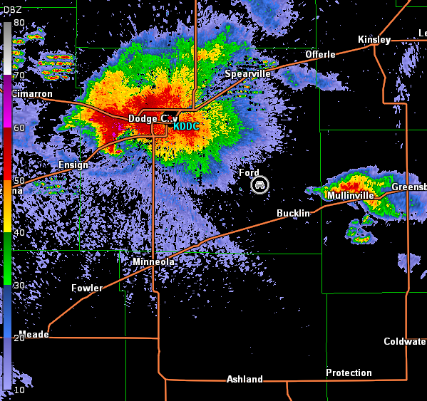
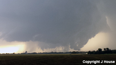
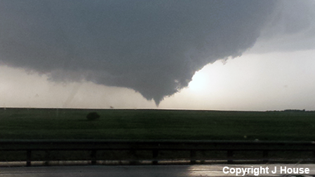
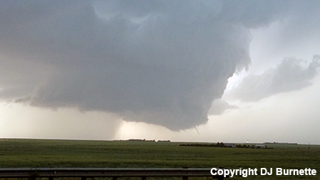
The tornado eventually became more rain-wrapped, as noted in the last image above. Thus, we continued north on KS-34 through Bucklin and then took U.S. 400 back to the west toward Ford, KS. U.S. 400 runs northwest-southeast between Dodge City and Bucklin and provided a perfect way for us to charge the mesocyclone. We stopped again southeast of Ford, KS with a large tornado observed to our southwest but it was occasionally obscured by rain (images below; view is southeast of Ford, looking southwest). Radar data are also included below (car symbol denotes our location).
Dodge City, KS Storm Relative Velocity 2322Z
Dodge City, KS Base Reflectivity 2328Z
Dodge City, KS Storm Relative Velocity 2328Z
Dodge City, KS Base Reflectivity 2335Z
Dodge City, KS Storm Relative Velocity 2335Z
Moving a little farther to the northwest, a large, ground-scraping wall cloud was observed as we approached Fort Dodge, KS (images below; view is looking northwest from southeast of Fort Dodge). We pulled over to watch this development. We were concerned that a wedge tornado might develop, but ground circulation/debris were never observed from our location. Our view was not ideal though, and other chasers closer to the wall cloud noted a tornado in progress from another angle at the time of the final image below. Radar data from this brief stop are included below (car symbol denotes our location).
We continued to move closer to the tornado-producing region of the storm and around the northeast side of Dodge City. We stopped on U.S. 283 just south of the U.S. 50/U.S. 283 interchange and northeast of the Dodge City Regional Airport and observed one tornado embedded in rain in the background with a new wall cloud in the foreground. That new wall cloud would also produce a tornado while the rain-wrapped tornado in the background continued moved into the rope stage. The rain-wrapped tornado dissipated as the second tornado entered the rope stage. We were not done yet though. Just as the second tornado roped out, a third tornado developed. The sequence of images from this time period are below (view is just south of U.S. 50/U.S. 283 interchange, looking northwest). Radar data showed continued good circulation with the storm, but another storm was moving up on our position from the southwest (images below; car symbol denotes our location).
Dodge City, KS Storm Relative Velocity 0002Z
Dodge City, KS Base Reflectivity 0008Z
Dodge City, KS Storm Relative Velocity 0008Z
Dodge City, KS Base Reflectivity 0015Z
Dodge City, KS Storm Relative Velocity 0015Z
Given the forward-flank of another storm was moving up on us from the southwest, we had to move to avoid heavy rain and hail. As we turned to the east on U.S. 50 though, yet another tornado developed to our north-northwest (image below). Storm relative velocity data did show a tight circulation in this area despite the messy interaction between multiple storms in the base reflectivity data (images below; car symbol denotes our location).
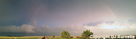
We continued east on U.S. 50 to stay out ahead of the rain and hail and ran into flooding at the U.S. 50/U.S. 183 interchange around Kinsley, KS. We had to use city streets to get around the debacle. Eventually, we found ourselves moving south on U.S. 183. Midway between Kinsley and Greensburg, KS, we observed a double rainbow and stopped to take in the sight (image below; view is looking east from south of Kinsley).
In total, we observed at least six tornadoes around Dodge City. While some damage was reported, it was a lot less devastating than it could have been. We headed back to Wichita, KS for the night to rest up before chase day number four.