Storm Chase Log 1 June 2014
Chasers: Dorian J. Burnette and Jeff House
Preliminary Destination: Russell, KS
Note: Images have been decreased in size. Click on an image to view a larger version.
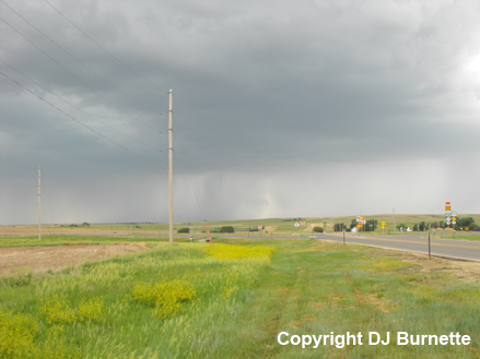
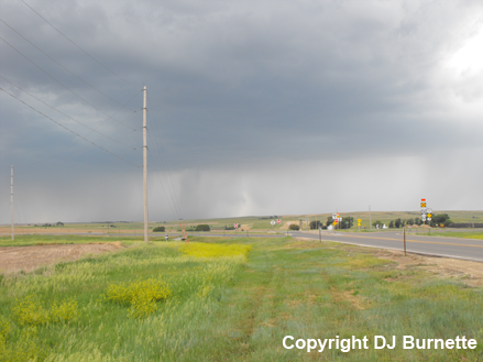
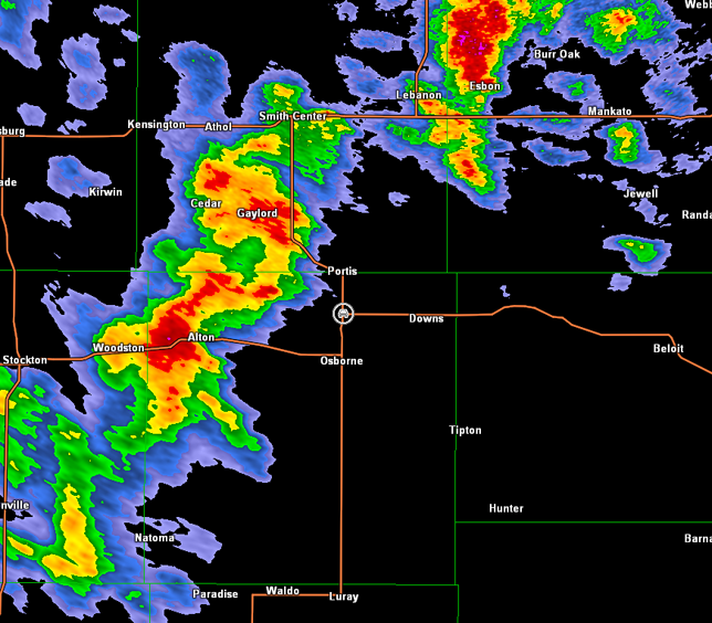
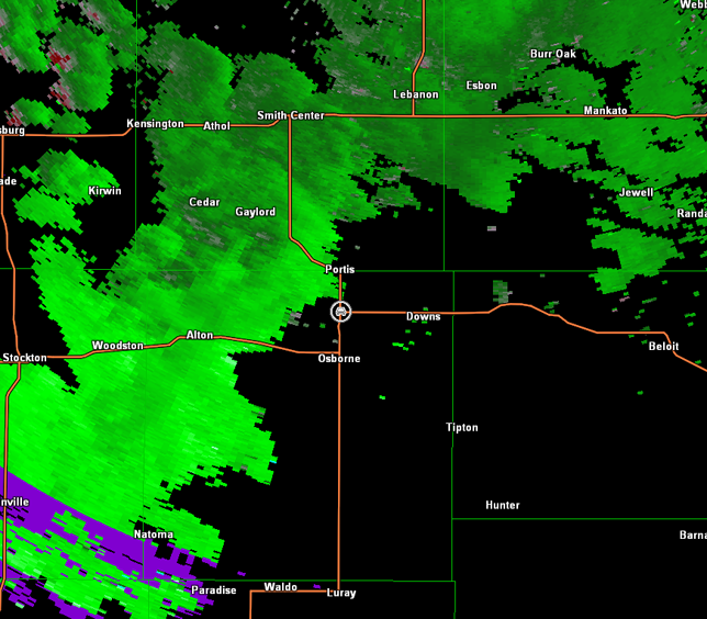
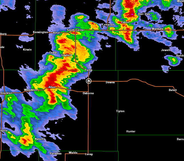
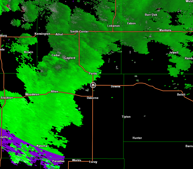
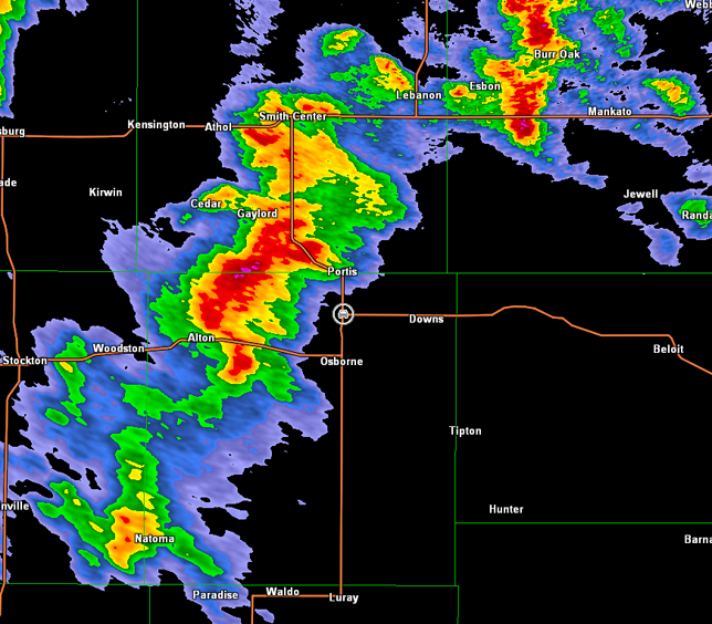
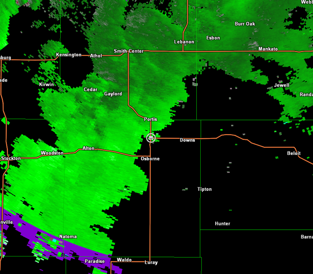
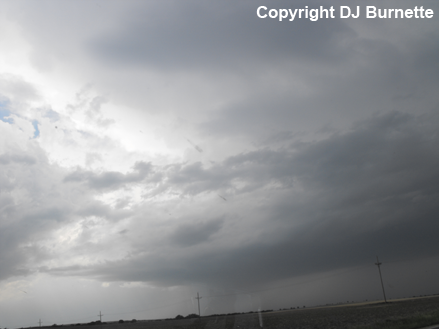
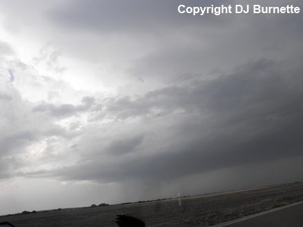
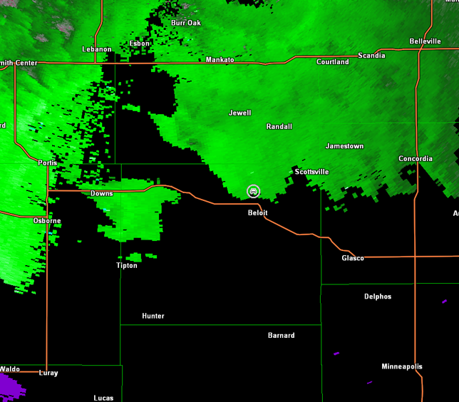
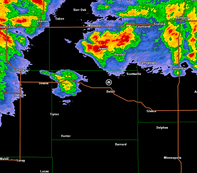
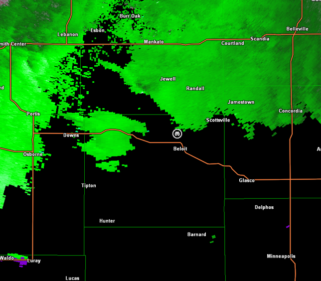
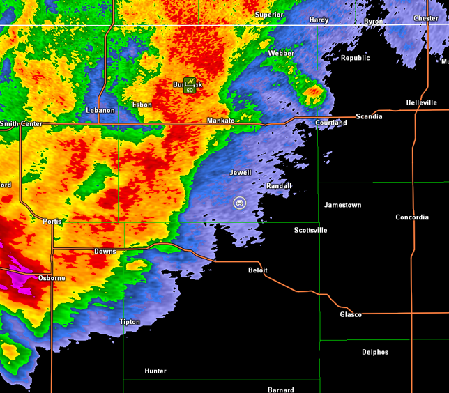
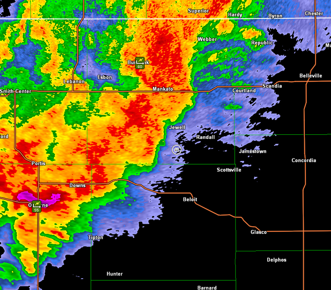
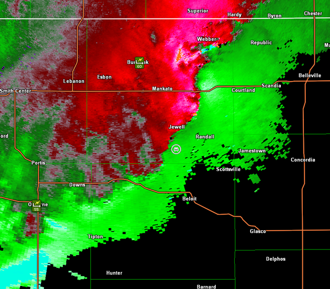
Ongoing storms over Nebraska and northern Kansas slowly began to intensify shortly after 1 p.m. CDT, as we grabbed a quick lunch in Russell. We traveled north on U.S. 281 toward the strongest storm west of Smith Center, KS. Meanwhile, other storms were intensifying farther to the southwest in vicinity of Stockton, KS. Those storms caught up with us north of Osborne, KS, and we pulled off at the intersection of U.S. 281/U.S. 24 to assess the intensifying storms to our west (images below; view is north of Osborne looking west). Radar data included below show the intensifying storms to our west (images below; car symbol denotes our location).
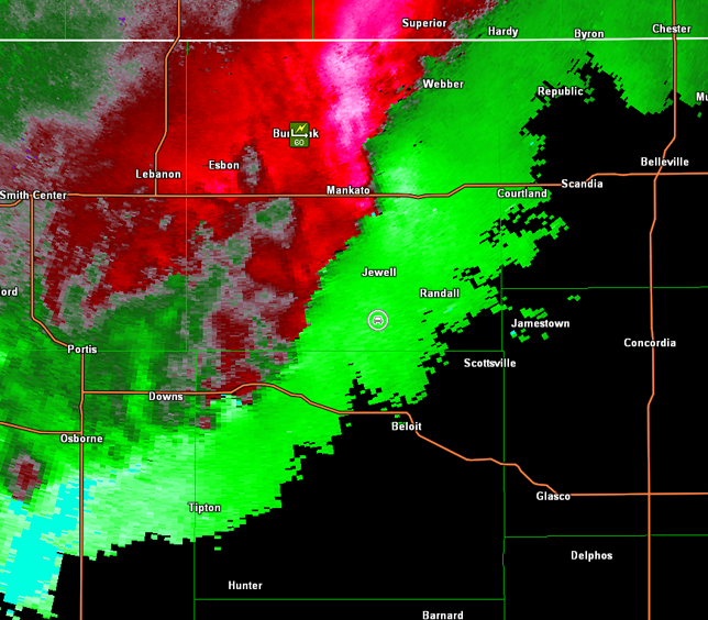
Hastings, NE Storm Relative Velocity 1913Z
Hastings, NE Base Reflectivity 1918Z
Hastings, NE Storm Relative Velocity 1918Z
Hastings, NE Base Reflectivity 1922Z
Hastings, NE Storm Relative Velocity 1922Z
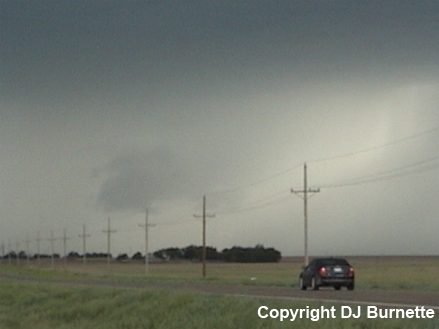
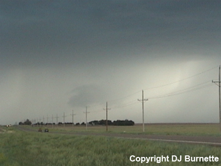
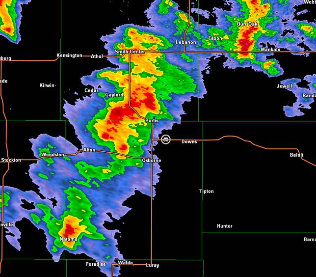
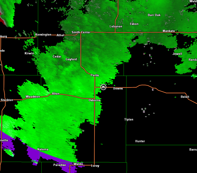
We traveled east on U.S. 24 and noticed a lowering in the rear view mirror that would be in the correct area of the storm, but it was very difficult to tell whether or not it was attached to the base of the storm (images below; view is west of Downs looking west-northwest). Radar data didn't show any significant organization (images below; car symbol denotes our location).
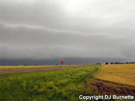
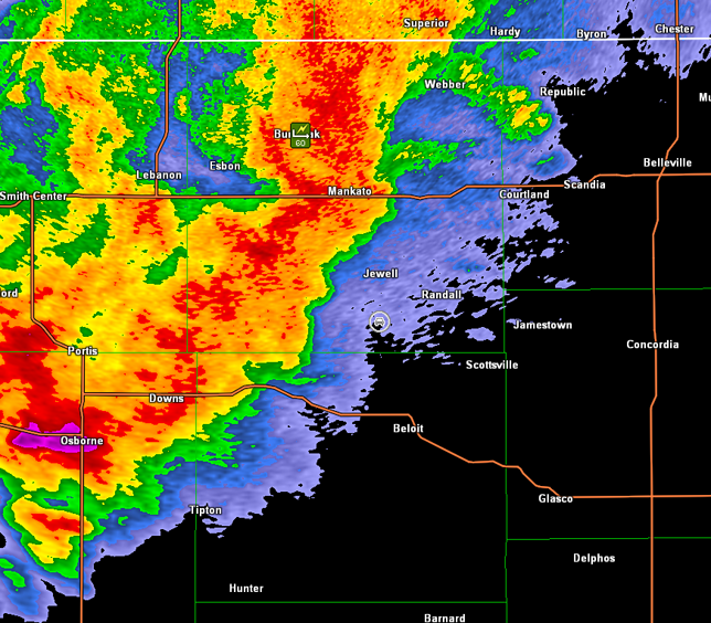
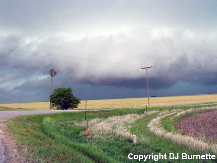
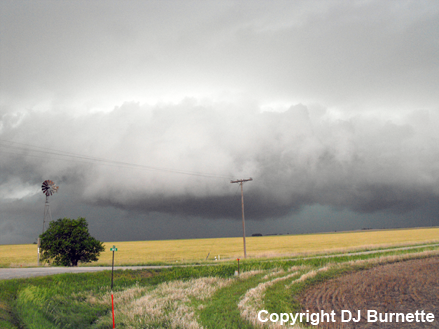
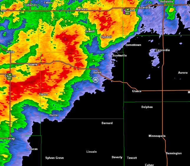
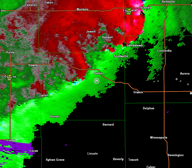
We continued moving east on U.S. 24, and followed the storm north of Downs. However, it looked less impressive with time. Thus, we moved back to Downs and then east on U.S. 24, as another storm developed off to southwest. We stopped in Beloit, KS, and waited on the intensifying storm that was located south of Downs. We eventually moved north on K-14 to intercept the storm. It had a nice rain-free base, as we approached it from the south (images below; view is north of Beloit looking north-northwest). Radar showed a tight reflectivity gradient on the backside and modest circulation (images below; car symbol denotes our location).
Hastings, NE Storm Relative Velocity 2057Z
Hastings, NE Base Reflectivity 2101Z
Hastings, NE Storm Relative Velocity 2101Z
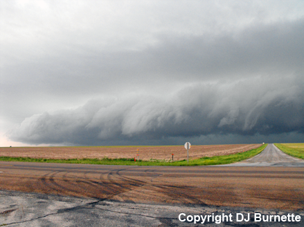
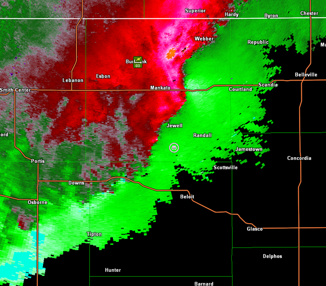
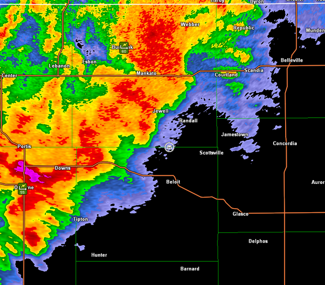
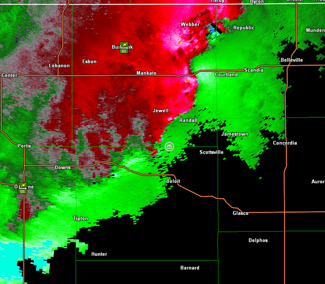
We followed the storm northeast and stopped on U.S. 36 north of Formoso, KS. The storm looked less impressive with time though. Meanwhile, a large area of severe thunderstorms was observed farther back to our west. Thus, we made our way back to the west on U.S. 36 and then south on K-14. Unfortunately, we moved south a bit too fast, and were south of Jewell, KS, when circulation developed on radar in vicinity of Mankato, KS. However, radar showed additional circulation, though weaker, farther down the line of storms in vicinity of our location (images below; car symbol denotes our location). We observed a very nice shelf cloud during this time with circulation noted (images below; view is south of Jewell looking west and northwest).
Hastings, NE Storm Relative Velocity 2214Z
Hastings, NE Base Reflectivity 2219Z
Hastings, NE Storm Relative Velocity 2219Z
Hastings, NE Base Reflectivity 2223Z
Hastings, NE Storm Relative Velocity 2223Z
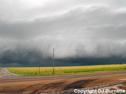
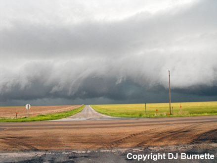
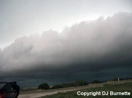
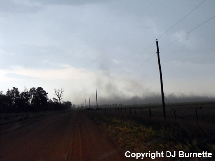
Given that moving back to north to intercept the stronger circulation would require a core punch, we continued south toward Beloit and observed occasional gustnadoes. We stopped again just north of Beloit. No gustnadoes were observed at this brief stop though. Just a nice shelf cloud (images below, view is north of Beloit looking west-northwest). Radar images are also below (car symbol denotes our location).
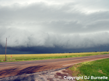
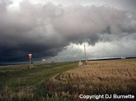
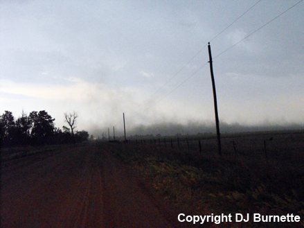
We continued south on K-14 and observed a few more gustnadoes. I tried to take photos of them while we were moving but that was futile. We stopped on K-14 south of Beloit to view the shelf cloud (images below; view is south of Beloit looking north and west). No further gustnadoes were observed, but circulation was noted. Radar images are also below (car symbol denotes our location).
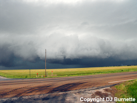
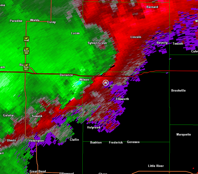
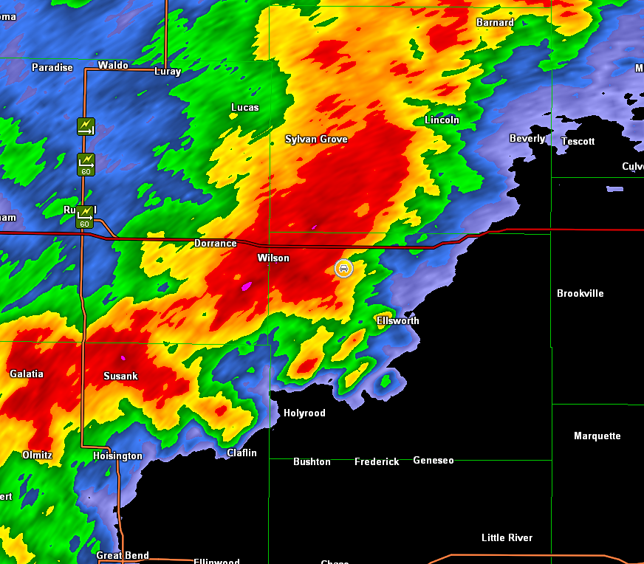
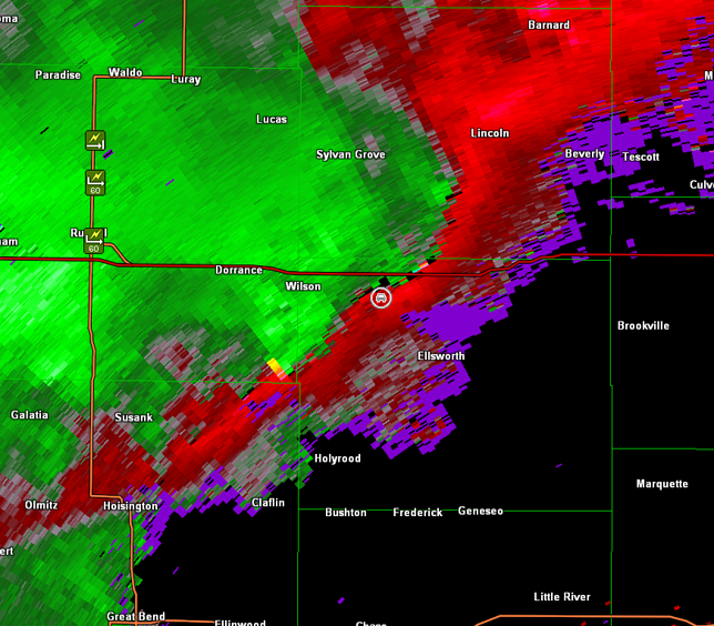
We continued down the line of storms to I-70 and then made a call to go west hoping to be able to get the Wilson exit and view the line of storms with gustnadoes from there. However, the line was moving too fast, and we had to bail three miles early. This put us on backroads, as the leading edge of the storms approched our location and a gustnado developed in front of us (images below; view is northwest of Ellsworth, KS looking south). Radar images are also below (car symbol denotes our location). Note the switch of the radar site to Wichita, KS.
Wichita, KS Storm Relative Velocity 2351Z
Wichita, KS Base Reflectivity 2355Z
Wichita, KS Storm Relative Velocity 2355Z
Once the gustnado moved off to the east and dissipated, we made a run for Ellsworth post-haste in order to get back out ahead of the line of storms. We eventually ended up at a rest area on I-135 south of Salina, KS, and with darkness approaching, it was time to call it a night. The next round of severe thunderstorms was expected on the 3rd (two days later), and that would be our next storm chase. We spent the night in Wichita, and visited with friends at AccuWeather Enterprise Solutions on the 2nd, before heading back to the Kansas City area later in the day to be in a better position for the next storm chase on the 3rd.