Storm Chase Log 3 June 2014
Chasers: Dorian J. Burnette and Jeff House
Preliminary Destination: Saint Paul, NE
Note: Images have been decreased in size. Click on an image to view a larger version.
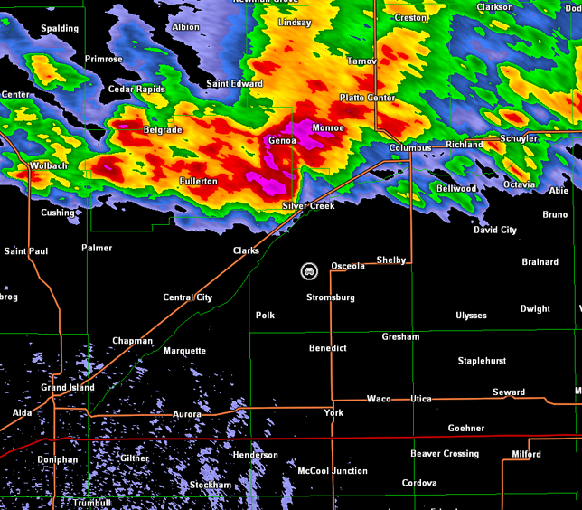
After a lunch in Saint Paul, NE, we traveled north on U.S. 281, and sat in vicinity of U.S. 281 and NE-91, while storms became more organized to our north and northwest. Shortly after 4 p.m. CDT, good rotation was detected on radar west of Burwell, NE, and we immediately moved to intercept the storm. We traveled west on NE-91 past Ericson, NE and then south-southwest on NE-70 into Ord, NE. A tornado warning was issued as we were en route to Ord, and we quickly found ourselves in the path of the mesocyclone. Thus, we entered the town of Ord and made an exit east-southeast on NE-11 post-haste, as the storm quickly approached the town. A tornado was reported north of the town, but we did not see it.
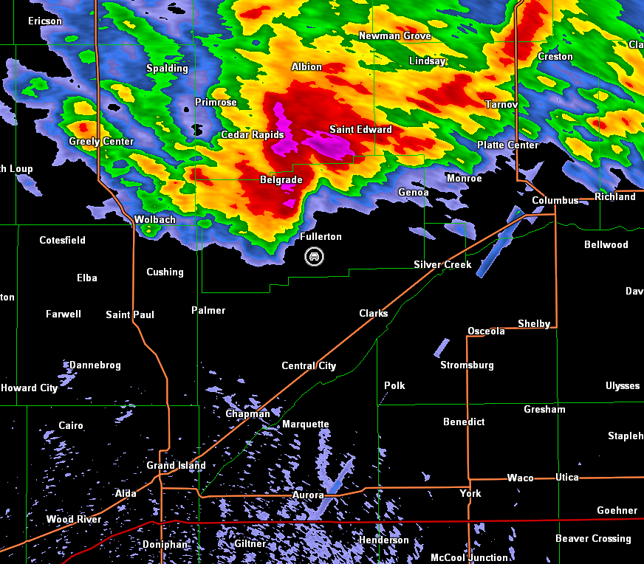
Tornadoes continued to be reported to our north as we passed by North Loup and Scotia, NE on our way back to U.S. 281. Unfortunately, NE-11 had taken us a bit far southeastward, and we could not see the tornadoes to our north. The storm moved east-southeast at a rapid 45-50 mph throughout this chase, which meant it was constantly on our tail. The storm was also a high-precipitation supercell by this time, and this combined with its speed and rivers limiting escape options meant that we had to play very conservatively. There was no real chance for us to get up into the notch and look at the mesocyclone area of the storm at any time following our close encounter with it in vicinity of Ord. The radar imagery below will show that we consistently played the southern end of the storm in advance of the rear-flank gust front. This supercell storm was also being warned for straight-line winds to 70 mph, and those winds were likely realized within this region of the storm given our observations.
It should come as no surprise that most of what we saw during this chase was blowing dust due to the high straight-line winds within the rear-flank downdraft and gustnadoes on the leading edge of the rear-flank downdraft. However, gustnadoes are shallow vortices which do not extend up to the cloud base, and there were times on this chase, where we observed rotating dust up to the cloud base with rotation noted in the cloud base. Such vortices blur the line between large gustnado and landspout tornado. For sure, this is a gray area, and it illustrates the problem associated with strict classifications. The atmosphere produces a wide range of vortices, and doesn't care how we classify things (see also the "What is a tornado?" essay by Dr. Chuck Doswell). Perhaps rear-flank gust front interaction with the surface warm front was part of the reason we observed large gustnadoes/landspout tornadoes rather than just simple shallow gustnadoes. See further discussion at the end of this storm chase account.
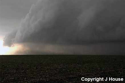
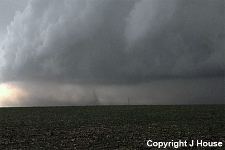
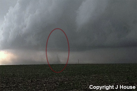
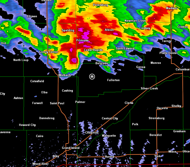
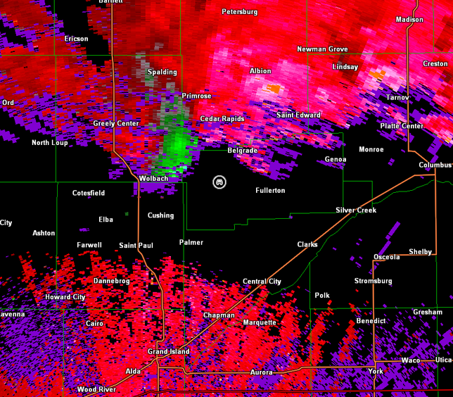
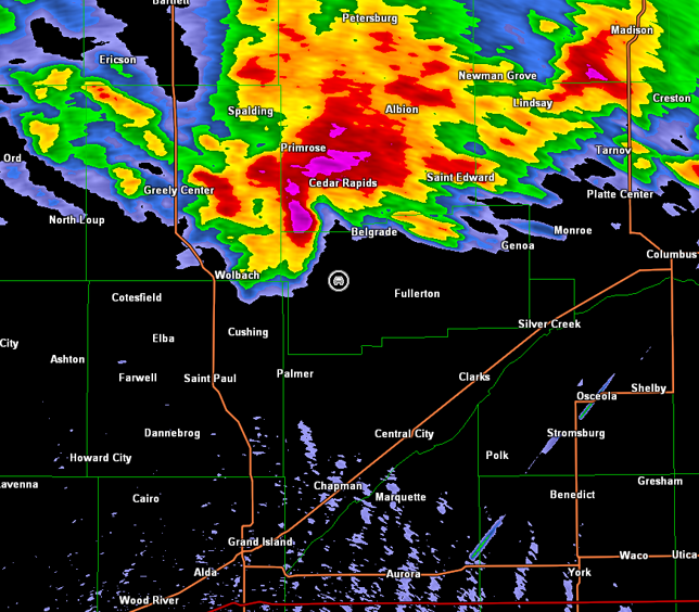
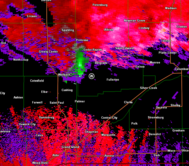
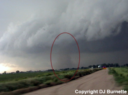
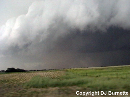
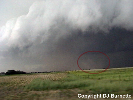
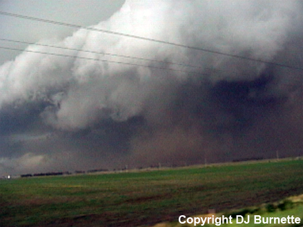
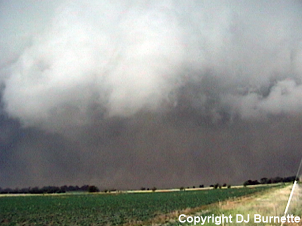
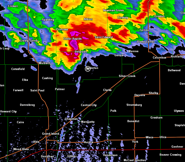
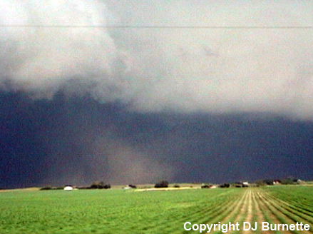
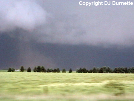
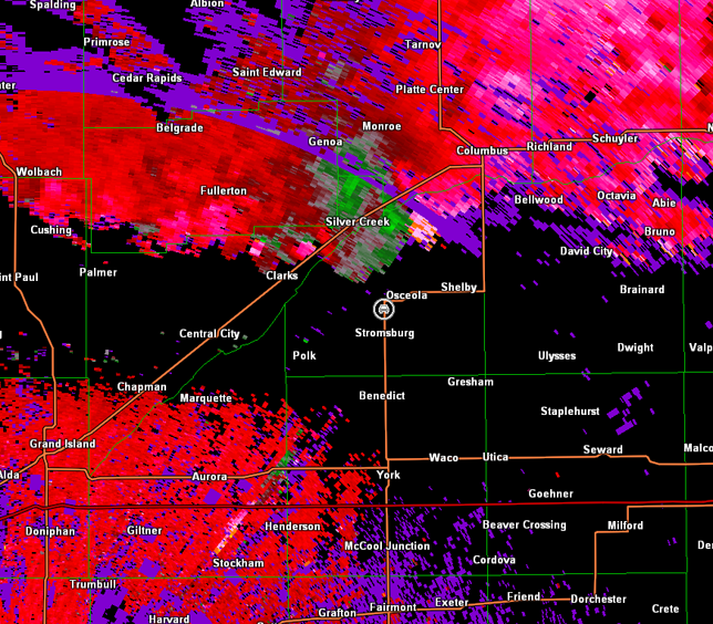
Once we got out ahead of the storm enough, we looked for an ideal spot to stop east of Wolbach, NE on NE-22. Stopping briefly, we observed a large amount of blowing dust (first image below; view is east of Wolbach looking west-southwest), but a circulation also developed on the right side of the blowing dust with dust appearing to rise toward a rotating base (last two images below, circulation circled in red; view is east of Wolbach looking west-southwest). Radar imagery below shows our location relative to the rear-flank gust front (images below; car symbol denotes our location).
Hastings, NE Storm Relative Velocity 2223Z
Hastings, NE Base Reflectivity 2227Z
Hastings, NE Storm Relative Velocity 2227Z
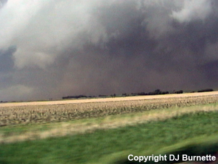
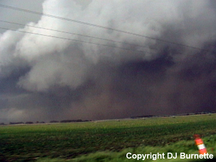
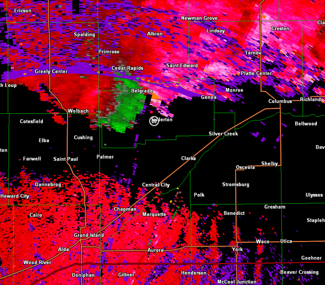
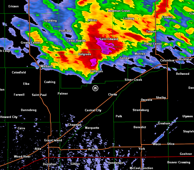
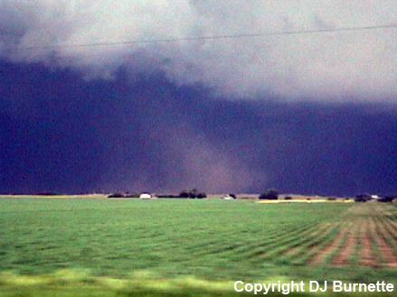
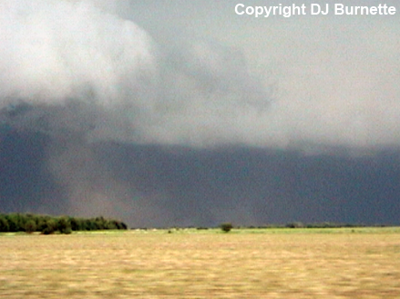
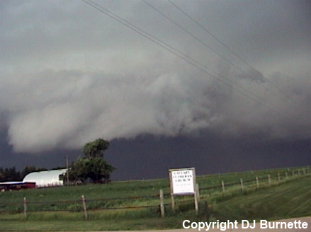
We continued east on NE-22, and then turned south on NE-14 at Fullerton, NE. As we moved south of Fullerton, NE, we observed what appeared to be a landspout tornado to our west (top left two images below, landspout circled in red; view is south of Fullerton looking west). Another rear-flank downdraft surge was observed as we continued south on NE-14 though, and a well-defined gustnado was observed on the leading edge (third and fourth images below, gustnado circled in red; view is south of Fullerton looking west). This new surge quickly turned into massive wall of dust, as we continued to the south (last four images below; view is south of Fullerton looking northwest). Radar data during this time are below (car symbol denotes our location as we continue moving south to stay ahead of the storm).

Hastings, NE Storm Relative Velocity 2236Z
Hastings, NE Base Reflectivity 2240Z
Hastings, NE Storm Relative Velocity 2240Z
Hastings, NE Base Reflectivity 2245Z
Hastings, NE Storm Relative Velocity 2245Z
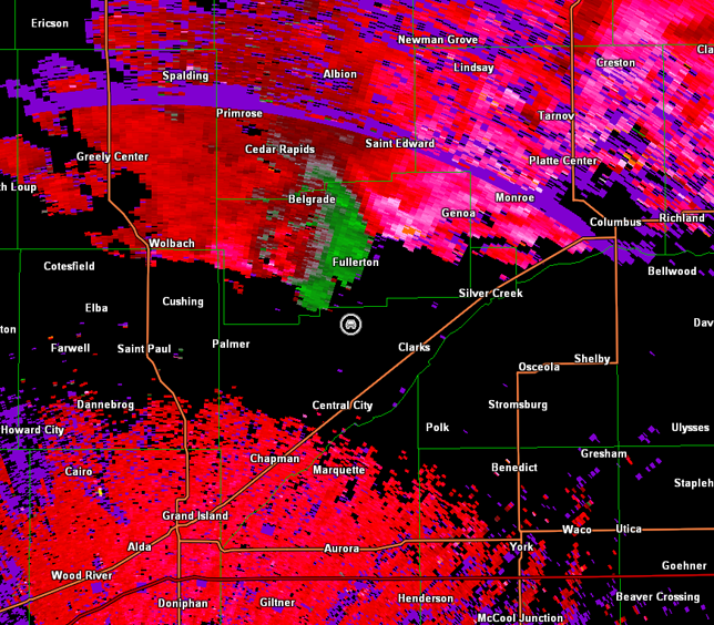
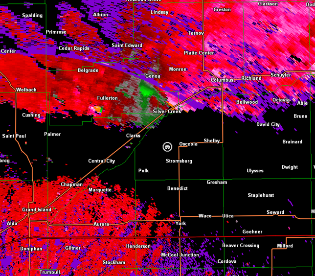
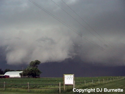
We continued south on NE-14 to NE-92, and then east on NE-92 toward Osceola, NE. As we passed by the junction of NE-39 and NE-92, another ground circulation was observed. Initially, it appeared to be another gustnado, but dust was observed rising to circulation in the cloud (images below; view is west of Osceola looking north). Radar data are below and again show this large gustnado/landspout tornado occurred along leading edge of the rear-flank downdraft (car symbol denotes our location), but warm front interaction may have been a key player in what we observed (see below).
We moved south on U.S. 81 and made a quick stop to view the increasingly menacing looking shelf cloud (images below; view is southwest of Osceola looking north-northwest). Radar imagery are also included below (car symbol denotes our location).
We continued to follow the southern end of the storm east and southeast, but the road network took us farther away from the storm. We were able to catch back with the southern end of storm east of Lincoln, NE, but by that time the storm was all outflow. We continued east to I-35, and then south back toward the Kansas City area for the night.
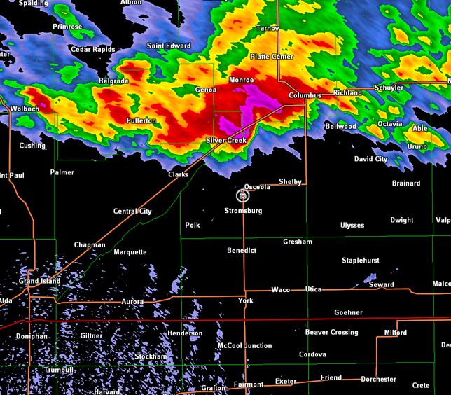
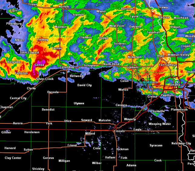
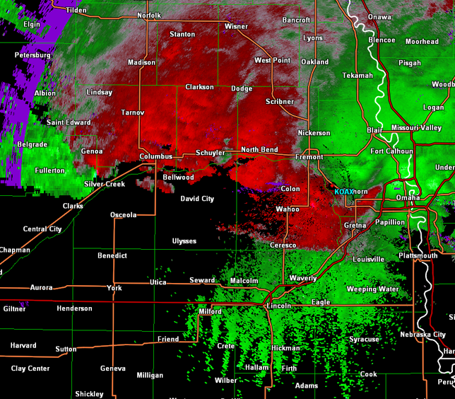
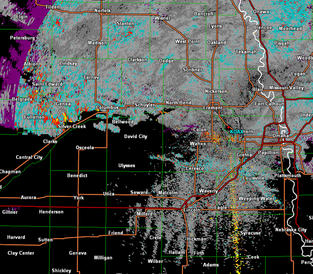
Assigning a precise term to every ground circulation we observed is difficult. Perhaps this was due to interaction of the rear-flank gust front with the surface warm front. A surface map from 23Z is below. The storm was northeast of Grand Island, NE (GRI) and just west-southwest of Columbus, NE (OLU) at that time. Base reflectivity, storm relative velocity, and spectrum width data from the Omaha, NE radar show a feature which is likely the warm front along a line from near Louisville to west of Ceresco, NE (images below). Extrapolating this line west-northwest and combining this information with the surface map suggests the warm front was most likely between Silver Creek and Osceola around 23Z.
Omaha, NE Storm Relative Velocity 2301Z
Omaha, NE Spectrum Width 2301Z
Based on the most likely location of the warm front, it seems plausible that interaction between the warm front and the rear-flank gust front resulted in enhanced low-level stretching and helicity leading to vortices that blur the line between a large gustnado and a landspout tornado. Large gustnadoes intensifying due to gust front interaction with a synoptic front have been observed before such as at Williamstown, KS in 2011, and whether that vortex was a large gustnado or a landspout tornado is debatable (see this discussion by Jon Davies). Perhaps the location of the warm front was also a reason why more significant tornadoes associated with the mesocyclone did not occur. The storm could never draw the surface warm front north, and may have remained slightly elevated as a result.
For sure, we all need to be aware that the atmosphere produces vortices of different sizes and strengths, and lines between tornadoes and non-tornadoes can blur significantly. This is not just an issue with gustnadoes and landspout tornadoes. What if the winds associated with the mesocyclone are doing damage equivalent to a tornado? That is one interpretation of the El Reno, OK tornado of 31 May 2013.