Storm Chase Log 19 May 2013
Chasers: Dorian J. Burnette, Jeff House, Megan Piquiet, and Liana Wagle
Preliminary Destination: Blackwell, OK
Note: Images have been decreased in size. Click on an image to view a larger version.
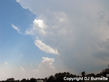
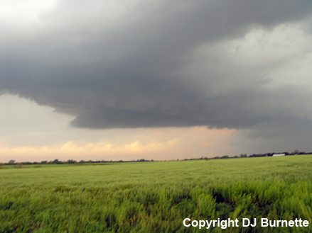
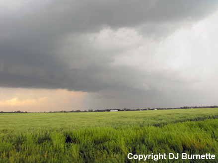
This was Day 2 of a three-day storm chase in KS and OK (click here for the Day 1 account). We arrived in Blackwell, OK with enough time for lunch, while we waited on afternoon thunderstorm development. Thunderstorms began to develop toward 3 p.m. CDT, and we moved west into Medford, OK to intercept growing towers (images below; view is from the east side of Medford, looking southwest and west).
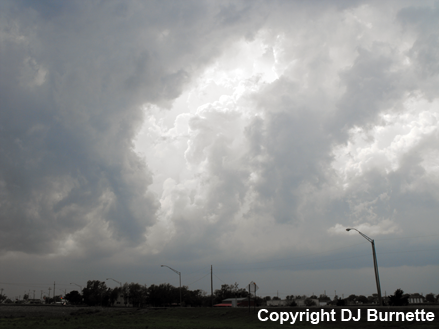
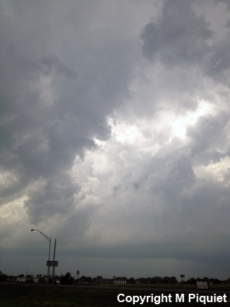
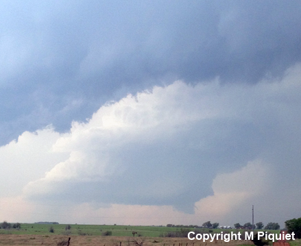
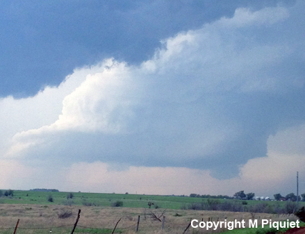
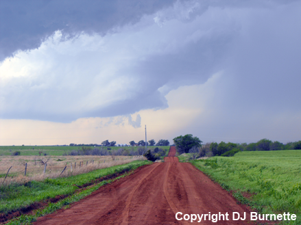
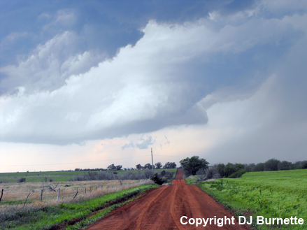
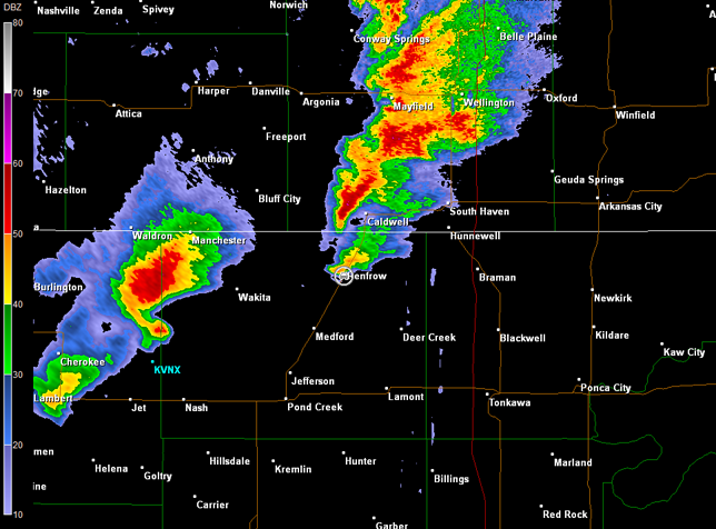
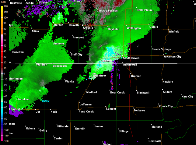
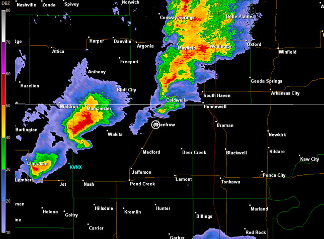
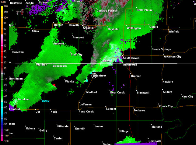
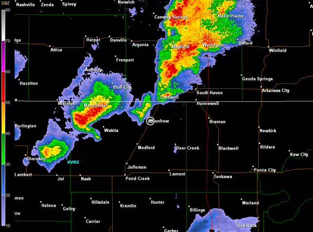
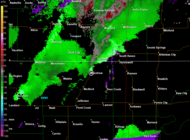
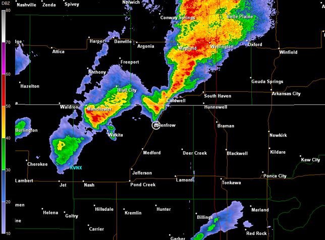
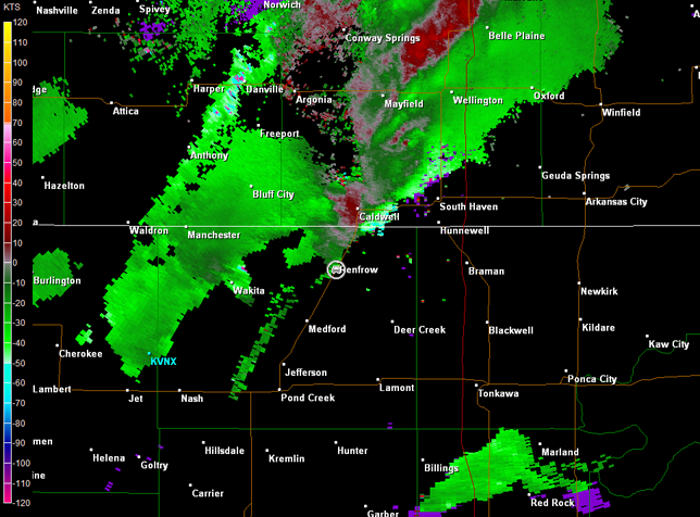
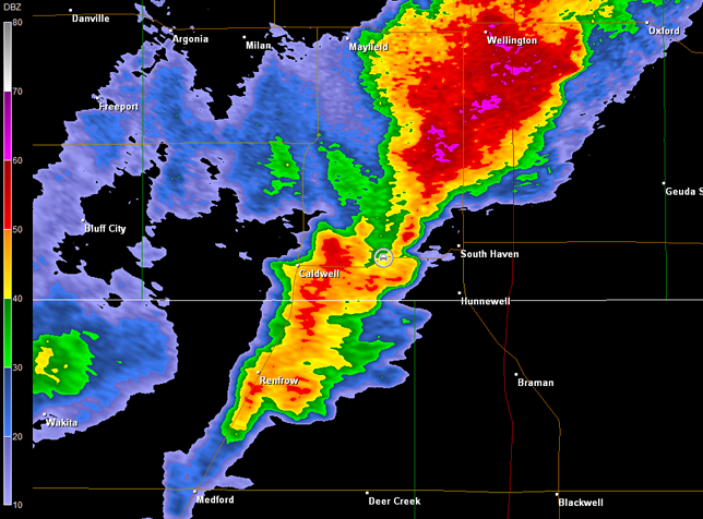
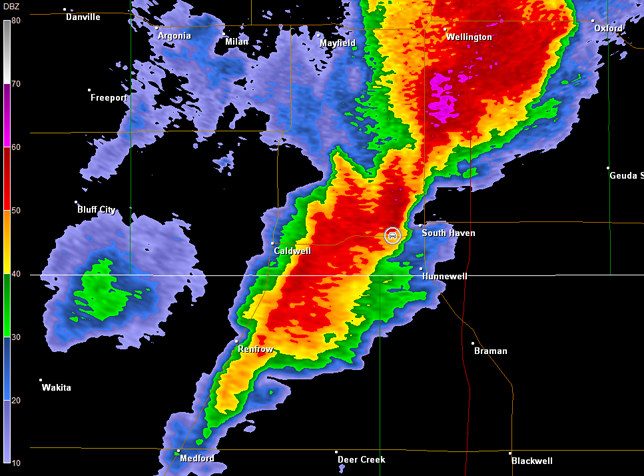
We followed the developing storms north on U.S. 81, and stopped to the southwest of Renfrow, OK to continue observing the storms. One cell was near us with a rain-free base organizing and lowering (first three images below; view is southwest of Renfrow, looking northwest and west). Radar data also showed a storm to the southwest of Wakita, OK that had a pronounced hook (images below; car symbol denotes our location), while visually from the field, the storm's structure looked like a "barber pole" (remainder of images below; view is southwest of Renfrow, looking west).
Wichita, KS Storm Relative Velocity 2059Z
Wichita, KS Base Reflectivity 2104Z
Wichita, KS Storm Relative Velocity 2104Z
Wichita, KS Base Reflectivity 2109Z
Wichita, KS Storm Relative Velocity 2109Z
Wichita, KS Base Reflectivity 2113Z
Wichita, KS Storm Relative Velocity 2113Z
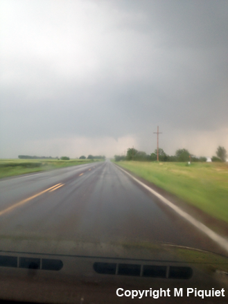
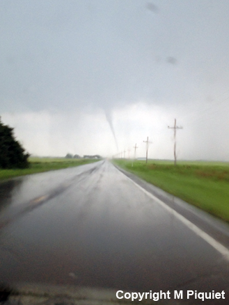
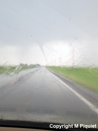
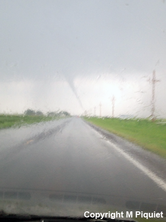
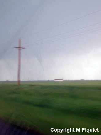
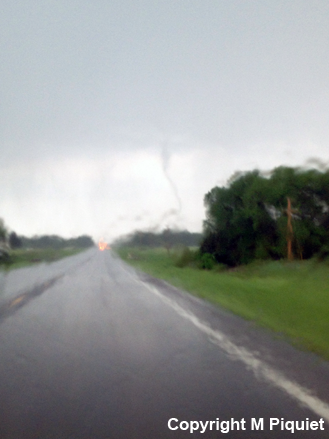
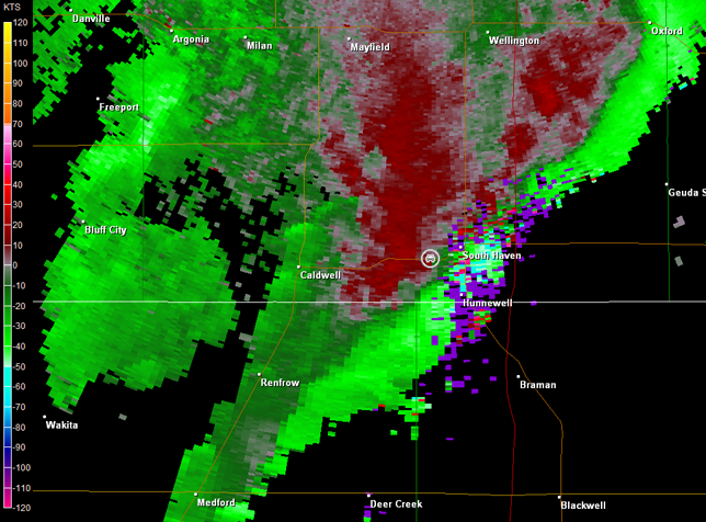
The cell near us eventually became the dominant supercell. Unfortunately, that meant we were out of position, as we moved north across the KS/OK line into Caldwell, KS. We attacked the storm from the west and punched through the rain east of Caldwell. A tornado developed in front us, and Megan snapped pictures while we continued to move eastward through the rain (images below; view is east of Caldwell, looking east). It is possible that we may have seen two separate tornadoes, since a couple of different reports are noted in the database, and the tornado in images 5 and 6 (lower right below) is back south of the highway again. That said, U.S. 81 turns north a bit between Caldwell and South Haven, KS, and rain was obscuring our view at times, so it is difficult to say for certain. Radar data are below, but our location, denoted by car symbol, is only approximate, since we were in motion and I was unable to reconstruct our precise location (GPS had failed on me all three chase days). Radar data also have issues with range-folding.
Wichita, KS Storm Relative Velocity 2132Z
Wichita, KS Base Reflectivity 2137Z
Wichita, KS Storm Relative Velocity 2137Z
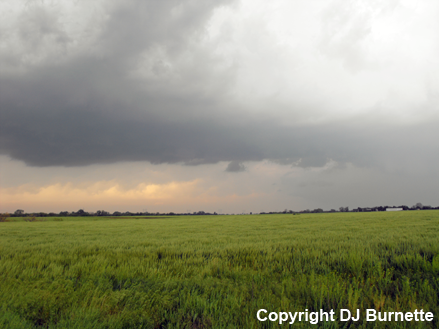
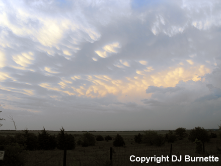
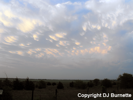
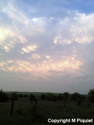
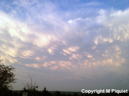
Once the tornado lifted, we moved southward from South Haven back into northern OK on U.S. 177. We stopped briefly to note the outflow dominance of the storm. This seemed to be a consistent problem during the rest of the chase--updrafts were being undercut by the cold front. Moreover, intense supercells had developed farther to the south in vicinity of I-40. These supercells were in such a position that they were potentially robbing moist inflow from storms farther to the north. The combination of these two issues seemed to cause the storms we intercepted the rest of the day to have difficulty in maintaining organization long enough for tornadogenesis. We would get on a storm and chase it for a ways, then its circulation would diminish, and new development would be noted farther to the southwest. We spent the next 4 hours hopping from one cell to the next without much more than isolated lowerings here and there. We eventually ended up west of Newkirk, OK taking pictures of mammatus clouds at sunset (images below; view is west of Newkirk, looking northeast).
Since darkness was upon us, we traveled back toward Wichita, KS to sleep fast before chase day number 3.