Storm Chase Log 20 June 2011
Chaser: Dorian J. Burnette
Preliminary Destination: Beatrice, NE
Note: Images have been decreased in size. Click on an image to view a larger version.
This was Day 2 of a two-day storm chase in KS and NE (click here for the Day 1 account). Computer models were rather quick in moving the big system for this day eastward, and while I had been quite skeptical of that speed, I started out farther east just in case. In the end, I should have stuck with my original thinking. I headed toward Beatrice and kept a close eye on the ongoing trends. While nothing had developed so far, I was getting nervous about storms developing shortly well to my west. I decided to continue north into Lincoln, NE, so I could use I-80 to quickly correct westward. This was the correct move, but I was way out of position with respect to the early storm initiation near Hill City, KS. A lone supercell thunderstorm developed north of Hill City and continued into southcentral NE producing one tornado after another.
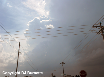
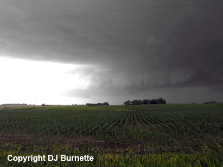
Meanwhile, I was moving west rapidly on I-80. While my original target was the storm coming out of KS, other towering cumulus were noted along the dryline as I passed through Hastings, NE. I decided to stay on the newly developing storm towers, since they would be in the better overall environment longer. I stopped west of Hastings, NE on U.S. 6 to briefly watch the towers, before following them north on a country road toward Wood River and Cairo, NE (images below; view is west of Hastings, looking west).
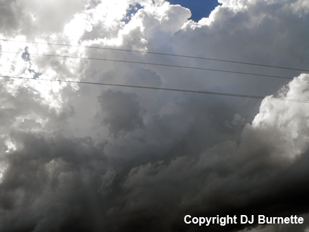
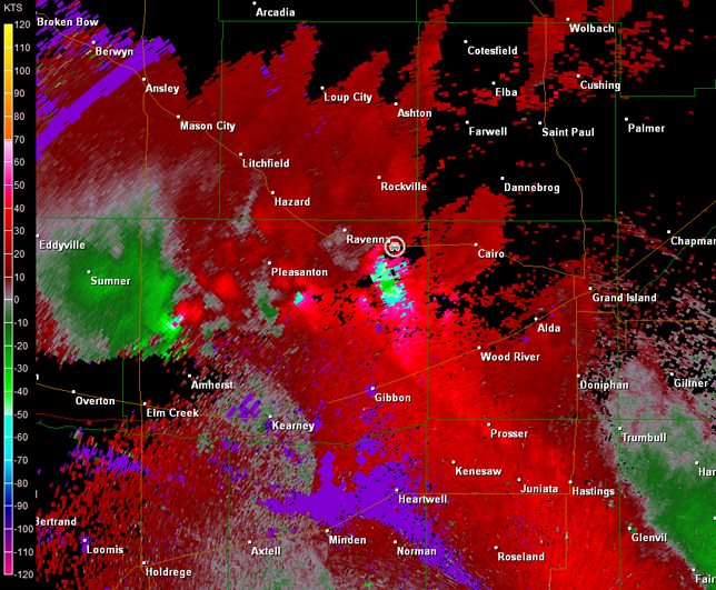
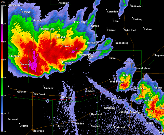
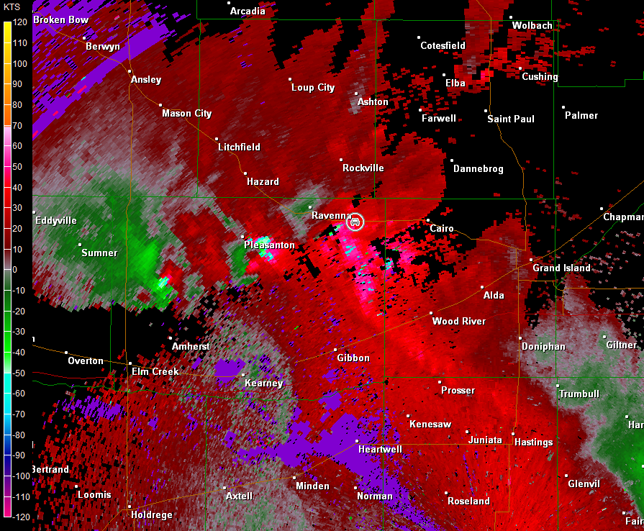
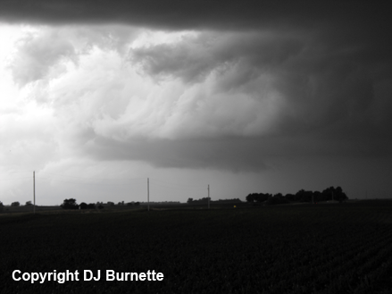
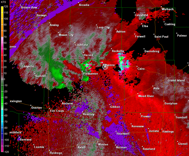
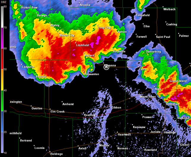
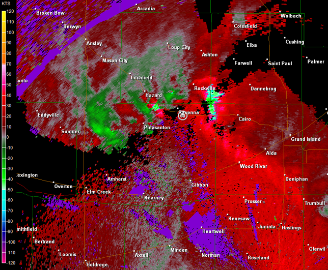
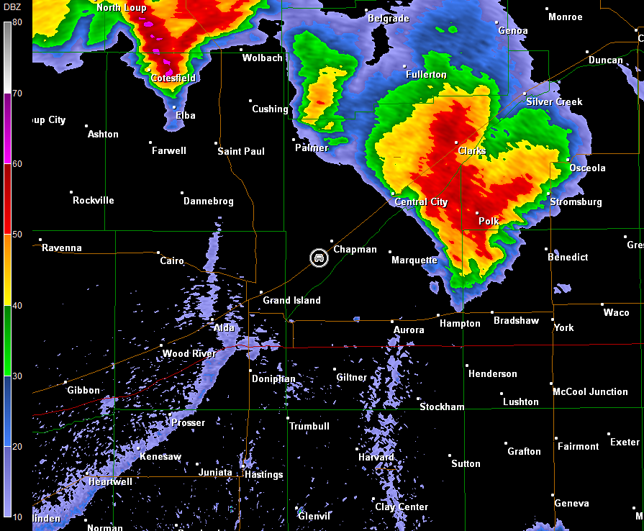
The towers exploded into cumulonimbus clouds the closer I got to Cairo. I stopped briefly on NE-2 west of Cairo to take a quick picture of the mesocyclone off to my west-southwest (image below; view is west of Cairo looking west-southwest). Radar data revealed a rather massive supercell storm with rotation in vicinity of Pleasanton (images below; car symbol denotes my location), and a tornado warning had already been issued on the storm.
Hastings, NE Storm Relative Velocity 2126Z
Hastings, NE Base Reflectivity 2130Z
Hastings, NE Storm Relative Velocity 2130Z
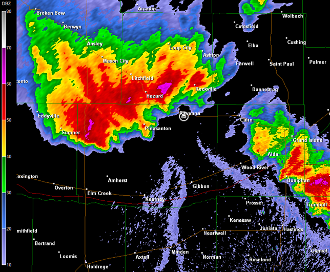
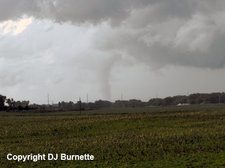
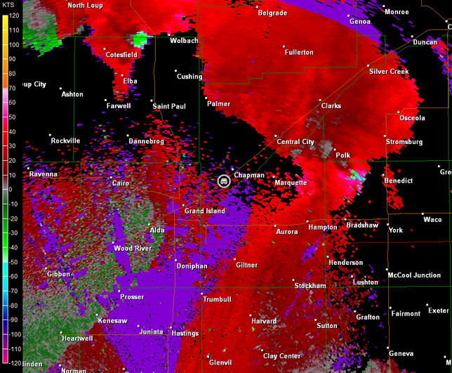
I continued west on NE-2 and as I crested a hill, I observed a cone tornado on the ground to my southwest near Pleasanton. This tornado become more stovepipe in shape as I watched it (images below; view is east of Ravenna, looking southwest). Radar data showed a good signature, as the storm moved north toward NE-2 (images below; car symbol denotes my location).
Hastings, NE Storm Relative Velocity 2140Z
Hastings, NE Base Reflectivity 2144Z
Hastings, NE Storm Relative Velocity 2144Z
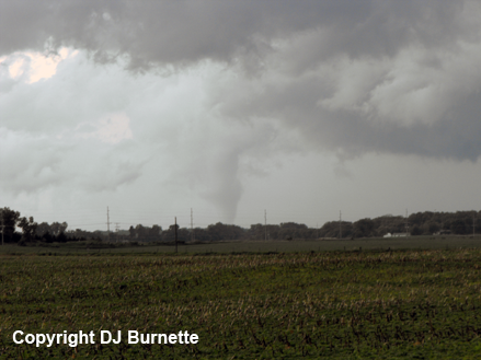
I set the video camera up, but had a heck of a time trying to keep the wind from knocking over the tripod, while I called in the tornado report. A video time-lapse of the tornado is below (approximately 3 minutes of video compressed into one minute; view is east of Ravenna, looking southwest). Unfortunately, the contrast is not the best.
Tornado Video (59 sec)
I followed the storm into Ravenna, where the tornado sirens were sounding. Various circulations were all around me, and I was not comfortable with my location. Instead, I chose a country road a little farther east to follow the storm up toward Rockville, NE. There was a tendency for new storms to the southeast to become the tornado producers, and a big storm to the southeast of me was catching my attention. I decided to go after this cell post-haste. It was the correct move, but I was on the wrong side. As I moved around the northern portions of Grand Island, NE and began to move up U.S. 30, a report of a multi-vortex tornado came through. I stayed on target and hoped that I could come around on the backside of the storm just as it crossed U.S. 30. Radar images are below with the car symbol depicting me chasing this tornadic supercell north-northeastward.
The storm began to decrease in intensity as the backside approached Silver Creek, NE, so while my plan of attack might have worked, it ended with nothingness. I followed the storm farther north into Columbus, NE, and almost decided to give up, when another tornado warning was issued. The storm I had been following had cycled again, and was showing some decent rotation. I followed it north on U.S. 81 for about five miles before noting that the rotation was looking less impressive.
The main show was now to my east in the form of a raging squall-line with hurricane-force winds taking aim on Omaha, NE. I followed this line on into Omaha to stay the night, and noted several intersections with traffic lights completely knocked out. Thanks to Cory Phelps for nowcast assistance. My friend and colleague, Jon Davies, has an interesting write-up about the storm environment on this day here.