Storm Chase Log 19 June 2011
Chaser: Dorian J. Burnette
Preliminary Destination: Concordia, KS
Note: Images have been decreased in size. Click on an image to view a larger version.
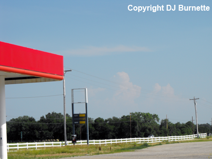
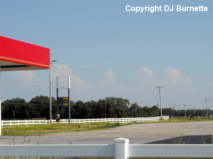
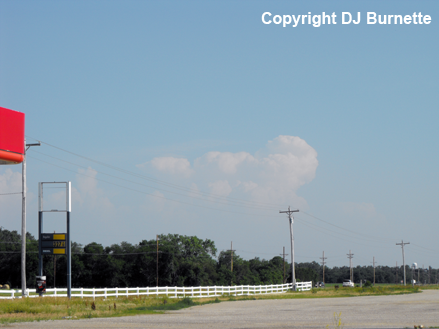
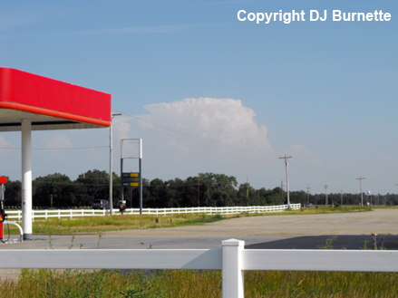
This was Day 1 of a two-day storm chase in KS and NE. I arrived in Concorida just before 5 p.m. CDT, and sat north of the city on U.S. 81 awaiting convective initiation. By 5:30 p.m. CDT, towering cumulus clouds were observed to my south (images below; view is north of Concordia, looking south). The first echoes on radar showed up by 6 p.m. CDT, as the towers grew into cumulonimbus clouds. It was time to move south and southeast to these intensifying thunderstorms south of Abilene, KS.
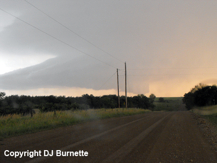
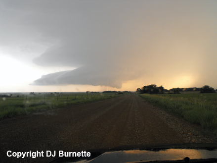
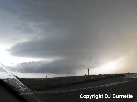
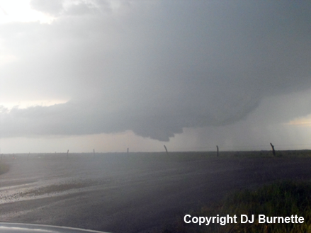
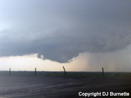
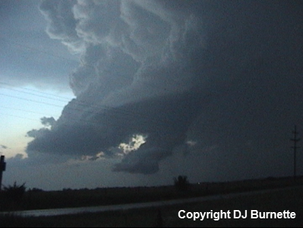
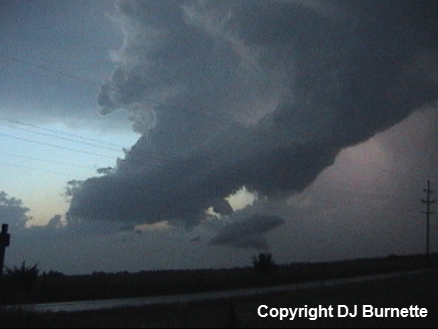
I moved south on U.S. 81 and then east on U.S. 24 through Manhattan to K-177. This highway took me south of I-70 into the beautiful Flint Hills. A tornado warning was issued on the storm to my southwest, and while I could see lowerings off to my southwest, I was still too far away to deduce much. There was a plethora of cloud-to-ground lightning strikes near me though. I stayed on K-177 until I arrived at a good dirt road southwest of Alta Vista, KS. I then moved west and was greeted by a tremendous mesocyclone (images below; view is southwest of Atla Vista, looking west)! I decided to call in to KSNW-TV to let them know what I was and was not seeing. Mark Bogner had received a report of tornado, but this must have been when I was in between hills and trees, since I never saw it.
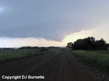
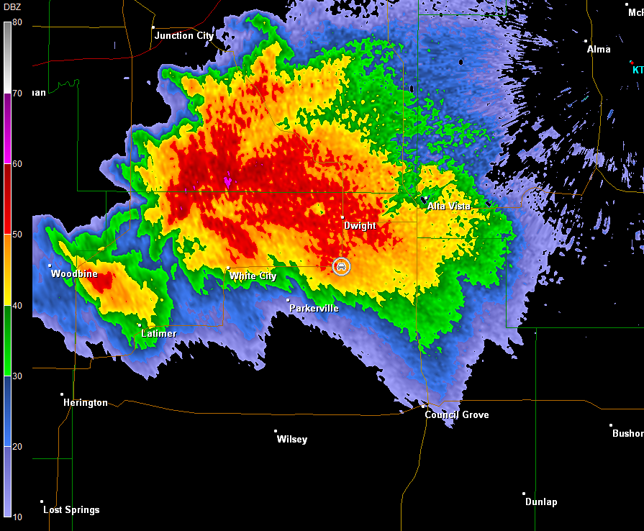
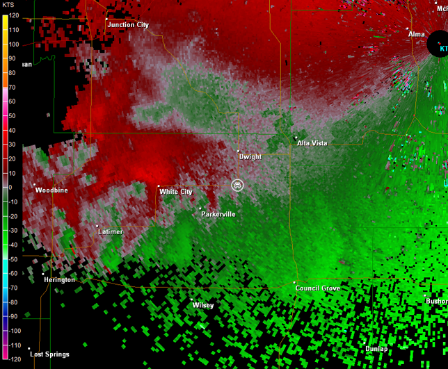
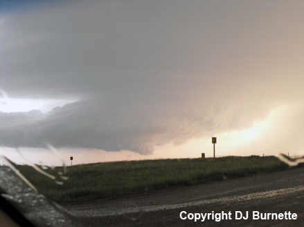
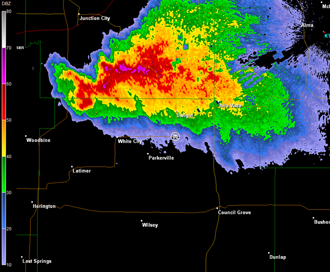
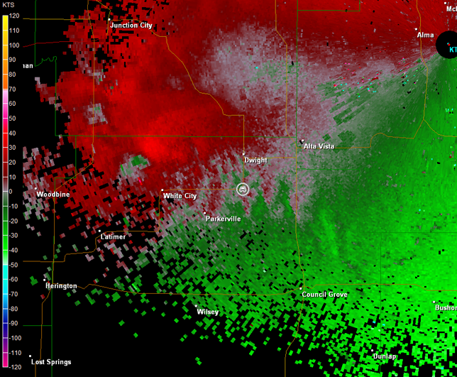
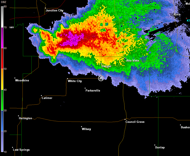
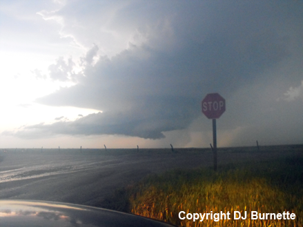
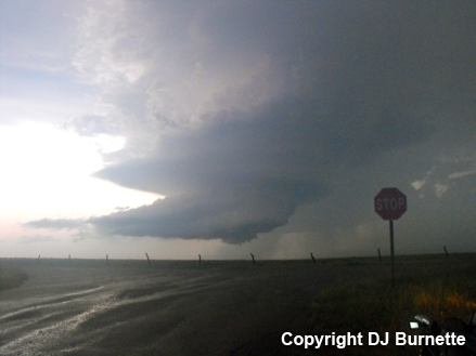
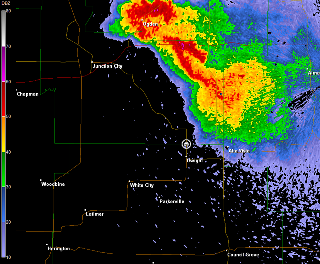
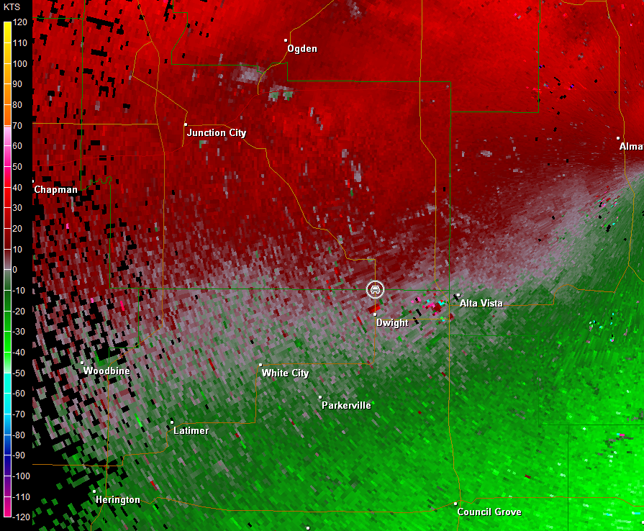
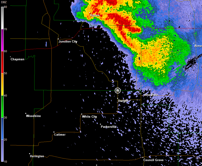
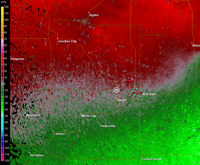
I found a good place to sit and watch the storm on K-4 south of Dwight (images below; view is south of Dwight, looking west-northwest). I was confined to the seat of my car initially given all of the cloud-to-ground lightning strikes going on around me. Some circulation was noted on radar imagery in vicinity of White City, KS (images below; car symbol denotes my location).
Topeka, KS Storm Relative Velocity 0134Z
Topeka, KS Base Reflectivity 0139Z
Topeka, KS Storm Relative Velocity 0139Z
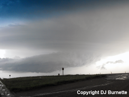
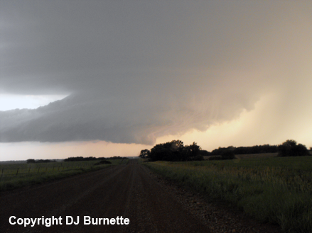
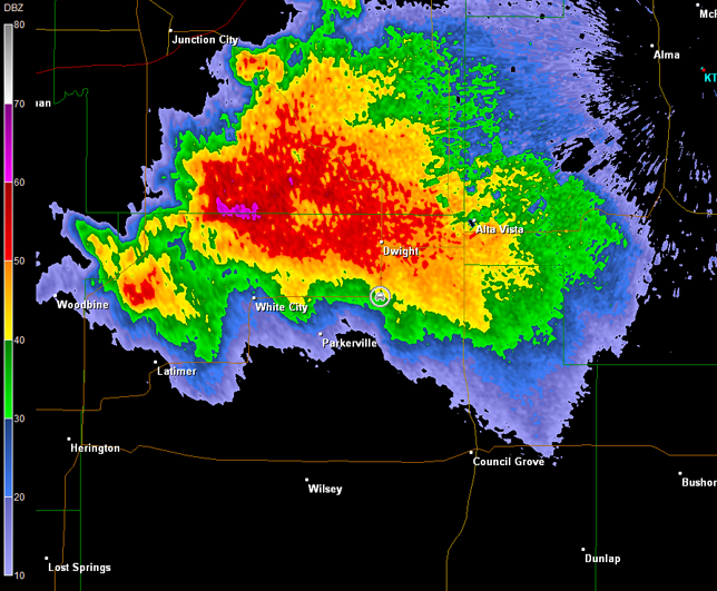
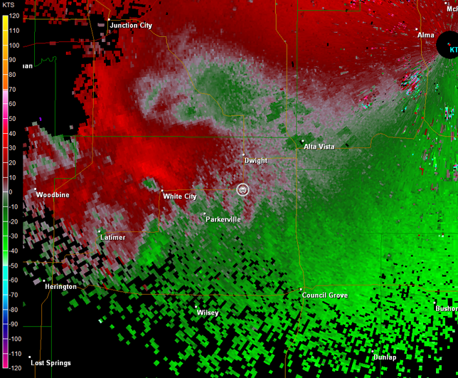
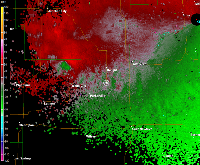
This storm continued to produce off and on wall clouds, but no additional tornadoes (images below; view is south of Dwight, looking west). The radar imagery is also below (car symbol denotes my location).
Topeka, KS Storm Relative Velocity 0153Z
Topeka, KS Base Reflectivity 0157Z
Topeka, KS Storm Relative Velocity 0157Z
A video time-lapse depicting the rotation associated with the mesocyclone and the off and on wall clouds is also below (approximately 12 minutes of video compressed into one minute; view is south of Dwight looking west).
Mesocyclone Video (1 min 2 sec)
I continued to follow the storm to the north of Dwight, and I stopped on K-57 at the Morris/Geary county line. The storm looked less impressive and more elevated with time (images below; view is north of Dwight, looking northwest). Radar data also showed the storm was losing its punch (images below; car symbol denotes my location).
Topeka, KS Storm Relative Velocity 0230Z
Topeka, KS Base Reflectivity 0234Z
Topeka, KS Storm Relative Velocity 0234Z
Darkness was now upon me and the storm was weakening, so I decided to head toward Topeka, KS to stay for the night and prepare for the next day's storm chase. Thanks to Cory Phelps and Mark Bogner at KSNW-TV for nowcast assistance.