Storm Chase Log 13 June 2010
Chasers: Dorian J. Burnette, Emmy Kvamme, and Jo Ann Kvamme
Preliminary Destination: Canadian, TX
Note: Images have been decreased in size. Click on an image to view a larger version.
This was Day 2 of a two-day storm chase in the TX and OK Panhandles (click here for the Day 1 account). Thunderstorms from the previous day were ongoing at the start this period. This early morning activity produced a well-defined outflow boundary oriented east-west in vicinity of the TX/OK border, and would be a key element for tornadogenesis later in the afternoon.
It was difficult to determine where storms might initiate, but indications were that the next round of severe thunderstorms would develop by the early-afternoon. One possible location for storm initiation was to our northwest in the area where we were chasing the previous day. A second possible area was farther southwest in vicinity of the dryline/cold front intersection. Thus, Canadian, TX, was chosen as the preliminary destination given the real good road network in that area.
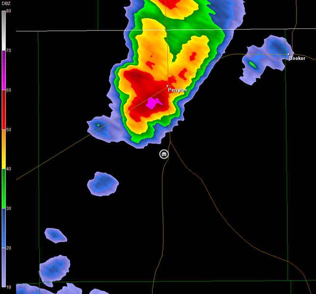
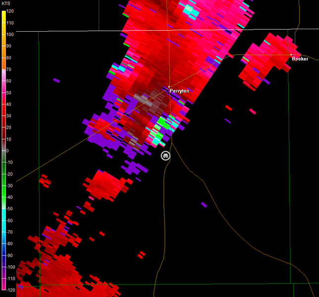
By 18Z (1 p.m. CDT), radar showed persistent redevelopment of thunderstorms to our northwest. This was all I was waiting on, and we immediately departed northwestward. The storms struggled to organize, as we watched them from Farm Road 281 southeast of Spearman, TX, through 2:30 p.m CDT. After that time, the storm we had been tracking northeast toward Perryton, TX, exploded, and we found ourselves near a developing circulation south of Perryton on TX-70. A video time-lapse depicting the rotation we observed is below (approximately 3 minutes of video compressed into 44 seconds; view is south of Perryton looking west/northwest). The radar imagery is also below (car symbol denotes our location). Unfortunately, the storm relative velocity data have some range folding issues.
Rotation Video (44 sec)
Amarillo, TX Storm Relative Velocity 1950Z
Amarillo, TX Base Reflectivity 1955Z
Amarillo, TX Storm Relative Velocity 1955Z
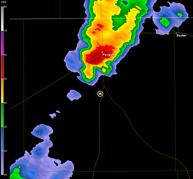
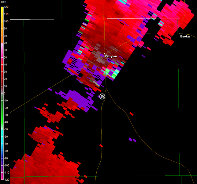
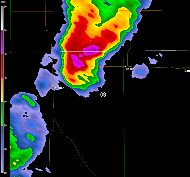
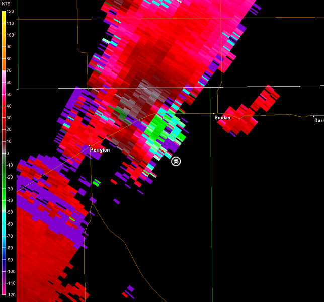
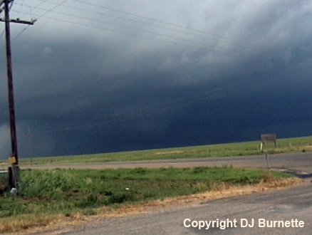
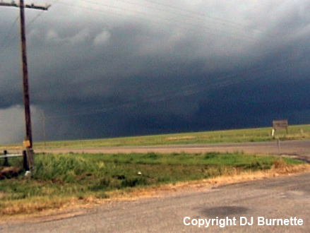
No funnel cloud was ever observed from that area of rotation, but we were hit by strong rear-flank downdraft winds at the end of the video, as the main circulation moved off to our north. We continued to follow the storm northeastward, and stopped again on Farm Road 2711 east of Perryton. Radar showed a solid supercell with good rotation (images below; car symbol denotes our location). We noted a wall cloud to our northwest, but did not observe any funnels (images below; view is east of Perryton looking northwest).
Amarillo, TX Storm Relative Velocity 2013Z
Amarillo, TX Base Reflectivity 2018Z
Amarillo, TX Storm Relative Velocity 2018Z
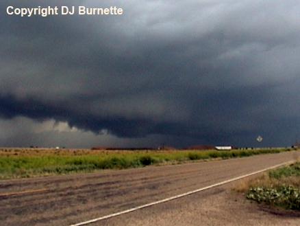
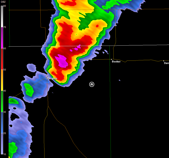
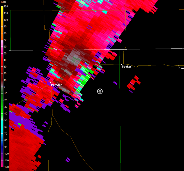
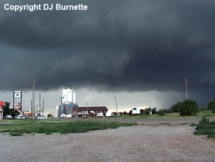
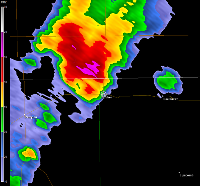
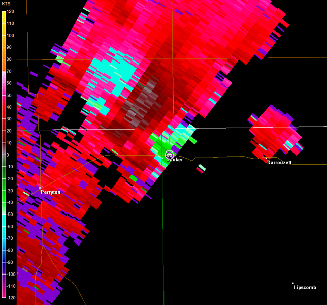
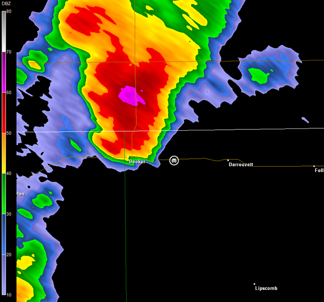
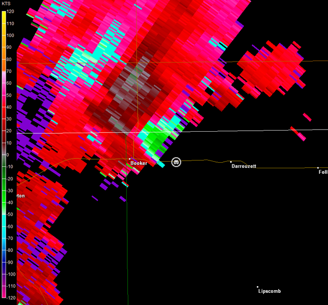
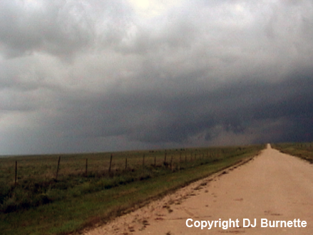
Storm chasers, including VORTEX2, had this storm covered well, and we passed various convoys, as we continued northeast into Booker, TX. We stopped near the TX-23/TX-15 intersection to briefly observe the good circulation with the storm (images below; view is from the east side of Booker looking west-northwest). Radar imagery continued to show strong rotation in our area (images below; car symbol denotes our location).
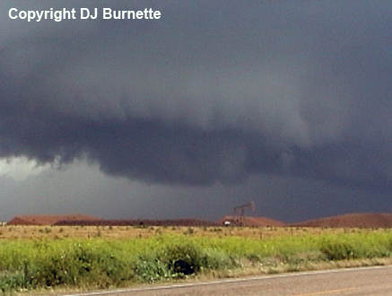
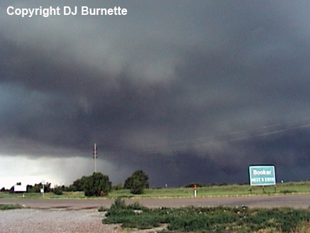
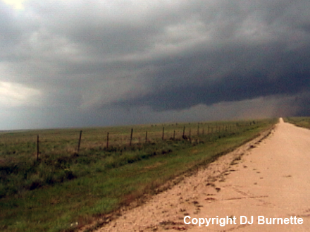
The circulation was a bit close, and the storm had the main road north of Booker blocked. Thus, we bailed a bit farther to the east to get closer to a good road that would allow us to move north. We stopped briefly to watch the wall cloud off to our northwest (images below; view is east Booker looking northwest). Radar imagery continued to show strong rotation in vicinity of this wall cloud (images below; car symbol denotes our location).
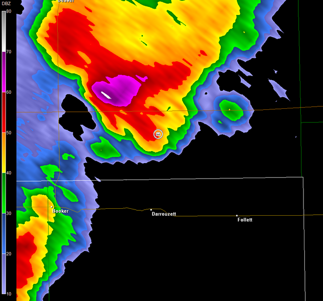
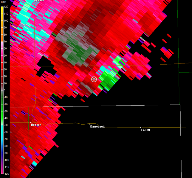
So far this storm was all bark and no bite, but that changed, as we repositioned ourselves farther to the northeast. The original wall cloud became rain-wrapped, and a tornado was reported at that time. Unfortunately, we did not observe that tornado, and the circulation was wrapped up in rain by the time we stopped on the TX/OK line north of Darrouzett, TX (radar imagery below; car symbol denotes our location). We did observe a new wall cloud to our southwest though (left image below), but this feature dissipated as the storm continued northeastward (right image below; view in both images is north Darrouzett looking southwest).
Amarillo, TX Storm Relative Velocity 2059Z
Amarillo, TX Base Reflectivity 2103Z
Amarillo, TX Storm Relative Velocity 2103Z
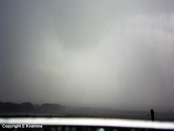
We continued north into OK to stay with the main circulation. This circulation was rain-wrapped, so my objective was to slowly edge us as close as possible. The storm forced us to stop shy of U.S. 412, and I could tell we were about to get slammed by wind and rain. No sooner had I faced the car in the direction of the wind that we were hit by straight-line winds of up to 80 mph (likely rear-flank downdraft given the radar imagery below; car symbol denotes our location as we were hit). The main circulation was just to our northeast in the radar imagery below. Given U.S. 412 was blocked by the storm, we moved back south to get back to a better road, and this is when we observed a rain-wrapped tornado to our east-northeast. From our position, this tornado only showed its ground circulation for about 10 seconds before a significant rain curtain obscured the view. Emmy took a picture, and this image was significantly enhanced in Photoshop (below; view is from extreme southern OK north of Darrouzett looking east-northeast). Alas, the rain curtain prohibits seeing much more than the top of the cone tornado.
Rain-Wrapped Tornado
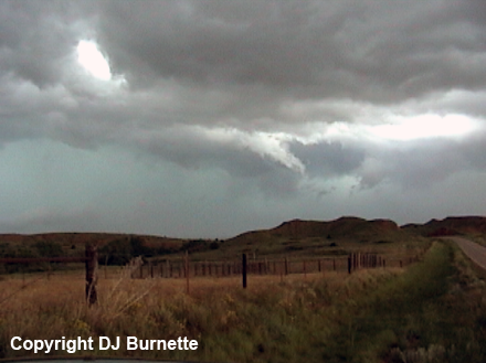
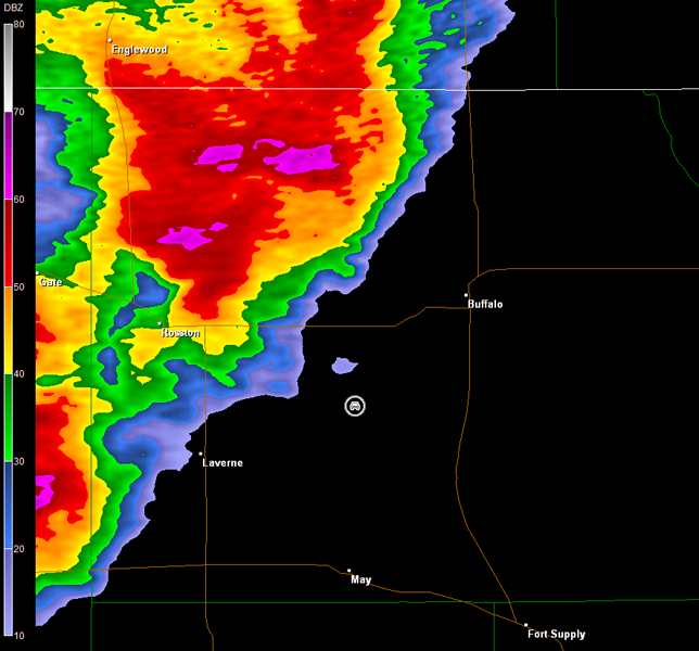
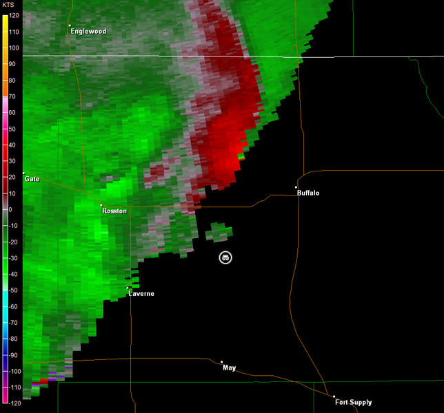
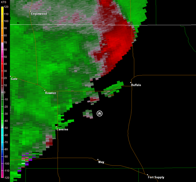
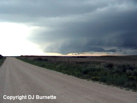
Unfortunately, my dumb mobile phone had zero bars, so I could not call in a report! I can't remember the last time that happened. Fortunately, this storm was surrounded by chasers and VORTEX2, so there was a high probability that somebody called it in. Nonetheless, I moved us back across the TX line, where I knew I had mobile phone coverage, and we stopped west of Follett, TX. The tornado had indeed been reported, so I did not bother the meteorologists who likely had their hands full with this storm and others. We reassessed the situation at this time. Other supercells were off to our southwest, but the storm we were on was the only one that had produced confirmed tornadoes at the moment. Thus, I had us continue to track the storm farther north into OK. In retrospect, this was the wrong move, given 1) by the time we arrived in a good position north of May and southwest of Buffalo, OK, the storm was transitioning into a bow echo and 2) the storm to our immediate southwest in the TX Panhandle produced a tornado shortly after we crossed the border into northwestern OK. Images of the storm from north of May are below (view is southwest of Buffalo looking north). Radar images are also below (car symbol denotes our location; note the brief change to the Dodge City, KS, radar due to the storm's location).
Dodge City, KS Storm Relative Velocity 2229Z
Dodge City, KS Base Reflectivity 2233Z
Dodge City, KS Storm Relative Velocity 2233Z
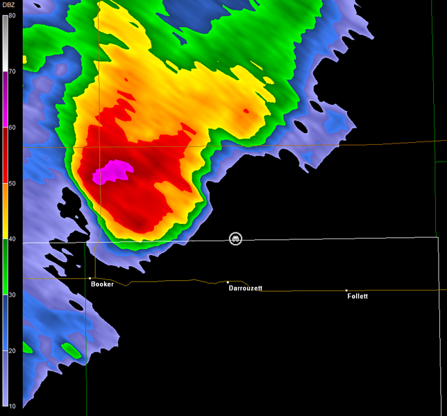
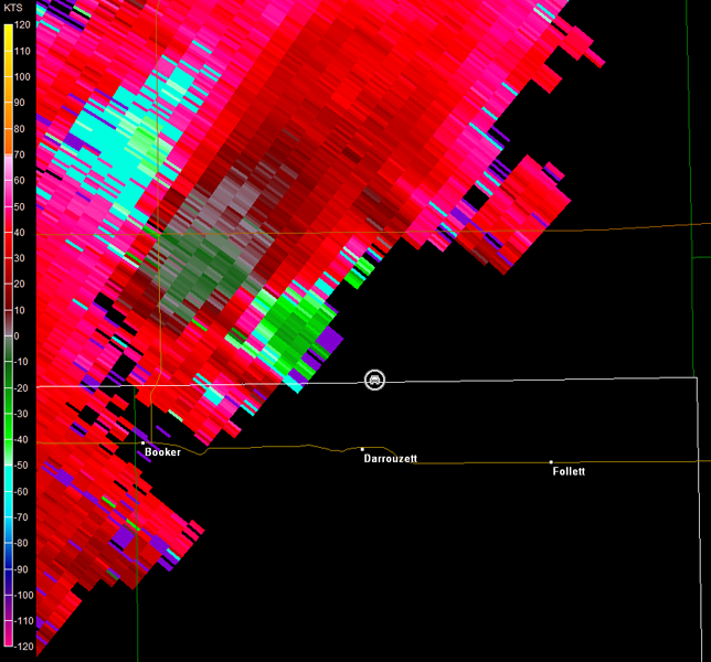
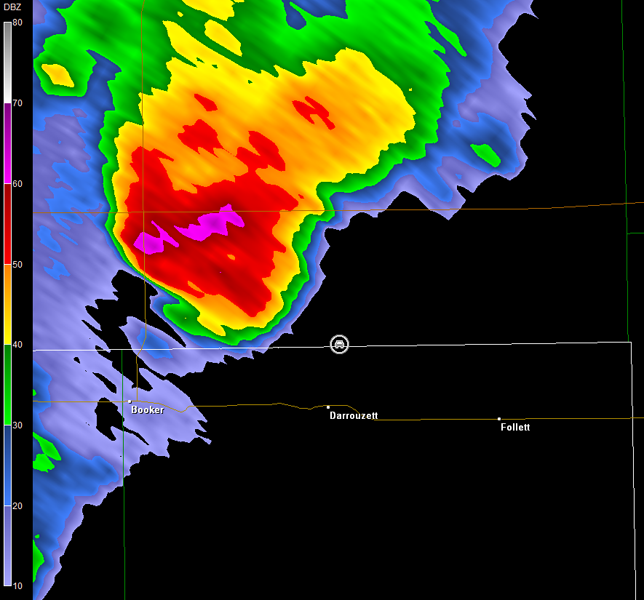
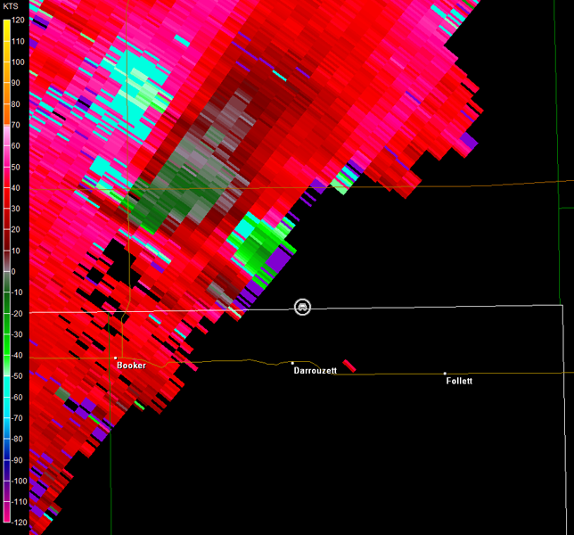
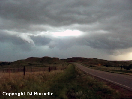
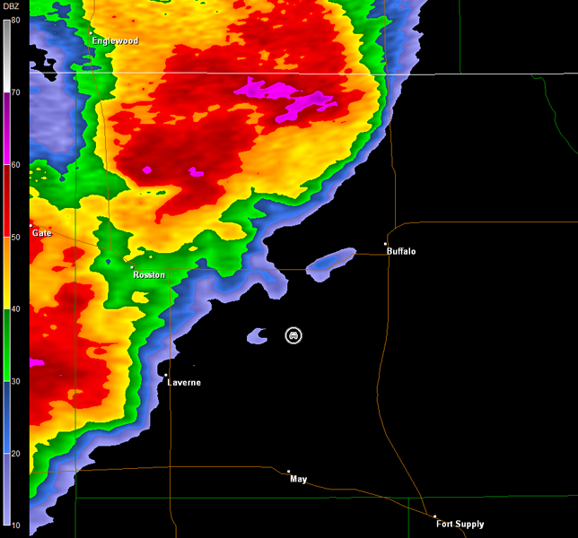
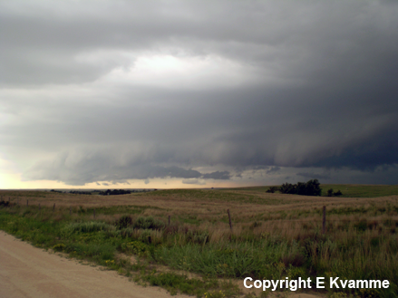
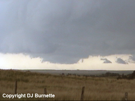
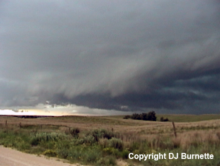
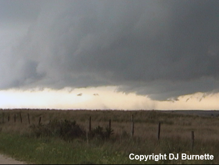
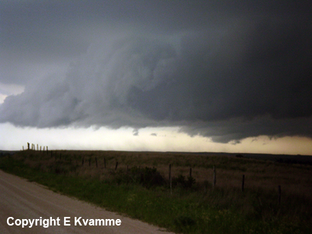
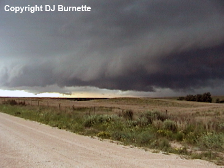
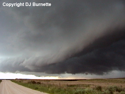
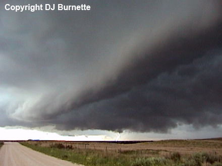
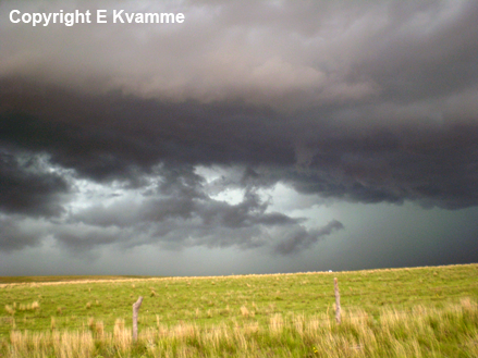
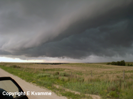
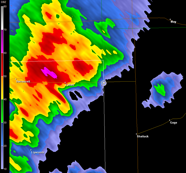
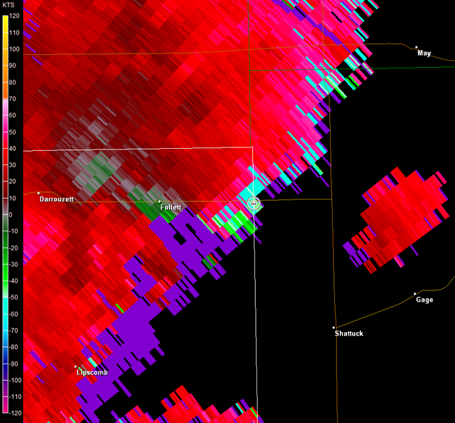
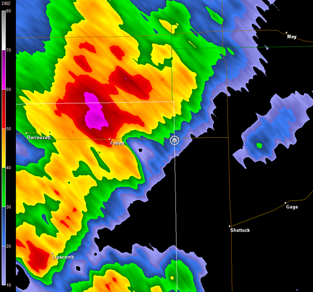
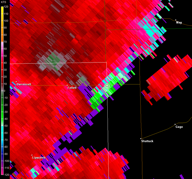
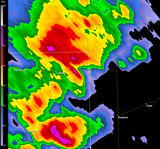
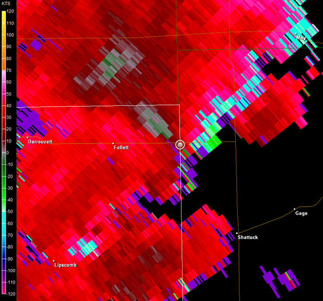
We moved back to the southwest to intercept a tornado warned supercell moving northeastward out of the TX Panhandle, and met up with the storm at the TX/OK line east of Follett. Radar imagery showed a hook echo moving in our direction with good rotation (images below; car symbol denotes our location). There was a wall cloud off to our southwest for a brief time (first three images below), but this dissipated as the storm moved closer to our location and looked more outflow dominant. We did observe blowing dust underneath the decaying wall cloud, but no circulation was evident. Our main observations were a grumpy looking shelf cloud and occasional lightning (remainder of the images below; all images view is east of Follett looking west-southwest).
Amarillo, TX Storm Relative Velocity 2306Z
Amarillo, TX Base Reflectivity 2311Z
Amarillo, TX Storm Relative Velocity 2311Z
Amarillo, TX Base Reflectivity 2317Z
Amarillo, TX Storm Relative Velocity 2317Z
We followed the storm into Woodward, OK, but failing to see anything more than outflow dominance, we began the journey back to Fayetteville. Thanks to Cory Phelps for nowcast assistance.