Storm Chase Log 12 June 2010
Chasers: Dorian J. Burnette, Emmy Kvamme, and Jo Ann Kvamme
Preliminary Destination: Amarillo, TX
Note: Images have been decreased in size. Click on an image to view a larger version.
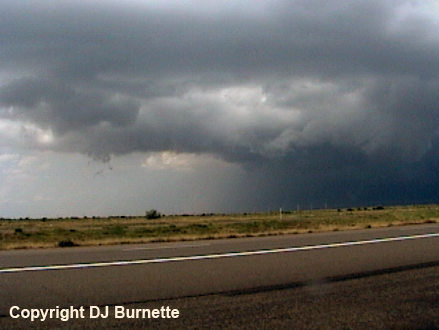
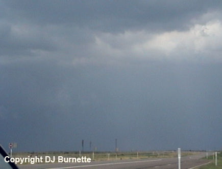
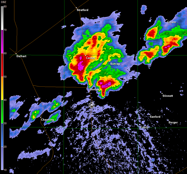
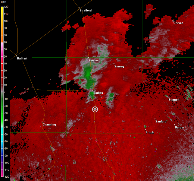
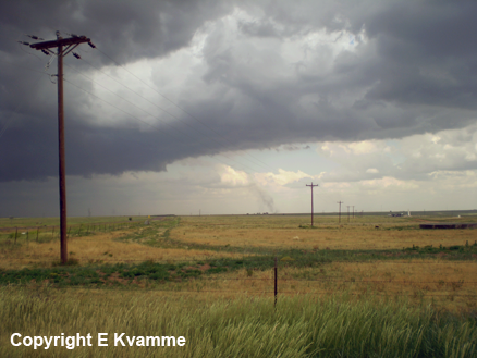
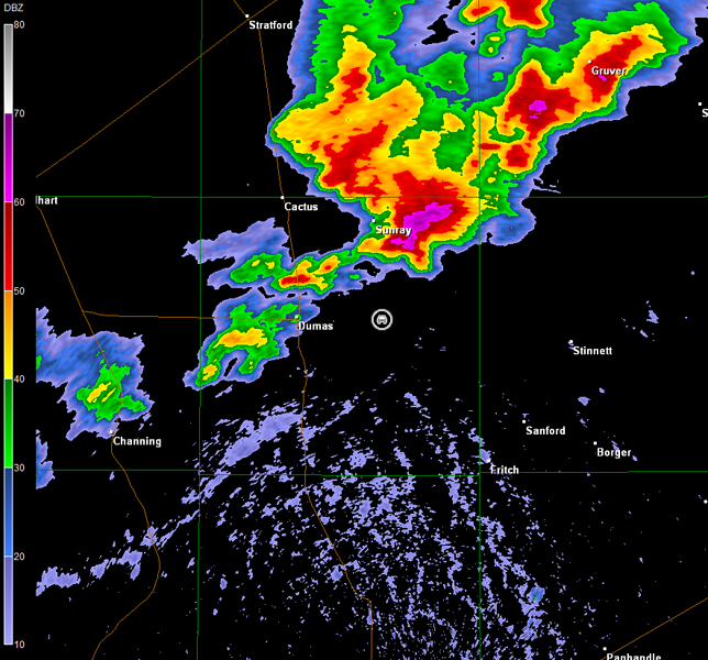
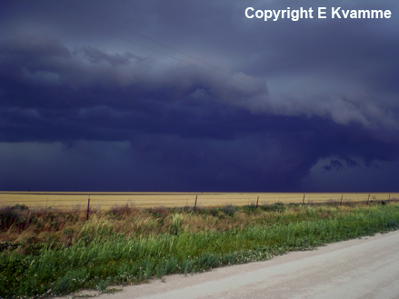
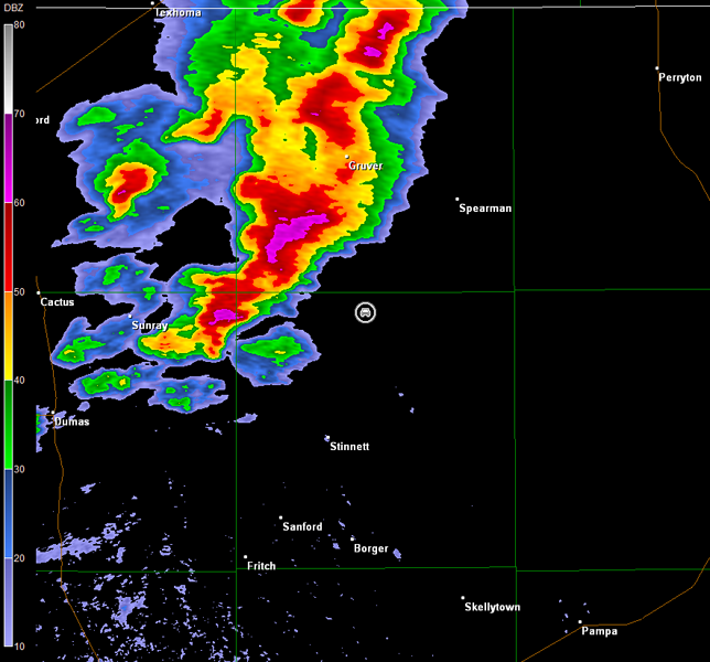
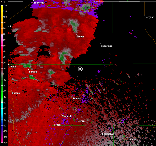
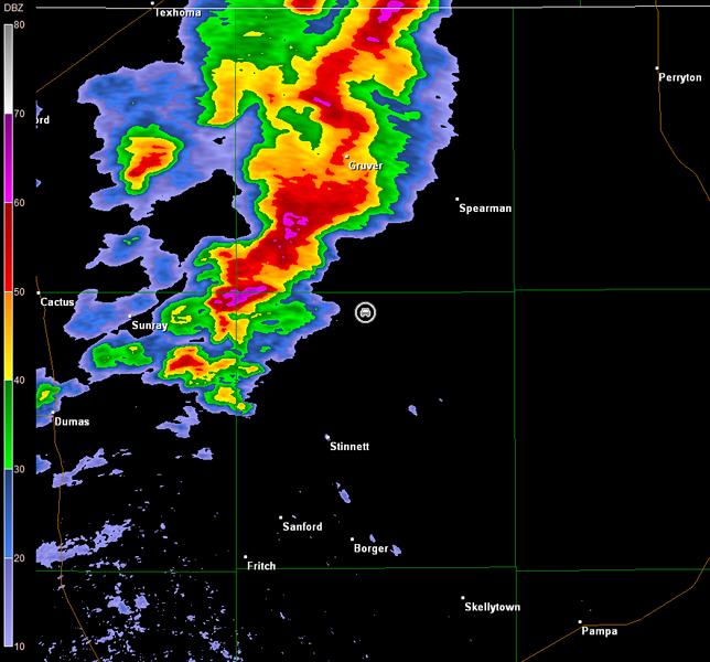
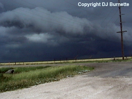
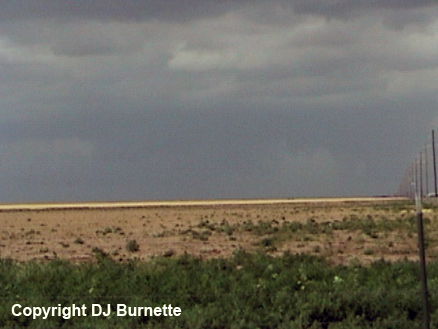
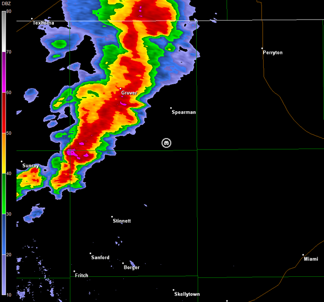
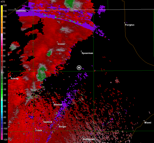
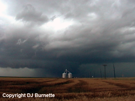
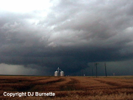
This was Day 1 of a two-day storm chase in the TX and OK Panhandles. We arrived in Amarillo shortly after 2 p.m. CDT, as thunderstorms began to develop to our north and a tornado watch was issued. We moved north on U.S. 87 toward Dumas, TX, to intercept these storms. North of Four Way, TX, scud clouds with good upflow were observed along the flanking-line of storms farther to our north. We stopped to observe this activity (images below; view is south of Dumas looking north), and check the radar to plan our method of attack. Radar data clearly showed the stronger storm located northeast of Dumas (images below; car symbol denotes our location).
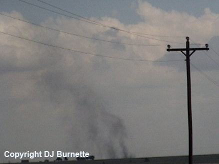
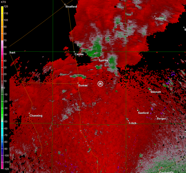
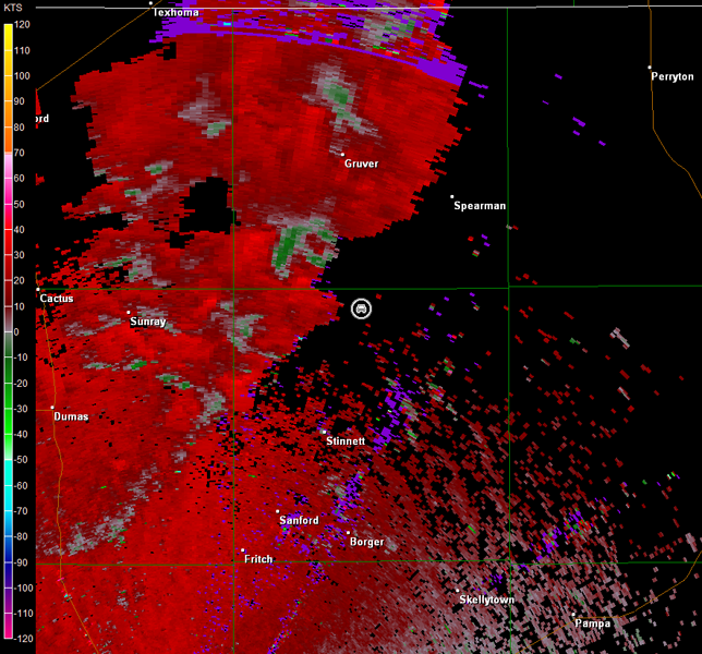
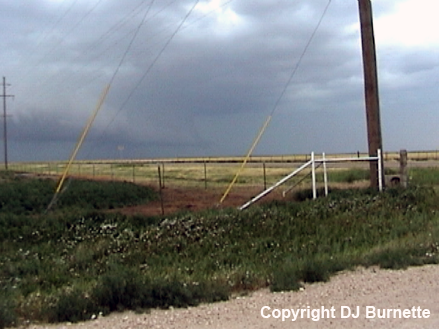
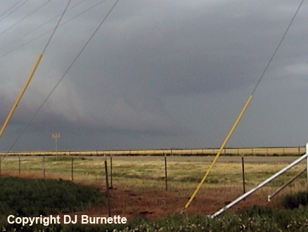
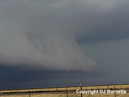
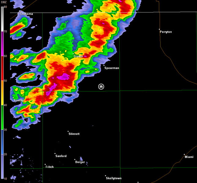
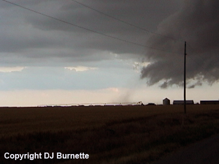
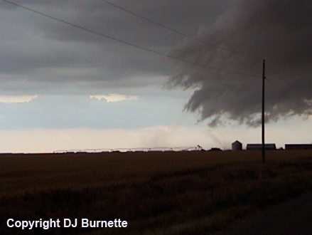
We moved north into Dumas, and then east on TX-152 to catch up with the most interesting storm. A gustnado developed to our southeast as we moved eastward, and we stopped to photograph it (images below; view is east of Dumas looking southeast). The main objective at this time was to intercept the storm east of Sunray, TX, which looked more interesting all the time (see radar data below; car symbol denotes our location).
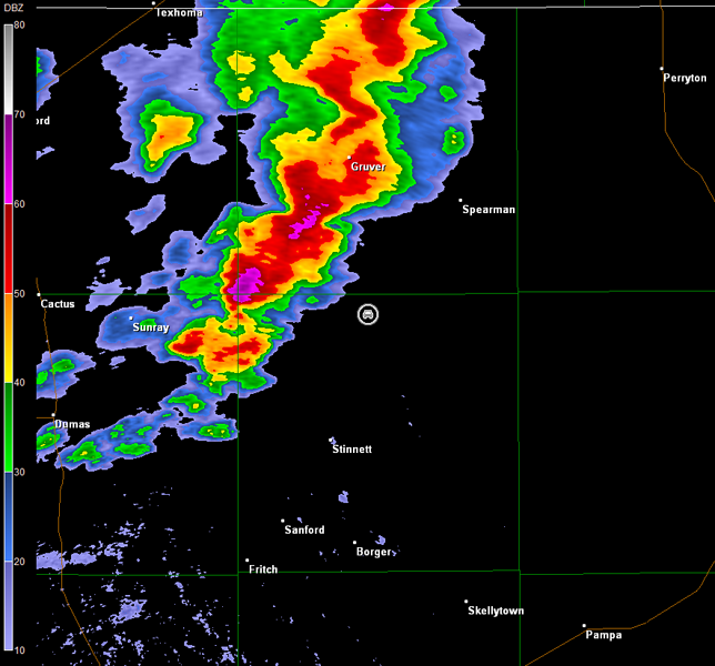
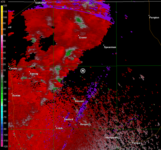
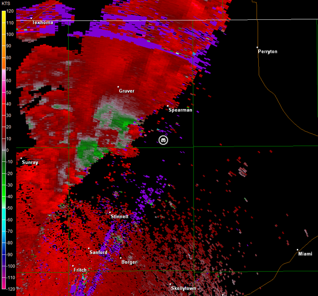
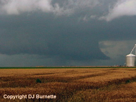
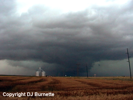
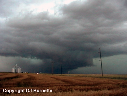
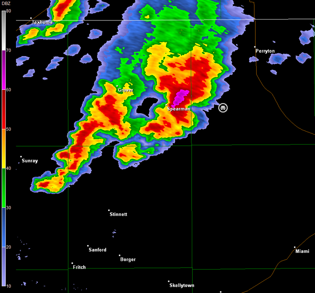
A tornado warning was issued for the storm, as we continued east on TX-152 and then north and east toward Morse Junction, TX. Incredibly large hail up to six inches in diameter was also reported! Thankfully, the road network was aligned just right for us to narrowly escape the hail core, but we were brought to within a mile of it, as we moved east on Farm Road 281 toward Morse Junction. Chaser convergence was observed in vicinity of Morse Junction with a wall cloud to our north. We continued a bit farther east to get away from the chaser convergence, and stopped on Farm Road 281 between TX-136 and TX-207 to observe the storm. By this time, the wall cloud was becoming rain-wrapped, but there were hints of another circulation on the 2109Z radar data below (car symbol denotes our location). The main circulation remained to our northwest though. Images of the storms from our position are below (view is east of Morse Junction, looking west and northwest).
Amarillo, TX Storm Relative Velocity 2109Z
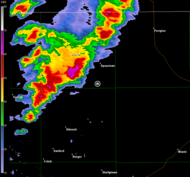
Amarillo, TX Base Reflectivity 2114Z
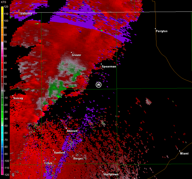
Amarillo, TX Storm Relative Velocity 2114Z
Amarillo, TX Base Reflectivity 2119Z
Amarillo, TX Storm Relative Velocity 2119Z
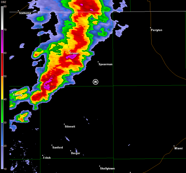
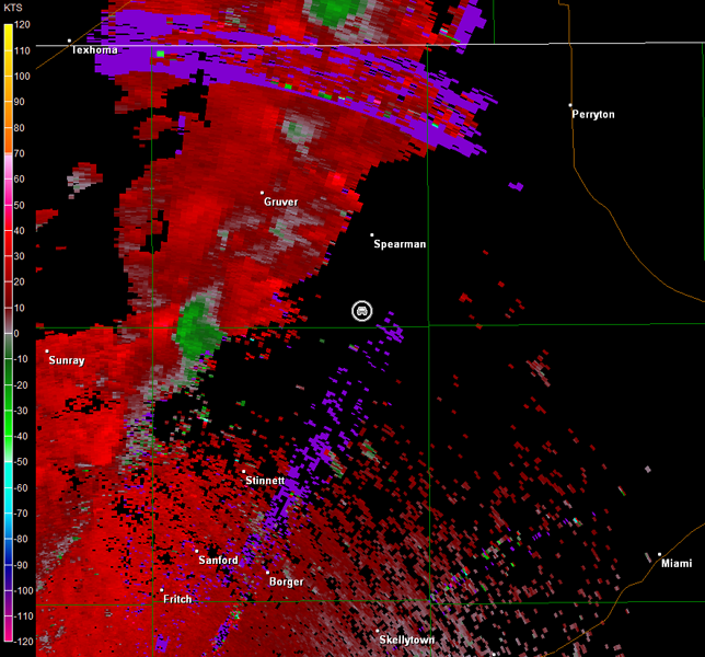
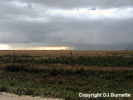
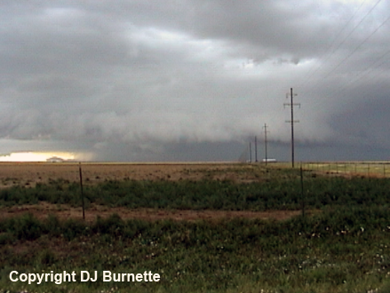
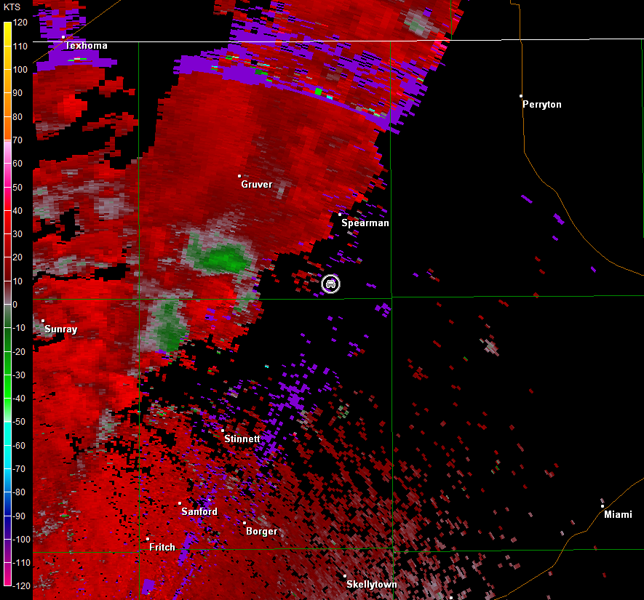
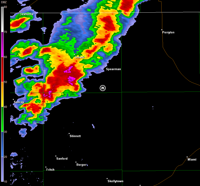
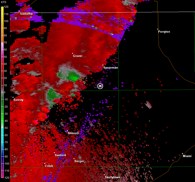
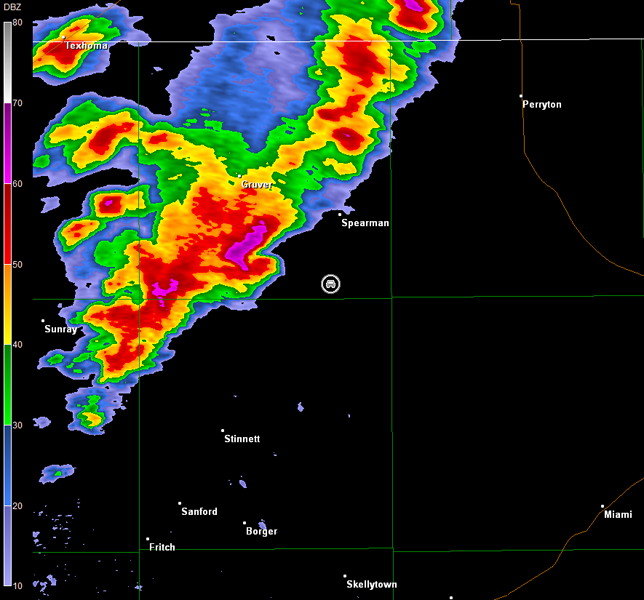
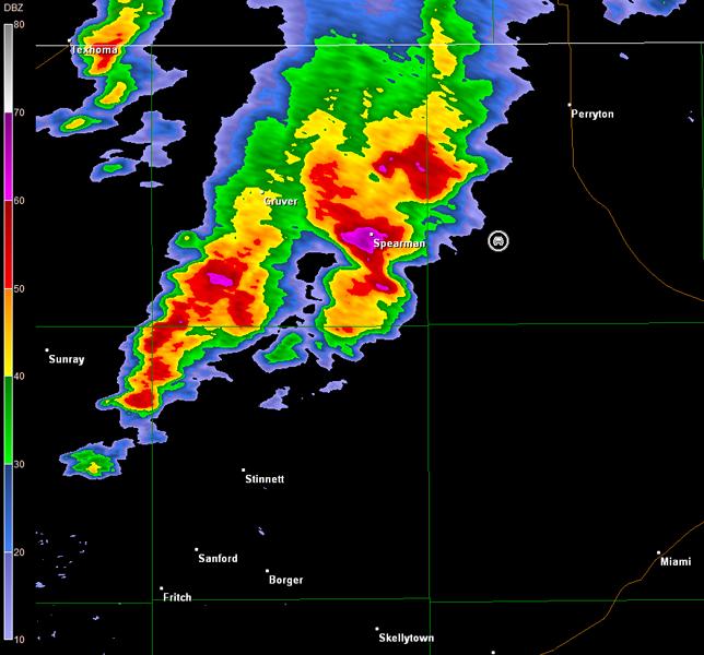
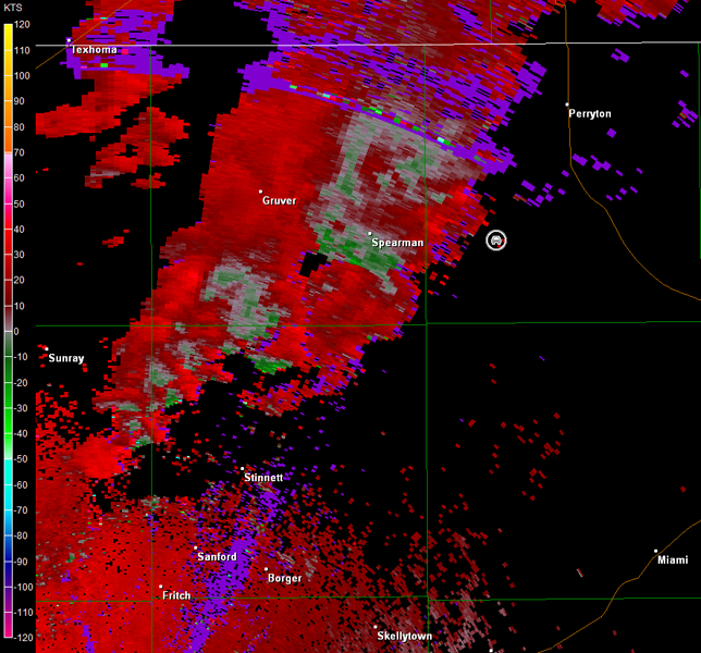
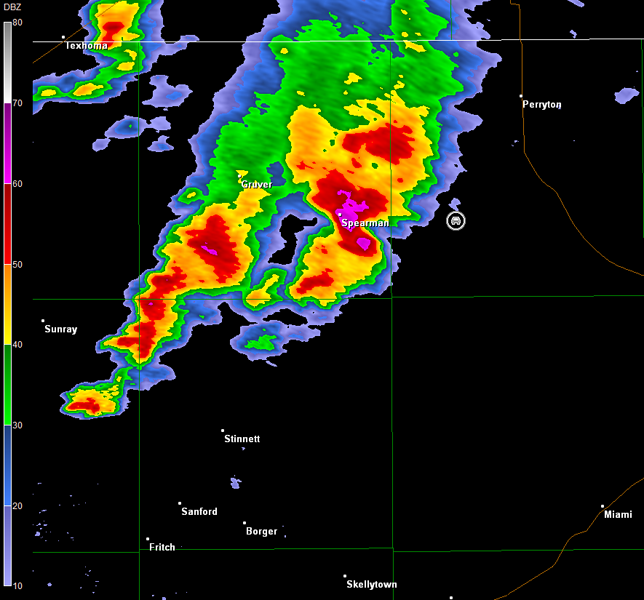
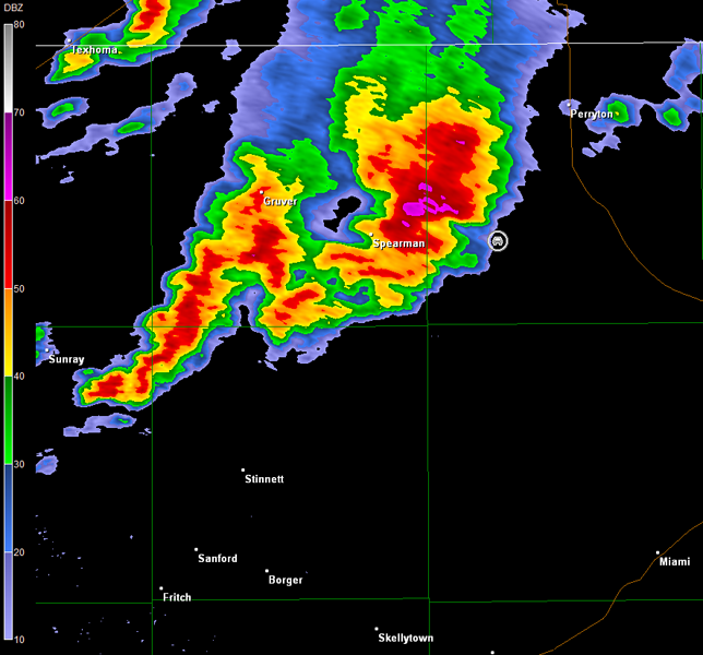
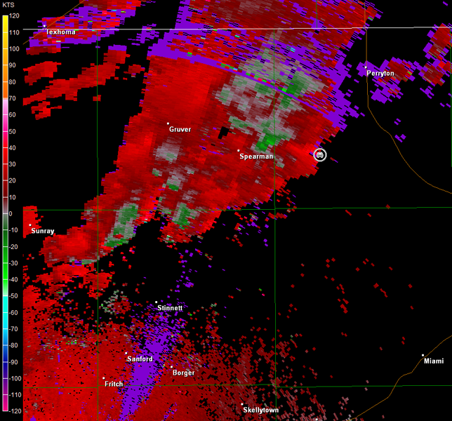
We moved northeastward on TX-207 and then east on TX-51 to stay ahead of the storm. The initial circulation had become rain-wrapped southwest of Gruver, TX, when we stopped to observe the storms on TX-51 south of Spearman, TX. However, another circulation was noted to our southwest (see radar imagery below; car symbol denoted our location). All we observed to our northwest was a modest shelf cloud (first image below; view is south of Spearman looking northwest). There were some lowerings noted well off the distance to our west though in vicinity of the secondary circulation on radar (second image below).
Amarillo, TX Storm Relative Velocity 2132Z
Amarillo, TX Base Reflectivity 2137Z
Amarillo, TX Storm Relative Velocity 2137Z
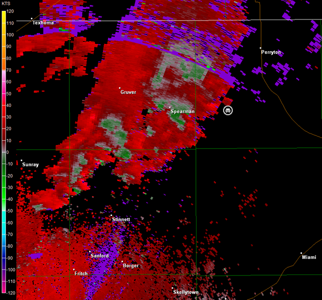
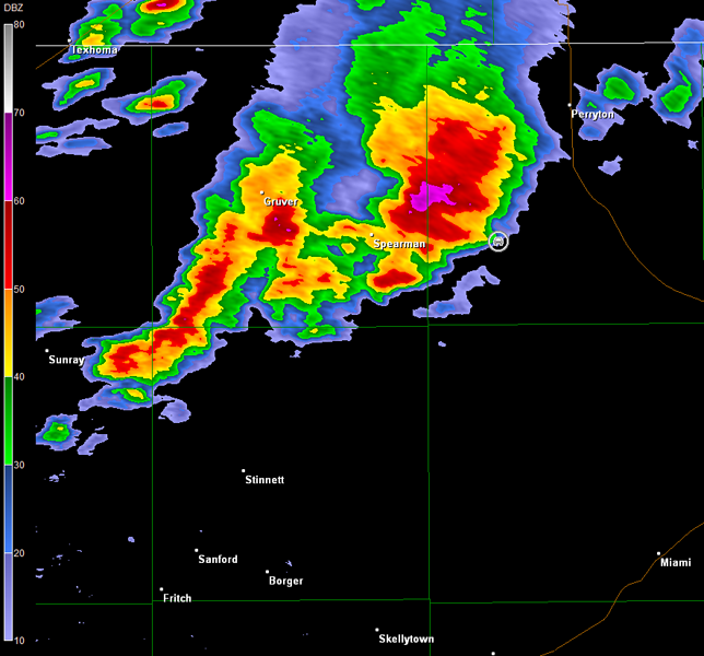
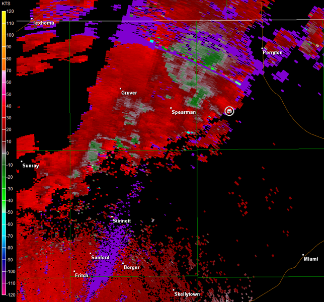
Eventually we were greeted by a tremendous shelf cloud, as this secondary area of interest approached. The storm took on an impressive "mothership look" (images below; view is south of Spearman looking west-northwest). Radar data suggested the low-level circulation was passing by to our west and northwest, but we never observed any circulation from our position (radar imagery below; car symbol denotes our location).
Amarillo, TX Storm Relative Velocity 2200Z
Amarillo, TX Base Reflectivity 2204Z
Amarillo, TX Storm Relative Velocity 2204Z
Amarillo, TX Base Reflectivity 2209Z
Amarillo, TX Storm Relative Velocity 2209Z
Amarillo, TX Base Reflectivity 2214Z
Amarillo, TX Storm Relative Velocity 2214Z
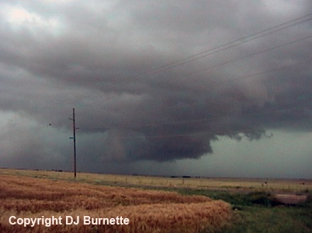
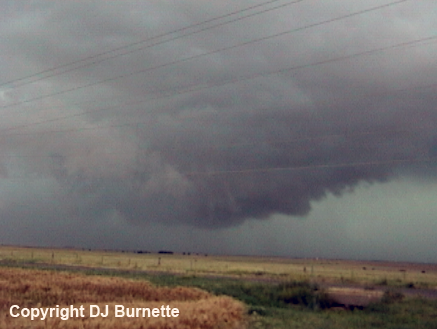
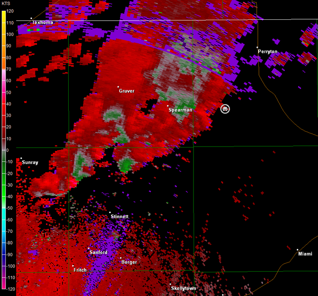
Cool outflow air arrived at our location, as we observed this tremendous shelf cloud. We moved east and north way out ahead of the storm on into Perryton, TX, so we could grab a snack, refuel, and look at the latest available radar and surface data to plan our next move. The original cell moved northeast by Spearman, and decreased in intensity, while the storms farther to the southwest were maintaining their intensity. We moved back southwest of Perryton to intercept the stronger storms, and one began to look more interesting on the radar, as it approached our location on Farm Road 759 (radar images below; car symbol denotes our location). A wall cloud was observed where the radar suggested some low-level rotation, but we only noted modest circulation and upward motion at best (first four images below; view is southwest of Perryton looking west). Cool air wrapped into this area of the storm, as it continued northeastward, and the lowered region quickly fell apart (last four images below; view is southwest of Perryton looking west).

Amarillo, TX Storm Relative Velocity 2332Z
Amarillo, TX Base Reflectivity 2337Z
Amarillo, TX Storm Relative Velocity 2337Z
Amarillo, TX Base Reflectivity 2341Z
Amarillo, TX Storm Relative Velocity 2341Z
Amarillo, TX Base Reflectivity 2346Z
Amarillo, TX Storm Relative Velocity 2346Z
Amarillo, TX Base Reflectivity 2351Z
Amarillo, TX Storm Relative Velocity 2351Z
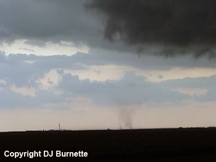
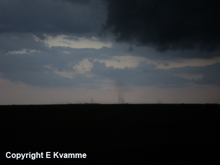
We also observed a few gustnadoes south of our location on the leading edge of the outflow (images below; view is southwest of Perryton looking south).
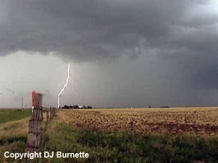
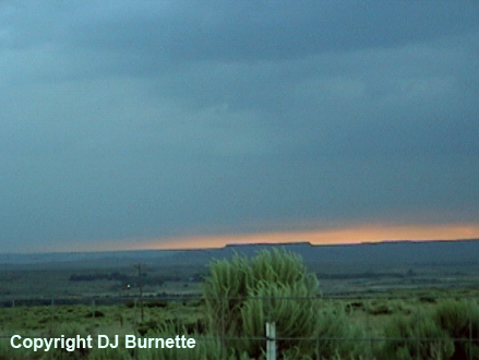
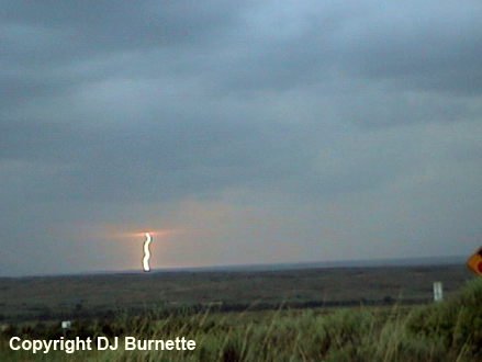
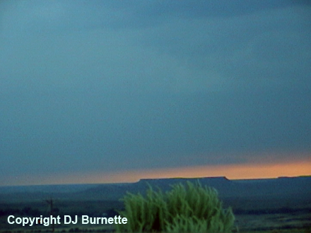
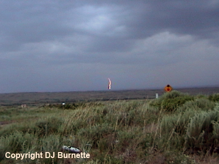
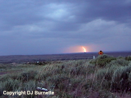
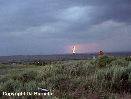
The storm looked less impressive, as we followed it northeastward into Perryton. Given that sunset was approaching, we moved back south on TX-70, and stopped between Spearman and Miami, TX, to view the sunset and lightning off in the distance (images below; view is southeast of Spearman and northwest of Miami; looking west).
Given darkness was upon us, we moved south on TX-70 into Pampa, TX, to rest for the night and prepare for the next day's storm chase. Thanks to Cory Phelps for nowcasting support.