Storm Chase Log 29 May 2004
Chasers: Dorian J. Burnette, Joseph Crane, Jeremy Howard, Brittany Millspaugh, Cory Phelps, and Liana Wagle
Preliminary Destination: Salina, KS
Note: Images have been decreased in size. Click on an image to view a larger version.
We departed Wichita, KS shortly after 2 p.m. CDT bound for the triple point that was setting up west of Salina, KS. On our way I made phone calls to both KSN and WeatherData to check in. As we closed in on Salina, we observed storm towers exploding off to our northwest. We stopped briefly in Salina to get gas and prepare for "chase mode." We then moved westward on I-70 and stopped at the K-156/I-70 interchange to the northeast of Ellsworth, KS. The towers that we had been watching were now thunderstorms, but nothing impressive was noted with them at the time and they were moving away from us at a decent speed. After conversations with both KSN and WeatherData, I elected to have my chase team sit at the K-156/I-70 interchange for awhile and monitor trends. Surface winds were incredibly strong, and surface moisture convergence across a large part of central Kansas was weak. We noted numerous towers that tried in our area and to the south, but the best development was to our north. Eventually the activity to our north began to prompt severe thunderstorm and eventually tornado warnings. There was a definite trend with development...nothing good was going on in our immediate vicinity or to our southwest. Instead the storms were developing a bit to our northwest and moving northeast across Mitchell County (a couple of counties to our north). This continued trend suggested that it was time for us to move and sit on the southern most storm. Other storms were ahead of this southern most storm. Thus outflow boundaries were likely in place, and the chances were good some interesting things would occur.
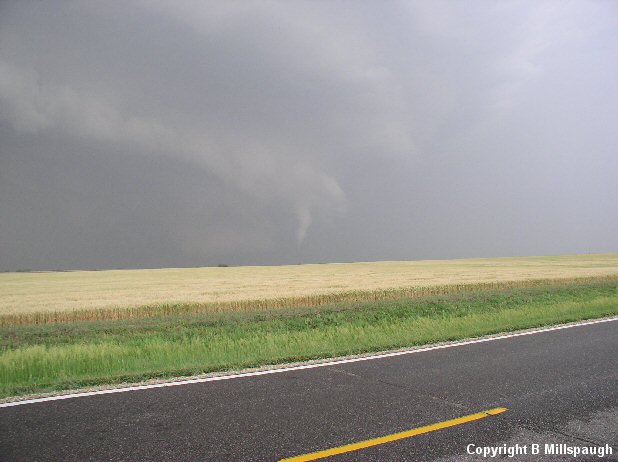
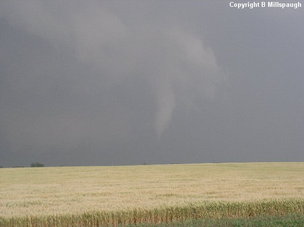
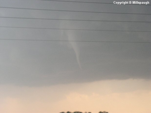
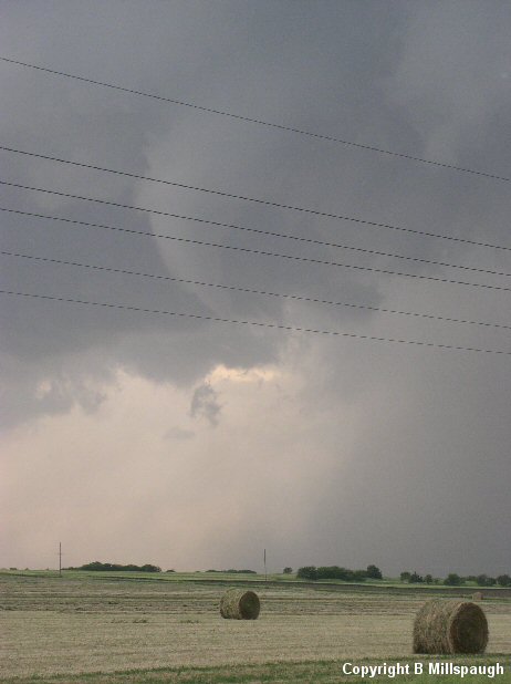
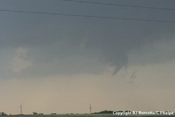
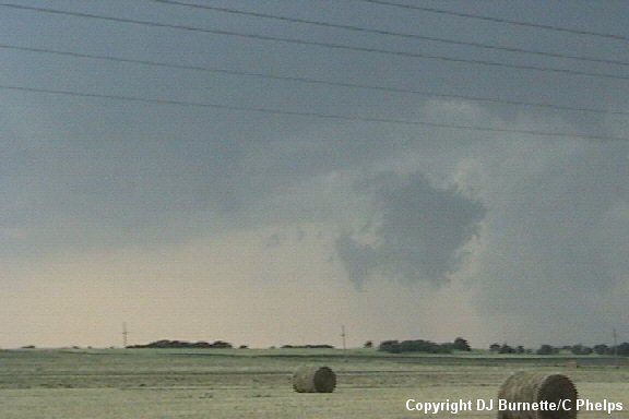
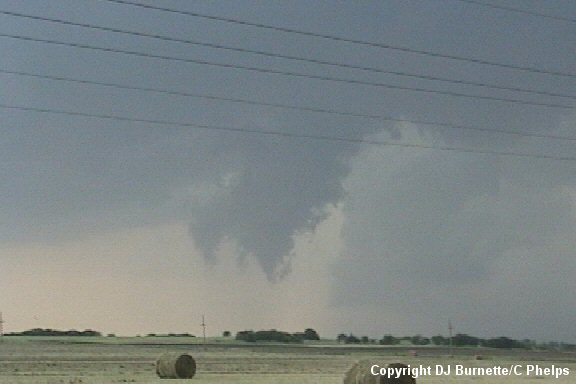
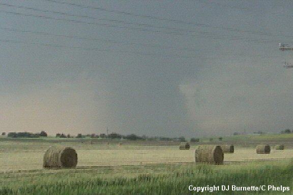
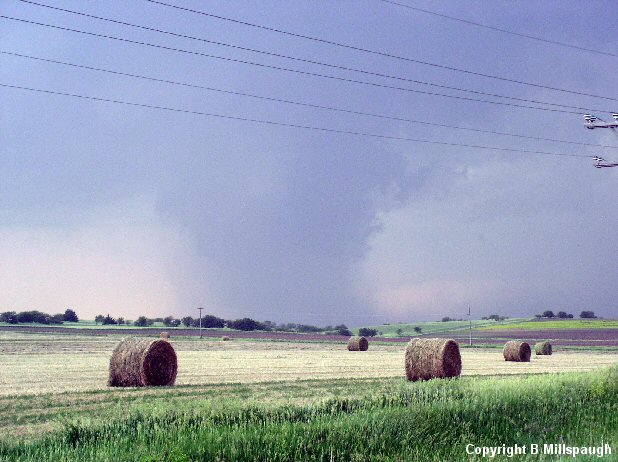
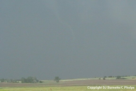
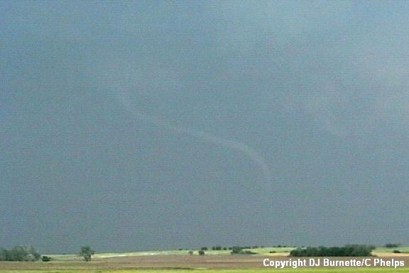
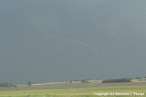
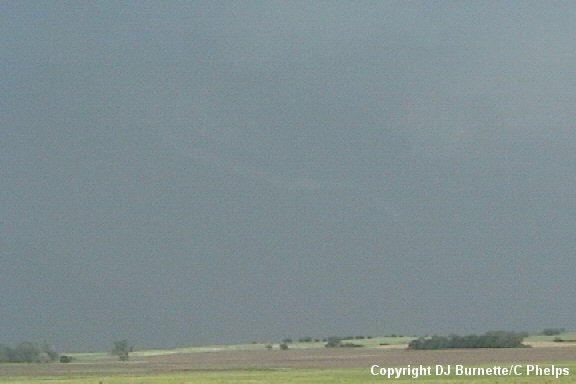
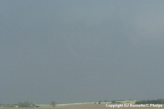
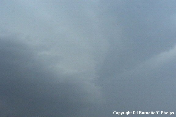
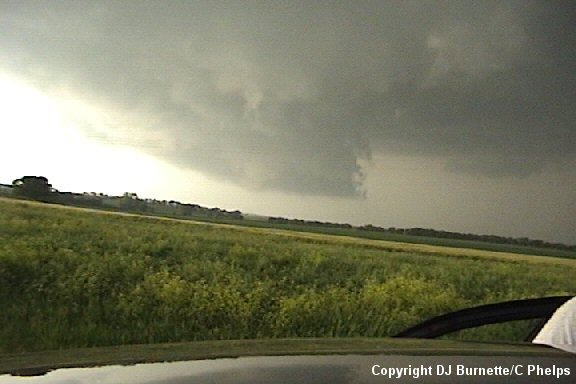
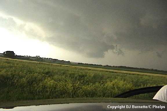
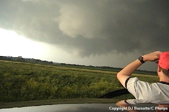
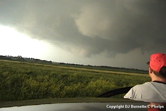
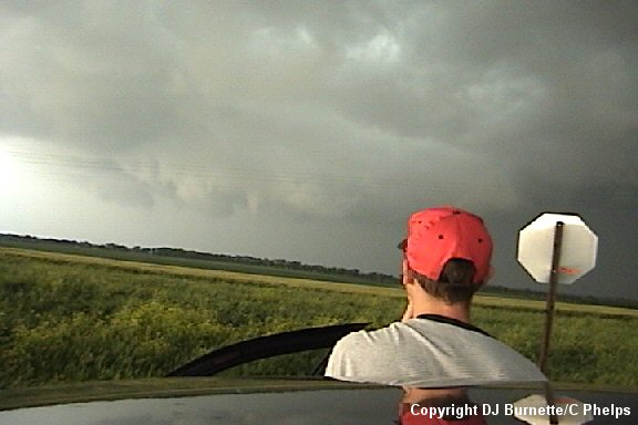
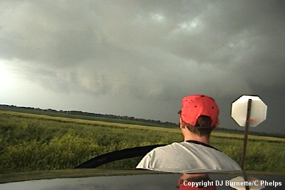
We moved northward on K-14 toward Beloit, KS. Once we arrived in Beloit, we began to notice what appeared to be a wall cloud ahead of us. We confirmed this massive wall cloud once we arrived at the K-14/K-9 interchange. I immediately made a phone call to both KSN and WeatherData to report the observation. We were moving out of KSN's viewing area, so this would be our last report to them. We then continued east on K-9 following the large wall cloud. A weak tornado formed to the south of this large wall cloud, and we immediately stopped for documentation (images below; view is east of Beloit, KS on K-9 looking north). We were unable to determine whether or not circulation made it to the ground, but other spotters and storm chasers in the area confirmed a brief touchdown. The large wall cloud we had been watching also is noted in the images below.
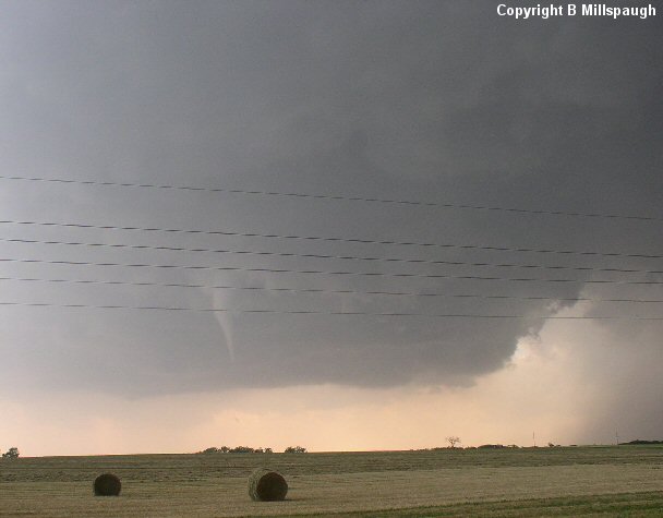
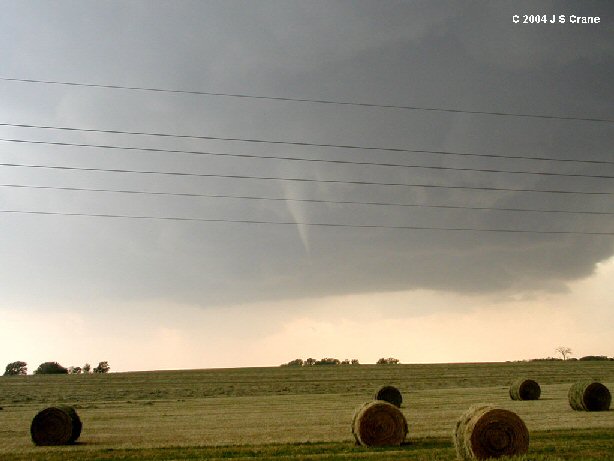
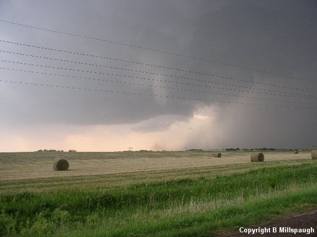
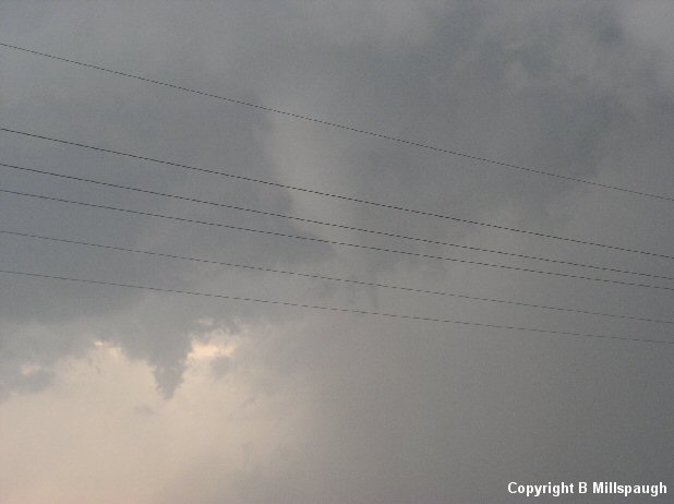
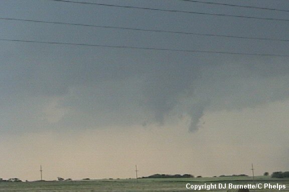
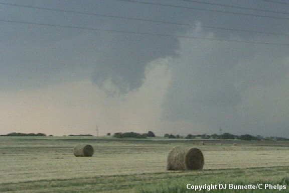
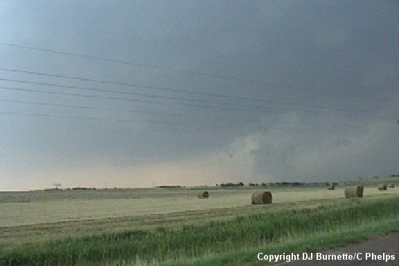
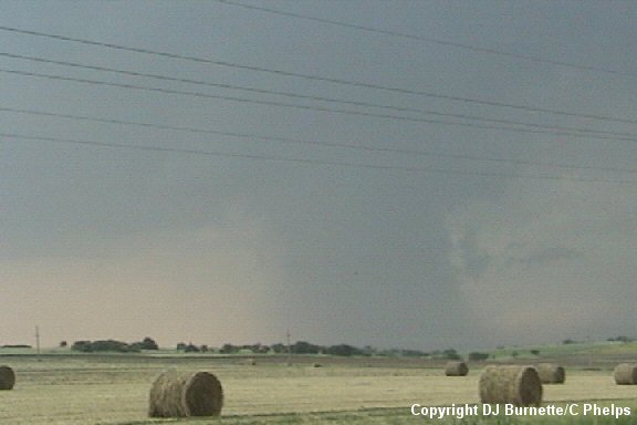
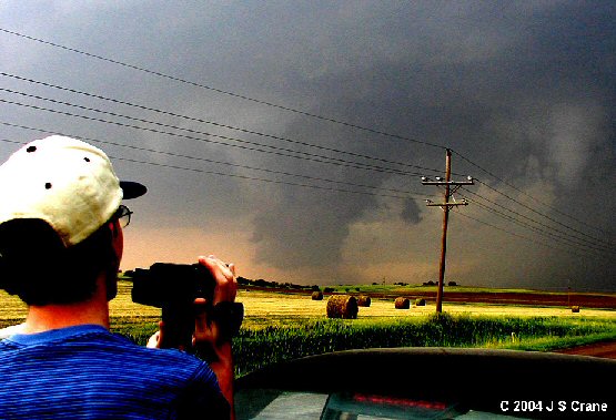
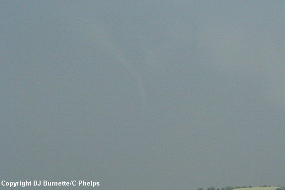
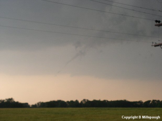
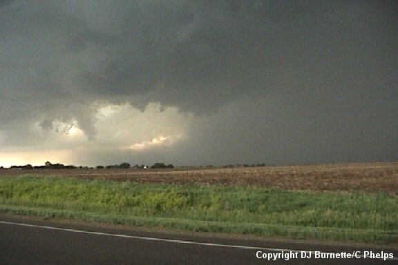
I made a call to WeatherData to report the observation. The storm was moving on toward Jamestown, KS, and once the tornado diminished, we continued to move east on K-9. Inflow winds were incredible at this time, and it was apparent this supercell was creating its own environment. There is a blacktop road that runs south out of Jamestown and intersects K-9. We turned to the north on that blacktop road, and observed the development of a funnel cloud off to our west once we arrived in an area due east of Scottsville, KS. This was another funnel cloud that we were unable to deduce whether or not it made contact with the ground, but it was very close. A touchdown was confirmed by other spotters and storm chasers though, so this tornado officially becomes tornado # 2 (images below; view is south of Jamestown and east of Scottsville looking west).
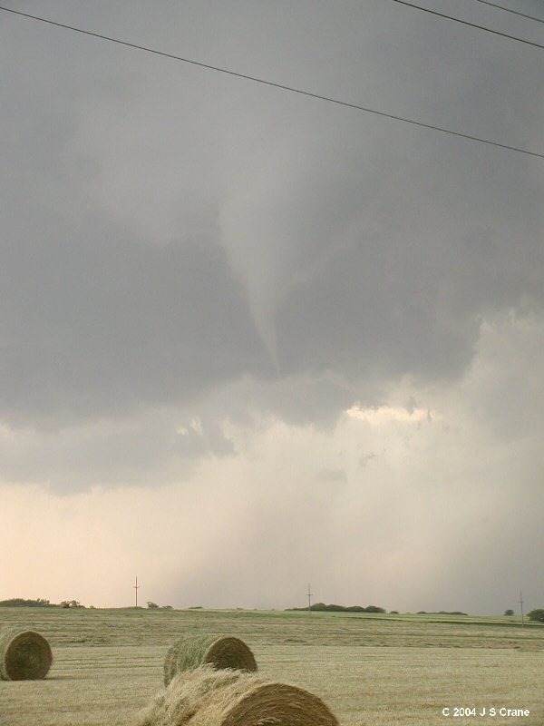
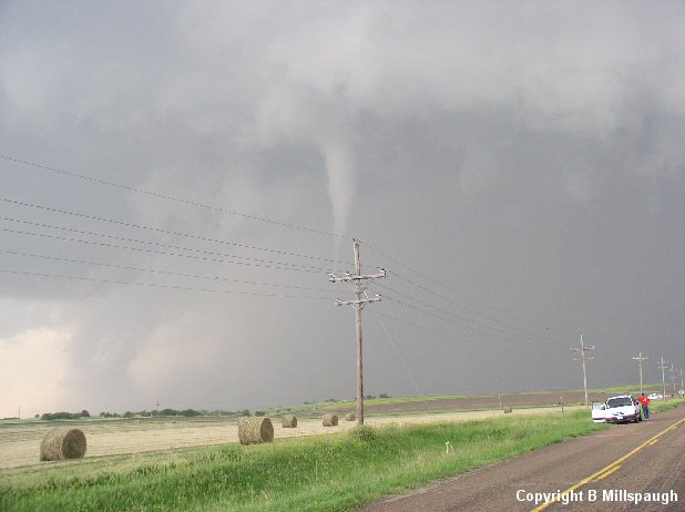
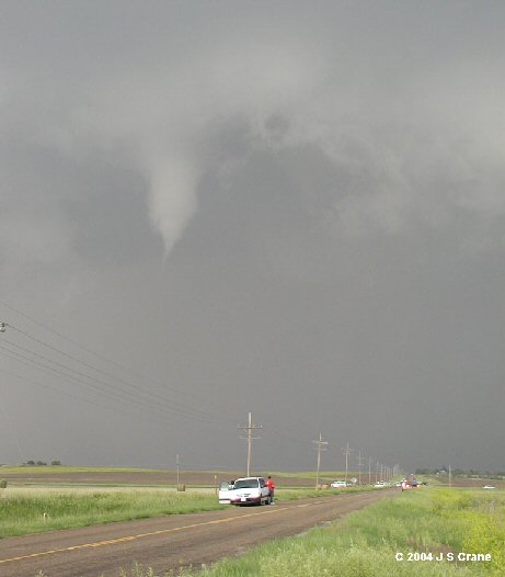
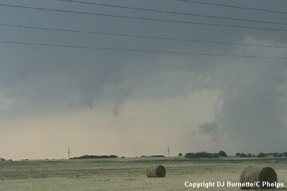
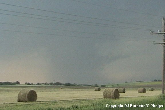
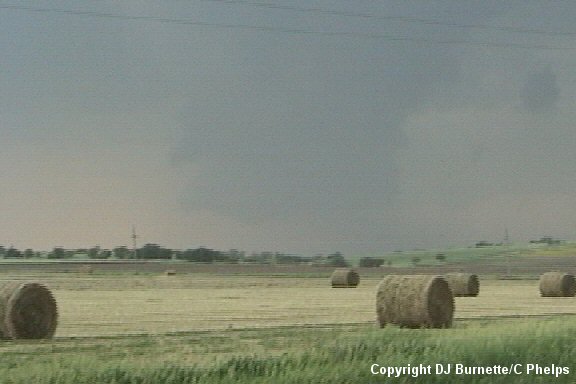
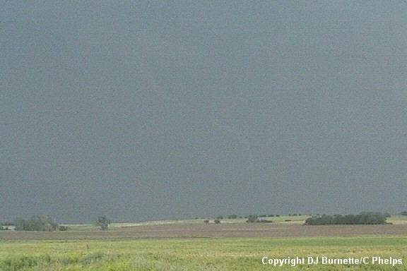
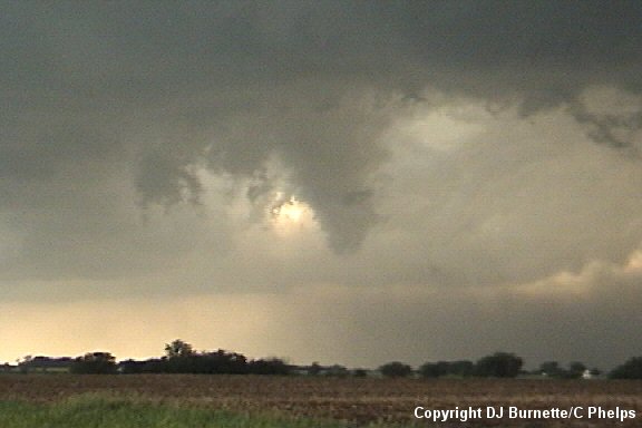
Shortly after tornado # 2 diminishes a third tornado develops off to our west. This tornado was anticyclonic (rotated backwards) with ground circulation easily visible from our location (images below; view is south of Jamestown and east of Scottsville looking northwest). The amount of time elapsed is around two minutes.
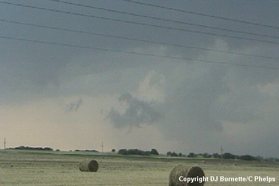
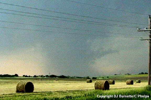
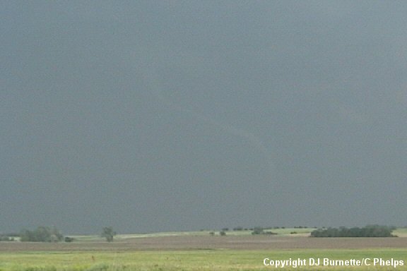
Another funnel cloud rapidly developed off to our northwest, as tornado #3 began to lift and shift off to the northeast. We were unable to confirm any ground circulation. Thus the final ruling is funnel cloud/possible tornado. The images are below (view is south of Jamestown and east of Scottsville looking northwest). The amount of time elapsed is around one minute and thirty seconds.

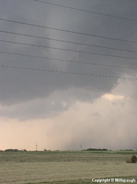
Unknown to us at the time was that there was a large rain-wrapped tornado ahead of us. This large tornado had been completely invisible to us, but it began to show itself as tornado #3 (above) and the funnel cloud/possible tornado (above) diminished. Hints of this large tornado can be observed in the background in all of the funnel cloud/possible tornado images above except the two in the upper left. At the same time this large tornado was showing itself, a downburst also was noted (first image below; view is south of Jamestown and east of Scottsville looking northwest). Given this and our location, it was tough to tell whether or not this tornado was indeed a wedge tornado or just high straight-line winds blowing underneath a very low wall cloud. I have seen high straight-line winds blowing underneath wall clouds before that can easily be mistaken for tornadoes (e.g., 7 May 2002 storm chase). It appeared to us that there was rotation, but we were too far away to be certain. Later it was confirmed via damage pictures and other accounts from chasers who were closer than we were that this was indeed tornado #4. It was a large and destructive tornado that did F2 damage (according to the Topeka National Weather Service) on the northside of Jamestown (images below; view is south of Jamestown and east of Scottsville looking northwest). The amount of time elapsed is about three minutes. Keep in mind this tornado was already on the ground when it emerged into view from being rain-wrapped (i.e., it was a long-lived tornado).
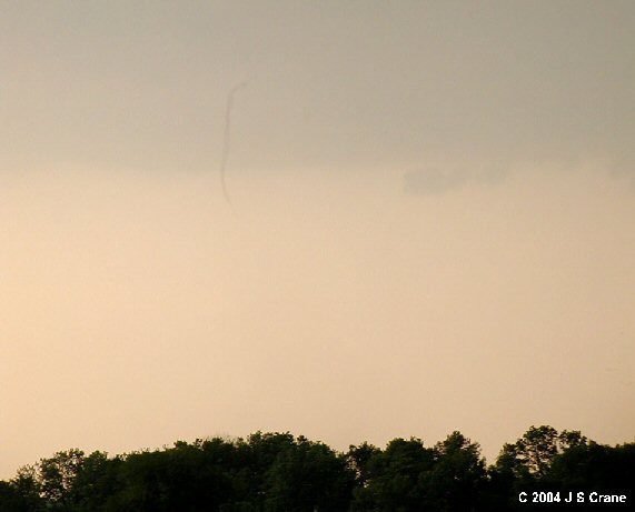
As this tornado began to diminish, we noticed a very photogenic rope tornado off to our north-northeast. Unfortunately, this rope tornado was a little farther away, so we had some contrast issues. Contact with the ground was noted though and this rope tornado became tornado #5 (images below; view is south of Jamestown and east of Scottsville looking north-northeast). The amount of time elapsed is around two minutes. The photograph second from the left on the bottom row has been digitally enhanced a bit to help bring out the rope tornado.

This high-precipitation supercell was nothing short of a beast! The first image below notes the "mothership-like" structure to the storm (view is south of Jamestown and east of Scottsville looking northeast). We observed at least four tornadoes in that one spot, and this storm was not done by a long shot! Once all the tornadoes had diminished we continued north on the blacktop road into Jamestown and noted damage as we moved into the northside of the town. We stopped briefly on the same blacktop road north of K-28. Just as we did so, a weak tornado developed off to our west. Ground circulation was easily noted from our location. The images are below (view is just north of Jamestown looking west). This tornado was very brief.
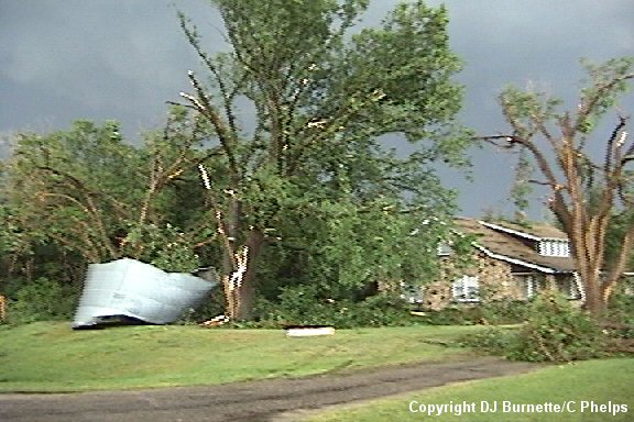
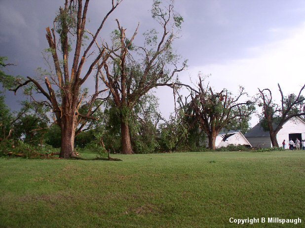
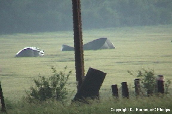
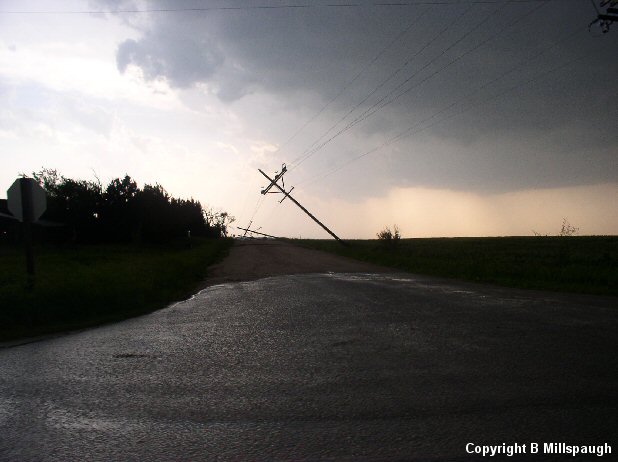
This was our last tornado that we could confirm, but not the end of the show by any means. I continued calling in reports to WeatherData and also let them know of the observed damage. Many trees were damaged heavily, a few buildings were damaged, and one building was demolished. Images of the damage just north of Jamestown are below. This damage was rated F2 by the Topeka National Weather Service.
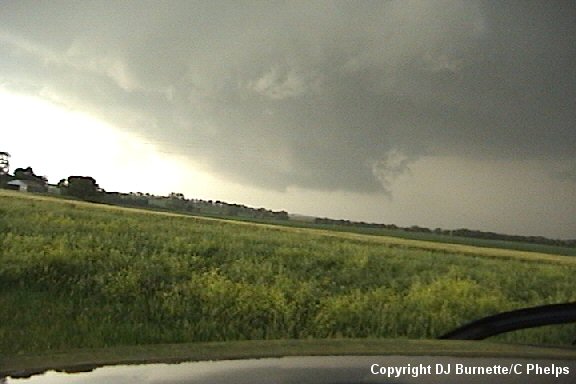
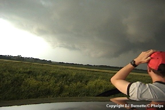
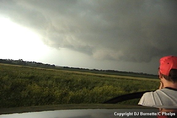
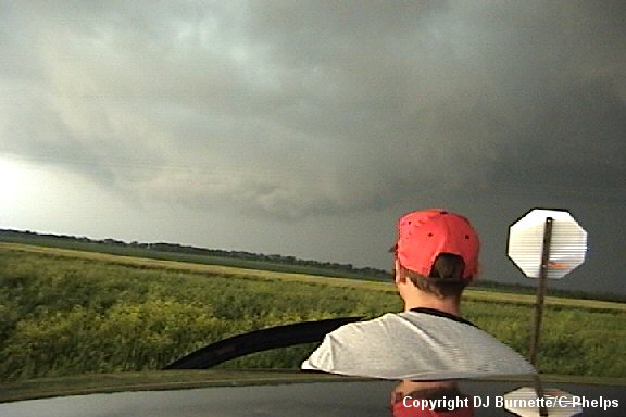
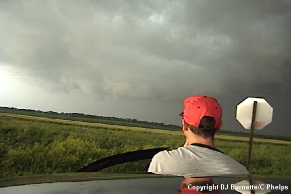
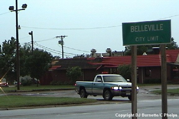
We continued to follow the storm to the east and north into Concordia, KS, and then took U.S. 81 back up to the southwestern end of the storm. The storm contained a number of scud clouds, but some rising motion also was noted. Thus we were very careful in moving north toward Belleville, KS. Rain increased as we arrived in the southern portion of Belleville. We also heard of rotation being observed to the west of Belleville toward Scandia, KS, and therefore we moved west on U.S. 36 toward this area of rotation. We intercepted the rotation between Belleville and Scandia, and that rotation eventually turned into the most violent wall cloud rotation I have ever observed. A few funnel clouds/possible tornadoes were observed, but we could not confirm any touchdown. I would not be surprised if touchdowns did occur though given how violent the rotation was. Incredible inflow winds were noted as well (Jeremy Howard has to hold on to his hat at times in the images below). The images of the rotation are below (view is looking north from U.S. 36 east of Scandia and west of Belleville).
Eventually we had to move east as additional, rapid upward motion was quickly moving toward us from the west and rain was beginning to wrap into our location. We moved east on U.S. 36 and stopped east of Belleville to observe the storm. Incredible inflow was still noted, and it was hard to stand up at times. We began to hear of tornado reports to our north at this time. This tornado was another large, rain-wrapped tornado. However, unlike the Jamestown tornado, this one did not show itself. Storm chasers who caught it mentioned that they had to drive through rain to see it. We did observe a downburst and a wall cloud (images below; view is looking north from U.S. 36 east of Belleville). This area was turning into more of an ugly shelf cloud with time though, and we noted the development of some horizontal roll clouds.
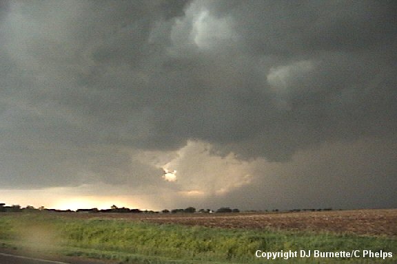
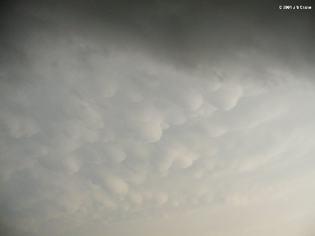
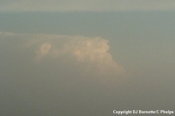
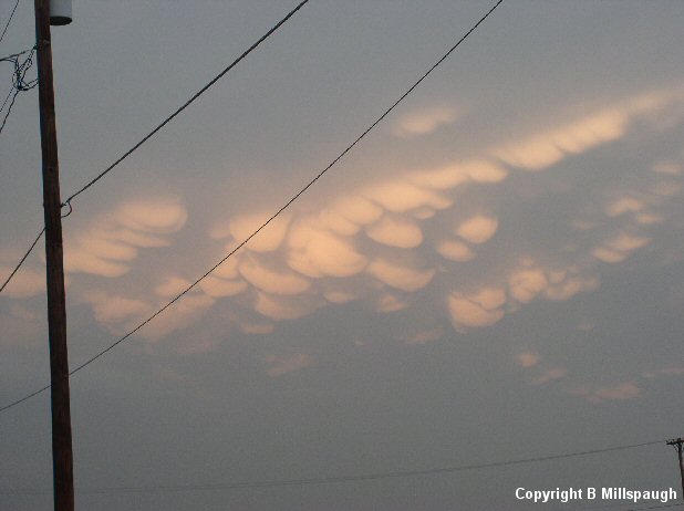
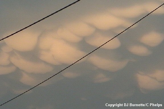
We also snapped images of the well-defined mammatus clouds off to our south-southeast and of the southcentral Kansas monster that was over 180 miles to our south (images below).
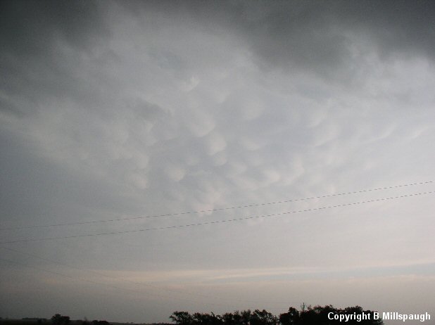
Eventually we felt a rush of warm, moist air as the storm stopped turning toward the right and began to move northeast away from our location. Darkness also was approaching, and we decided to let the storm go and move back into Belleville to check on any damage prior to departing for home. Tree damage was the main story across the town, but there also was some damage to a Dairy Queen. We also took one last shot of the mammatus clouds off to our east-southeast (images below).
Thanks to Wes Etheredge at WeatherData, Inc. and Dean Jones at KSNW-TV for morning discussions. Thanks to Guy Pearson and Mike Smith at WeatherData, Inc. and to Dave Freeman and Dave Schaffer at KSNW-TV for nowcasts.