Storm Chase Log 4 June 2001
Chasers: Dorian J. Burnette, Joseph Crane, and Cory Phelps
Preliminary Destination: Hutchinson, KS
Note: Images have been decreased in size. Click on an image to view a larger version.
We started out heading northwest on K-96 out of Wichita toward Hutchinson. After stopping in Hutchinson to gas up and eat, we checked the Internet to see how things were setting up. It seemed to us that the storms were going to fire off to our east a short distance as evident by a fine line of cumulus noted on visible satellite imagery. So we decided to head eastward on U.S. 50. We ran into a developing line of towers east of Burrton, and decided to stop and watch them.
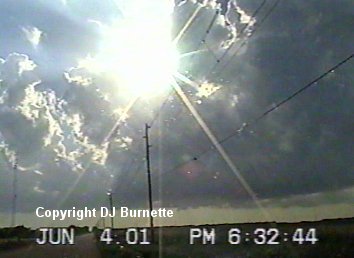
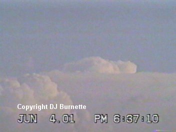
After watching the towers for about an hour, they were still going nowhere and were also right on top of us. So we decided to continue eastward to get back out ahead of the line. We stopped in Newton to watch the towers continue to grow. By this time, there was one main tower to our west and a severe thunderstorm noted well to our south in Harper County. I did make a telephone call to WeatherData, and Jeff House mentioned that the storm to the south was not all that impressive yet. Thus, we decided to stay on the ever growing tower to the west. We picked a spot just outside of Newton and watched the tower slowly grow (images below).
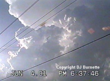
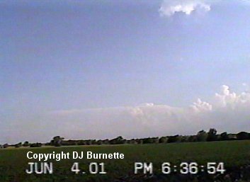
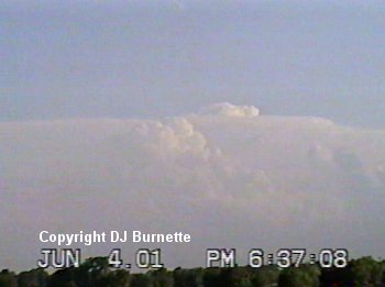
The tower was having trouble though. We did observe one rainshaft for a brief time, but it went away. We also kept an eye on the thunderstorm to the south in Harper County. It was looking more impressive all of the time. From a distance, we were able to photograph an overshooting top (images below).
We eventually gave in, and decided that since the tower we were on was taking too long to fully develop, we would go ahead and head south on I-135 to the Turnpike and then down to the storm in Harper County that was now having rotation reported. On the way, we got on the Internet to see what the storm looked like. It was all by itself and had a supercell appearance on the radar. Meanwhile, the one that we left was now finally becoming a full fledged storm, but unlike the one to the south, it was not all by itself.
We continued to have a good feeling about this decision until we heard that Rodney Price from KSN was on the storm that we were on, and was reporting a wall cloud. Doh! That said, upon looking back at the storm, I noticed that the flanking line was quickly going away. This was a sure sign that the storm would be doomed very shortly. Thus, we maintained our track toward the storm in Harper County. As we got closer to the storm, we photographed mammatus clouds along with a sunset (images below).
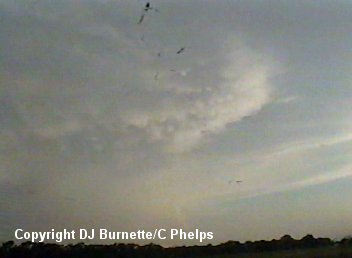
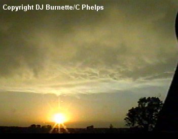
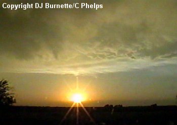
Notice how the mammatus clouds look wispy instead of very sharp pouches. This gave me a bad feeling that the storm was dying. And indeed it was. The severe thunderstorm warning was allowed to expire, and by the time we got to the Wellington exit and moved westward to where the storm was, we received a call from Jeff House at WeatherData saying that the storm had died. That was very evident from our view, as all that remained was anvil debris. Jeff did mention that there was another storm well off to our southwest in Oklahoma. However, since it was getting dark, we decided to return home, and wait for another storm chase the next day (5 June 2001). Basically what happened was that the cap remained too strong. The storms were able to break through the cap with strong surface heating, but once that surface heating went away, the cap resumed its hold and stopped new towers associated with the flanking lines of both storms from developing.