Storm Chase Log 5 June 2001
Chasers: Dorian J. Burnette, Mary Fisher, Joseph Hall, and Cory Phelps
Preliminary Destination: Wellington, KS
Note: Images have been decreased in size. Click on an image to view a larger version.
The chase began by heading south on the Kansas Turnpike to Wellington. At Wellington, we connected to the Internet one last time before going out of digital coverage to make certain we were on the right track. Towering cumulus were noted on visibile satellite imagery to the west of us toward Attica. Thus, we began the journey westward to Attica on U.S. 160.
While traveling to the west, we hear of severe thunderstorm warnings being issued for Harper County, which is the county we were heading into. The storm began to show itself in a big way as we passed out of the western edge of the town of Harper. At this point, I was able to observe lowerings in the back of the storm. Unfortunately, as we continued westward on U.S. 160 toward Attica, the highway had construction (one lane traffic with stop lights) at virtually every bridge. This was unacceptable, as we were now observing a persistent wall cloud with the storm in front of us. Thus, we began meandering around on dirt roads in order to avoid the construction. Unfortunately, this also meant that our view would be somewhat obstructed by trees.
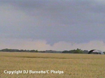
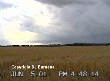
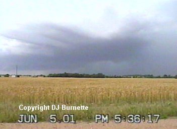
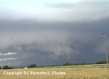
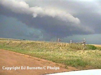
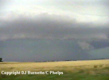
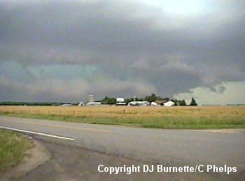
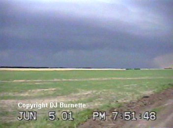
The first set of images were taken at our first available opportunity to get off U.S. 160 and onto a dirt road. The view is looking west toward Attica.
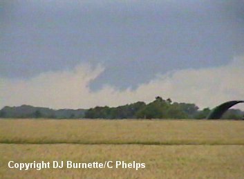
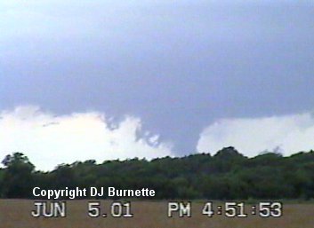
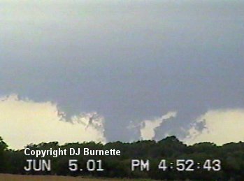
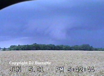
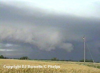
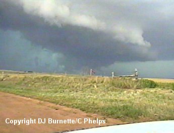
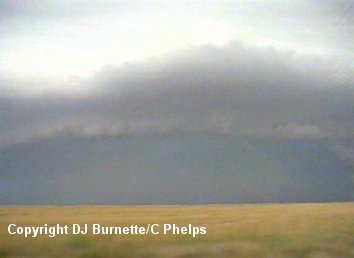
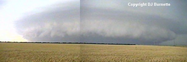
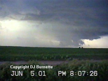
We meanered through some more dirt roads in order to get a closer view of the storm. This second set of images is about 1 mile closer to the storm. A brief tornado touchdown was reported at this time (image below). The view is looking west toward Attica.
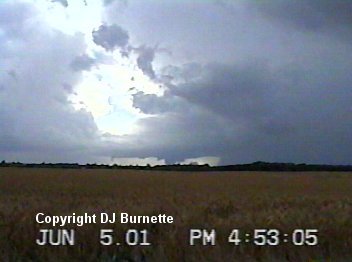
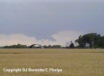
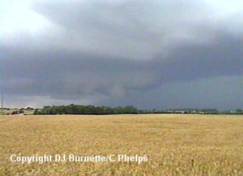
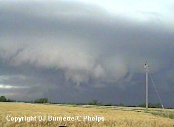
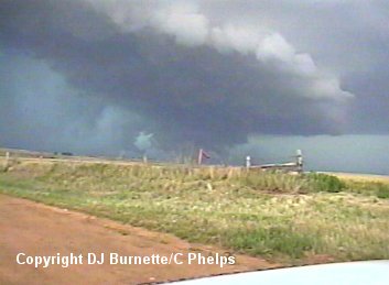
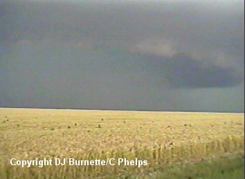
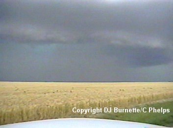
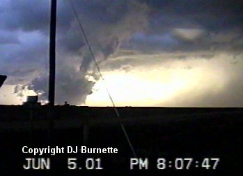
During both stops, I attempted to call KSN to report what I was observing. This was difficult, as the mobile phone was not in the best of coverage areas. I was able to get through to KSN, but it took multiple attempts. A couple of times I could hear them just fine but they could not hear me, and that was very frustrating. We wondered into the town of Attica, where I made a phone call (this time using a pay phone and a 1-800 number) to WeatherData. I talked to Guy Pearson and told him what I had observed so far. He mentioned that the storm was beginning to turn toward the right and would be coming after me shortly. Thus, we headed back eastward on U.S. 160 to the first decent dirt road with a view. From this observation point, we continued to film the storm. The storm had a well-defined hailshaft and a well-defined wall cloud. The following set of images are from that point in time. The view is looking west toward Attica.
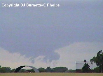
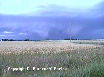
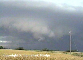
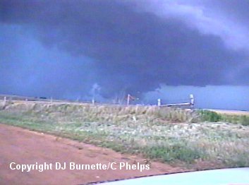
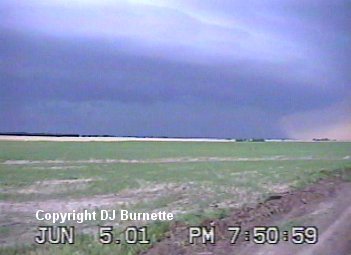
We eventually moved farther eastward ahead of the storm, as it was coming too close for comfort. Our next stop was on another dirt road off of U.S. 160. We once again looked back to the west toward Attica and captured some very interesting video. The first thing we noted was that the old wall cloud we had been watching became disorganized and was being fed into the new main updraft (images below).
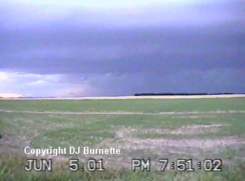
Immediately after the organization of the new wall cloud, a rapidly spinning vortex attempts to develop downward from the new wall cloud. However, it was not able to make it very far toward the ground. Something was lacking for tornadogenesis to complete (images below).
At this time, we decided to move a little farther eastward. There is a dirt road, which continues eastward past the interchange of U.S. 160 and K-2. We decided to continue on that dirt road. Eventually, we came to good view point and we stopped to resume storm observations. We are now due south of Harper looking west-northwest into the storm. From this point we observed a massive wall cloud set in behind green skies. Also of note is precipitation falling off to the southwest of the wall cloud (images below).
The storm was transitioning from a classic supercell into a high-precipitation supercell, and we were observing the development of a hook echo from the field (wall cloud in the hook and heavy rain to the south and southwest of the wall cloud indicating the hook itself). It was tempting to move closer to the wall cloud and grab some video, but I did not like the green skies (indicating hail) that I would have to go through to get there. The storm was also continuing to move in our general direction. We moved northward for a time on some dirt roads in order to continue to observe the wall cloud, but from our view the rain eventually wrapped all the way around it.
It was pointless to continue chasing the storm as if we were going to see a tornado. So we decided to get into a good position to where we could photograph the storm as a high-precipitation supercell. We took some pictures north of the town of Freeport (images below). There was another brief tornado touchdown around this time, but we had no chance of observing it.
We eventually got a very good look at the storm once we got southeast of Freeport on K-44. We pulled off on a couple of different dirt roads to take some pictures (images below).
We also ran into the Doppler On Wheels crew along with their squad of probe vehicles. One vehicle obviously had a close encounter with a hailcore...their back windshield was knocked out.
Eventually, we ended up farther southeastward northwest of South Haven. From this point, the storm began to change. The mesocyclone was no longer as rain-wrapped with a wall cloud visible from our location (image below). We also noted a downburst with this storm (image below). High-precipitation supercells will most often evolve into a bow echo. A call to WeatherData confirms this is occurring. Steve Drews mentioned that the transition into a bow echo was underway with straight-line winds around 60 to 70 mph.
We continued eastward and arrived in Arkansas City by the time it was pitch black outside with the exception of lightning (of course). I made one final phone call to WeatherData to inquire what the storm was doing and how far south it extended. I was looking for a way to move around the storm and head back toward home. I did entertain the thought of finding shelter in Arkansas City and allowing the storm to go over me. However, this storm had been producing tornadoes and was still capable of more nasty stuff. WeatherData mentioned that the storm was still producing massive straight-line winds to around 70 mph, but did not extend much past the Oklahoma line. I was not going to play games with the storm, and told the folks with me that we would take U.S. 77 southward into Oklahoma far enough to move around the storm safely without any high wind danger.
Once in Oklahoma, we were able to move around the storm very easily and continue looking at the lightning show off to the north of us. Once we arrived at I-35, we were able to continue on toward home with no storm troubles.