Storm Chase Log 23 May 2016
Chasers: Dorian J. Burnette and Jeff House
Preliminary Destination: Woodward, OK
Note: Images have been decreased in size. Click on an image to view a larger version.
This was day two of a five-day long storm chase in the Plains. We started the morning in Elk City, OK and noted the best setup for the day was likely in vicinity of Woodward, OK given morning thunderstorms in KS producing an outflow boundary that would move west-southwest with time and a dryline moving in from the west. We arrived in Woodward by the late-morning hours, had lunch, and watched trends closely.
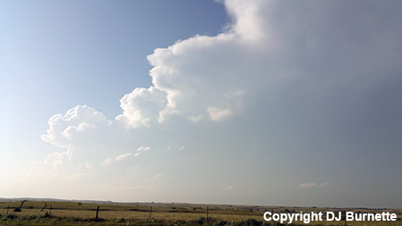
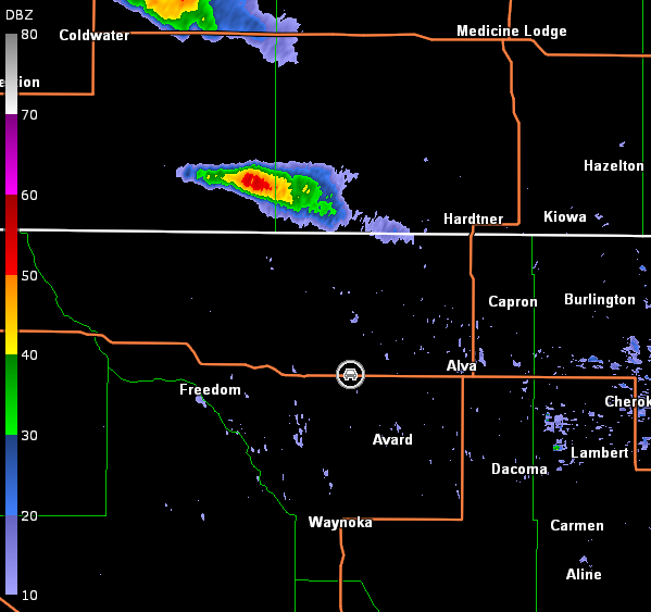
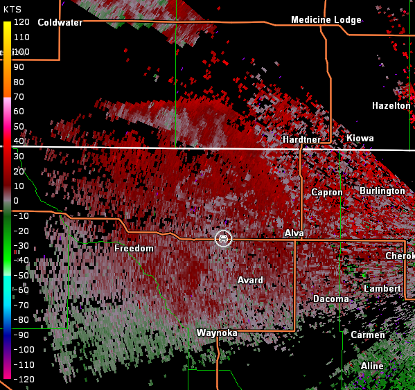
Towering cumulus started to be observed by the mid-afternoon hours, but they continuously banged on the cap and fell apart. Meanwhile, shortly after 5 p.m. CDT, a few echoes were noted along the KS/OK line west-southwest of Medicine Lodge, KS. Despite reservations, we made the decision to head north toward those echoes. A storm developed, but it was up and down in intensity as we traveled east on U.S. 64 and stopped west of Alva, OK. The view from our position was promising (image below; view west of Alva, looking north-northwest). The storm also had a decent echo on radar (images below; car symbol denotes our location).
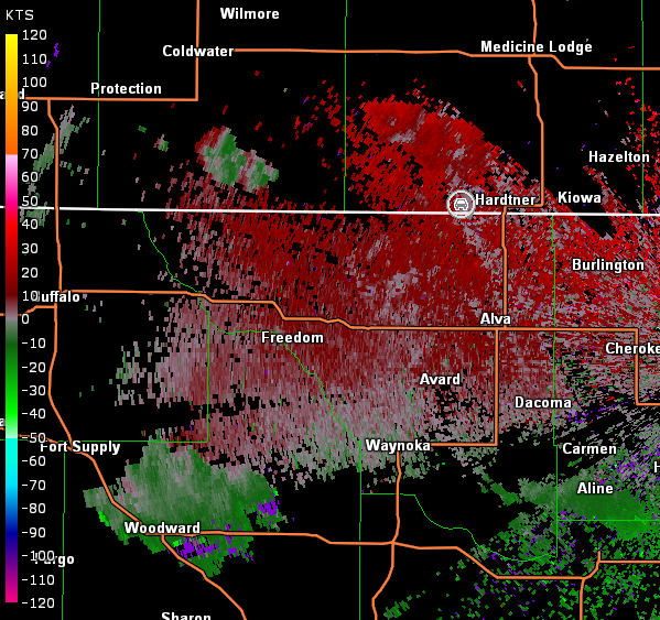
Vance Air Force Base, OK Storm Relative Velocity 2334Z
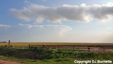
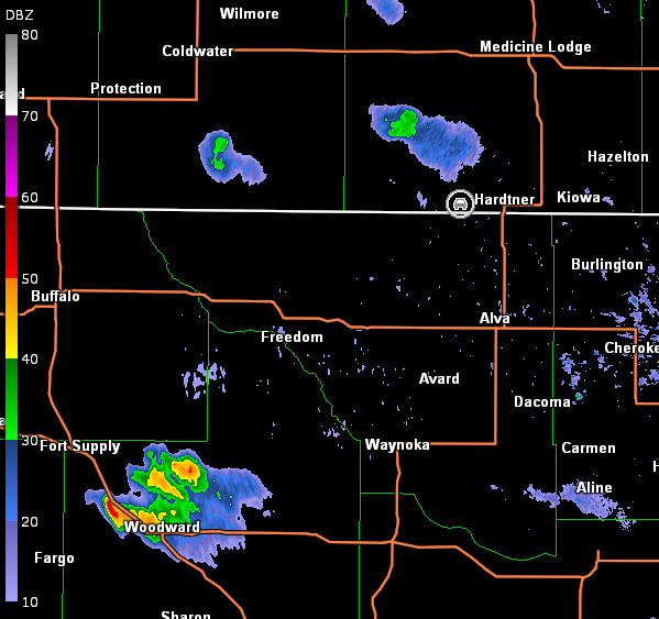
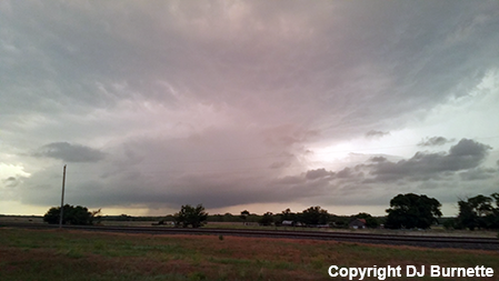
We moved north on U.S. 281 into KS and stopped just west of Hardtner, KS. And...our storm had died. Meanwhile, a quick visual noted a rather impressive looking cumulonimbus back to our southwest in vicinity of Woodward (image below; view west of Hardtner, looking southwest). Radar also showed solid echoes in this location (images below; car symbol denotes our location).
Vance Air Force Base, OK Storm Relative Velocity 0009Z
Sometimes patience gets the best of you, and that is what happened on this day. We should have been more patient at Woodward, but all was not lost yet. We moved back south on U.S. 281 hoping to catch the storm 1) before dark and 2) before it produced a tornado. We were lucky on both counts.
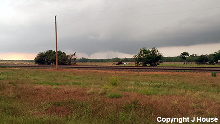
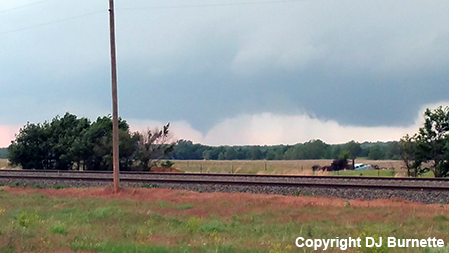
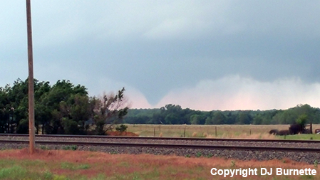
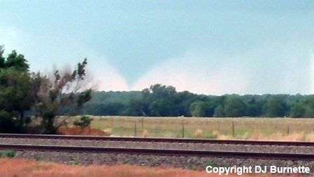
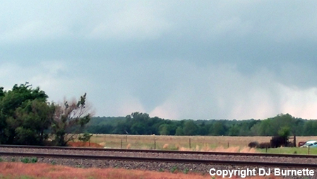
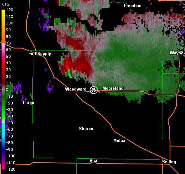
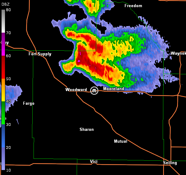
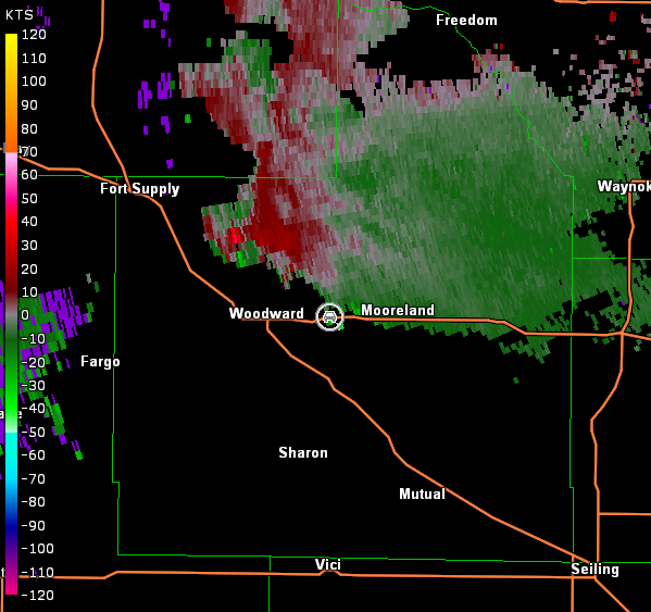
A wall cloud was observed as we approached the storm from the east on U.S. 412. As we closed in on Woodward, a tornado developed to our northwest (images below; view east of Woodward, looking northwest). Radar showed a classic signature (images below; car symbol denotes our location).
Vance Air Force Base, OK Storm Relative Velocity 0128Z
Vance Air Force Base, OK Base Reflectivity 0135Z
Vance Air Force Base, OK Storm Relative Velocity 0135Z
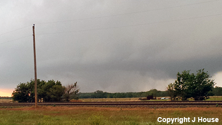
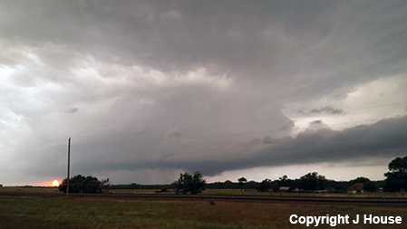
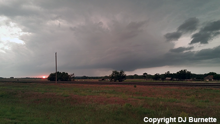
The tornado wrapped up in rain right as sunset occurred yielding a spectacular view of the storm with the setting sun from our location (images below; view east of Woodward, looking northwest).
We moved into Woodward to see if the storm would do anything more. However, darkness was upon us fast, so we retreated east to Enid, OK to rest ahead of the next day's storm chase.