Storm Chase Log 22 May 2016
Chasers: Dorian J. Burnette and Jeff House
Preliminary Destination: Amarillo, TX
Note: Images have been decreased in size. Click on an image to view a larger version.
This was day one of a five-day long stretch of storm chasing days in the Plains. We made it to Amarillo, TX by the afternoon, and thunderstorms developed to our east and southeast by mid-afternoon. One of the thunderstorms had an appendage on the end of it in vicinity of Goodnight, TX, as we moved east on I-40 and then east-southeast on U.S. 287 to intercept.
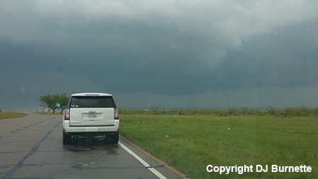
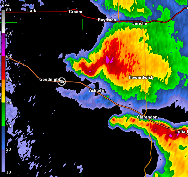
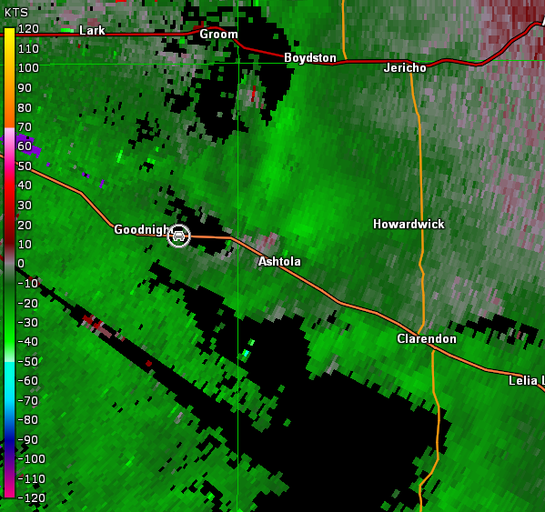
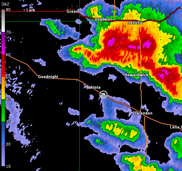
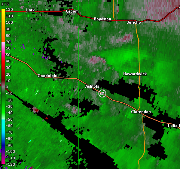
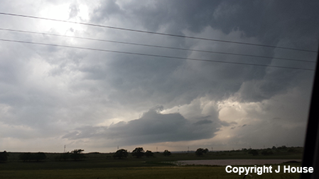
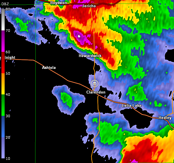
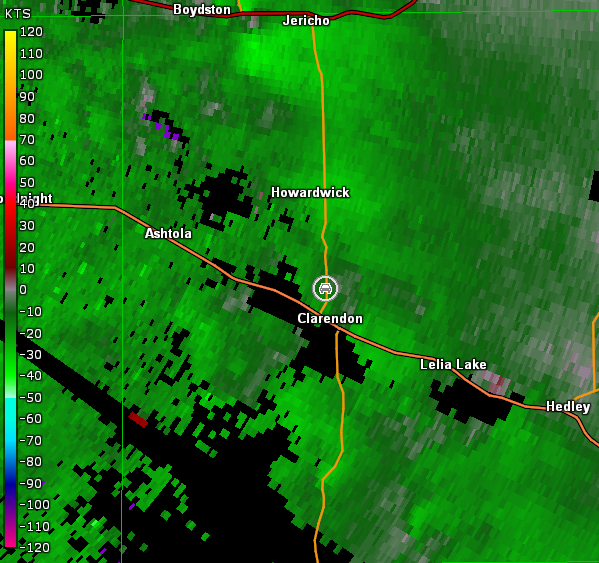
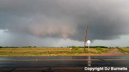
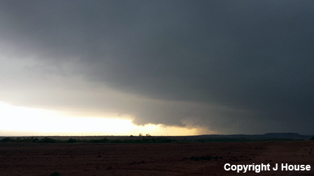
We spotted a wall cloud as we approached the storm from the west, and stopped on U.S. 287 east of Goodnight, TX to see if it would do anything (image below; view east of Goodnight, looking east). Modest circulation was noted in the general location of this wall cloud (radar images below; car symbol denotes our location).
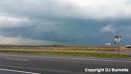
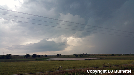
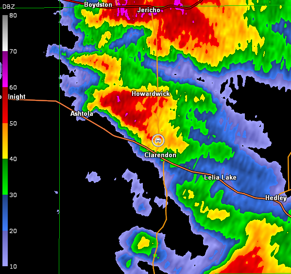
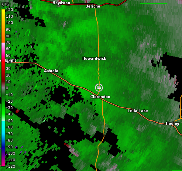
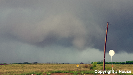
We continued to monitor the wall cloud as we moved southeast on U.S. 287. The storm was moving northeast away from us though. We stopped again northwest of Clarendon, TX to watch the storm some more (image below; view northwest of Clarendon, looking north-northeast). Radar images are included below (car symbol denotes our location).
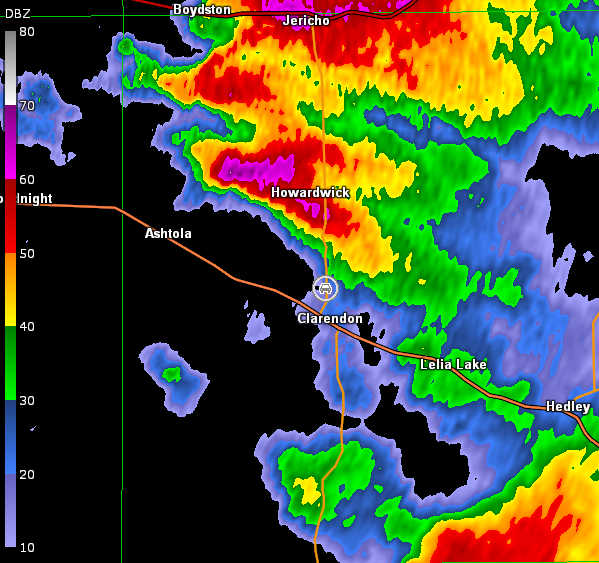
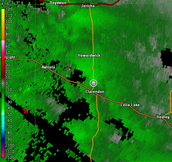
Another storm was moving up on us from the southwest and strengthening. Thus, we moved into Clarendon, TX and then north on TX-70 to keep an eye on the storm now up by I-40 and the intensifying cell to our west. Overall, we didn't view much from this location (images below; view north of Clarendon, looking west-northwest). Moreover, the interesting look the storm to our west had for a couple of radar scans was lost as it ran into the storm ahead of it in vicinity of I-40 (images below; car symbol denotes our location).
Amarillo, TX Storm Relative Velocity 2155Z
Amarillo, TX Base Reflectivity 2200Z
Amarillo, TX Storm Relative Velocity 2200Z
Amarillo, TX Base Reflectivity 2205Z
Amarillo, TX Storm Relative Velocity 2205Z
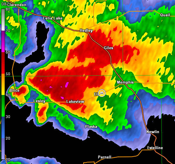
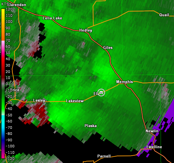
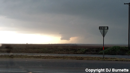
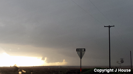
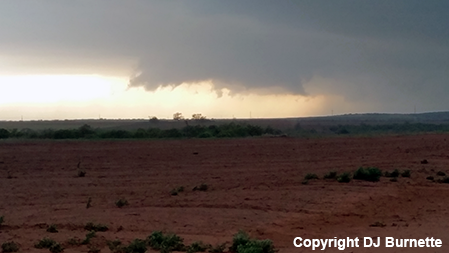
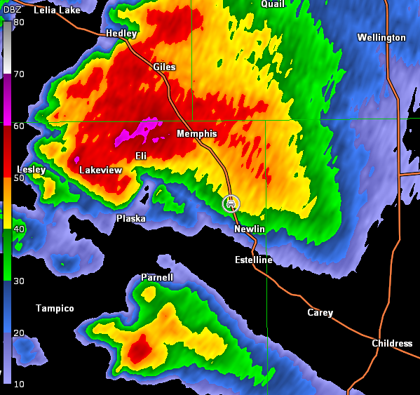
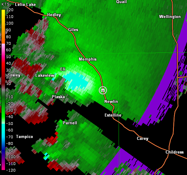
Another storm was observed off to our south-southeast in vicinity of Lakeview, TX. Thus, we bailed on the storms up by I-40 and moved back south through Clarendon, TX and then east on TX-256. The storm continued to get more impressive as we approached Lakeview from the west, and a tornado warning was issued. We did have to pause briefly to let the storm move across the road. Once we could continue east safely, we moved to just east of Eli, TX and stopped. A rotating wall cloud was just to our north and a modest funnel cloud was observed (images below; view east of Eli, looking north). Circulation was noted in this area on radar but do note that even better circulation was located off to our west-southwest (images below; car symbol denotes our location).
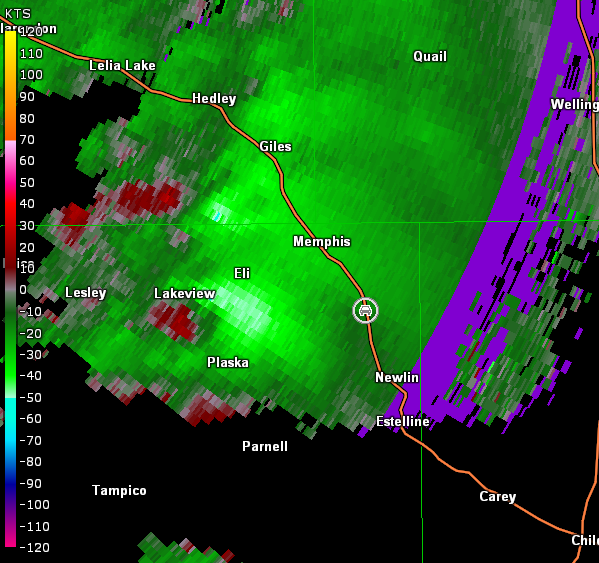
The circulation to our west-southwest also had a wall cloud, and we wasted no time moving east on TX-256 into Memphis, TX and then south on U.S. 287. We stopped between Memphis and Newlin, TX to view the wall cloud (images below; view is south of Memphis, looking west). The circulation to our west was observed to be tightening on radar (images below; car symbol denotes our location).
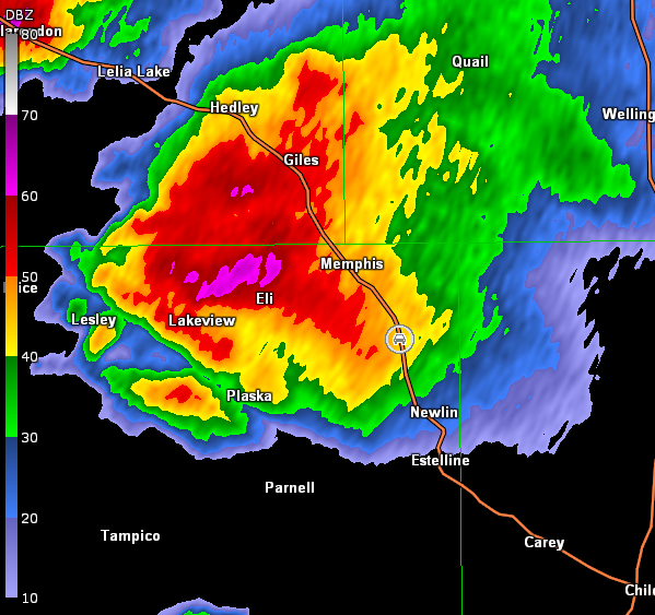
Amarillo, TX Storm Relative Velocity 2330Z
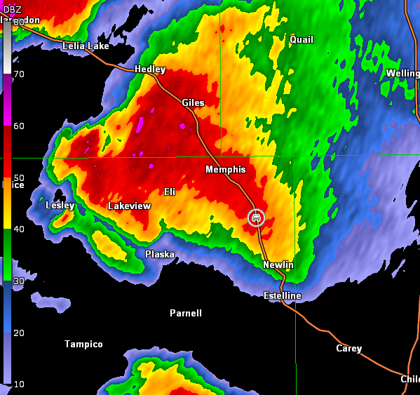
Amarillo, TX Base Reflectivity 2336Z
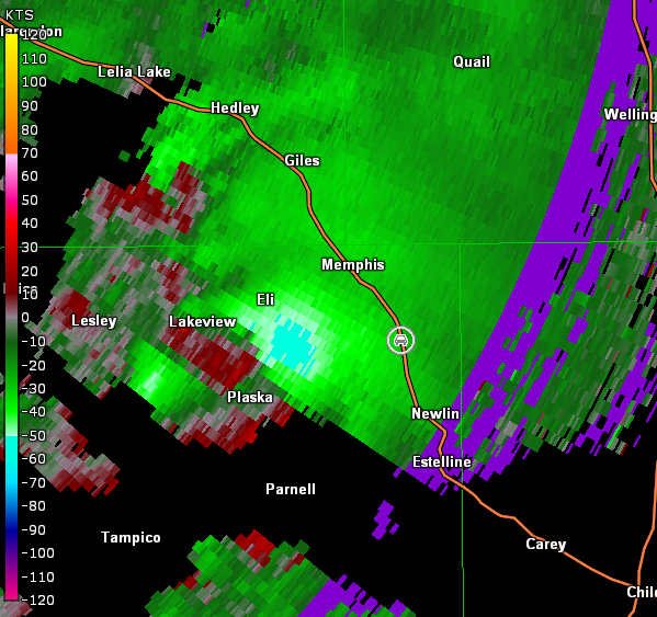
Amarillo, TX Storm Relative Velocity 2336Z
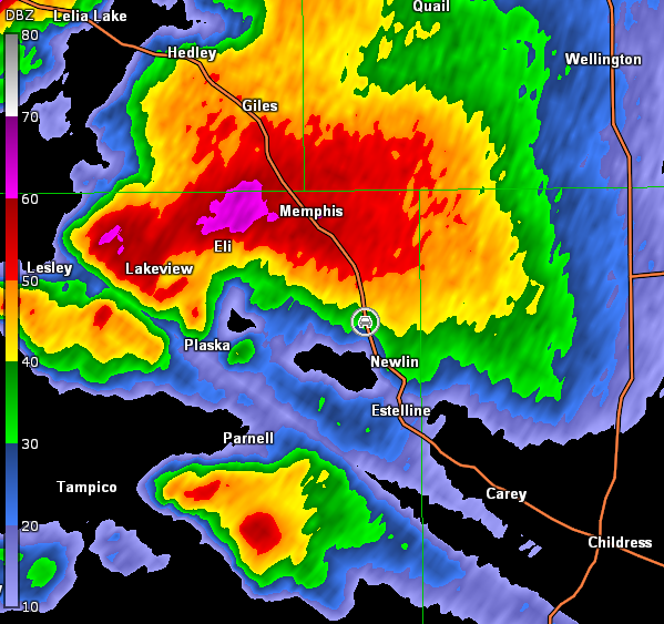
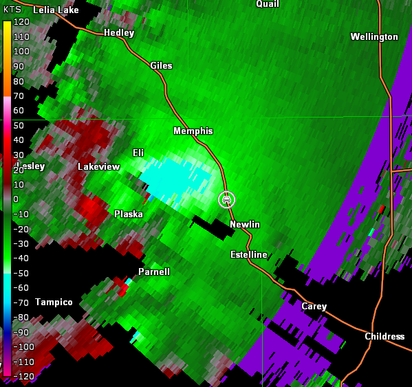
Rain was beginning to impact us, and we were losing view of the wall cloud. Thus, we moved a little farther south on U.S. 287, and stopped again north of Newlin, TX. Strong inflow into the wall cloud was observed at our location along with blowing dust.
Amarillo, TX Storm Relative Velocity 2342Z
Amarillo, TX Base Reflectivity 2348Z
Amarillo, TX Storm Relative Velocity 2348Z
The wall cloud became more obscured in rain with time, and eventually spotters reported a large cone tornado. However, we were unable to see it, since the circulation was well rain-wrapped at that point. Meanwhile, other storms continued to move up on this high-precipitation supercell from the south-southwest. Given the activity was becoming much more messy, we bailed to Elk City, OK for the night to await the next day's storm chase.