Storm Chase Log 24 May 2015
Chasers: Dorian J. Burnette and Megan Piquiet
Preliminary Destination: Elkhart, KS
Note: Images have been decreased in size. Click on an image to view a larger version.
We arrived in Elkhart, KS by the late-morning hours, and were uncertain whether thunderstorm initiation would be to our northwest in CO or farther to the south into the OK/TX Panhandles. By early-afternoon, an area of thickening cumulus clouds was observed on visible satellite imagery over southeastern CO with increasing instability noted across this region. Thus, it was now clear that thunderstorms were going to initiate over southeastern CO, and we moved back to the northwest into southeastern CO.
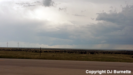
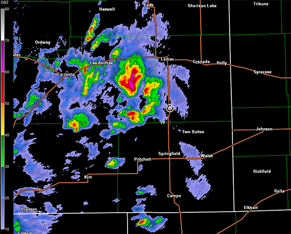
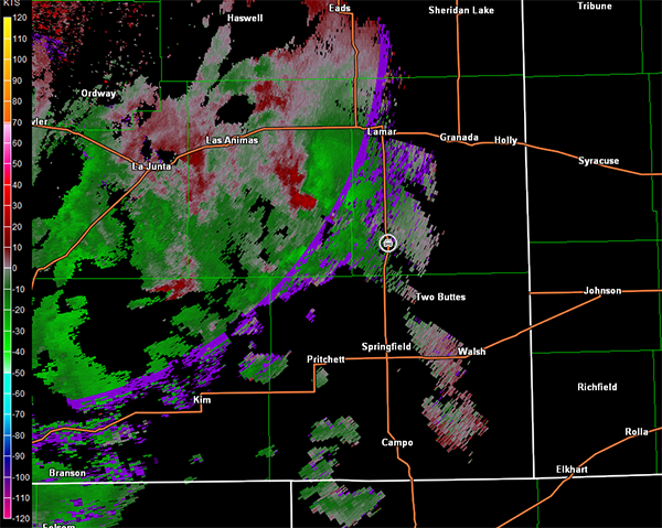
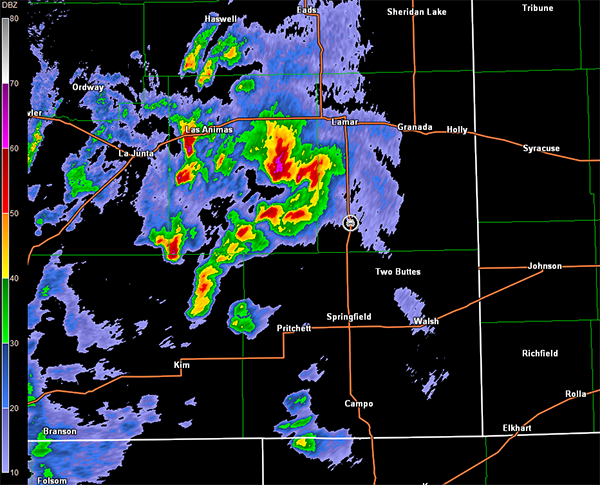
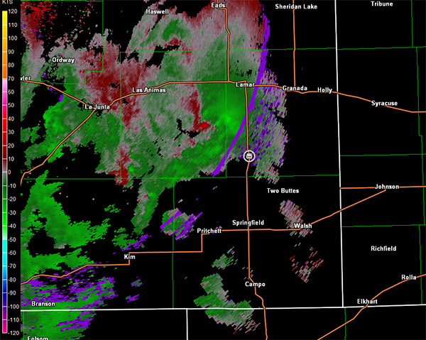
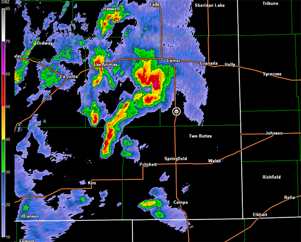
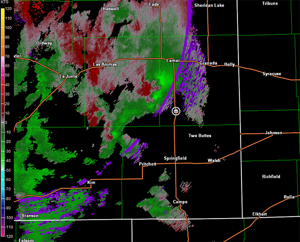
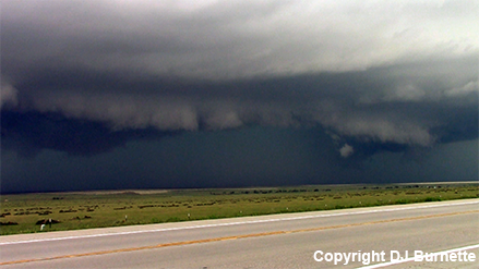
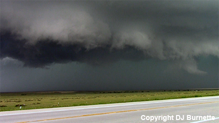
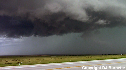
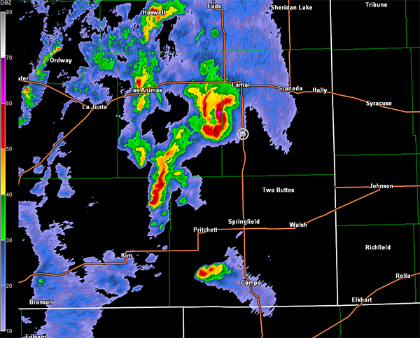
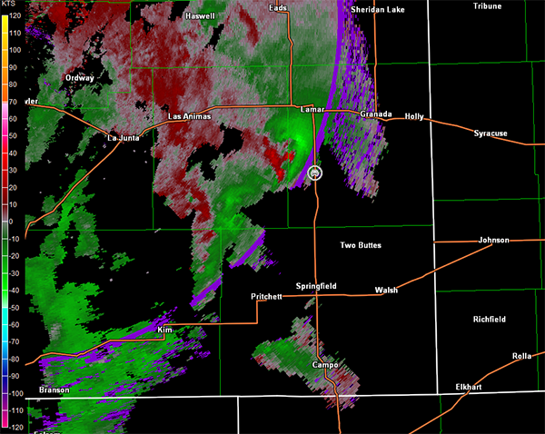
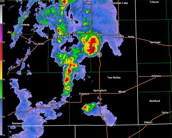
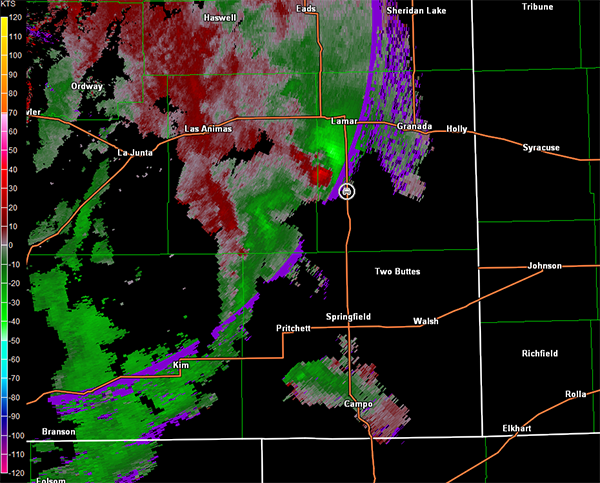
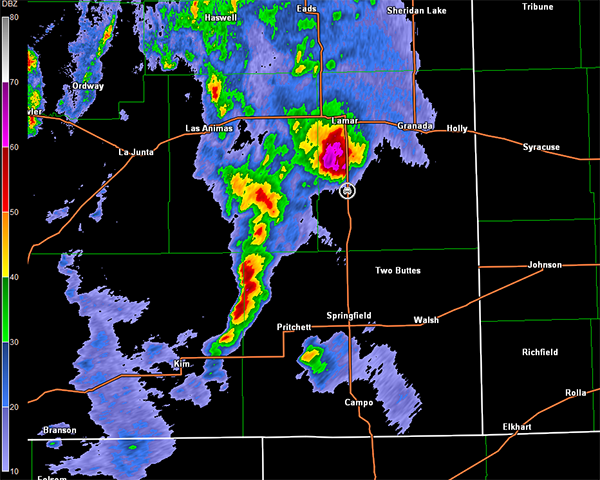
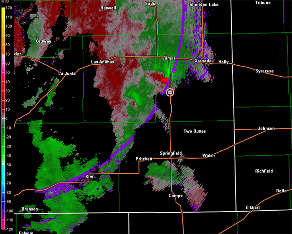
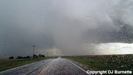
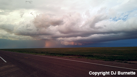
We arrived in Springfield, CO shortly before 3 p.m. MDT, and after a quick fuel stop, moved north on US. 287 toward Lamar, CO. A severe thunderstorm was southwest of Lamar at this time, and radar data suggested rotation was organizing. We continued north toward Lamar and stopped on U.S. 287 halfway between Lamar and Springfield. We did not have data at this time, but it was clear that some organization was occurring with lowerings noted to west and southwest (images below; view is south of Lamar looking west and southwest). Moreover, Jeff House was helping with nowcasting and informed us to be patient. Indeed, radar data during this time revealed a complex scenario with one dominate storm cell merging with other nearby storm cells (images below; car symbol denotes our location). A tornado warning was issued for the area at 3:36 p.m. MDT, and radar noted a couple of different circulations in the 2139Z storm relative velocity image below.

Pueblo, CO Storm Relative Velocity 2112Z
Pueblo, CO Base Reflectivity 2117Z
Pueblo, CO Storm Relative Velocity 2117Z
Pueblo, CO Base Reflectivity 2123Z
Pueblo, CO Storm Relative Velocity 2123Z
Pueblo, CO Base Reflectivity 2128Z
Pueblo, CO Storm Relative Velocity 2128Z
Pueblo, CO Base Reflectivity 2133Z
Pueblo, CO Storm Relative Velocity 2133Z
Pueblo, CO Base Reflectivity 2139Z
Pueblo, CO Storm Relative Velocity 2139Z
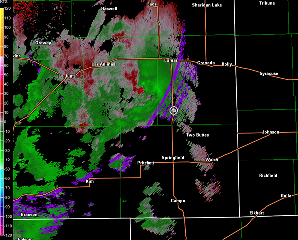
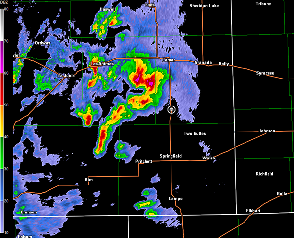
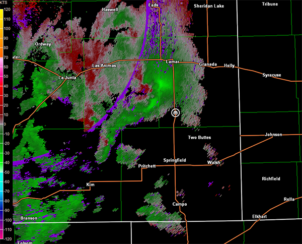
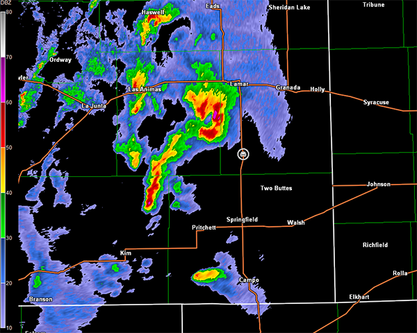
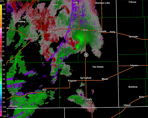
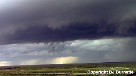
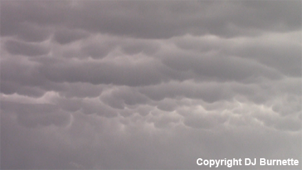
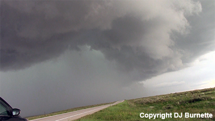
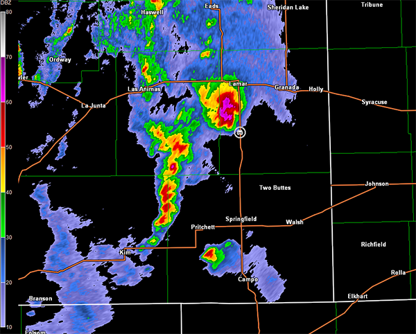
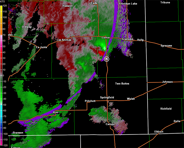
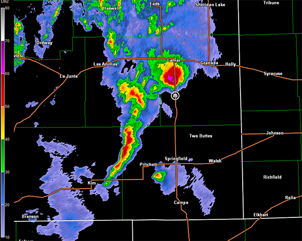
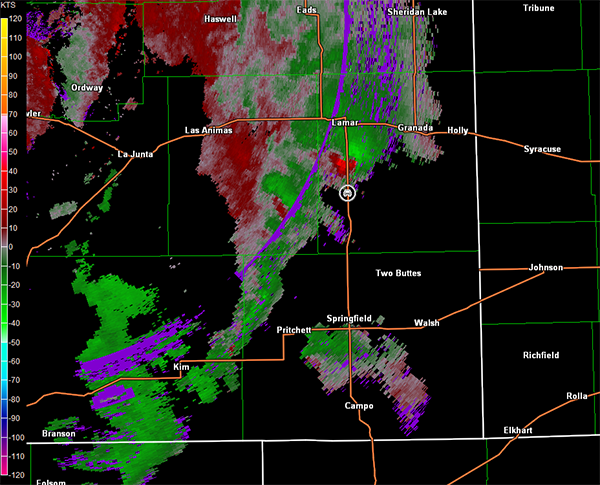
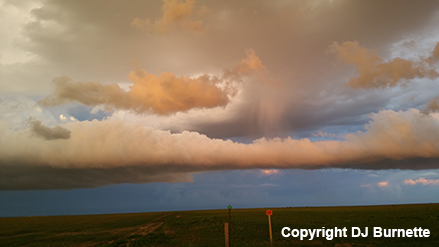
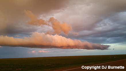
We could not confirm anything from our location, so we continued to follow the storm north on U.S. 287 for a closer look. It was clear that the complex scenario had evolved a high-precipitation supercell. We observed an impressive shelf cloud with a wall of rain between us and the main circulation (images below; view is south of Lamar looking west and northwest, except east-southeast for quick photo of mammatus clouds). A storm chaser was able to see a funnel cloud from a location just ahead of the mesocyclone, but the rain obscured our view. Data had returned by this time, and we were able to see the well-defined circulation become firmly embedded in rain with time (images below; car symbol denotes our location).
Pueblo, CO Storm Relative Velocity 2144Z
Pueblo, CO Base Reflectivity 2152Z
Pueblo, CO Storm Relative Velocity 2152Z
Pueblo, CO Base Reflectivity 2157Z
Pueblo, CO Storm Relative Velocity 2157Z
Pueblo, CO Base Reflectivity 2203Z
Pueblo, CO Storm Relative Velocity 2203Z
Pueblo, CO Base Reflectivity 2208Z
Pueblo, CO Storm Relative Velocity 2208Z
The plan from here was to allow the storm to cross the highway and follow it northeast toward Granada, since the storm's position relative to the road network would not allow us to get in front of it with ease. Unfortunately, even following the storm proved to be quite difficult. We continued north toward Lamar and then east on U.S. 50. We stopped east of Lamar on U.S. 50 again to allow the tornadic storm, now approaching Granada, to cross the highway. Meanwhile, we lost data again and storms farther to the southwest in the 2208Z radar image above had caught up to us with occasional hail now occurring at our location. We could hear on NOAA Weather Radio that those storms were also severe (not tornado-warned). My cell phone locked up as I was trying to communicate with Jeff House about the latest radar trends. To make matters worse, the complex cell interaction between the original supercell to the east and the storm in vicinity of our location made it very difficult to deduce storm structure (i.e., where we were relative to trouble). Perhaps this was continued fallout from my close call on 31 May 2013, but I quickly became very uncomfortable with our position. It was clear that I was losing situational awareness. Thus, I executed an escape route back to the west to get away from the complex storm interaction.
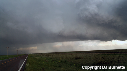
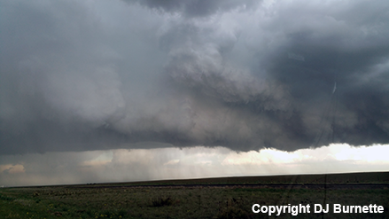
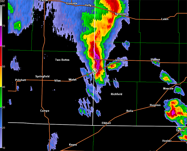
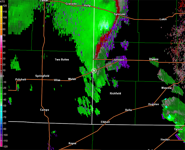
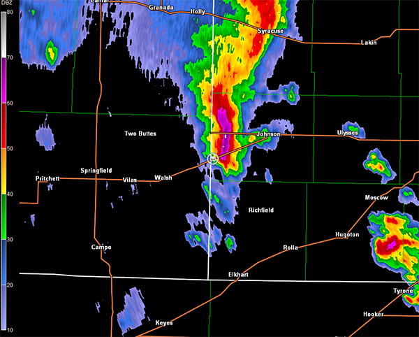
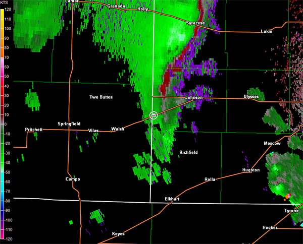
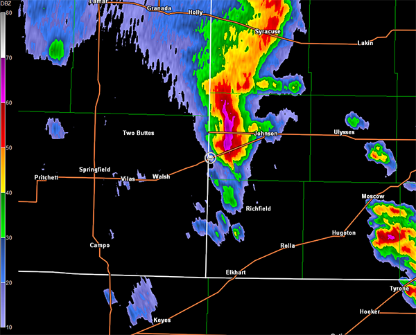
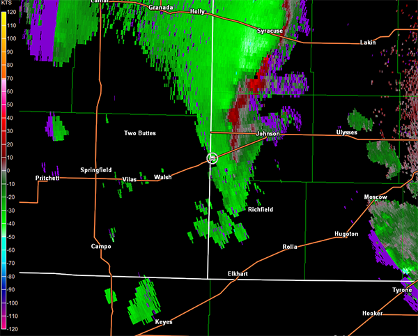
Data returned once we got back into Lamar, and Jeff House mentioned that the second cell now was looking the most interesting. Unfortunately, the road network would not allow for a good interception. Thus, we continued to the next cell farther to the south. This ultimately worked in our favor because the storms organized into a line and the storm of interest was on the end of that line. We moved back through Springfield, and then east on U.S. 160 toward the CO/KS line. Once again, we would lose data coverage in this region, but we did catch up with the cell just east of the CO/KS line. Impressive cloud structure was observed but no significant lowerings that would suggest tornado potential (images below; view is southwest of Johnson City, KS looking east). Radar data from this time are below, which showed a nice core to the storm but little in the way of circulation (note the switch to the Dodge City, KS radar, car symbol denotes our location).
Dodge City, KS Storm Relative Velocity 0047Z
Dodge City, KS Base Reflectivity 0053Z
Dodge City, KS Storm Relative Velocity 0053Z
Dodge City, KS Base Reflectivity 0059Z
Dodge City, KS Storm Relative Velocity 0059Z
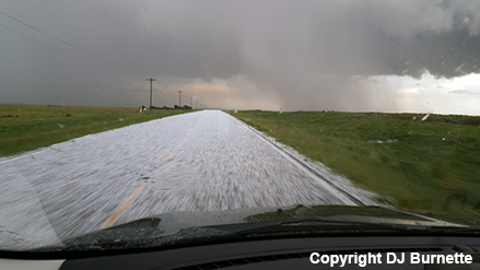
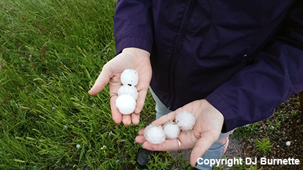
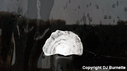
The storm's core was quite productive in producing large hail, and as we continued to follow the storm northeastward, we observed hail covering the roadway (images below). We stopped and noted some of the stones were over quarter-sized and potentially in upwards of golfball in size (images below).
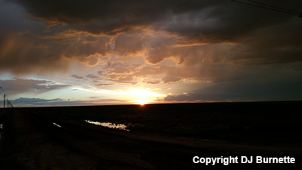
U.S. 160 runs northeast and this combined with the motion of the storm and the fact that it was backbuilding to the south significantly delayed our movement east. Eventually, we ran into KS-27 at Johnson City, and were able to move south away from the storm. A nice angle to the sunset relative to the storm to the northeast produced some beautiful color on the clouds, and we stopped briefly to take some photos (images below).
Meanwhile, while we are getting delayed by the storms entering KS from CO, additional supercells had initiated northeast of Liberal, KS. Unfortunately, we way out of position at sunset with the storms two counties to our east. At 9:30 p.m. CDT, we were still one full county away to the west and it was completely dark. Thus, despite the tornado reports, we let those storms go. We were treated to a nighttime lightning show though while en route to the hotel. Thanks to Jeff House for nowcast assistance.