Storm Chase Log 23 May 2015
Chasers: Dorian J. Burnette and Megan Piquiet
Preliminary Destination: Kit Carson, CO
Note: Images have been decreased in size. Click on an image to view a larger version.
This was Day 1 of a two-day storm chase in the High Plains. Many storm chases in the spring of 2015 were plagued by the early development of mesoscale convective systems (MCSs). These tended to have a negative impact on the environmental conditions during the afternoon hours. This storm chase was no different, and there was uncertainty whether the main target region on this day would be in OK/TX or farther to the northwest in CO. We hedged are bets with CO, since there was a good chance that on-going flood issues and probable high-precipitation nature to the supercells would make storm chasing difficult farther to the south.
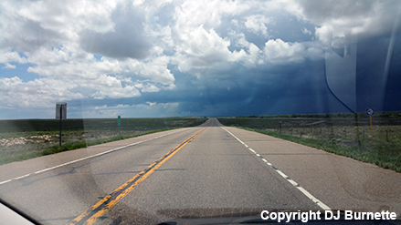
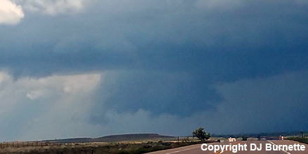
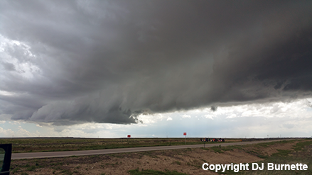
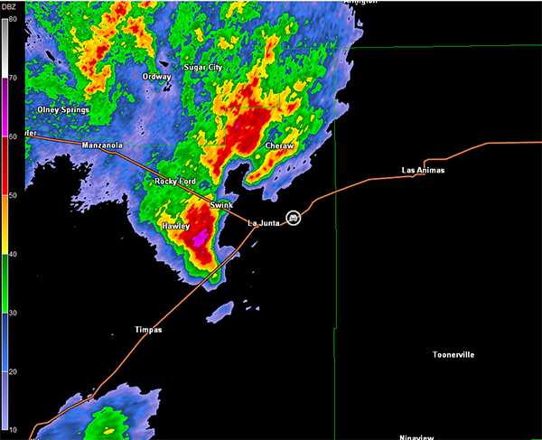
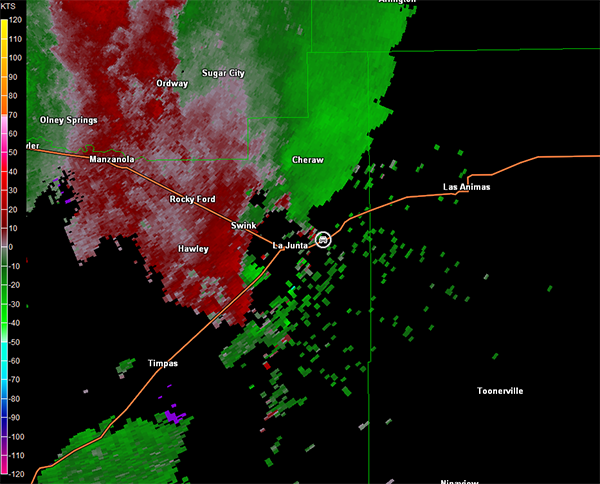
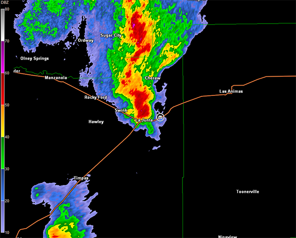
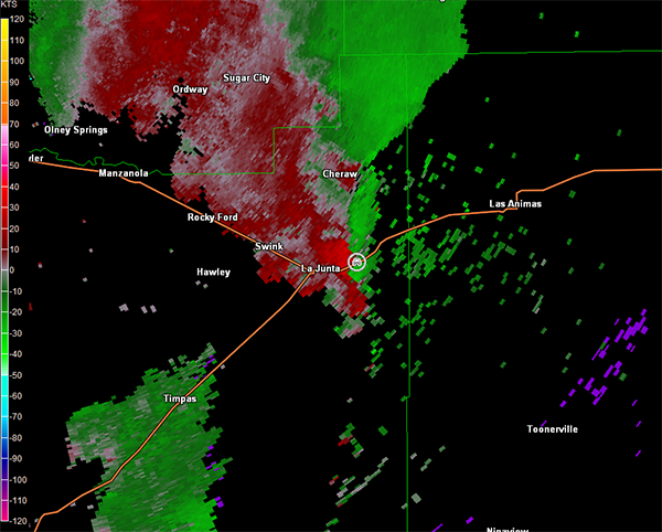
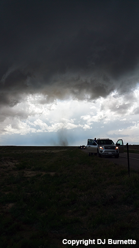
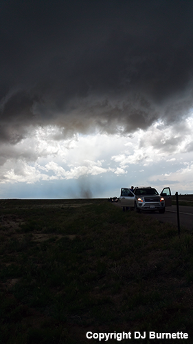
The morning of the chase started off by driving through a MCS across KS on our way into CO. We arrived in the Kit Carson, CO area around 12 p.m. MDT. An area of gradually intensifying thunderstorms to the west and southwest of an Ordway to La Junta, CO line was getting our attention, so we moved south on U.S. 287 through Eads toward the U.S. 287/50 interchange west of Lamar, CO. Severe thunderstorm warnings started to be issued on this group of thunderstorms while we were en route, and tornado watch number 195 was hoisted for eastern CO. There was one storm cell out ahead of the other two farther to the west, which was looking more interesting on radar. It was moving toward La Junta, and so we moved to intercept that particular storm. As we moved through Las Animas, CO, a tornado warning was issued on the storm. Traffic, unfortunately, was against us, and spotters reported a brief tornado, which we were unable to see from our location. We are able to see a good wall cloud from a distance (images below; view is northeast of La Junta looking southwest). We arrived at a good stopping place about 10 minutes after that tornado report, and observed a less organized storm (view is east-northeast of La Junta looking west and northwest). Radar images are below (car symbol denotes our location).
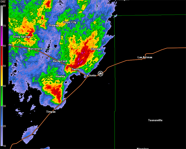
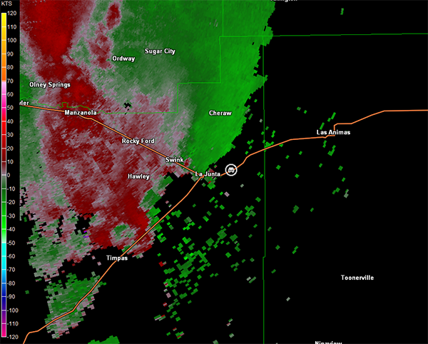
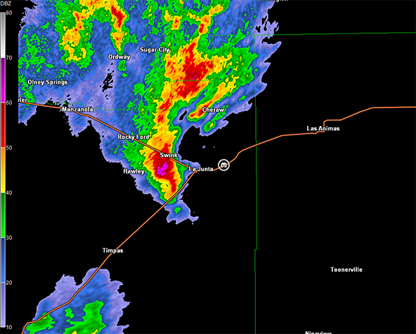
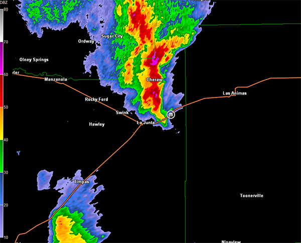
Pueblo, CO Storm Relative Velocity 1954Z
Pueblo, CO Base Reflectivity 2000Z
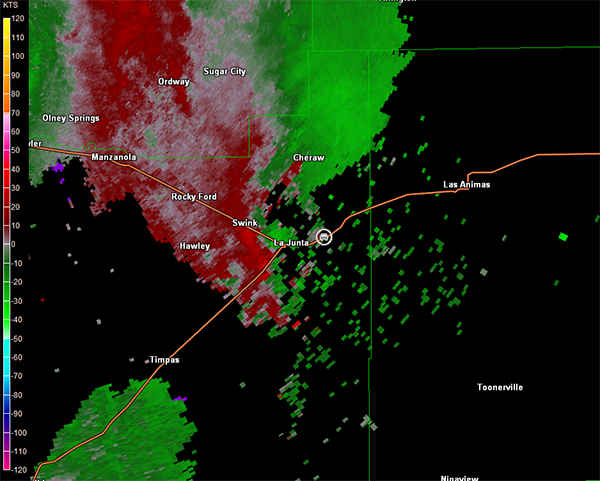
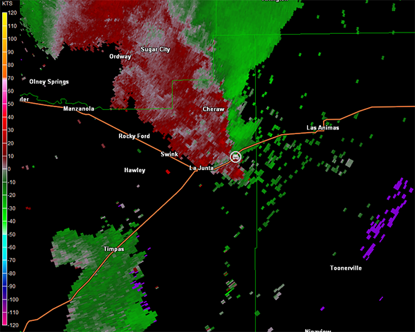
Pueblo, CO Storm Relative Velocity 2000Z
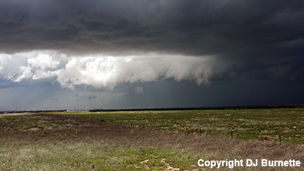
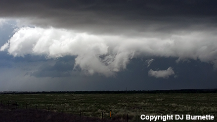
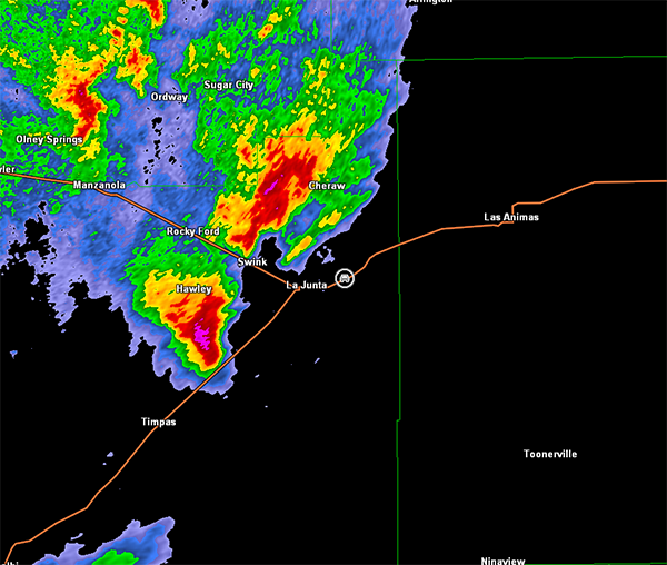
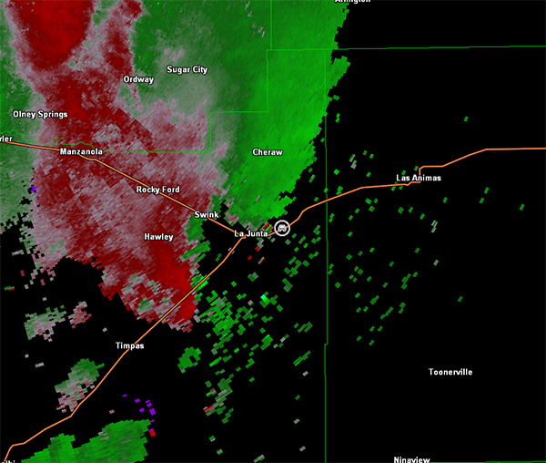
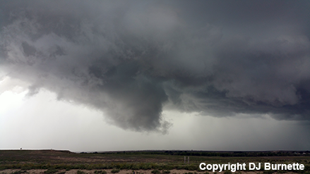
Meanwhile, another storm was noted moving toward us from the southwest. It was also showing some signs of organization (radar images below; car symbol denotes our location). We observed a decent shelf cloud and a brief wall cloud, but no tornadoes were observed (images below; view is east of La Junta looking west and north).
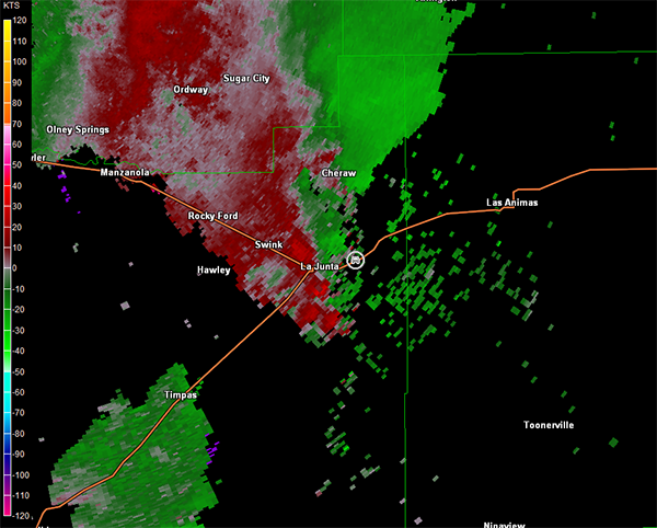
Pueblo, CO Storm Relative Velocity 2005Z
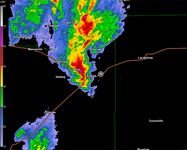
Pueblo, CO Base Reflectivity 2011Z
Pueblo, CO Storm Relative Velocity 2011Z
Pueblo, CO Base Reflectivity 2016Z
Pueblo, CO Storm Relative Velocity 2016Z
Pueblo, CO Base Reflectivity 2022Z
Pueblo, CO Storm Relative Velocity 2022Z
We continued to follow the storm to the east back toward Las Animas, and observed the development of gustnadoes. We stopped a few times on U.S. 50 to take a few quick photographs of the gustnadoes (images below; view is east of La Junta looking west).
From this point on, weakening trends in the storms were observed. This may have been due to the lackluster instability that was able to materialize in wake of the morning MCS, especially closer to the KS/CO line. We moved east into Lamar, CO and sat there for some time to see if any reintensification would occur. The storms evolved into a line with only occasional severe thunderstorm warnings. Therefore, we called it a day well before sunset occurred, and booked into a hotel to prepare for the next day's storm chase. Thanks to Jeff House for nowcast assistance.