Storm Chase Log 30 May 2013
Chaser: Dorian J. Burnette
Preliminary Destination: Perry, OK
Note: Images have been decreased in size. Click on an image to view a larger version.
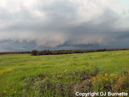
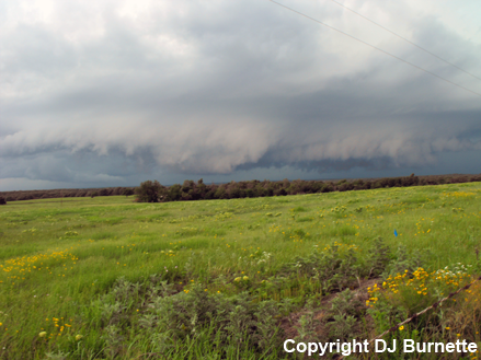
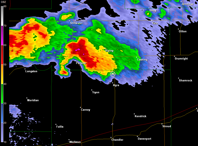
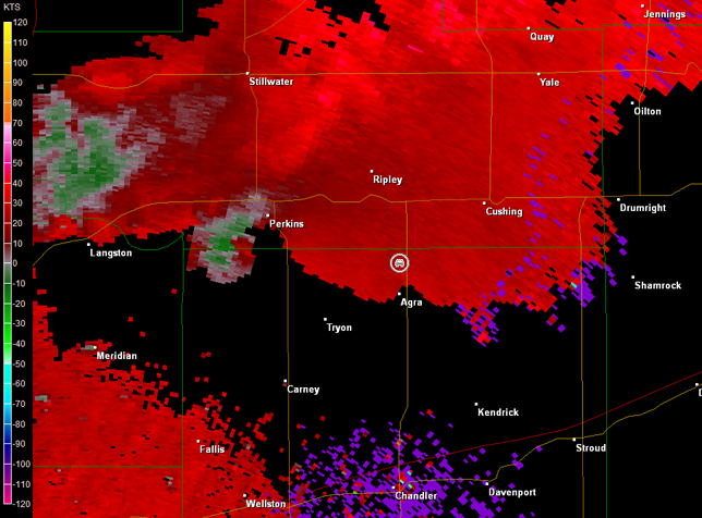
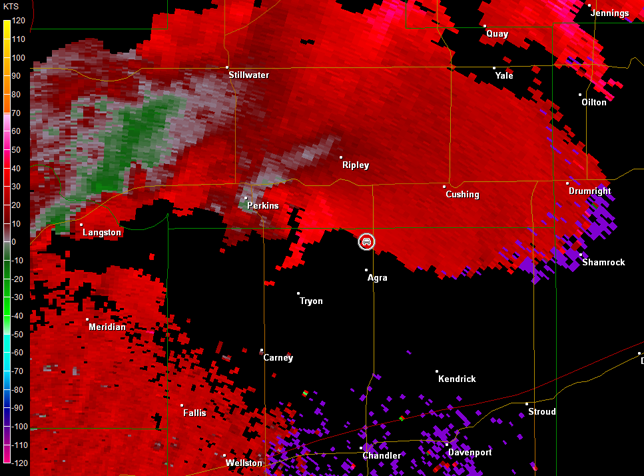
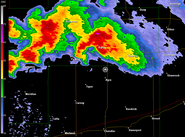
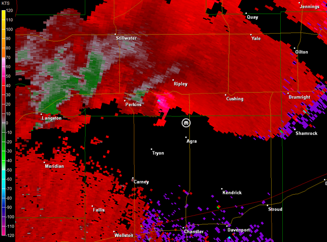
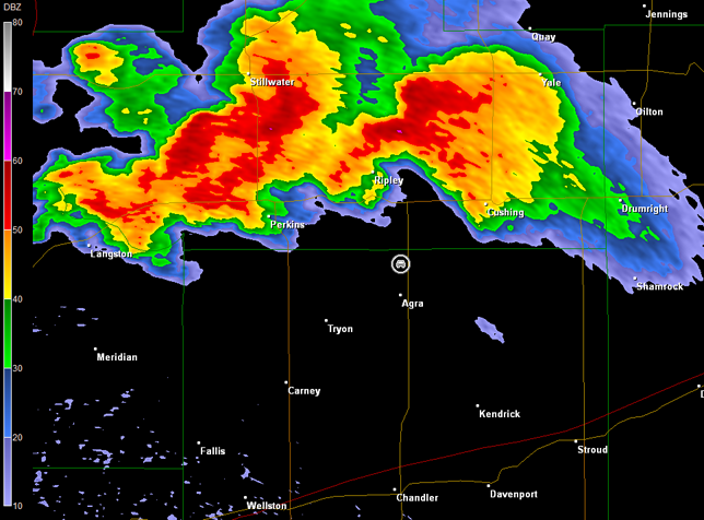
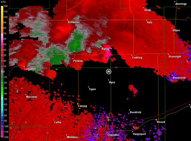
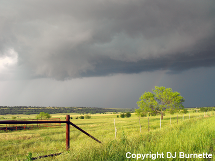
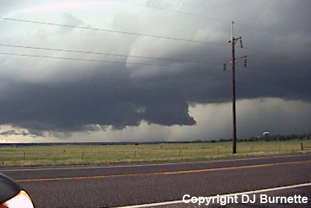
This was Day 1 of a two-day storm chase in OK. Storms developed early while I was still en route, so I never made it to Perry, OK. Jeff House communicated with me via phone, as I moved out of Tulsa, OK, saying the best storm was in vicinity of Guthrie moving northeast. Therefore, I continued south and west toward Perkins, OK. This storm met me east of Perkins, and I had to turn around to avoid core-punching the storm. I moved back to the east on OK-33 and then south on OK-18. I stopped on OK-18 north of Agra, OK and southeast of Perkins to view the storm as moved northeast. A large wall cloud was observed with the storm (images below; view is north of Agra looking northwest). Radar imagery during this time showed good circulation too (images below; car symbol denotes my location). A TV helicopter was able to confirm an official tornado from a better vantage point than I had. No visible condensation cloud could be determined from my location.
Norman, OK Storm Relative Velocity 2000Z
Norman, OK Base Reflectivity 2009Z
Norman, OK Storm Relative Velocity 2009Z
Norman, OK Base Reflectivity 2014Z
Norman, OK Storm Relative Velocity 2014Z
Norman, OK Base Reflectivity 2023Z
Norman, OK Storm Relative Velocity 2023Z
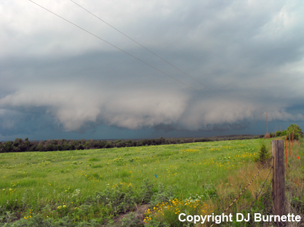
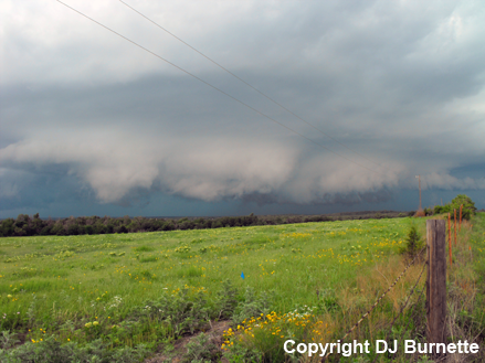
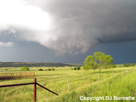
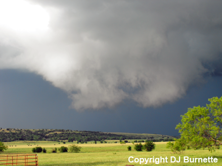
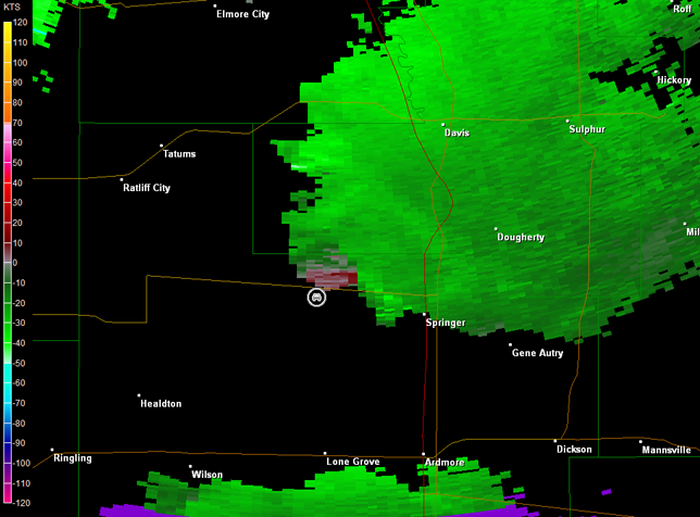
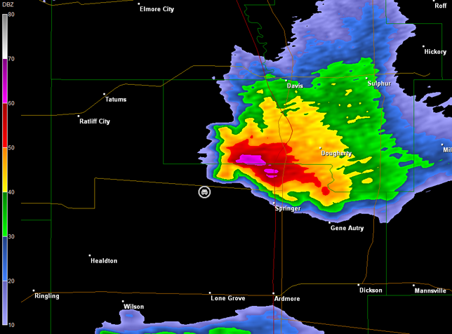
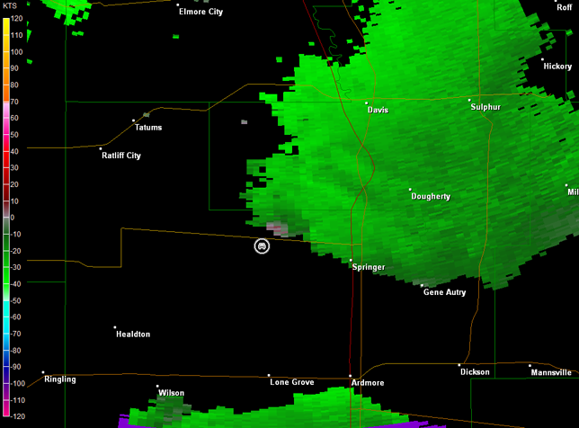
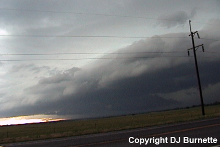
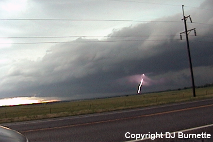
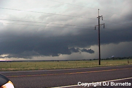
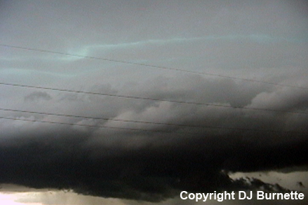
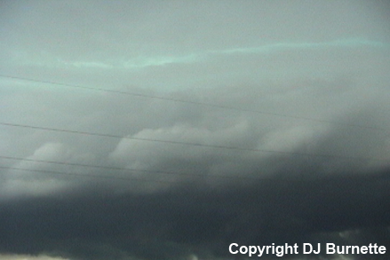
The circulation was getting away from me, so I moved back to the north to OK-33 and then followed the storm east into Cushing, OK. Meanwhile, other storms were interacting with this cell (see 2023Z radar data above). I moved south on OK-99 into Chandler, OK to reassess the situation given this trend and the fact that the storms were moving toward a metro area and poorer chase country. Storms to the south and southwest were impressive and in better area for chasing. Thus, I decided to move south on OK-99 through Seminole, OK and intercept the cell moving out of the southeastern sections of the Oklahoma City metro area. If this cell were to dissipate, then another storm southwest of Pauls Valley, OK could be intercepted. This was indeed the case, the first storm dissipated as I arrived, and so I continued southwest toward the storm southwest of Pauls Valley. I had to take the long way around the storm by moving south out of Davis, OK to OK-53, and then west on OK-53. By this time, a decaying wall cloud had made itself visible from my location. This feature dissipated, but rotation was still evident, and shortly after I stopped on OK-33, another wall cloud developed to my east (images below; view is west of Springer, OK looking east). Rotation was still evident on radar too (images below; car symbol denotes my location).
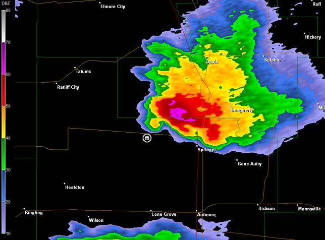
Norman, OK Storm Relative Velocity 2359Z
Norman, OK Base Reflectivity 0003Z
Norman, OK Storm Relative Velocity 0003Z
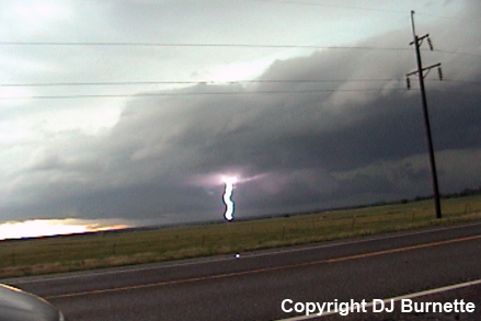
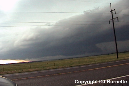
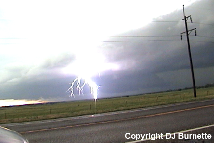
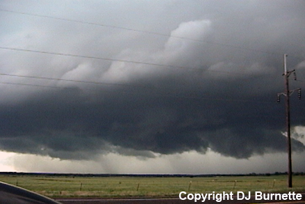
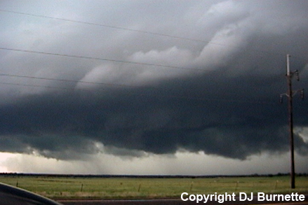
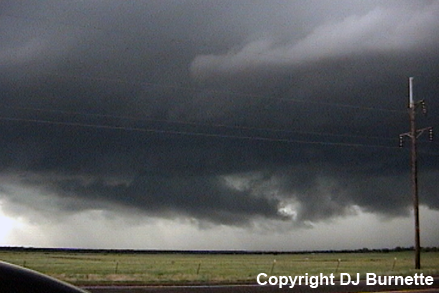
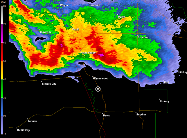
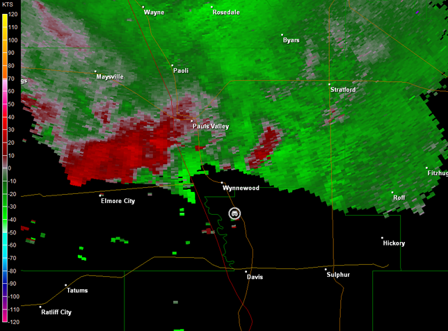
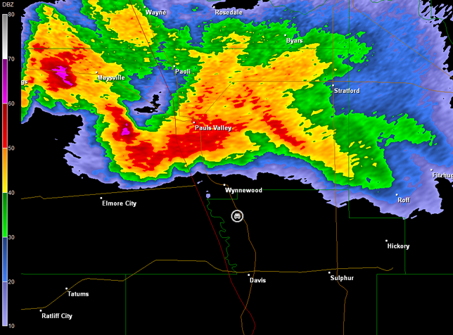
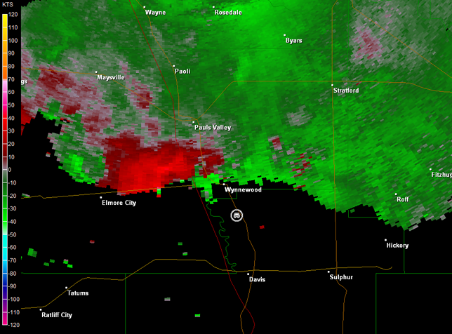
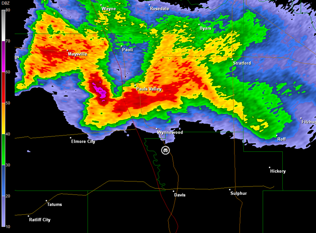
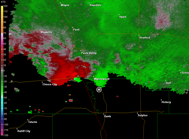
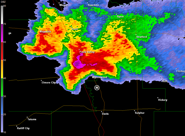
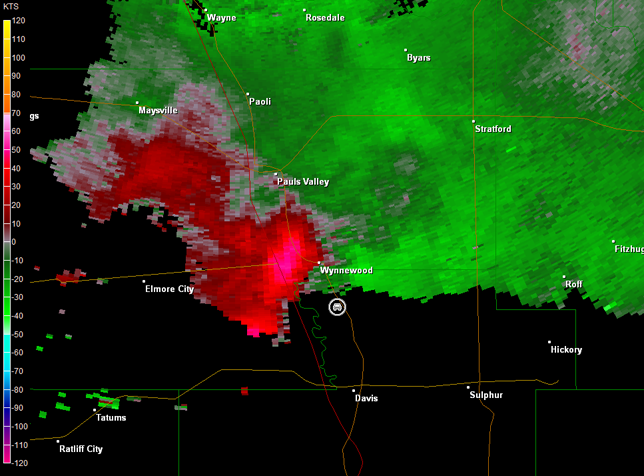
I continued to follow the storm east, but this was its last gasp before it dissipated. Meanwhile, other storms had developed farther north and were heading toward Pauls Valley. Thus, I moved back to the north through Davis and toward Wynnewood, OK. A tornado warning was issued on the storm as I was en route. I stopped on U.S. 77 south of Wynnewood and monitored the storm, which produced a couple of wall clouds and plenty of cloud-to-ground lightning (images below; view is south of Wynnewood, looking northwest). The most consistent trend I observed was upflow scud would develop into a wall cloud followed by an outflow dominant look to the whole area. Radar imagery showed broad circulation that tightened up (images below; car symbol denotes my location). The storm gained an appendage on radar just before I moved back to the south. However, while I did observe some rotation in the bottom center images below, this region looked less healthy with time (last image below). No tornado was ever observed.
Norman, OK Storm Relative Velocity 0103Z
Norman, OK Base Reflectivity 0112Z
Norman, OK Storm Relative Velocity 0112Z
Norman, OK Base Reflectivity 0117Z
Norman, OK Storm Relative Velocity 0117Z
Norman, OK Base Reflectivity 0126Z
Norman, OK Storm Relative Velocity 0126Z
The storm was closing in on my location, so I moved back to the south on U.S. 77. Gusty outflow winds hit me, as I retreated back toward Davis. I eventually ended up south of Sulphur, OK on U.S. 177. It was getting dark though, so I did not linger long before I retreated south into Ardmore, OK to stay the night and prepare for the next day's storm chase. Thanks to Jeff House for nowcasting assistance.