Storm Chase Log 18 May 2013
Chasers: Dorian J. Burnette, Jeff House, Casey Osburn, and Megan Piquiet
Preliminary Destination: Dodge City, KS...later revised to Greensburg, KS
Note: Images have been decreased in size. Click on an image to view a larger version.
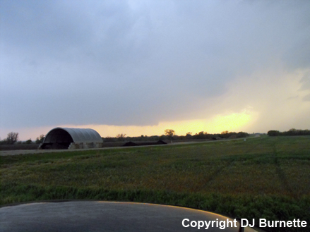
This was Day 1 of a three-day storm chase in KS and OK. We started this day heading west toward Dodge City, KS on U.S. 400, but stopped in Greensburg, KS instead to be out ahead of storm initiation. Towering cumulus were observed to our west shortly after 2 p.m. CDT, and storms developed off to our northwest shortly after 3 p.m. CDT. However, we decided to hang back at a Gazebo in Greensburg and wait for additional development. During this time, Jim Bishop joined us to wait on new development followed by Simon Brewer and Juston Drake from The Weather Channel's Storm Riders series.
Toward 6 p.m. CDT, we observed a well-developed, though highly elevated, thunderstorm to our west. This storm didn't look like much on the radar, but the mid-level structure was quite impressive. All that was needed was time for the lower portions of the storm to develop as the low-level jet intensified. Thus, all of us immediately took off to intercept this cell. Jim Bishop, Simon Brewer and Juston Drake went in their separate directions, and we moved out of Greensburg and north on U.S. 183 toward Kinsley, KS. On the way, we noted the base was lowering.
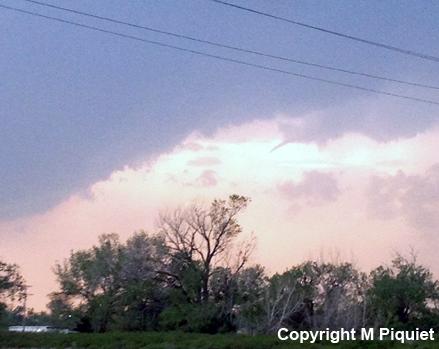
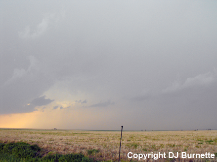
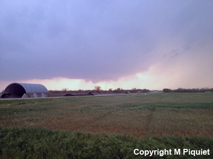
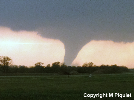
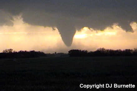
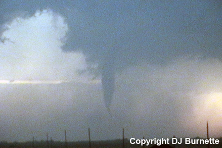
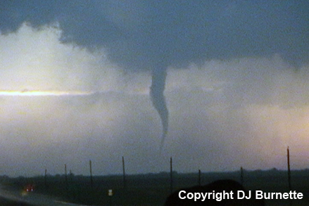
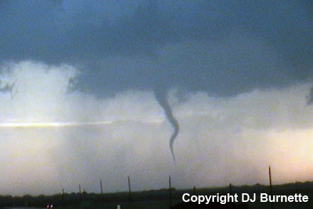
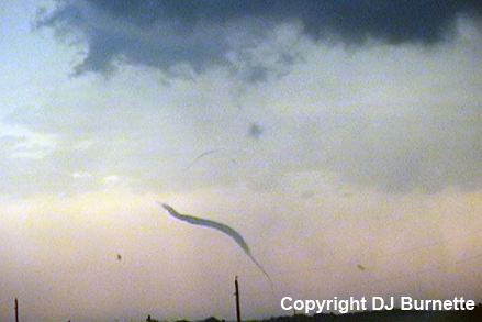
As we moved northeastward on U.S. 56/183 out of Kinsley, a couple of needle funnels were observed protruding from the main storm tower (image below; view is northeast of Kinsley, looking northwest). These funnels were clearly still too high off the ground, but a sign that something bigger might be on the horizon.
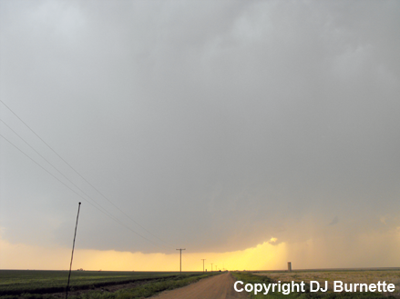
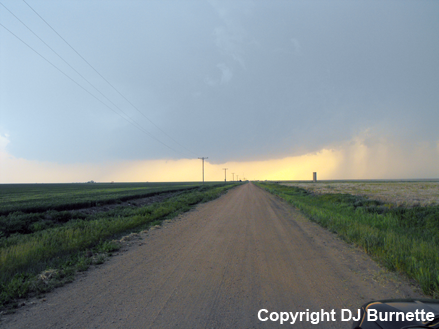
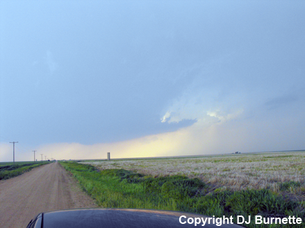
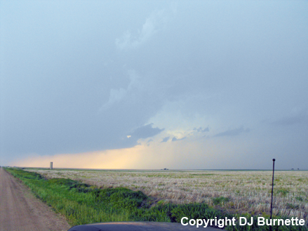
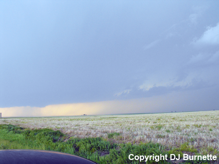
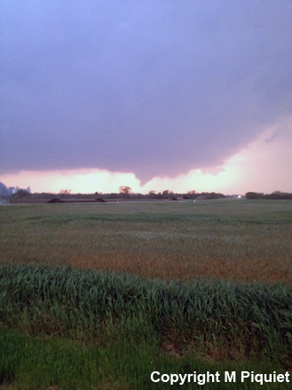
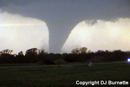
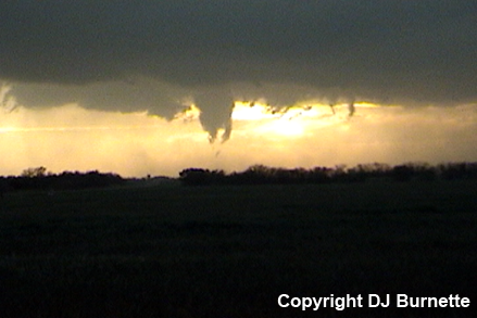
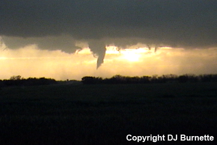
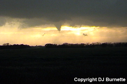
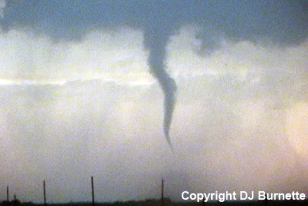
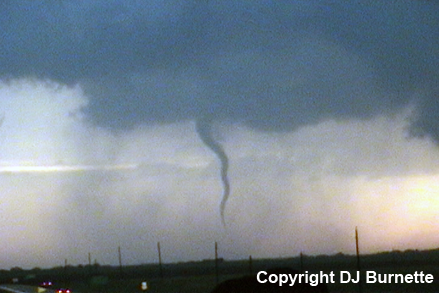
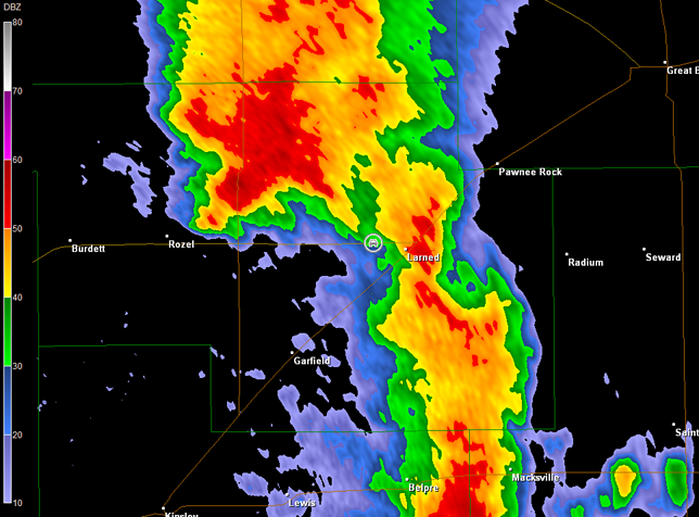
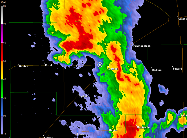
We stopped on U.S. 183 northeast of Kinsley and south of Sanford, KS to monitor the storm (images below; view is south of Sanford looking west and northwest). Radar showed two distinct cells, but the southern cell was beginning to collide with the northern cell (imagery below; car symbol denotes our location). As the collision took place, rotation became more disorganized, but started to tighten once again in the last image. The cloud pattern toward the north also began to resemble the development of a Beaver Tail toward 7 p.m. CDT (second set of images below).

Dodge City, KS Storm Relative Velocity 2336Z
Dodge City, KS Base Reflectivity 2341Z
Dodge City, KS Storm Relative Velocity 2341Z
Dodge City, KS Base Reflectivity 2346Z
Dodge City, KS Storm Relative Velocity 2346Z
Dodge City, KS Base Reflectivity 2350Z
Dodge City, KS Storm Relative Velocity 2350Z
Dodge City, KS Base Reflectivity 2355Z
Dodge City, KS Storm Relative Velocity 2355Z
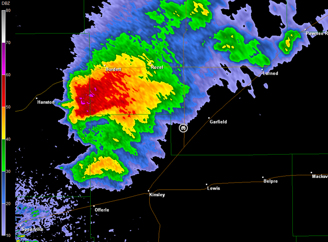
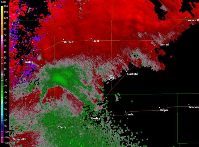
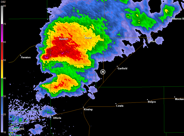
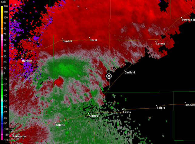
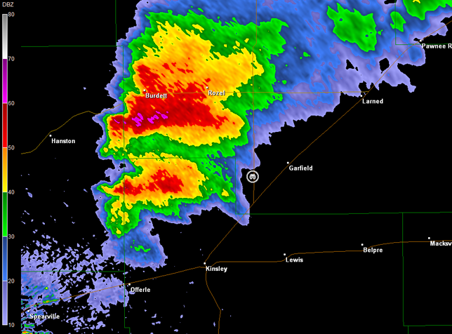
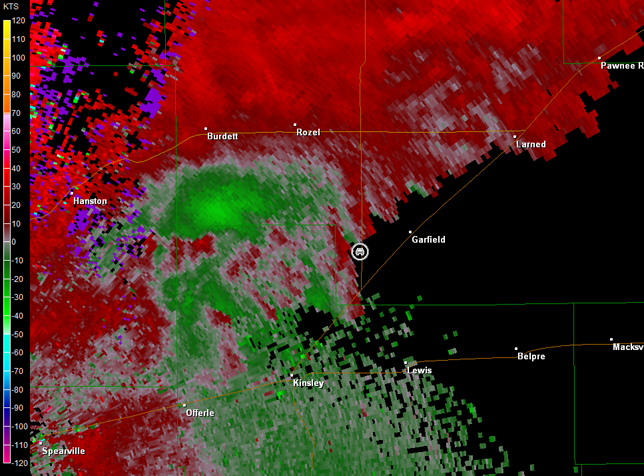
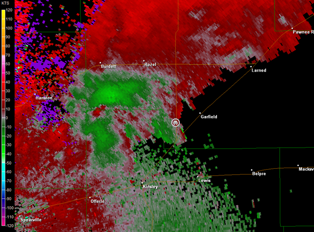
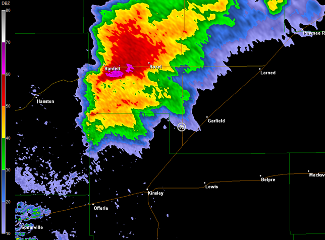
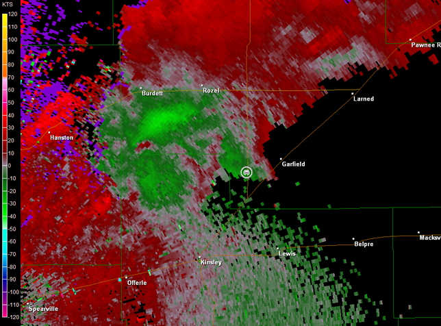
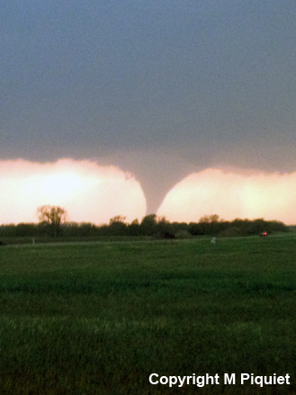
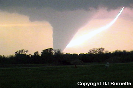
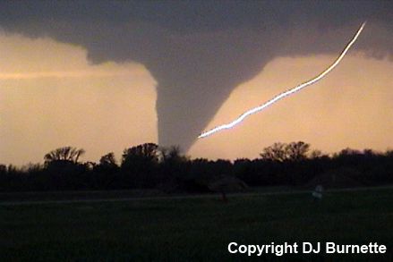
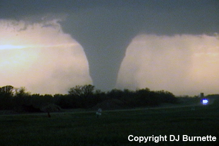
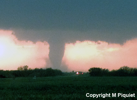
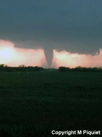
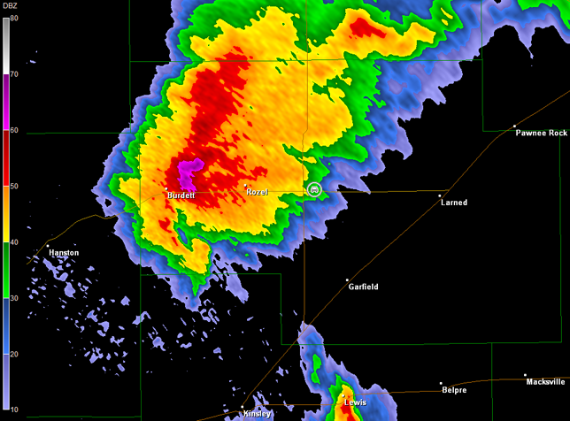
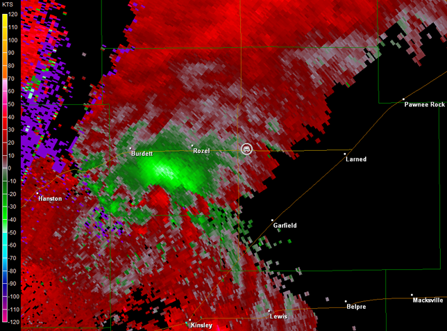
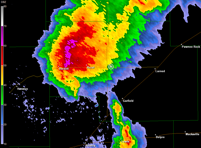
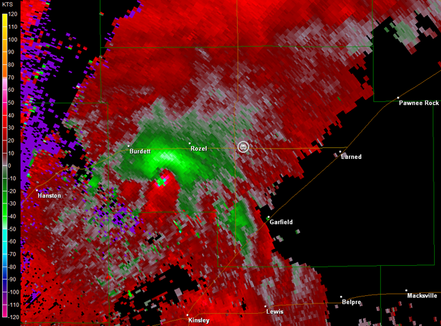
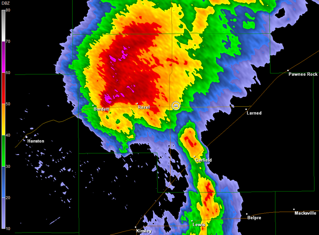
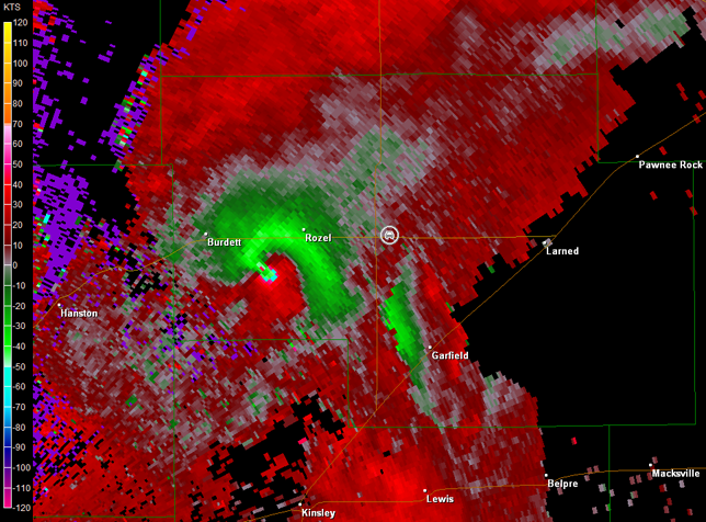
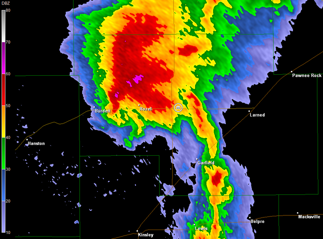
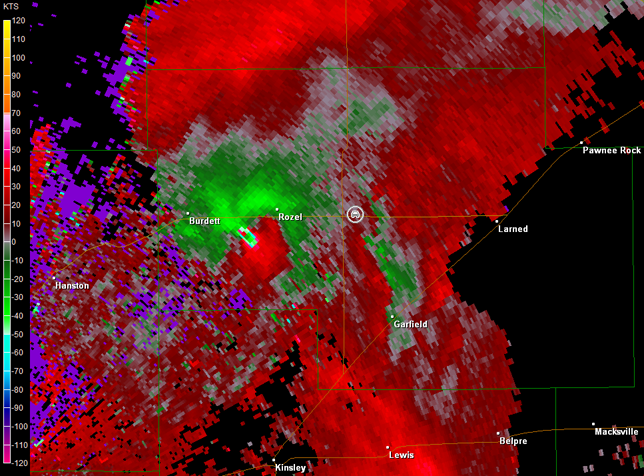
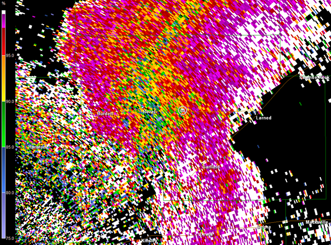
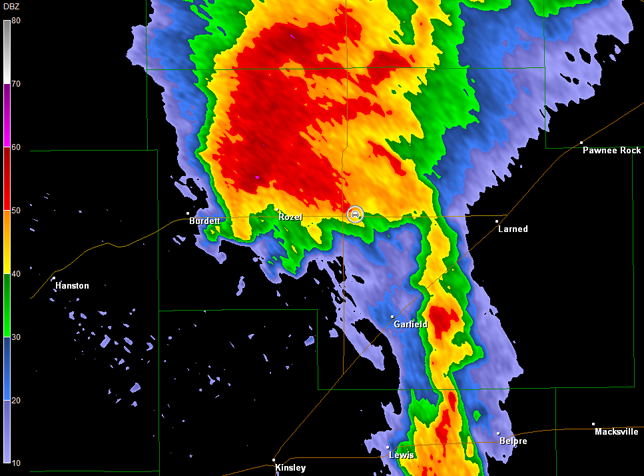
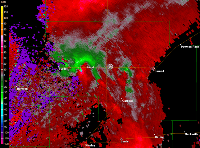
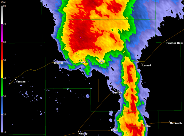
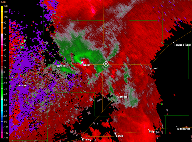
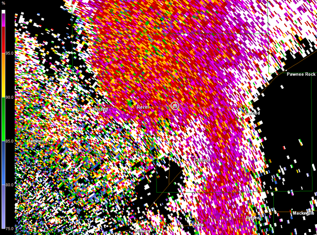
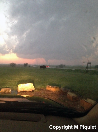
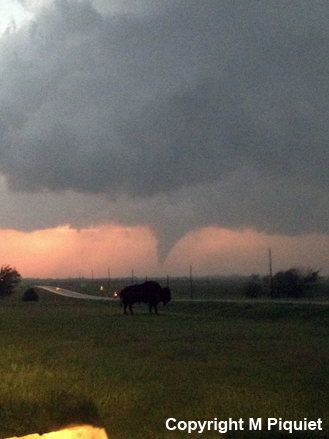
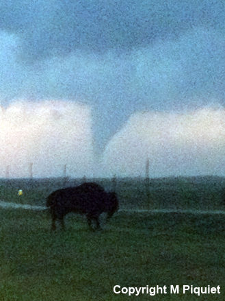
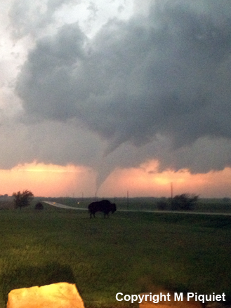
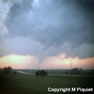
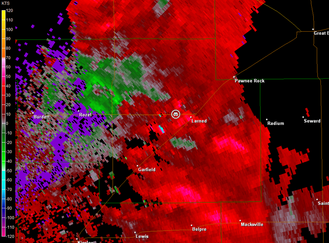
We moved farther to the north through Sanford, and then sat northeast of Sanford just off K-156 highway to watch the wall cloud continue to organize. Rotation dramatically increased on radar and the storm showed a classic hook echo (imagery below; car symbol denotes our location). A large tornado then developed about five miles to our southwest. It moved north-northeast and crossed K-156 just west of Rozel, KS (images below; view is northeast of Sanford, looking southwest). Unfortunately, this tornado did do damage to five farms and one farm house. Debris can be observed in the images below as well as in the video. Radar data also include the new dual-polarization correlation coefficient product. Note the lower correlations denoted by the bluer colors southwest of Rozel and near Rozel in the first and second correlation coefficient images below, respectively. These lower correlations were in the same place as the circulation on storm relative velocity data suggesting a tornado is on the ground and debris is being lofted (debris is of varying size, so correlation values decline).
Dodge City, KS Storm Relative Velocity 0014Z
Dodge City, KS Base Reflectivity 0018Z
Dodge City, KS Storm Relative Velocity 0018Z
Dodge City, KS Base Reflectivity 0023Z
Dodge City, KS Storm Relative Velocity 0023Z
Dodge City, KS Base Reflectivity 0028Z
Dodge City, KS Storm Relative Velocity 0028Z
Dodge City, KS Correlation Coefficient 0028Z
Dodge City, KS Base Reflectivity 0032Z
Dodge City, KS Storm Relative Velocity 0032Z
Dodge City, KS Base Reflectivity 0037Z
Dodge City, KS Storm Relative Velocity 0037Z
Dodge City, KS Correlation Coefficient 0037Z
A video time-lapse of the large tornado is below (approximately 16 minutes of time edited and compressed into a little more than one minute; view is northeast of Sanford, looking southwest and then west). The tornado was already on the ground at the start of the video according to the damage survey conducted by the Dodge City National Weather Service despite the fact that the visible condensation cloud had not reached the ground yet. This tornado was officially rated EF4 based on measured winds of 165-185 mph by the Doppler On Wheels. It was on the ground for 7 miles and was 0.6 miles wide. Thanks to Casey Osburn for holding the camera steady on the tripod, while I phoned in a report to Dodge City.
Video of Large Tornado Near Rozel, KS (1 min 19 sec)
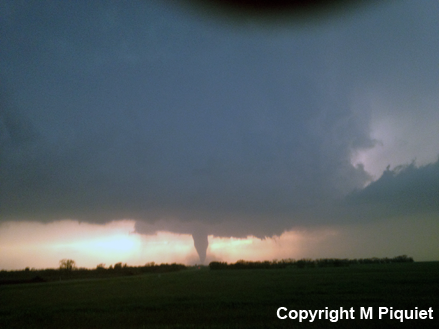
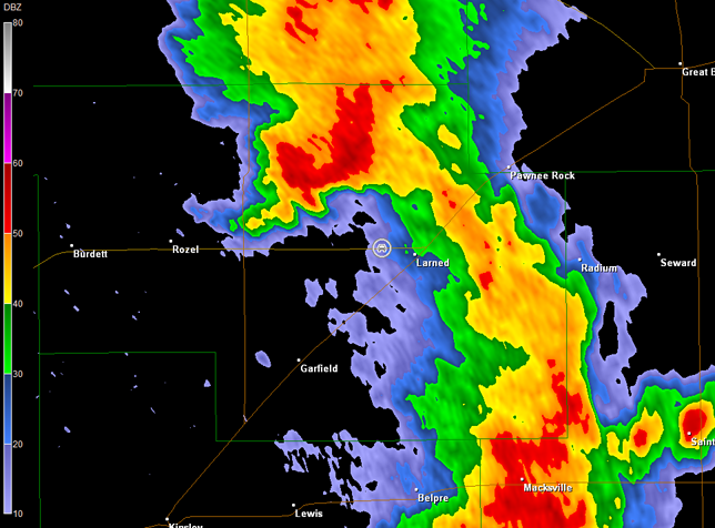
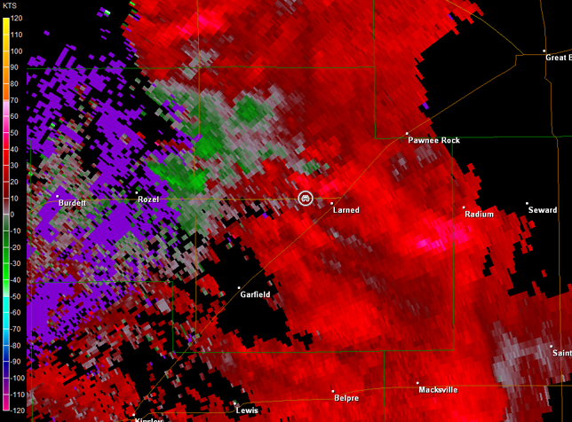
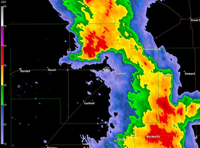
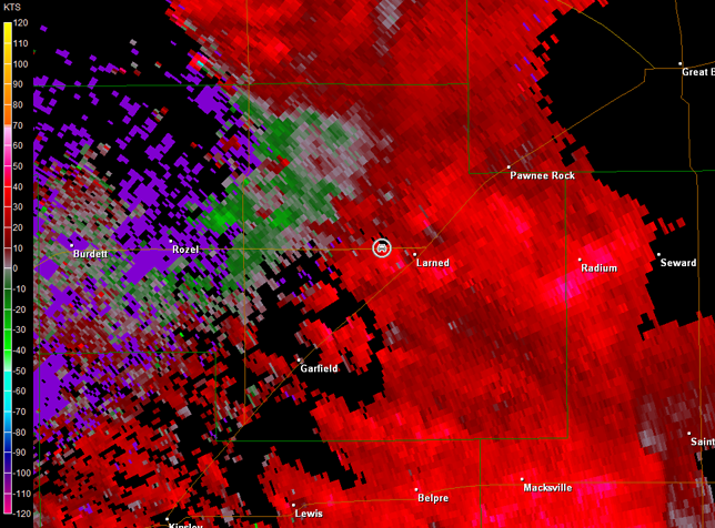
Note also on the radar base reflectivity data above, a line of thunderstorms approaching the tornadic supercell from the south. We did note rain and very isolated small hail at our location late in the tornado's life cycle. As time goes on, this line would eventually merge more with the supercell, but not before it produced two more tornadoes. We had moved east to just west of Larned, KS by this time and watched the renewed organization. A second tornado developed from the storm and lasted about 15 minutes (images below; view is west of Larned, looking west). While this tornado was on the ground, another tornado developed in front of it (upper-right and middle-left images below). From our location, we could not determine whether this funnel was on the ground, but later conversations with other chasers confirmed it was on the ground--tornado number 3. This third tornado only lasted a couple of minutes before dissipating. Radar data continued to show this supercell merging with a line of thunderstorms (images below; car symbol denotes our location).

Dodge City, KS Storm Relative Velocity 0056Z
Dodge City, KS Base Reflectivity 0100Z
Dodge City, KS Storm Relative Velocity 0100Z
Dodge City, KS Base Reflectivity 0105Z
Dodge City, KS Storm Relative Velocity 0105Z
Dodge City, KS Base Reflectivity 0110Z
Dodge City, KS Storm Relative Velocity 0110Z
The line of storms continued to east, and with darkness approaching, we stopped at Applebee's in Great Bend for dinner with a variety of storm chasers. After dinner, we traveled back to Wichita, KS for the night and to prepare for the next day's storm chase.