Storm Chase Log 14 April 2012
Chasers: Dorian J. Burnette, Steve Boss, Erika Kohler, and Jo Ann Kvamme
Preliminary Destination: Harper, KS
Note: Images have been decreased in size. Click on an image to view a larger version.
This was a very nasty day with many tornadoes, and it started early with PDS (particularly dangerous situation) tornado watch number 165 issued at 10:45 a.m. CDT. This watch was in response to increasing severe thunderstorms over southwestern KS. We had departed Fayetteville, AR, at 10 a.m. CDT, so we were obviously still en route. We closely monitored the trends over southwestern KS and northwestern OK, and the overall environment was becoming increasingly explosive for long-lived tornadic supercells.
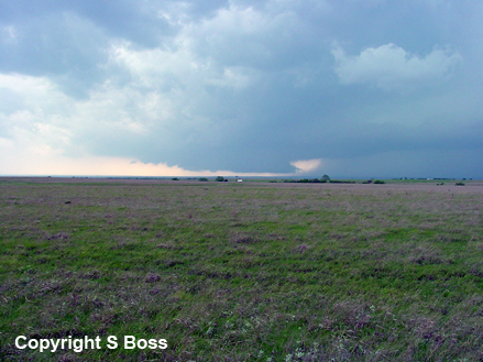
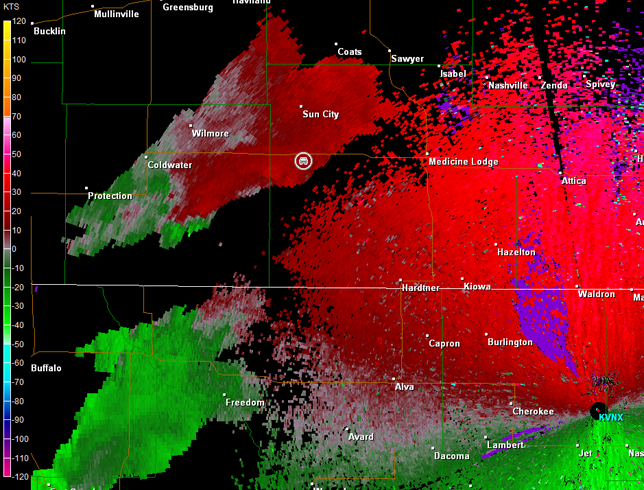
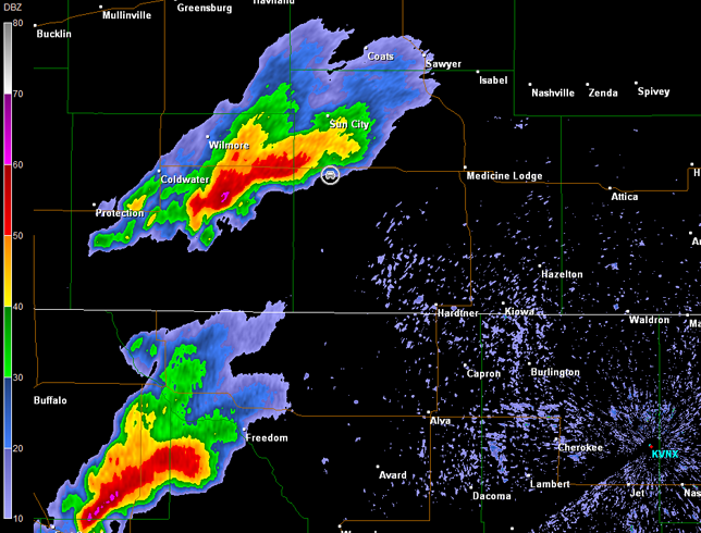
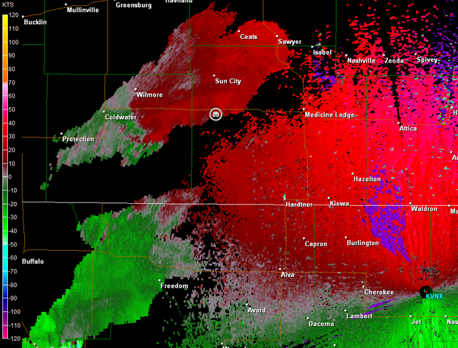
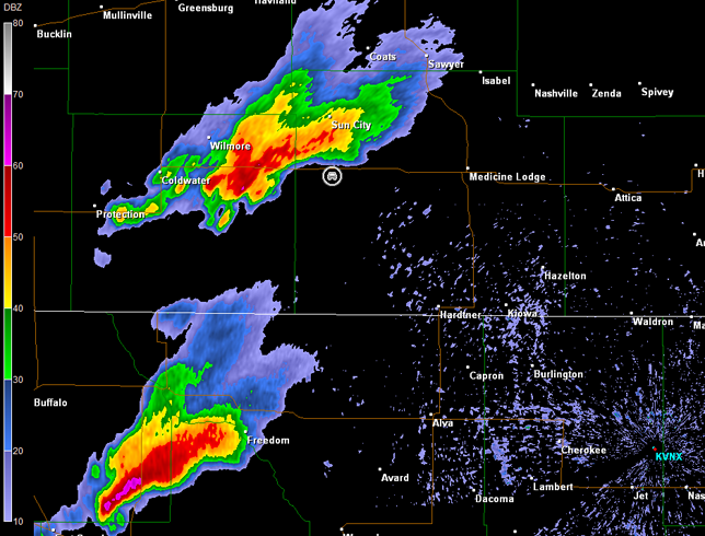
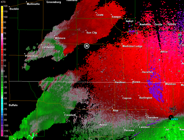
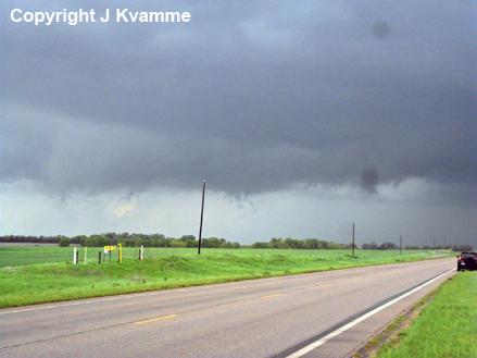
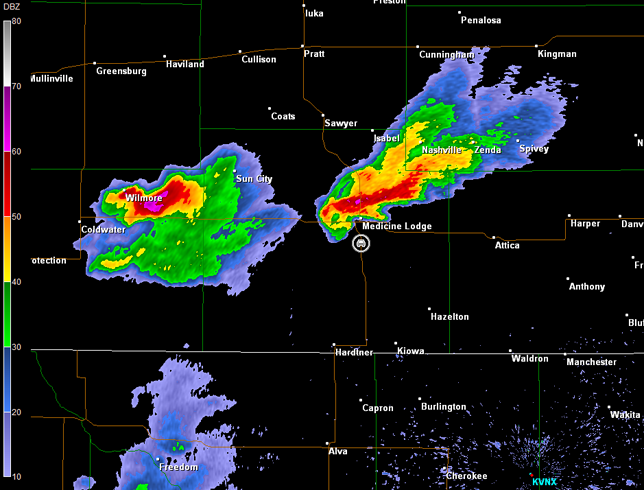
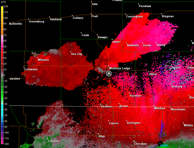
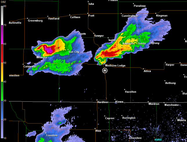
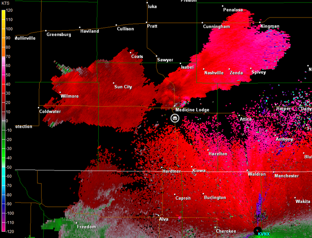
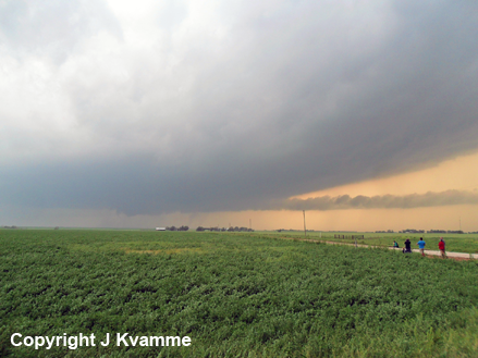
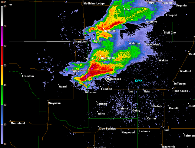
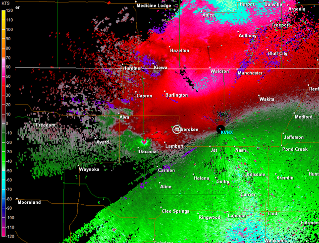
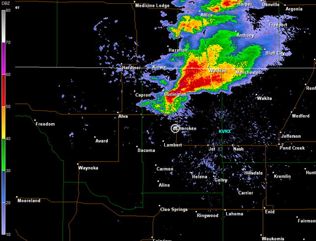
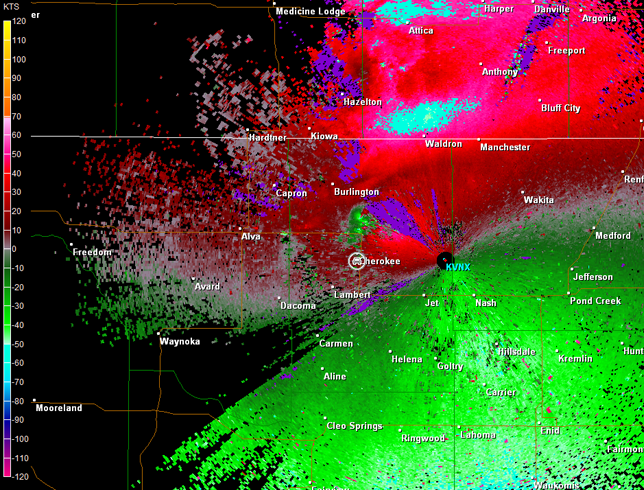
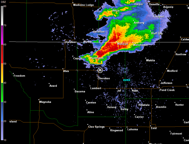
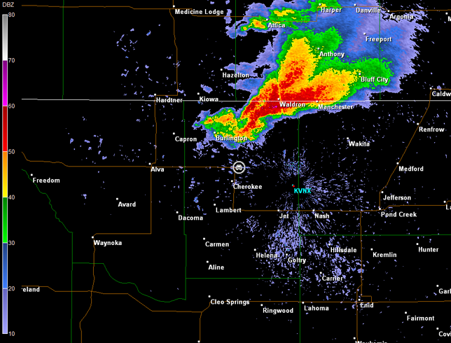
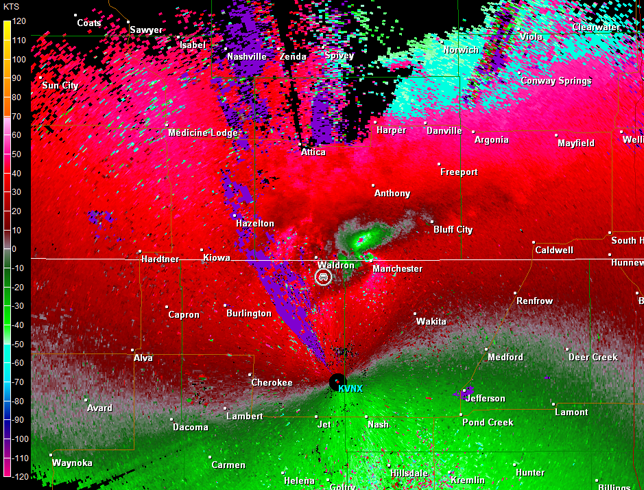
We arrived in the Harper area around 3 p.m. CDT, and immediately continued to the west to intercept a supercell moving northeast out of OK and into Comanche and Barber Counties in KS. As we moved into rural western Barber County west of Medicine Lodge, KS, a large wall cloud could be seen to our southwest. We pulled over on a dirt road south of U.S. 160 to monitor the wall cloud (images below; view is west of Medicine Lodge, looking west). A good radar appearance was observed too (images below; car symbol denotes our location), and a tornado warning was in effect. This wall cloud dissipated and a new wall cloud formed as rotation intensified (see 2059Z through 2108Z radar data). No tornado was observed from either wall cloud while we were watching.
Vance Air Force Base, OK Storm Relative Velocity 2049Z
Vance Air Force Base, OK Base Reflectivity 2054Z
Vance Air Force Base, OK Storm Relative Velocity 2054Z
Vance Air Force Base, OK Base Reflectivity 2059Z
Vance Air Force Base, OK Storm Relative Velocity 2059Z
Vance Air Force Base, OK Base Reflectivity 2103Z
Vance Air Force Base, OK Storm Relative Velocity 2103Z
Vance Air Force Base, OK Base Reflectivity 2108Z
Vance Air Force Base, OK Storm Relative Velocity 2108Z
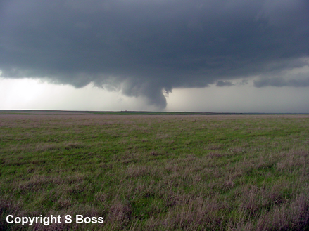
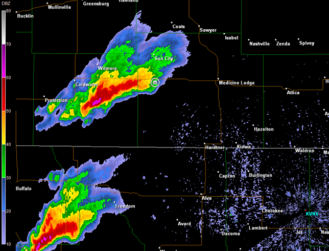
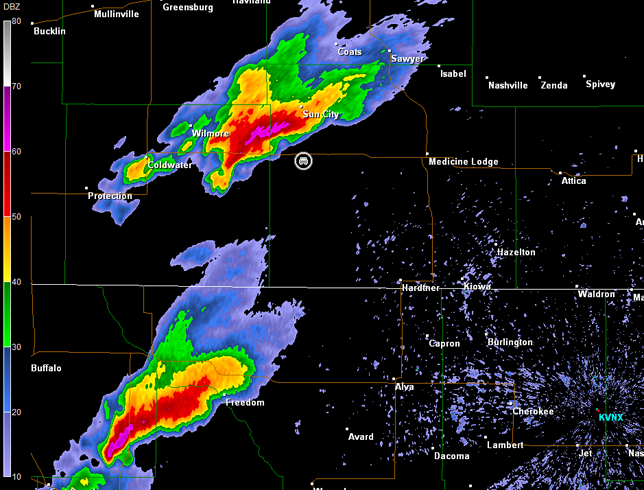
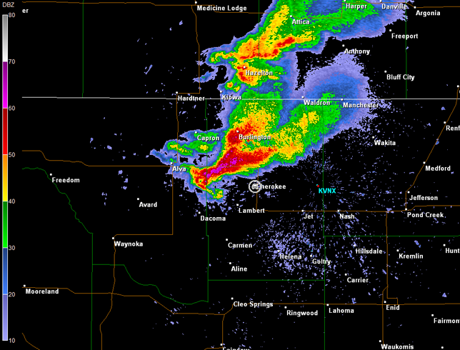
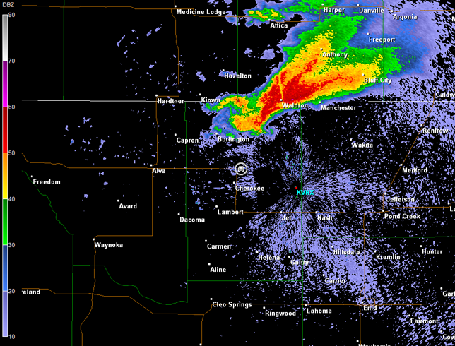
The storm was moving at a good pace toward the northeast. We followed it toward Lake City, KS, and then east and north on country roads to U.S. 281 south of Sawyer, KS. By this time, the storm's appearance on radar was not as impressive. It also had enlarged its distance from us, and another storm coming out of northwest OK and into Barber County was looking very healthy. Thus, we moved back to the south on U.S. 281 and intercepted the next storm south of Medicine Lodge. While there was circulation on radar with this storm (imagery below; car symbol denotes our location), we only observed minimal organization at best. Mostly it was just a classic rain-free base (image below; view is south of Medicine Lodge, looking north).
Vance Air Force Base, OK Storm Relative Velocity 2242Z
Vance Air Force Base, OK Base Reflectivity 2247Z
Vance Air Force Base, OK Storm Relative Velocity 2247Z
We continued to follow the storm into Harper, KS, but it was getting away from us quickly. Meanwhile, other supercells in northwestern OK were looking interesting, and this combined with a prime overall environment was enough to lure us toward that region by going west and southwest on K-14 toward Hazelton, KS. There were two supercells on the radar, and by the time we arrived in Hazelton, we could go no farther southwest without core-punching the first supercell. Therefore, we moved south out of Hazelton on various country roads to go around the leading edge of the first supercell. We crossed the KS/OK line and finally got out of the rain to see the towers of the first supercell off to our west. While this storm did show modest signs of organization according to the radar, the second supercell approaching Cherokee, OK, looked more promising. Thus, we continued south toward Cherokee.
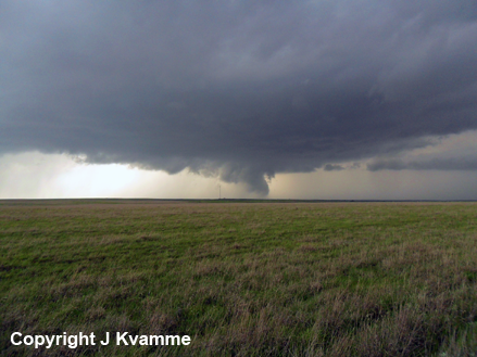
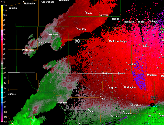
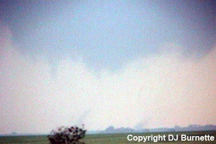
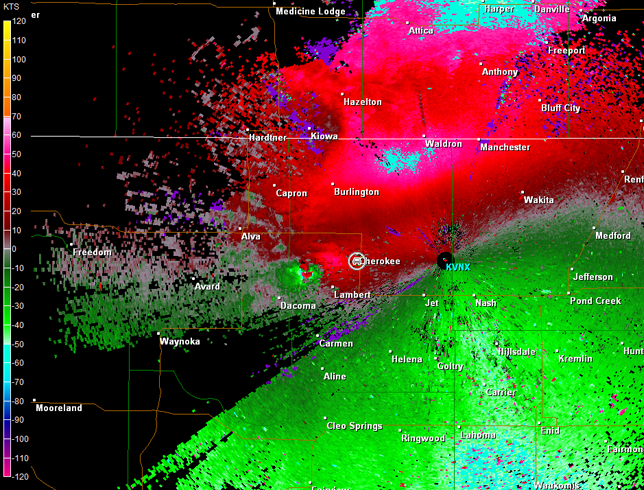
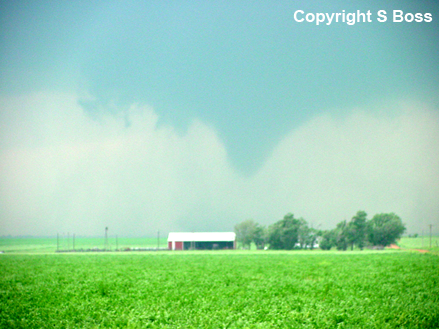
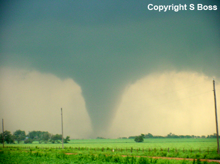
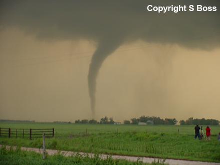
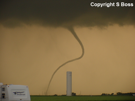
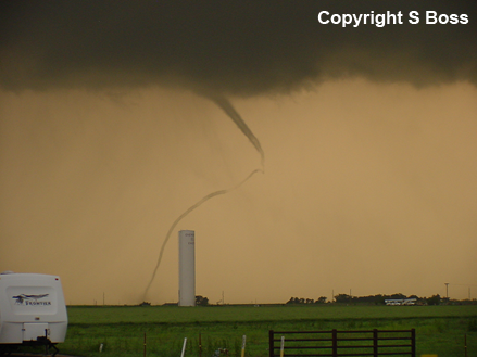
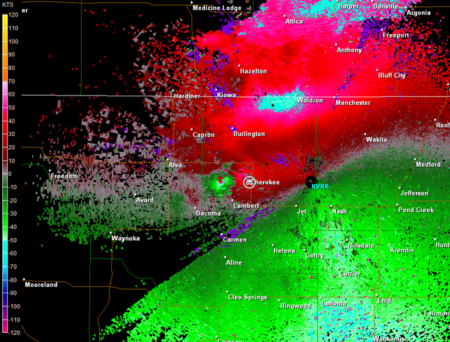
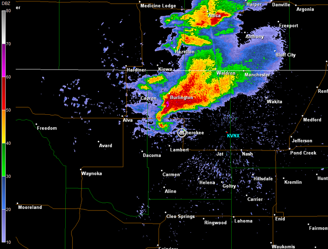
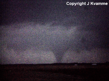
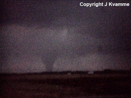
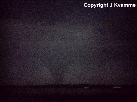
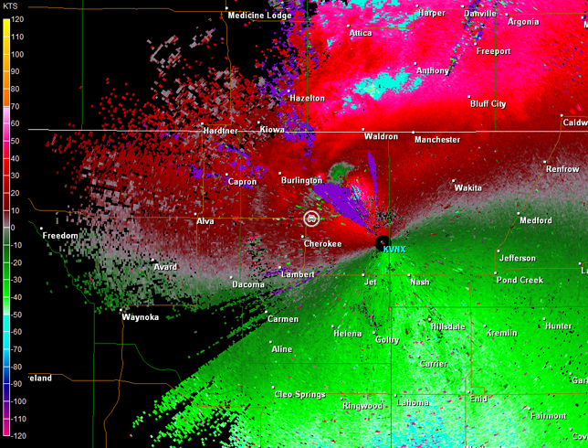
We set up shop on the south side of Cherokee, and things got interesting quick. A wall cloud was observed to our west-southwest and a multi-vortex tornado developed just as I started recording video (images below, view is south of Cherokee, looking west-southwest). Unfortunately, haze and rain led to contrast issues from our location. Radar data showed a classic signature to our west-southwest (imagery below; car symbol denotes our location). This tornado lasted about 4 minutes and then dissipated. The wall cloud continued to exhibit very strong rotation, and a very nice tail could be observed (far right image below, view is south of Cherokee, looking west).
Vance Air Force Base, OK Storm Relative Velocity 0046Z
Vance Air Force Base, OK Base Reflectivity 0051Z
Vance Air Force Base, OK Storm Relative Velocity 0051Z
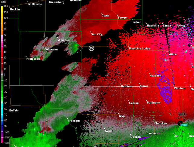
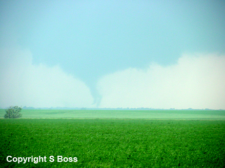
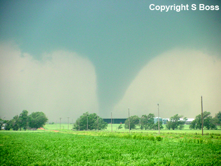
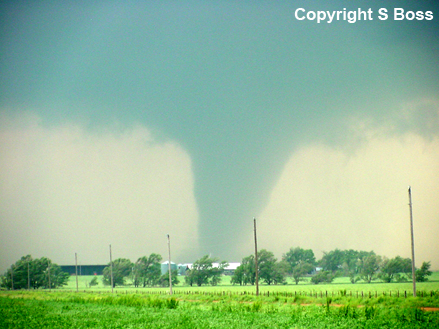
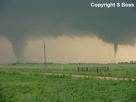
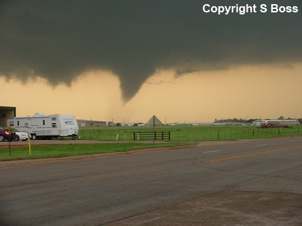
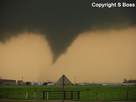
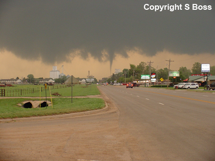
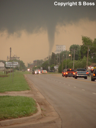
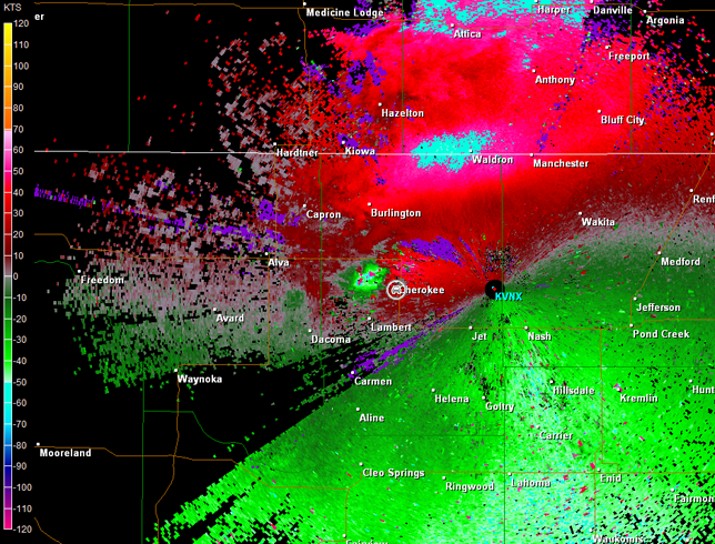
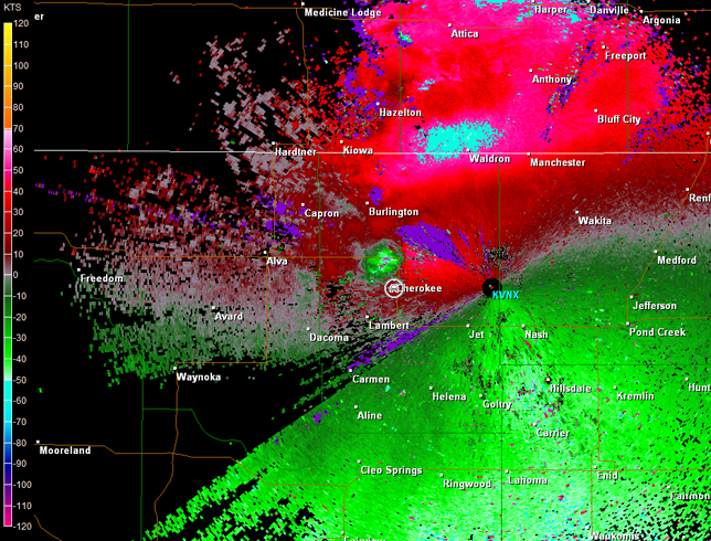
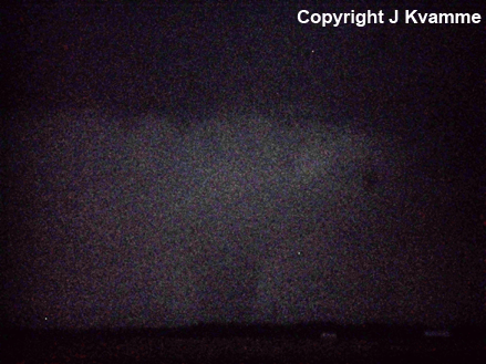
The wall cloud continued to exhibit very strong rotation, and a second tornado developed within a couple of minutes (hereafter referred to as "tornado 2"). We were approximately 4 miles from this tornado, and haze and rain were impacting the contrast of the tornado at first. It eventually became a large tornado. Tornado 2 was on the ground for approximately 11 minutes depending on when contact with the ground became continuous. A new wall cloud had developed about 2 miles closer to us, and as tornado 2 peaked in size, a third tornado developed about 2 miles to our northwest (hereafter referred to as "tornado 3"). This tornado was on the ground for approximately 10 minutes, and thankfully moved north of the city of Cherokee. Images of tornado 2 and tornado 3 are below (view is south of Cherokee, looking west, northwest, and eventually north). Radar data continued to show a classic signature (imagery below; car symbol denotes our location).

Vance Air Force Base, OK Storm Relative Velocity 0055Z
Vance Air Force Base, OK Base Reflectivity 0100Z
Vance Air Force Base, OK Storm Relative Velocity 0100Z
Vance Air Force Base, OK Base Reflectivity 0105Z
Vance Air Force Base, OK Storm Relative Velocity 0105Z
Vance Air Force Base, OK Base Reflectivity 0109Z
Vance Air Force Base, OK Storm Relative Velocity 0109Z
A video time-lapse depicting tornado 2 and 3 is also below (approximately 13 minutes of time edited and compressed into one minute; view is south of Cherokee, looking west, northwest, and eventually north). Strong inflow winds at our location made it difficult to keep the tripod standing at times. Therefore, the video is occasionally shaky.
Video of Tornadoes 2 and 3 (1 min 2 sec)
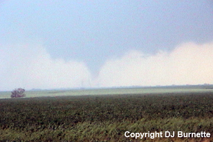
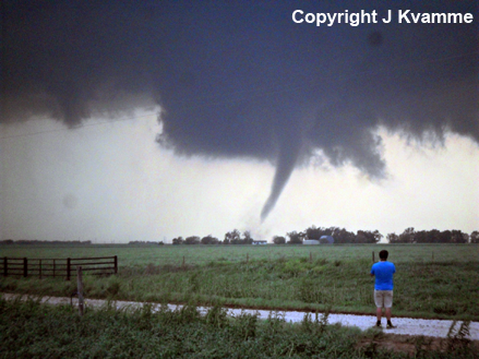
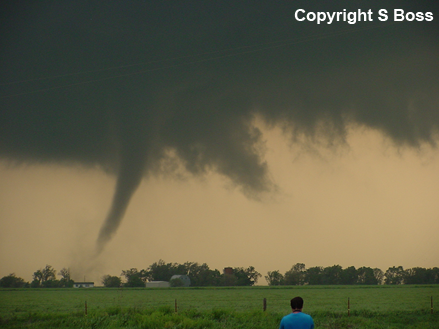
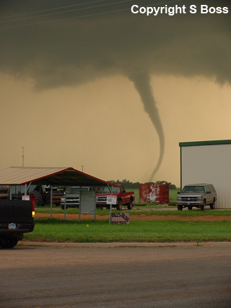
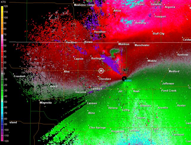
All tornado activity from this storm had briefly stopped, so we moved back through Cherokee to continue following the storm. Unfortunately, darkness was quickly becoming an issue, but not before another large tornado developed to our north. We stopped on OK-11 to view our fourth tornado of the night from this single supercell thunderstorm (images below; view is north-northeast of Cherokee, looking north). Radar imagery depicted the storm crossing the border into KS (images below; car symbol denotes our location). Unfortunately, the radar imagery has range-folding issues in a key location.
Vance Air Force Base, OK Storm Relative Velocity 0114Z
Vance Air Force Base, OK Base Reflectivity 0119Z
Vance Air Force Base, OK Storm Relative Velocity 0119Z
Vance Air Force Base, OK Base Reflectivity 0123Z
Vance Air Force Base, OK Storm Relative Velocity 0123Z
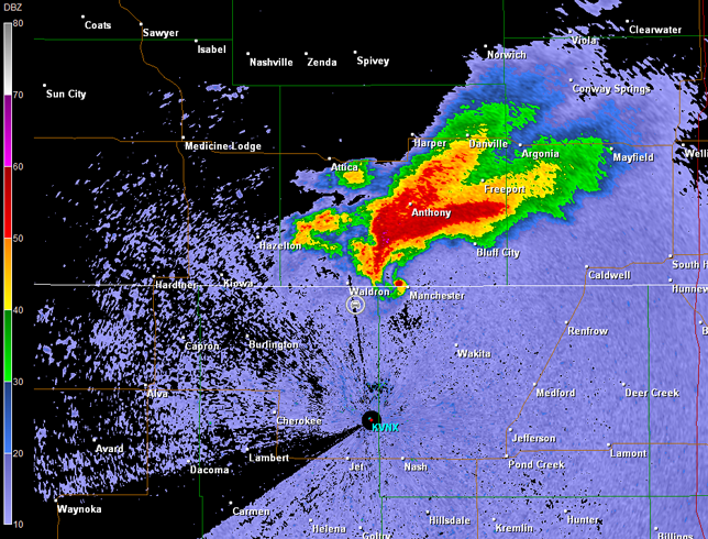
We continued east and then moved north on the next good country road that was available. It was very dark now, but the large tornado was illuminated off and on by lightning. We were closing in on the KS/OK border when we ran into the damage path, and could go no farther. Radar data showed an impressive tornadic supercell with its sights unfortunately set on the Wichita, KS, metro area (images below; car symbol denotes our location).
Vance Air Force Base, OK Storm Relative Velocity 0142Z
Since it was completely dark and the storm was clearly running away from us, we ended the storm chase. Nevertheless, we continued to listen to radio stations out of Wichita talking about a large tornado moving toward the city. Thankfully, the storm took a right turn into the southern suburbs of Wichita instead of going through the heart of downtown. While there was plenty of damage, remarkably there were zero fatalities.
No doubt an amazing storm chase. However, it is interesting to note that we intercepted three supercells with signatures that generated tornado warnings. Yet, only one produced tornadoes, and it went nuts. We can detect storms that are capable of producing tornadoes pretty well. Alas, the false alarm rate is too high. Researchers are working on this, but it will take time.