Storm Chase Log 18 March 2012
Chaser: Dorian J. Burnette
Preliminary Destination: Sayre, OK
Note: Images have been decreased in size. Click on an image to view a larger version.
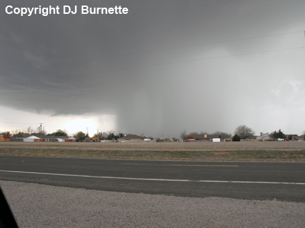
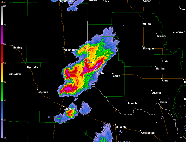
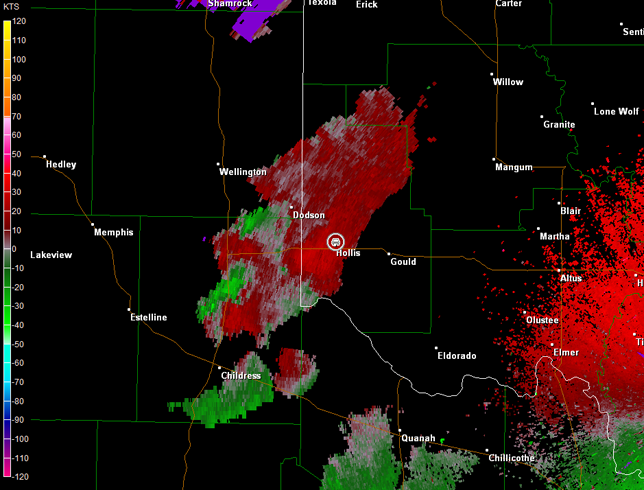
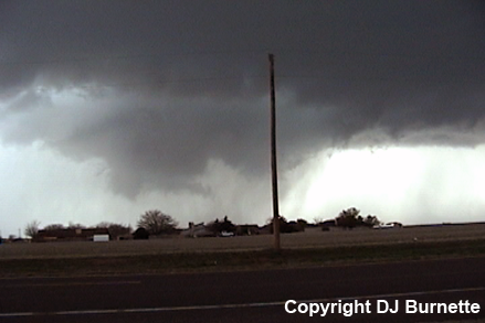
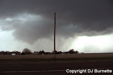
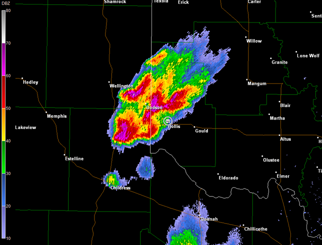
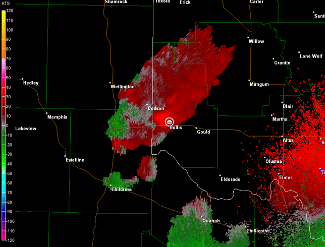
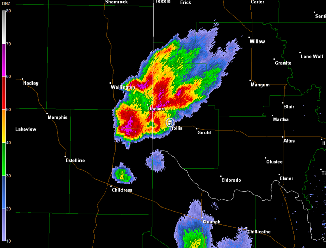
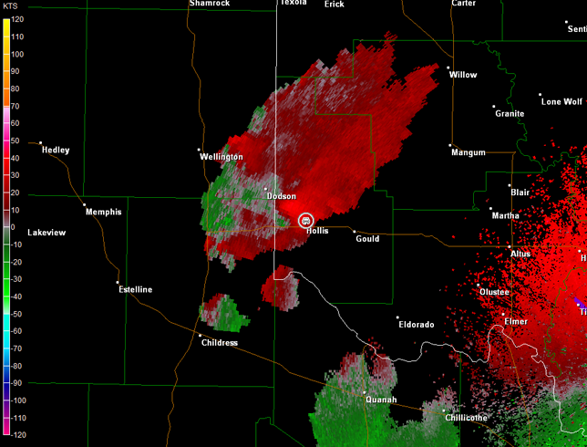
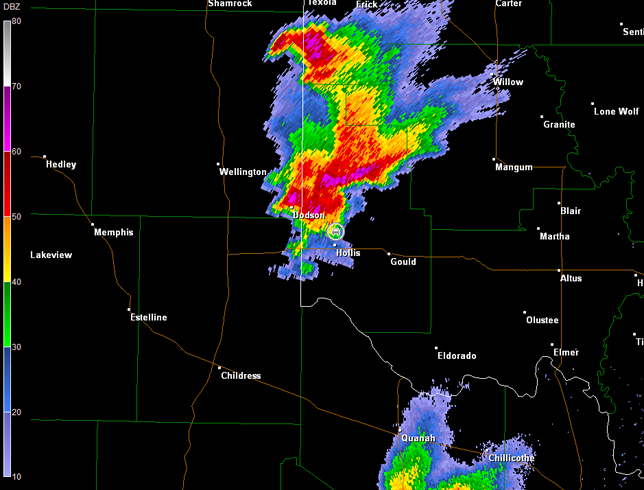
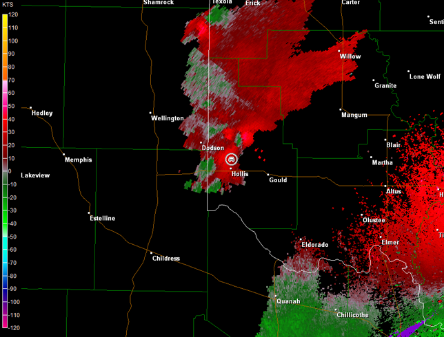
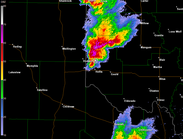
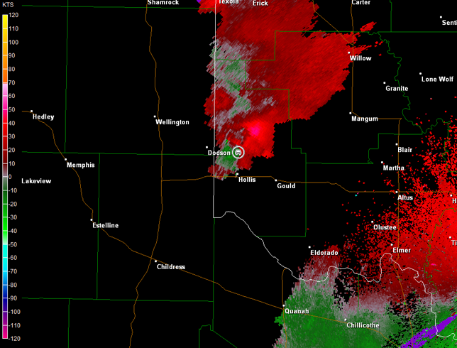
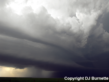
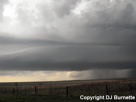
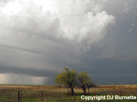
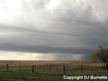
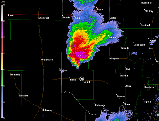
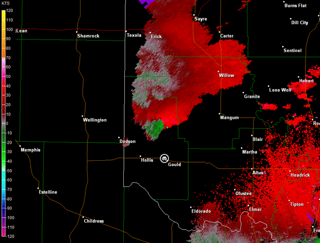
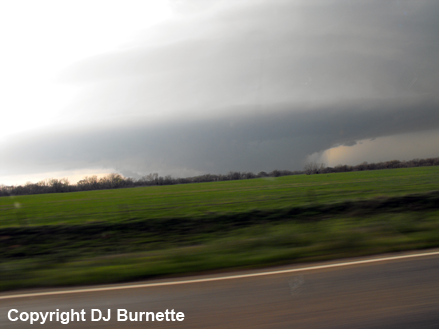
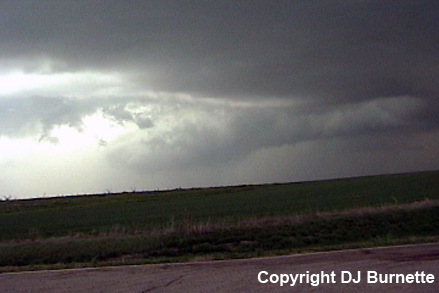
Widespread low clouds were observed during much of the trip into far western OK, but the farther west I got, the more breaks in the clouds were observed. Clouds broke up completely into sunshine as I arrived in Sayre, OK just before 4 p.m. CDT. I stopped to refuel and take a look at ongoing conditions. A tornado watch had already been issued, and thunderstorms had initiated in vicinity of Childress, TX. I moved south on U.S. 283, west on OK-9, and then south on OK-30 to intercept the now severe thunderstorm moving toward Hollis, OK. I went through the leading edge of the storm, but only experienced rain. However, as I arrived on the northern side of Hollis, embedded hail was observed. The hail was no bigger than quarter-sized, but the main hail core was off to my west and northwest. Meanwhile, the backside of the storm began to show interesting signs of organization (images depicting the lowering cloud base are below; view looking west from the north side of Hollis). Radar imagery showed a healthy supercell thunderstorm, but only modest low-level circulation was noted off to the immediate southwest (car symbol denotes my location). Better circulation was observed with another cell farther off to the southwest.
Frederick, OK Storm Relative Velocity 2220Z
Frederick, OK Base Reflectivity 2229Z
Frederick, OK Storm Relative Velocity 2229Z
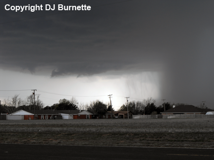
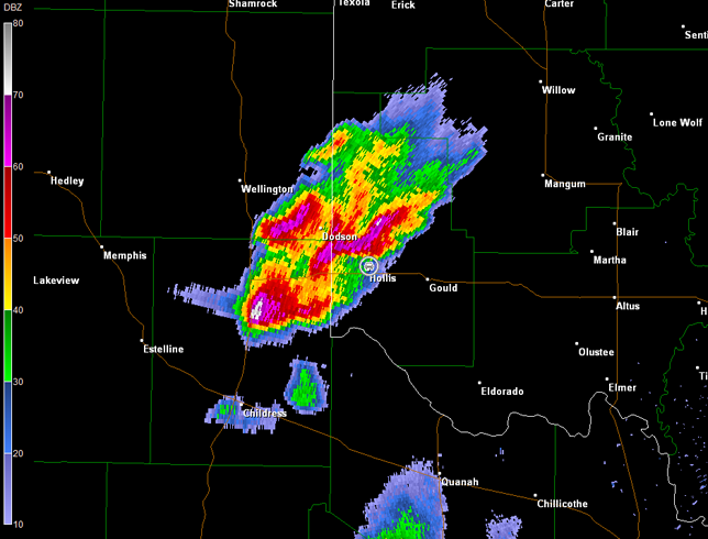
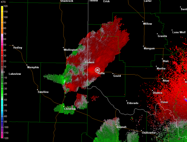
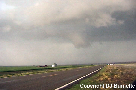
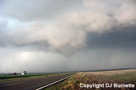
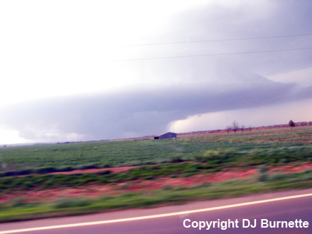
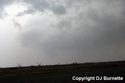
I stayed at this location, as low-level convergence strengthened. Eventually a rain-wrapped rotating wall cloud developed (images below; view is from the north side of Hollis, looking west). Radar data also showed the rain-wrapped nature of the low-level circulation (radar imagery below; car symbol denotes my location).
Frederick, OK Storm Relative Velocity 2233Z
Frederick, OK Base Reflectivity 2239Z
Frederick, OK Storm Relative Velocity 2239Z
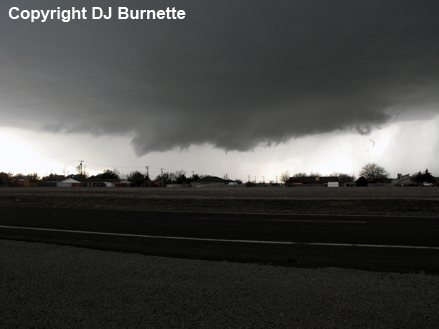
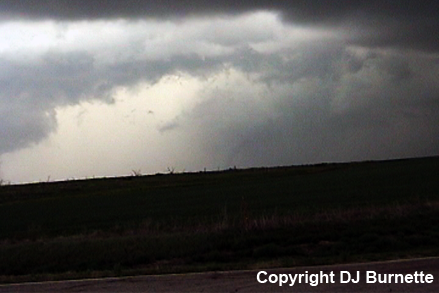
Yet another case where all of the precursors were there, but for some localized reason, tornadogenesis did not occur. This rotation continued northeast and crossed over OK-30, as I moved slightly north to keep up with it. I was hit by what was likely rear-flank downdraft winds, which rocked the car a bit, as I watched the rotating wall cloud to my north (images below; view is north of Hollis, looking north). Meanwhile, another wall cloud was developing to my northwest (far right image below). Radar imagery showed a continued intensification of the low-level rotation, as the storm to the southwest merged with the storm I was monitoring (images below; car symbol denotes my location). Still no tornadogenesis though.
Frederick, OK Storm Relative Velocity 2246Z
Frederick, OK Base Reflectivity 2259Z
Frederick, OK Storm Relative Velocity 2259Z
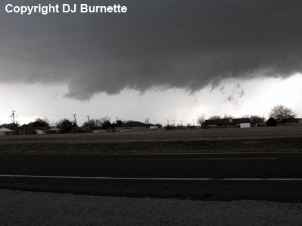
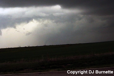
I continued north, and caught a glimpse of a brief funnel cloud with the wall cloud off to my north-northeast, as I passed through some trees. I stopped again on OK-30 north of Hollis to continue watching both areas of rotation, but the rotating wall cloud to my north was quickly becoming the main show (images below; view is north of Hollis, looking north). Radar data showed a new inflow-notch had developed in my area with strengthening low-level circulation (images below; car symbol denotes my location).
Frederick, OK Storm Relative Velocity 2303Z
Frederick, OK Base Reflectivity 2307Z
Frederick, OK Storm Relative Velocity 2307Z
Rain and hail was wrapping around the wall cloud, and arrived at my location. There was another main road not too much farther to the north, but it would involve racing the wall cloud in rain and hail with a number of other chasers in the area. I wasn't about to play that game. Instead, I moved back south into Hollis, and then took U.S. 62 eastward to OK-34. The objective was to get images of the supercell thunderstorm from a distance (images below; view is east of Hollis, looking north), and then intercept the storm again near/just north of Mangum, OK. Radar data showed an impressive supercell thunderstorm with good low-level rotation (images below; car symbol denotes my location).
The first tornado warning was issued on the storm, as I moved north on OK-34 toward Mangum. Storm spotters had reported a tornado, but the wall cloud was wrapped up in rain very well, which obscured the view from my location (images below; view is southwest of Mangum, looking west).
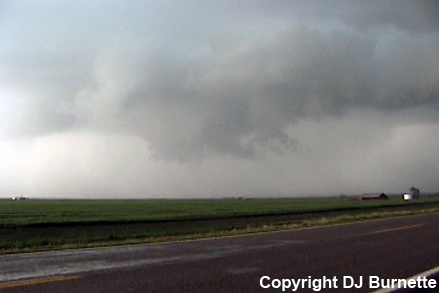
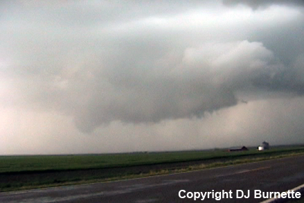
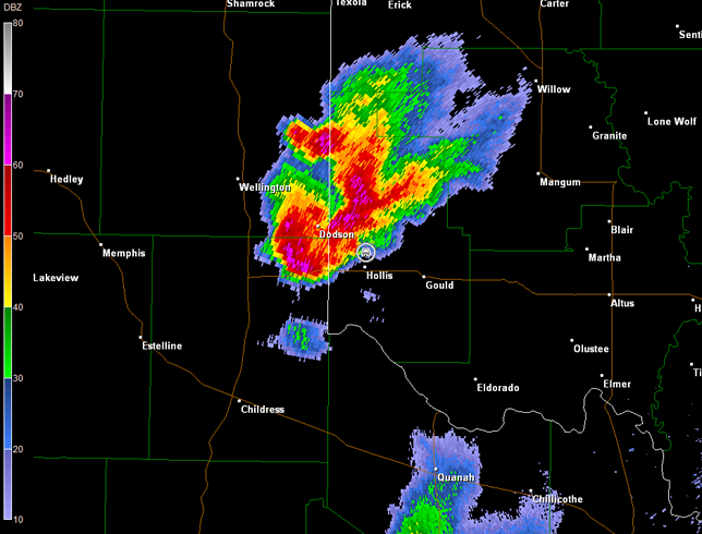
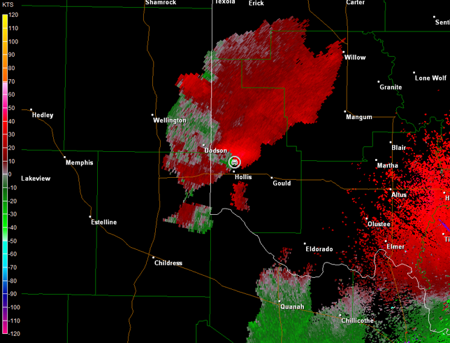
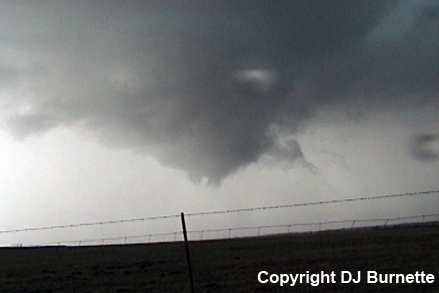
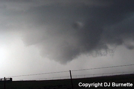
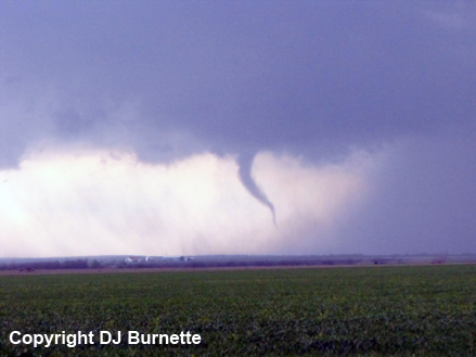
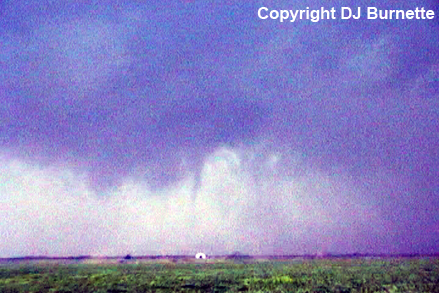
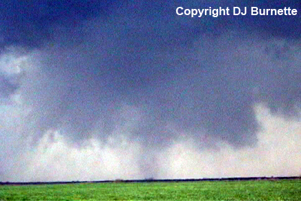
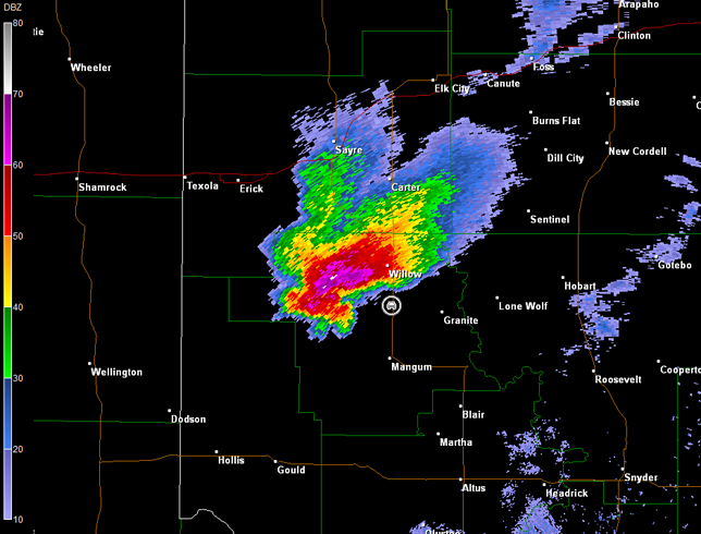
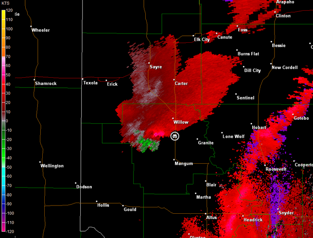
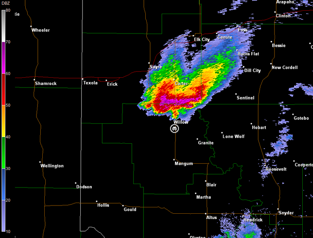
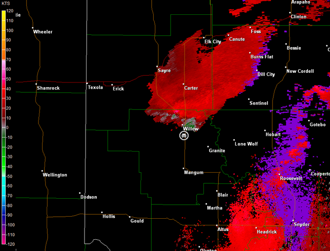
I closed in on the storm, as I moved through Mangum on OK-34 and U.S. 283. I continued north of Mangum watching the rain-wrapped mesocyclone carefully. A tornado emerged from the rain, and I immediately pulled over to take pictures and call in tornado reports (images below; view is north of Mangum and southeast of Brinkman, looking west). It was tough to tell, but there may have been two other tornadoes embedded in the rain (right two images below). The first was at least a funnel cloud, but I could not confirm ground circulation. The second could have been an artifact of the rain, but there are some indications of ground contact on the video. Both of these possible tornadoes lasted only a few seconds. A circulation well wrapped up in rain was observed on radar data, as the storm zeroed in on Willow, OK (images below; car symbol denotes my location).
Frederick, OK Storm Relative Velocity 0003Z
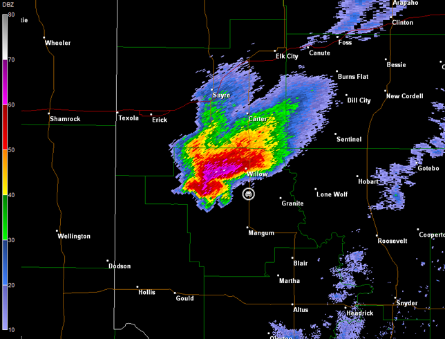
Frederick, OK Base Reflectivity 0007Z
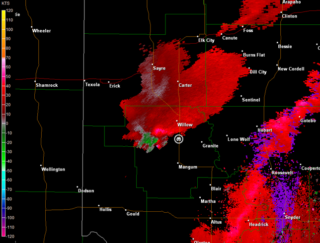
Frederick, OK Storm Relative Velocity 0007Z
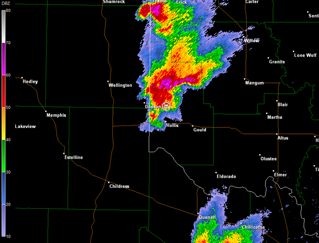
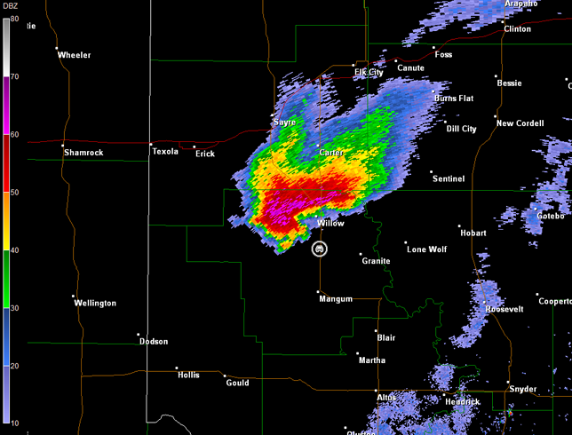
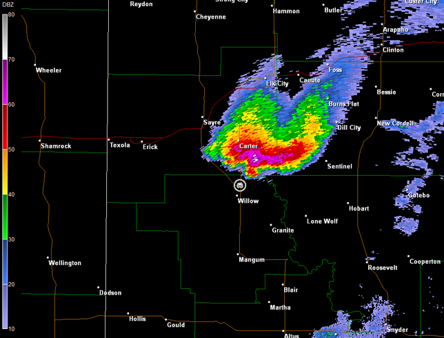
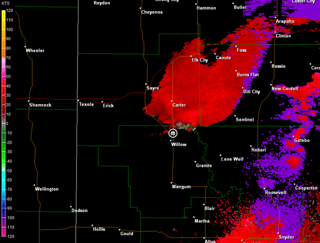
Frederick, OK Base Reflectivity 0016Z
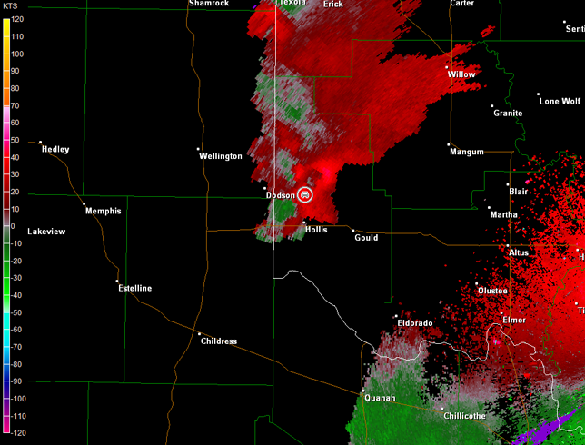
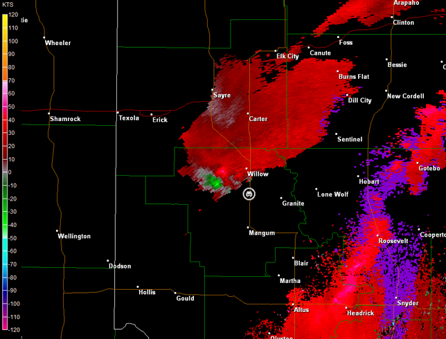
Frederick, OK Storm Relative Velocity 0016Z
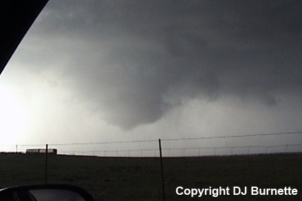
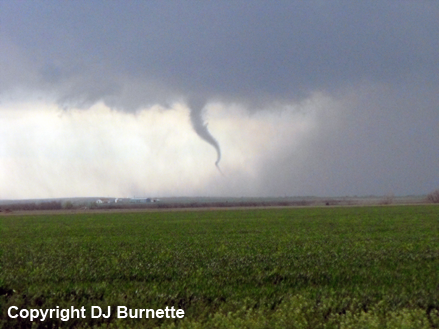
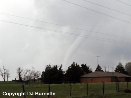
The number of chasers on the storm had increased dramatically, since other storms had decreased in intensity and this supercell was the only game left. I continued to follow the storm to the north, and stopped again to observe the wall cloud to my north that was not as obscured by rain. Another tornado developed at this time, and appeared to take on a cone shape (right two images below; view is north of Mangum and east of Brinkman, looking north). Unfortunately, the tornado is far enough away from me that it is very poor contrast. Radar imagery is also below (car symbol denotes my location).
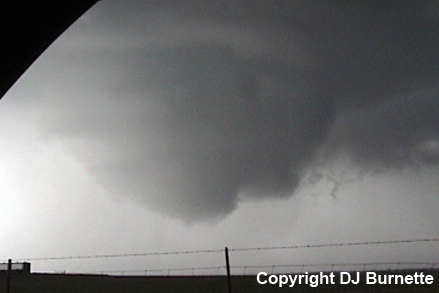
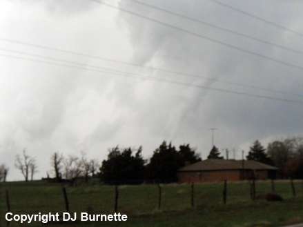
I continued north on U.S. 283 and then on OK-34 to get a closer view. The tornado was a stovepipe shape by the time I pulled off where I could to monitor the tornado (images below; view is northeast of Willow, looking north). The tornado transitioned into the rope stage and dissipated. Radar imagery is also below (car symbol denotes my location).
It was getting dark by this time, and the storm was beginning to move out of the best environment, which was confined to a thin axis. Thus, I decided to end the storm chase. As an aside...this was the first time that I had gotten into such a massive row of vehicles on a two-lane road near a tornadic supercell. I had heard the numerous horror stories, and I hope the day never comes when a tornadic supercell turns right or a flanking-line tornado develops that heads right for such a plethora of chasers.