Storm Chase Log 24 May 2011
Chasers: Dorian J. Burnette, Malcolm Cleaveland, Kevin Kinder, Safarie Moore, Henry Turner, and Liana Wagle
Preliminary Destination: Tonkawa, OK
Note: Images have been decreased in size. Click on an image to view a larger version.
I blew off the 22 May 2011 Joplin setup in favor of this day, since it would be over terrain that is much better for storm chasing. However, this severe thunderstorm event was complicated by the fact that storms were very close to one another and interacting in complex ways. This significantly cut down what would have been a much larger tornado outbreak. Unfortunately, the complexity started early with storms initiating in southwestern OK toward 2 p.m. CDT. I considered going after those cells immediately, but decided to stay on target toward Tonkawa. We refueled in Tonkawa and met up with Liana Wagle who joined us out of Wichita. By that time, the tornado-warned storms were gradually approaching to our southwest. We moved west and southwest to intercept these storms, where my plan of attack was simple--pick the closest storm and follow it north-northeast through northern OK and into southern KS.
These storms looked more linear on radar (instead of in the form of scattered supercells), as we approached them. Eventually, the tornado warnings were dropped in favor of severe thunderstorm warnings. Staying with these storms would mean not seeing much, and the action was clearly much farther south on I-40 west of El Reno, OK, where a large tornado was on the ground. Thus, I had us make a mad dash south on I-35 toward Guthrie, OK. We continued to hear reports of this large tornado doing significant damage, and it looked like it was heading straight for Guthrie.
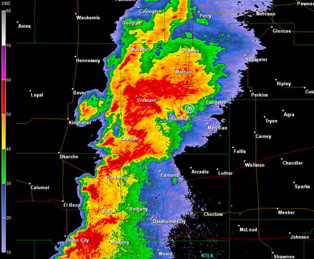
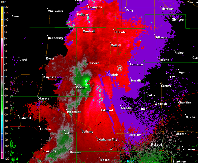
By the time we arrived in Guthrie, tornado sirens were sounding. I was looking for a good position to setup and wait for the storm to arrive. I found us a spot to the northeast of Guthrie on OK-33, which we could also use to follow the storm farther northeast toward Stillwater. This plan would have worked had the circulation not become rain-wrapped (radar images below; car symbol denotes our location).
Norman, OK Storm Relative Velocity 2214Z
Norman, OK Base Reflectivity 2218Z
Norman, OK Storm Relative Velocity 2218Z
We couldn't see a thing from our location. The big supercell was also well-embedded in a line of storms, so the chances that it would produce additional tornadoes were declining. It did produce another tornado near Stillwater that did damage, but I had us move farther south toward I-40 in order to intercept the more scattered tornadic supercells approaching Oklahoma City. The Oklahoma City metro area is not something to storm chase in though, so I had us move east to U.S. 177 and then south toward Shawnee, OK.
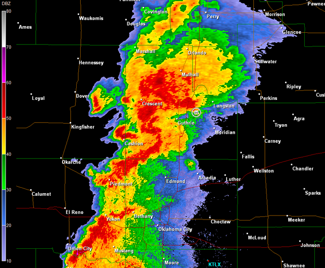
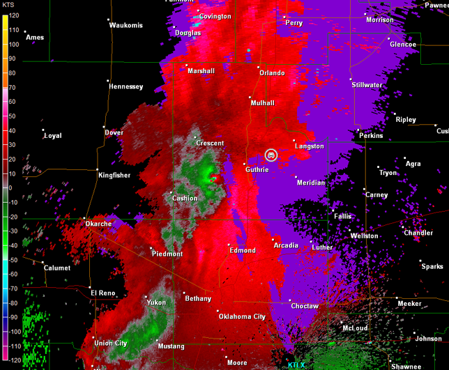
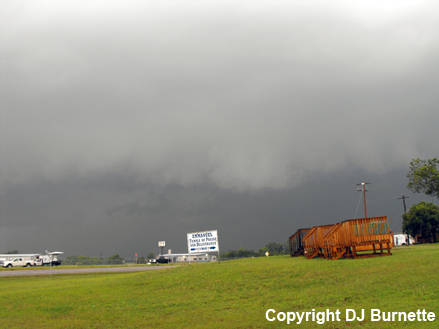
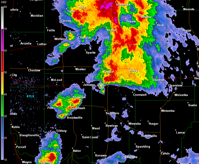
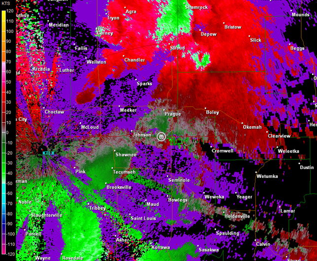
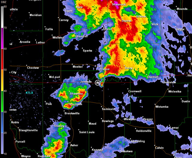
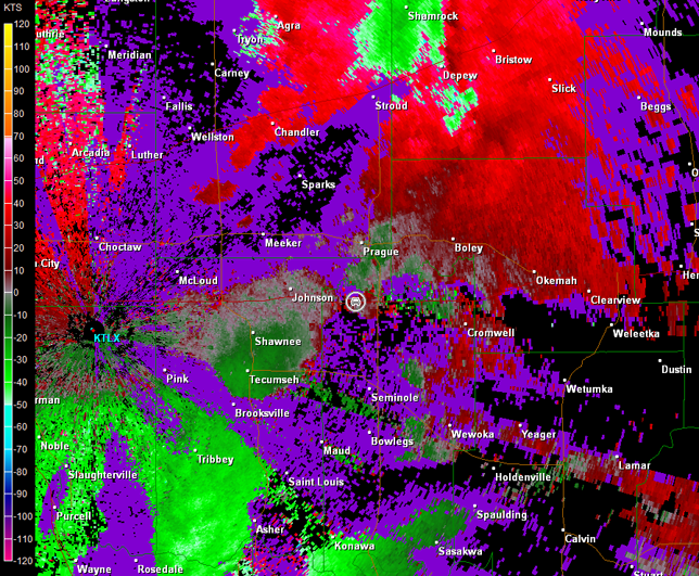
We went through some rain, but eventually emerged in the rain-free area where there were a mass of storm chasers. I looked for a good spot to stop south of I-40, and eventually came on one between Shawnee and Tecumseh. We only had to wait there about 5 minutes or so, and a tornado was reported northwest of our location just north of I-40. We couldn't see anything from our location, but inflow winds were quite strong. We found another place to stop just north of I-40. We never did see the short-lived tornado, but the mesocyclone signature was still there (images below; view is north of the U.S. 177/I-40 interchange, looking northwest). Radar imagery continued to show a nice gap between this storm and another potentially tornadic storm to our immediate south (images below; car symbol denotes our location). Unfortunately, the velocity data have some range folding issues.
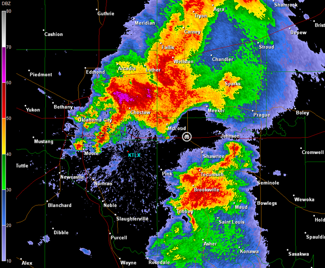
Norman, OK Storm Relative Velocity 2339Z
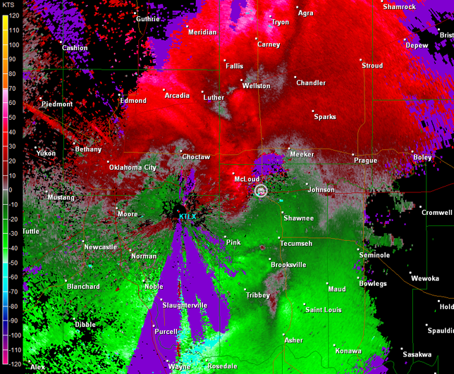
Norman, OK Base Reflectivity 2343Z
Norman, OK Storm Relative Velocity 2343Z
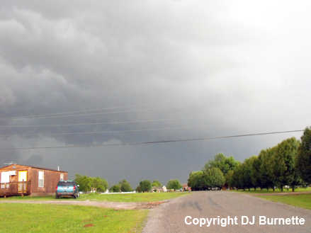
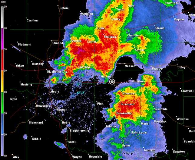
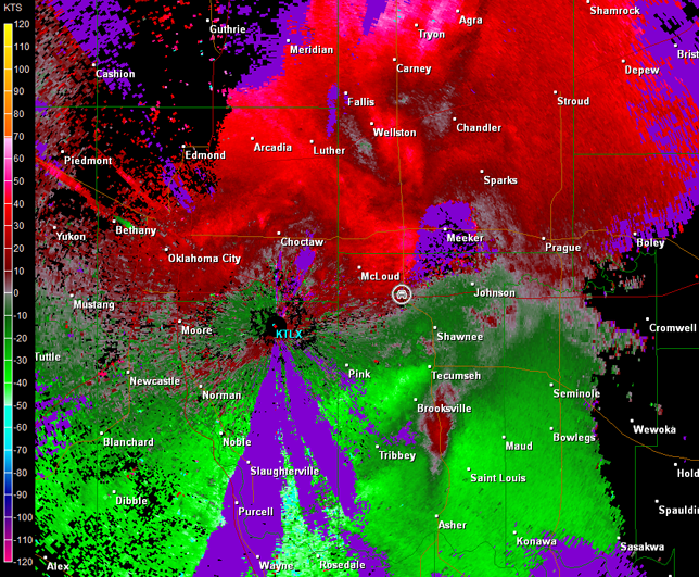
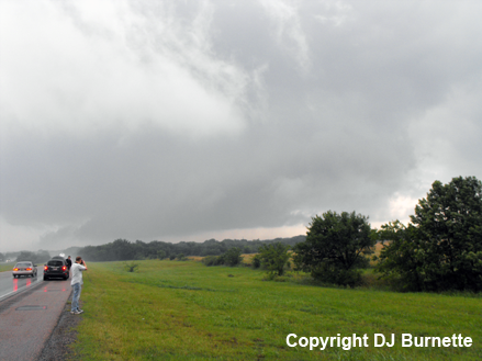
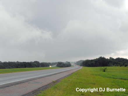
We continued to follow both the cell to our north and the cell to our south farther east on I-40. As the storm to our south closed in on Seminole, OK, a large wall cloud was reported. We were able to intercept this wall cloud on I-40 west of the Seminole exit. Radar imagery showed some circulation in this location (images below; car symbol denotes our location; range folding issues remain). We monitored this wall cloud, but it was all bark and no bite (images below; view is west of the U.S. 377/I-40 interchange, looking east).
Norman, OK Storm Relative Velocity 0013Z
Norman, OK Base Reflectivity 0017Z
Norman, OK Storm Relative Velocity 0017Z
We stopped on U.S. 377 north of Seminole to evaluate the trends, which showed that the storms north of I-40 were becoming more linear and the big show was to our southwest moving into the poor chase terrain of southeast OK. Given these trends, we began the journey back to Fayetteville. However, we would keep a close eye on the ongoing storms, which continued to generate tornado warnings. By this time, it was dark, and to get to the proper areas would have meant core punching, chasing at night, and chasing in poor terrain. I wasn't about to play that game, but we did move through some intense rain and wind at times.