Storm Chase Log 12 May 2010
Chasers: Dorian J. Burnette, Tyler Engelhardt, Greg Hutchinson, and Cory Phelps
Preliminary Destination: Tonkawa, OK
Note: Images have been decreased in size. Click on an image to view a larger version.
This storm chase started and ended with a bang. We arrived in Tonkawa, OK shortly after storms had developed in southcentral Kansas. These storms quickly became tornadic, and we wasted no time moving northward into KS to meet up with Greg and Cory at the U.S. 160/K-49 interchange.
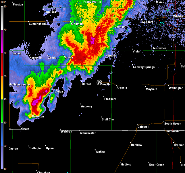
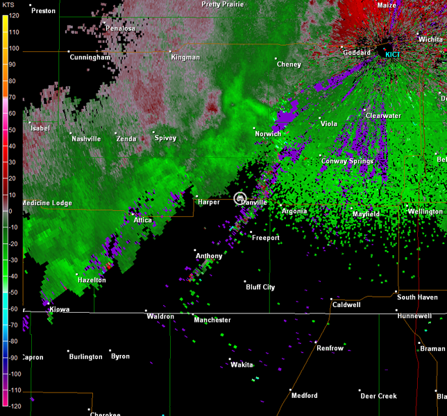
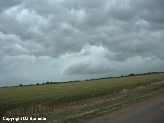
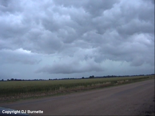
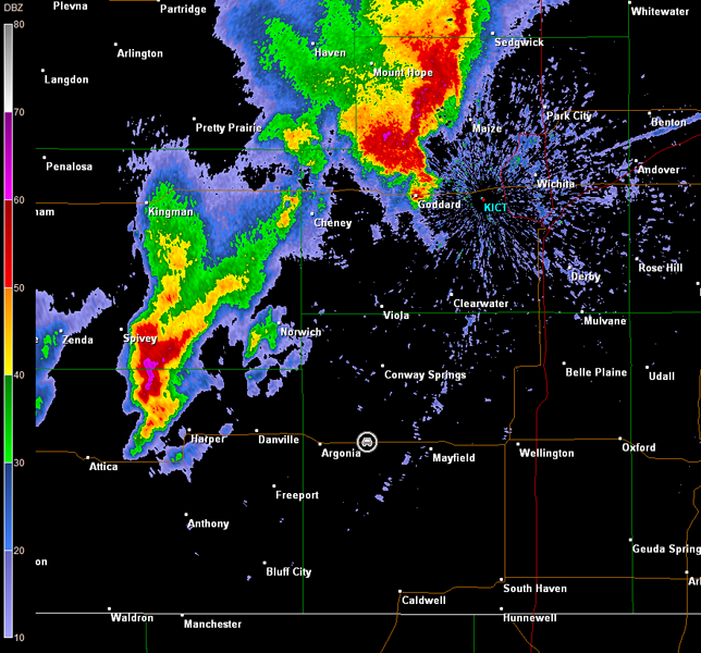
We proceeded west to intercept the broken line of supercell storms in vicinity of Danville, KS. By the time we arrived, the strongest storm had an intense amount of outflow, and all we observed was a shelf and some horizontal rolling clouds (images below; view is from the west side of Danville looking northwest). Radar data also showed another severe storm to the southwest (images below; car symbol denotes our location).
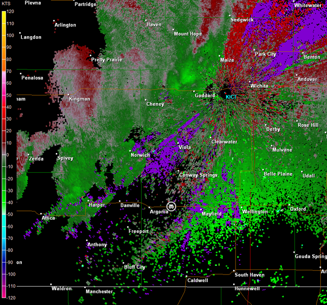
Wichita, KS Storm Relative Velocity 2212Z
Wichita, KS Base Reflectivity 2216Z
Wichita, KS Storm Relative Velocity 2216Z
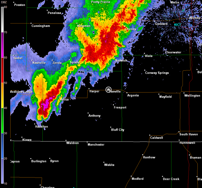
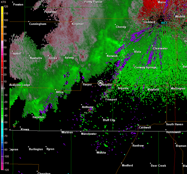
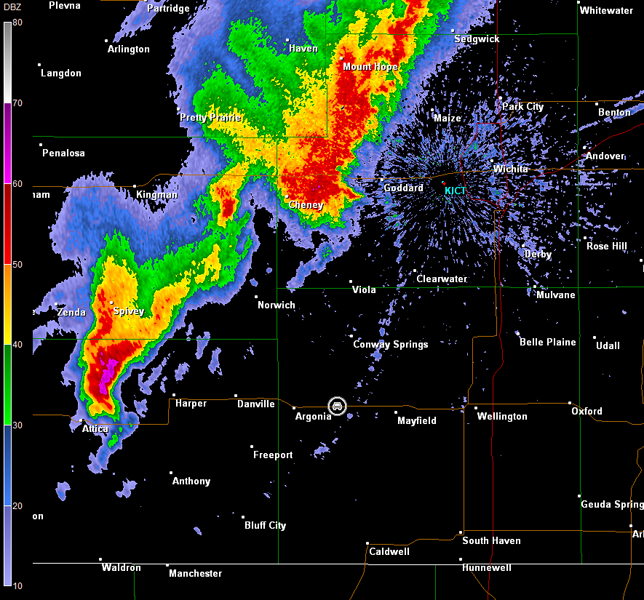
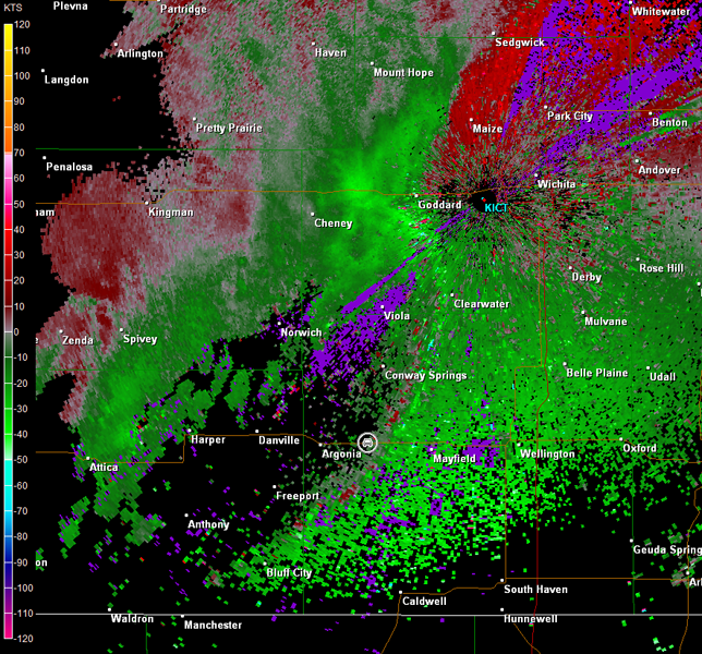
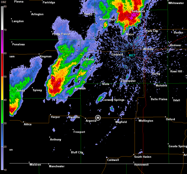
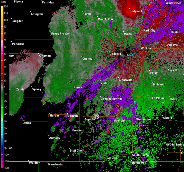
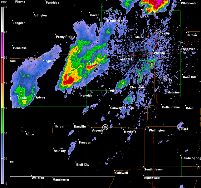
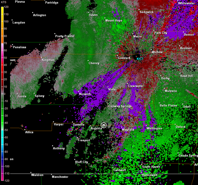
We moved back to the east toward K-49. The plan from there was to move north to stay with this storm northwest of Danville. Andrew Gagnon and several other meteorologists from WeatherData were farther to our northeast, and reported to us that they had seen some gustnadoes from the storm. Nothing much more was observed though, and the cell was looking more outflow dominant. Meanwhile, the storm farther to the southwest showed an interesting radar signature, and we stopped shy of K-49 north of Milan, KS to reassess the situation (radar images below; car symbol denotes our location). Despite the fact that this cell looked like a tornadic supercell on base reflectivity, storm relative velocity data did not show any low-level rotation. Moreover, there was plenty of cool air outflow in wake of the storm to the northeast. Unless the interesting looking storm could turn right, it would run into an increasingly poor overall environment.
Wichita, KS Storm Relative Velocity 2235Z
Wichita, KS Base Reflectivity 2244Z
Wichita, KS Storm Relative Velocity 2244Z
We held stationary to see what this trailing storm would do, if anything. The farther northeast it moved, the weaker it looked on radar imagery (radar images below; car symbol denotes our location). Eventually, all severe thunderstorm warnings were discontinued for the cell. This left us with not much else to chase.
Wichita, KS Storm Relative Velocity 2258Z
Wichita, KS Base Reflectivity 2307Z
Wichita, KS Storm Relative Velocity 2307Z
Meanwhile, well off to the southwest, tornadic supercells were moving out of TX and into southwestern OK. The environmental conditions appeared to be better across that area, and there might be a chance to catch one of those tornadic supercells if we left immediately. Unfortunately, that would be too far for Cory and Greg to go, so they traveled back to Wichita, while Tyler and I headed toward westcentral OK.
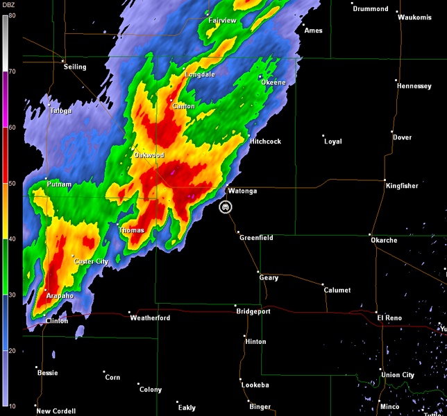
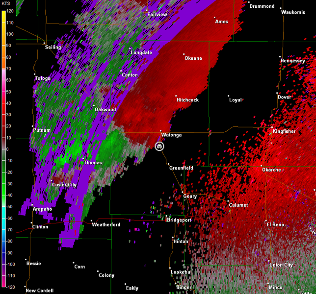
We had to punch through an unimpressive line of showers and thunderstorms developing near the KS/OK border. Once we moved through that, we continuously monitored any activity to our west as well as NOAA Weather Radio. Eventually we began to see consistent lightning to our southwest, which became more intense the closer we got to Watonga, OK. A tornado warning was issued on the storm to our immediate southwest, as we approached Watonga from the north (radar imagery below; car symbol denotes our location). Alas, it was past sunset, and darkness was upon us.
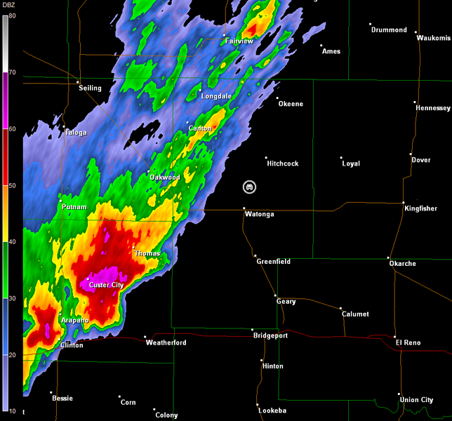
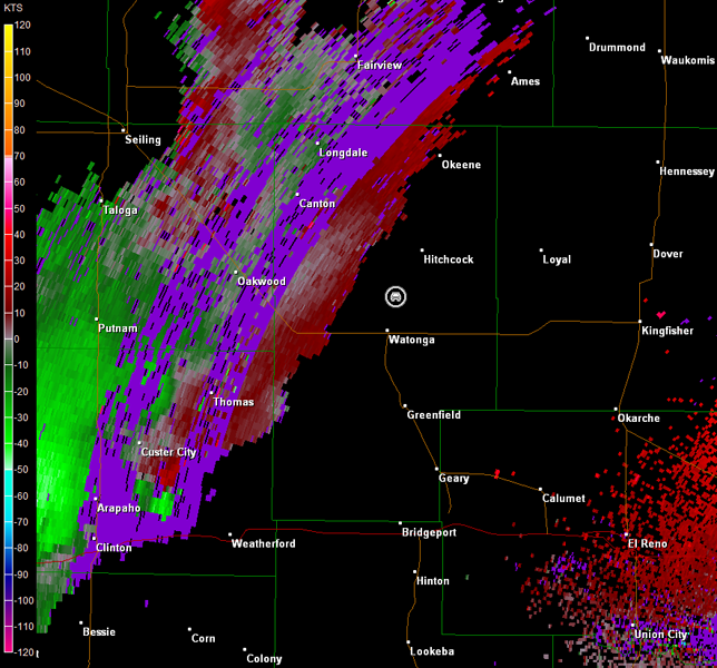
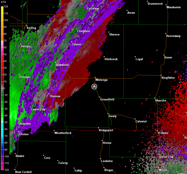
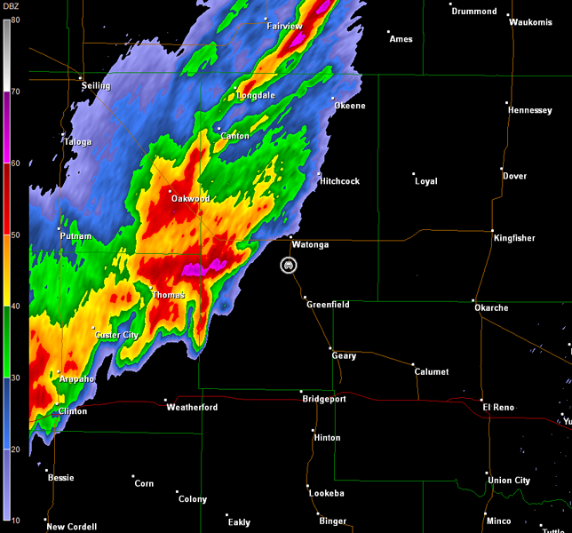
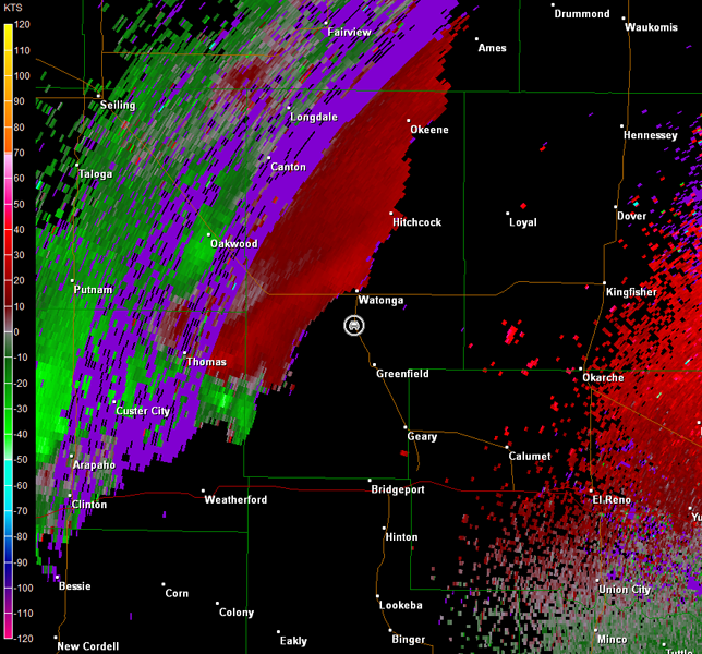
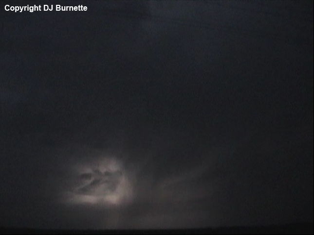
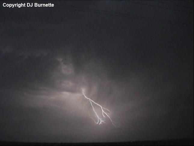
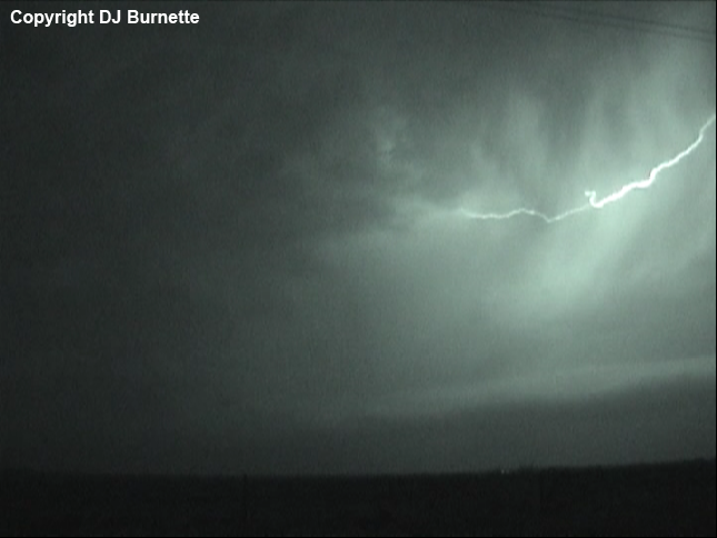
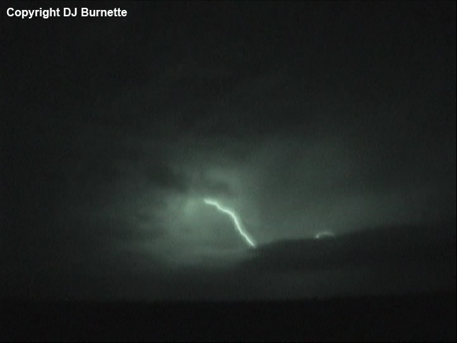
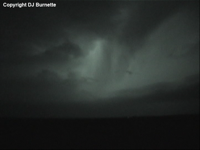
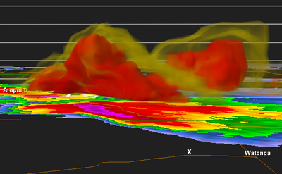
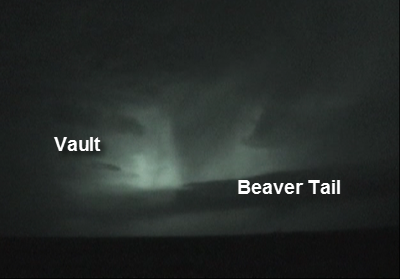
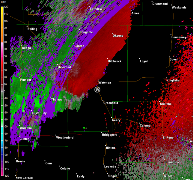
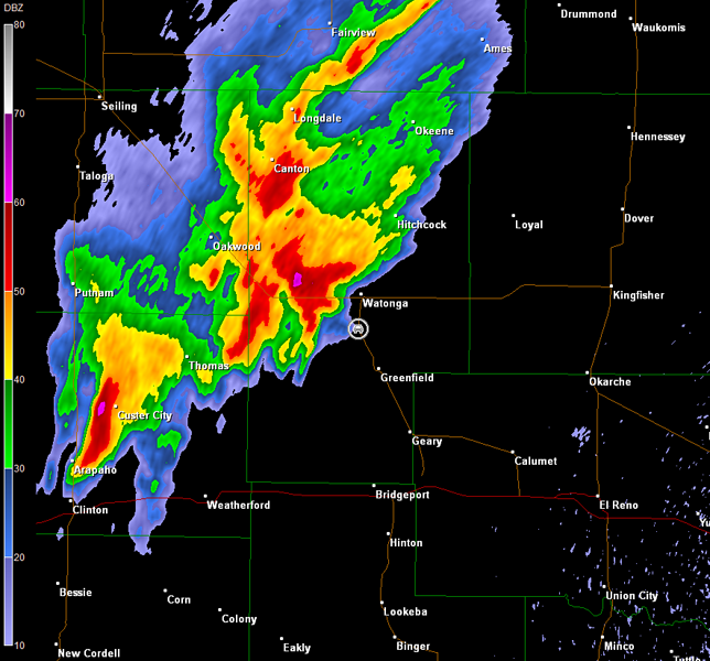
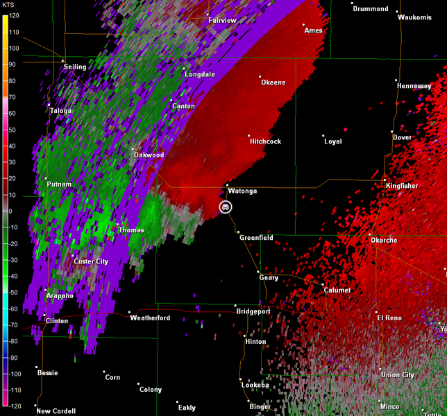
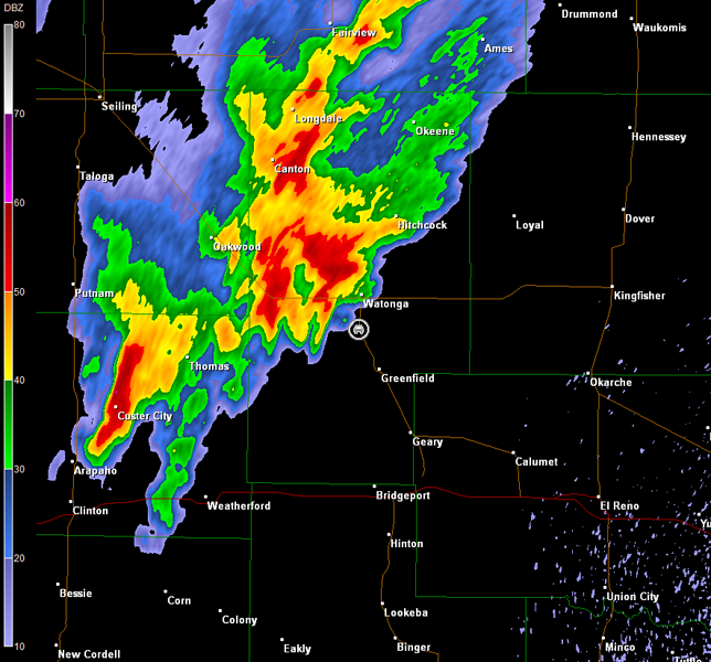
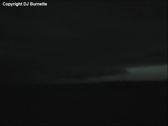
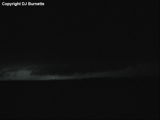
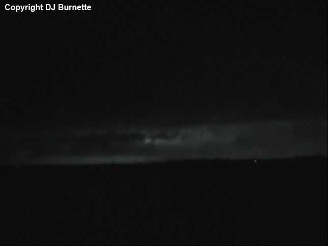
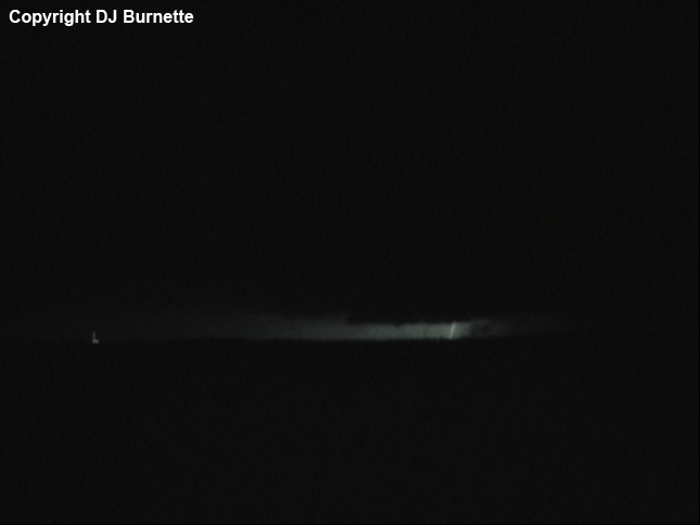
The storm was moving straight for Watonga. We moved about two miles south of the town on U.S. 270, and stopped to observe the approaching tornadic supercell. The lightning show was some of the most intense I had seen in some time, and certainly revealed impressive storm structure (images below; sequence goes from left to right and top to bottom; view is south of Watonga looking west-southwest). The tornado warning was expanded northeast, and by 02Z (9 p.m. CDT), we could hear the tornado sirens in Watonga. Radar imagery indicated that the most intense circulation, which produced a tornado over I-40, was now rain-wrapped and occluding (images below; car symbol denotes our location). A 3D image of the tornadic supercell at 0152Z constructed with GR2Analyst is also below with an annotated video capture of the storm structure (the x in the 3D radar image denotes our location; lesser radar echoes have been removed).
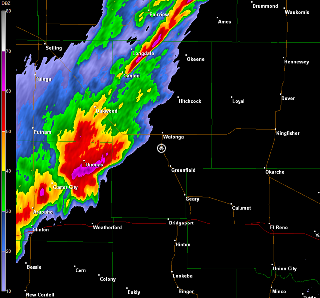
Norman, OK Storm Relative Velocity 0152Z
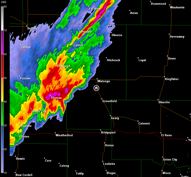
Norman, OK Base Reflectivity 0156Z
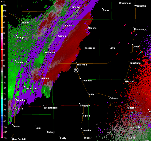
Norman, OK Storm Relative Velocity 0156Z
Norman, OK Base Reflectivity 0201Z
Norman, OK Storm Relative Velocity 0201Z
Norman, OK Base Reflectivity 0205Z
Norman, OK Storm Relative Velocity 0205Z
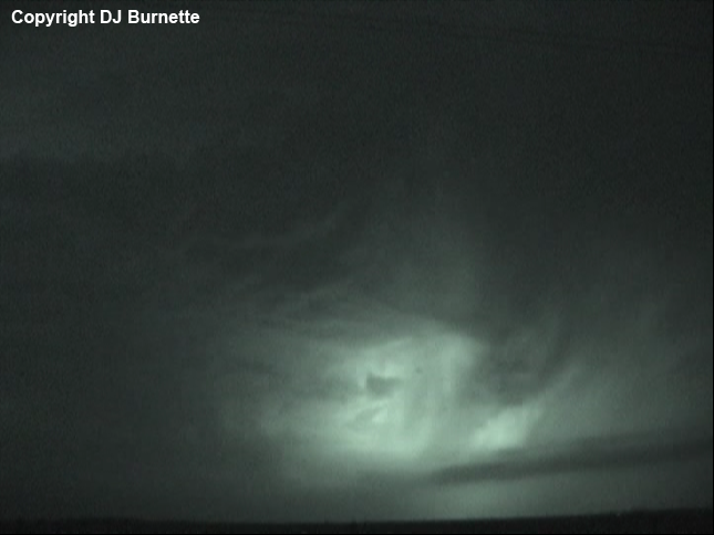
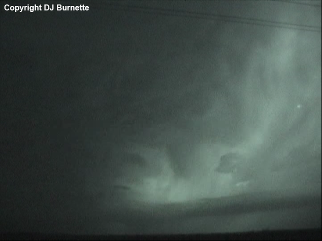
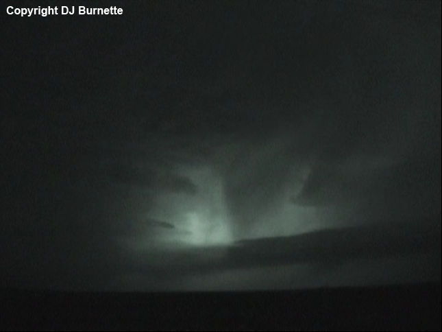
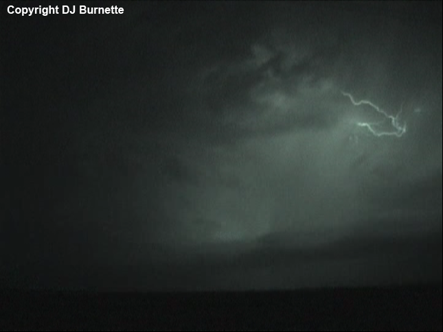
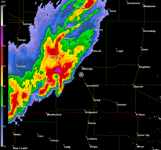
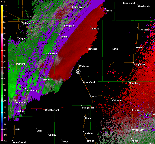
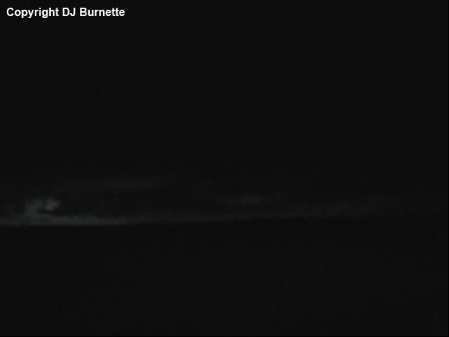
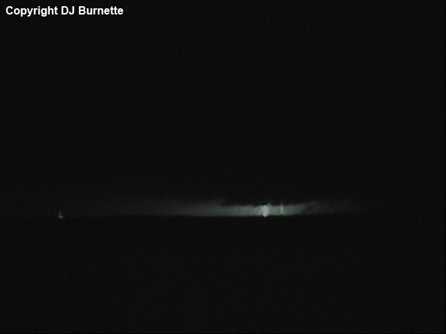
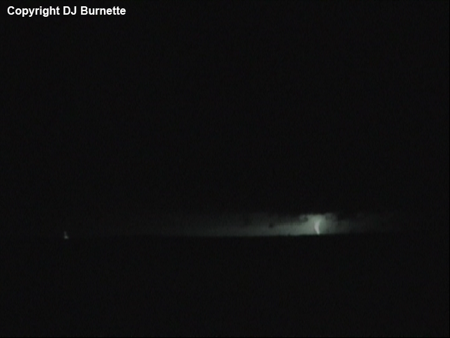
Base reflectivity radar data suggested that a new circulation might be developing a bit farther to the east, and we did observe some lowerings, as this part of the storm closed in on our location (images below; sequence goes from left to right and top to bottom; view is south of Watonga looking west-southwest). Note that the first image on left in the top row reveals a structure that could be a wall cloud. It was difficult for us to tell given we had to rely on lightning to flash in the correct location, and scud clouds can look like they are attached to the base depending on the observer's perspective. It would be in the correct location per radar imagery, but the rotation was not tight (images below; car symbol denotes our location). Perhaps this was one final attempt at some organization. Whatever the case, as this portion of the storm continued to pass to our west and northwest, the cloud appearance looked more like outflow scud.
Norman, OK Storm Relative Velocity 0210Z
Norman, OK Base Reflectivity 0215Z
Norman, OK Storm Relative Velocity 0215Z
Norman, OK Base Reflectivity 0219Z
Norman, OK Storm Relative Velocity 0219Z
The storm weakened as it moved farther to the northeast, and by 0230Z (9:30 p.m. CDT), the tornado warning was allowed to expire. We then began the journey back to Fayetteville with an impressive lightning show off to our west at times.