Storm Chase Log 10 May 2010
Chasers: Dorian J. Burnette, Chris Cerny, Malcolm Cleaveland, Mark Cooper, Tyler Engelhardt, Greg Hutchinson, Cory Phelps, and April Phelps
Preliminary Destination: Ponca City, OK
Note: Images have been decreased in size. Click on an image to view a larger version.
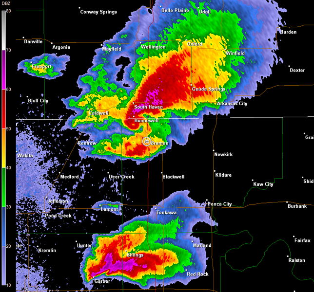
This was a very interesting day with many tornadoes reported, but chasing these tornadic supercells was far less than ideal given the insane storm motions. The slowest storms were moving at 50 mph, while the faster storms were moving closer to 65 mph. Our best intercept all day was the storm that produced a multiple vortex tornado near Wakita, OK. The remainder of the storm chase was spent trying to catch up with these fast moving beasts on a road network that would not cooperate.
We approached the U.S. 412/I-35 interchange just as thunderstorms were developing west of a Medford, OK to Enid, OK line. We moved north on I-35 to the Tonkawa exit in order to meet up with folks from Wichita and refuel. The skies grew ever darker the closer we got to Tonkawa. Radar and other key environmental data were assessed once we stopped to refuel. Thunderstorms were exploding by this time from KS southward down the dryline into TX. Once we heard of a tornado reported moving toward Medford, we moved up I-35 in order to intercept the storm. Typically, I refrain from chasing on interstates due to the lack of exit options, but this time we had no choice given the storm was racing northeastward.
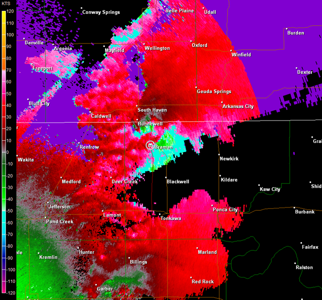
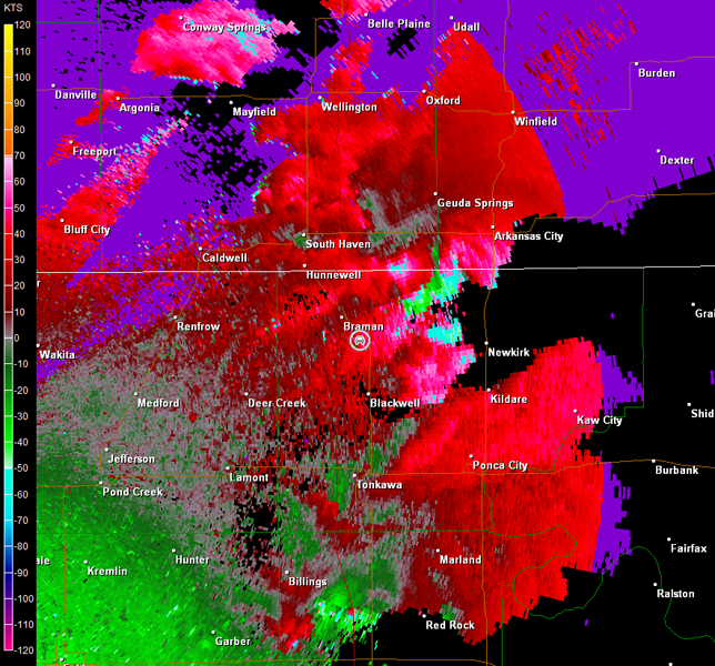
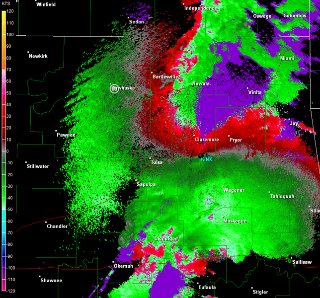
Our efforts to intercept would have been successfull had the tornado not become rain-wrapped, but the storm was quickly becoming a high-precipitation supercell. The radar also showed a new circulation was developing to the southeast in vicinity of our location. We did observe real strong upflow at times prior to being hit by straight-line wind gusts on the order of 70-80 mph (radar imagery shortly after we were hit by the strong winds is below; car symbol denotes our location).
Vance Air Force Base, OK Storm Relative Velocity 0.6° Tilt 2123Z
Vance Air Force Base, OK Storm Relative Velocity 1.4° Tilt 2123Z
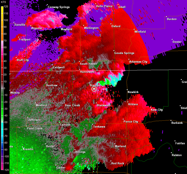
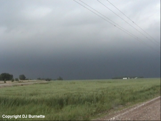
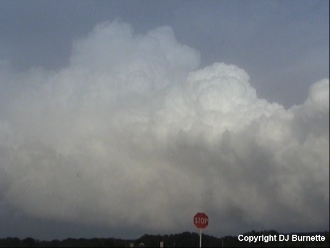
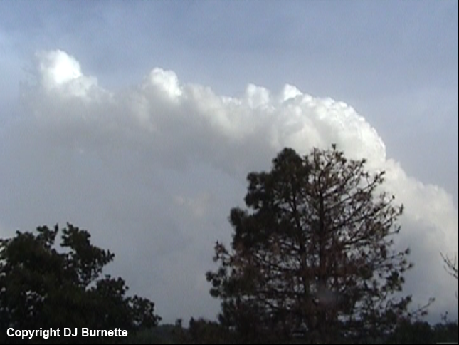
Needless to say, we were not in a good spot, we got off I-35 and moved quickly southeast on U.S. 177 to escape the strong winds and developing circulation area. We stopped east-southeast of Braman to reassess things, and observed some incredible winds flowing into the high-precipitation supercell off to our northwest (images below; view is east-southeast of Braman looking northwest and west). Radar imagery during this time is also included below (car symbol denotes our location).
Vance Air Force Base, OK Storm Relative Velocity 2132Z
Vance Air Force Base, OK Base Reflectivity 2136Z
Vance Air Force Base, OK Storm Relative Velocity 2136Z
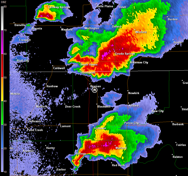
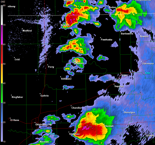
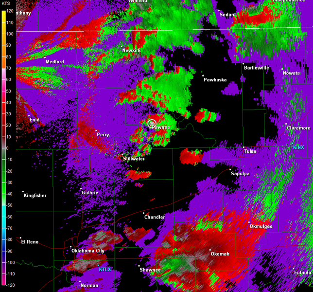
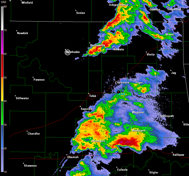
The best warm, moist sector for tornadic supercells was confined to an area no more than 150 miles wide with extensive cloudiness and cooler temperatures noted outside of this zone to the east and northeast. This high-precipitation supercell was quickly outrunning the ideal environment, and certainly was not going to cease with rain-wrapped circulations anytime soon. Another tornadic supercell was located southwest of Ponca City (note radar images above), and so I directed us in that direction. In retrospect, I should have done this sooner given the storm motions on this day (i.e., there is very little time to stop and take a breath). Our efforts to catch this storm in vicinity of Ponca City were futile. We did cross the damage path on U.S. 177 south of Ponca City, but the road network in this area would not allow for fast eastward travel. Overall, we were constantly on the wrong side and would have had to core punch. A core punch though was out of the question given the storm's forward speed and its history of baseball to softball-sized hail.
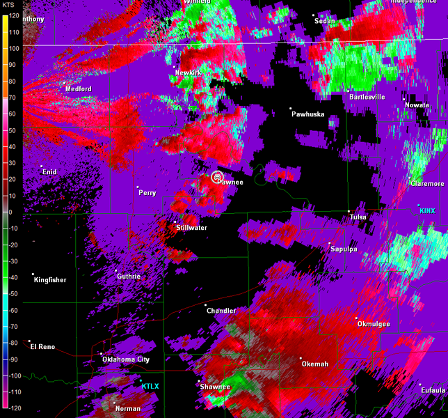
Meanwhile, we did observe new storm towers developing to our west and northwest along the dryline, and stopped in Pawnee, OK to reassess the situation. We could either stay with this activity or move east-southeastward post-haste on various turnpikes to intercept a tremendous supercell moving eastward just south of I-40. The new storms to our west and northwest were not looking too bad on radar (images below; car symbol denotes our location). The storm east of Newkirk was tornado warned, and about 10 minutes later, the storm to its south was warned tornado. This pretty much made our decision for us given the fast storm motion, and we moved back to the north toward Ralston, OK to intercept.
Vance Air Force Base, OK Storm Relative Velocity 2310Z
Vance Air Force Base, OK Base Reflectivity 2314Z
Vance Air Force Base, OK Storm Relative Velocity 2314Z
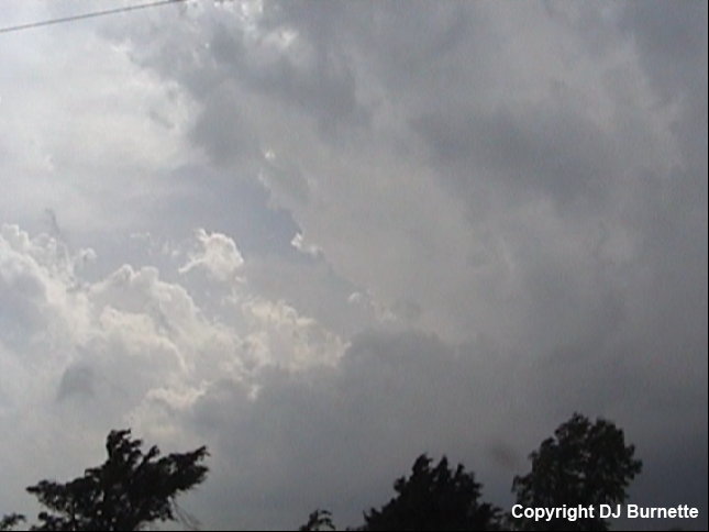
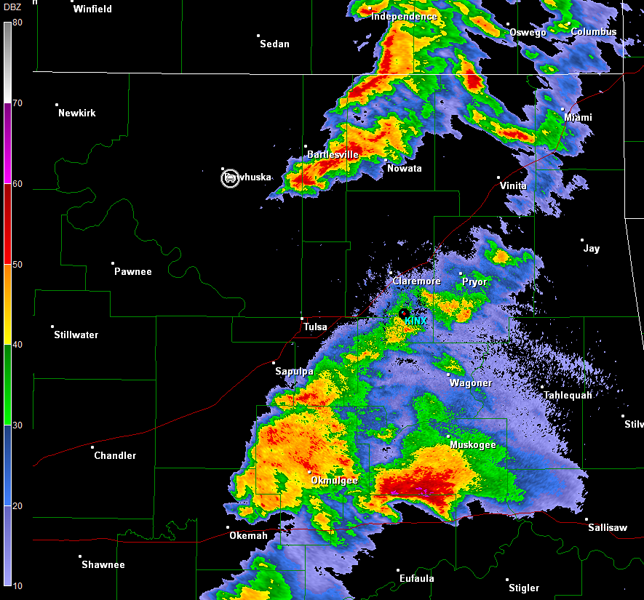
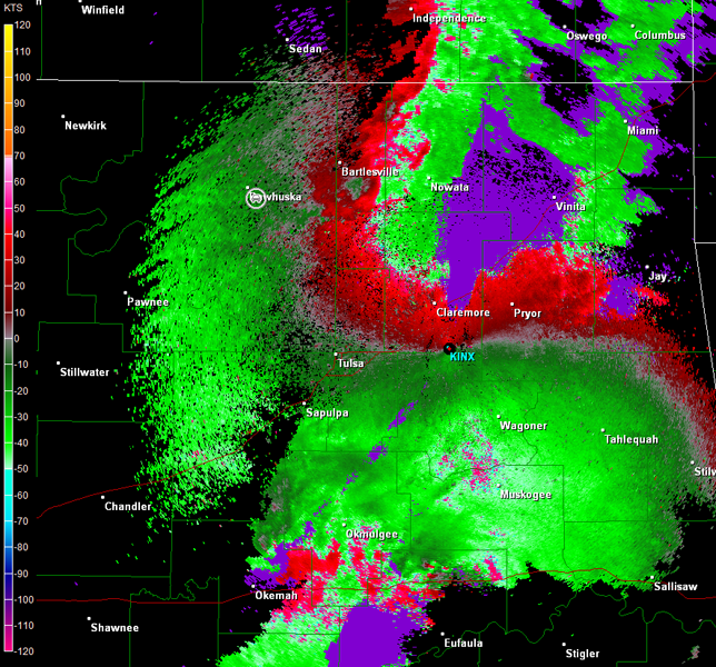
We were able to see the rain-free base of the storm once we arrived in Ralston, OK. There were no lowerings though, and the longer we followed the storm, the weaker it looked. This was not real surprising, since 1) the storm was moving through an environment that had already been worked over by a tornadic supercell and 2) the real good inflow was being robbed by storms farther to the south. We followed the broken line of storms farther to the east toward Pawhuska, OK, and briefly stopped south of the city (images below; view is south of Pawhuska looking east and southeast). Overall though the storms in our area were not that impressive...the real show was along I-40 in vicinity of Checotah, OK (radar images below; note the switch to Tulsa's radar due to the location of the storms; car symbol denotes our location).
Tulsa, OK Storm Relative Velocity 0037Z
Tulsa, OK Base Reflectivity 0041Z
Tulsa, OK Storm Relative Velocity 0041Z
Overall, I think this will be the last time I chase on a day when storms are expected to move at 50 mph or more. Such storm motions often leave you with one good intercept if you want to stop and take pictures. Otherwise, you have to constantly stay on the go or you will be left in the dust. Moreover, if one storm becomes less impressive, then the odds of successfully intercepting a different storm are not good, especially if any minor issues in the road network arise. This was a day with many tornadoes, but you had to be in the right place at the right time or you did not see them.