Storm Chase Log 15 May 2009
Chasers: Dorian J. Burnette and Jo Ann Kvamme
Preliminary Destination: Newton, KS
Note: Images have been decreased in size. Click on an image to view a larger version.
This was yet another frustrating storm chase day, which seemed to be a consistent thing in 2009. It was difficult to pinpoint an exact target early in the morning, and trends were monitored through the day for a possible storm chase much farther to the north and northeast. In the end, we should have gone up into northwestern MO. Although, some chasers were slammed by baseball and softball-sized hail trying to see the tornadoes up there. We kept the southern target though and waited for a couple of hours in Newton, KS for storms to initiate.
We talked briefly with Jeff House, as the storms began to develop in vicinity of the KS/OK line southwest of Wichita, KS. Those really were the best cells, but they were not super impressive by any means. Nevertheless, this was the only game in town nearby, and so we departed to intercept the storms before they moved into Wichita.
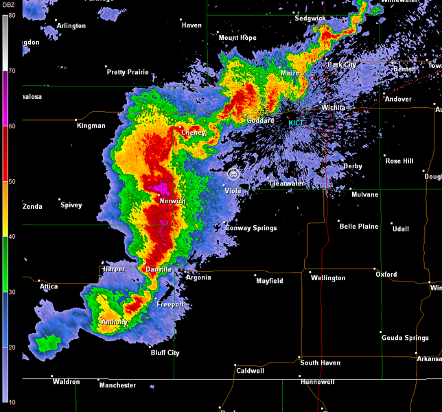
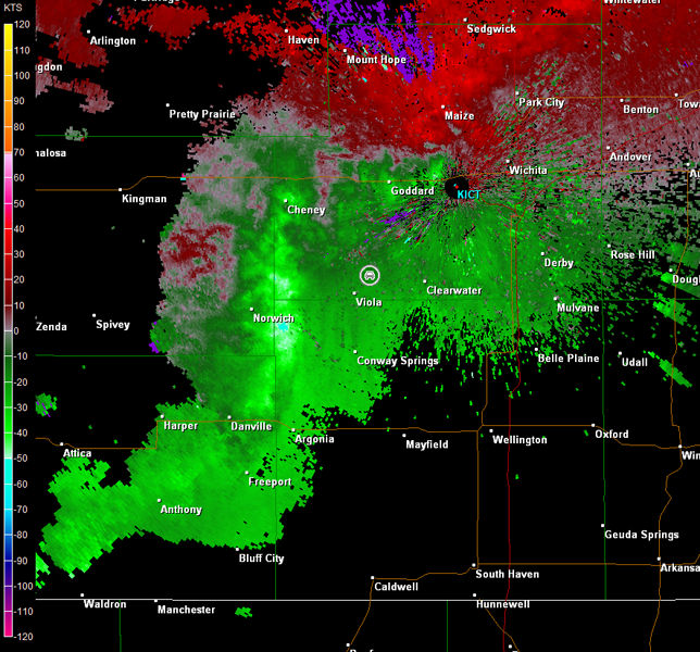
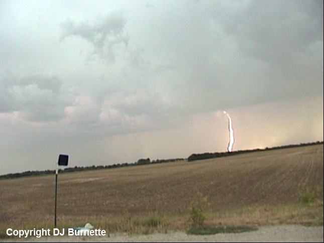
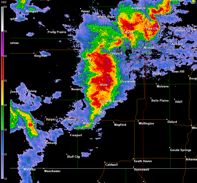
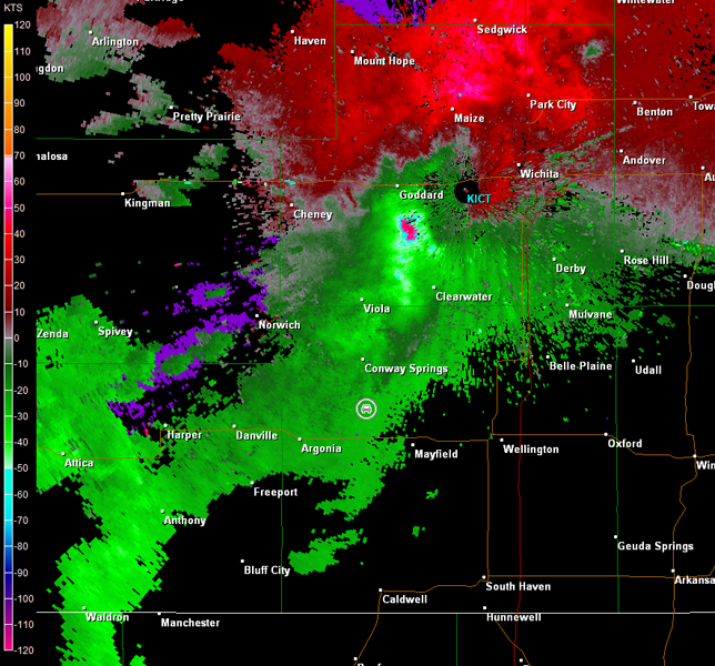
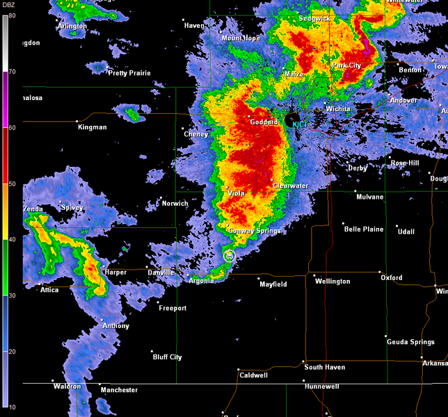
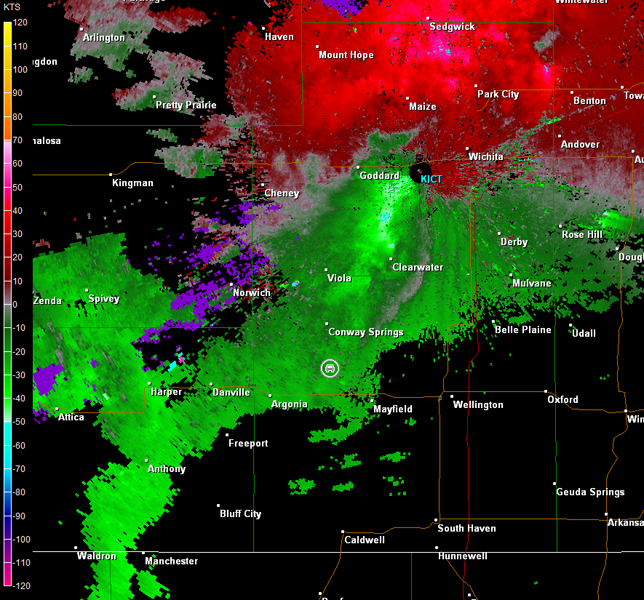
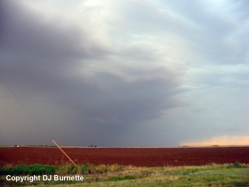
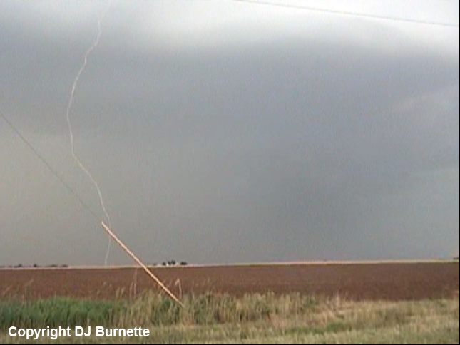
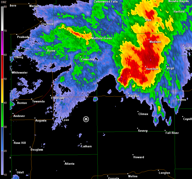
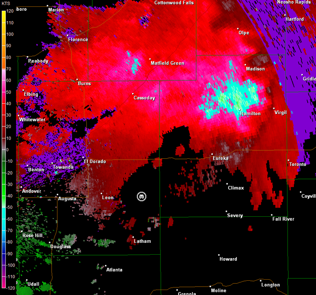
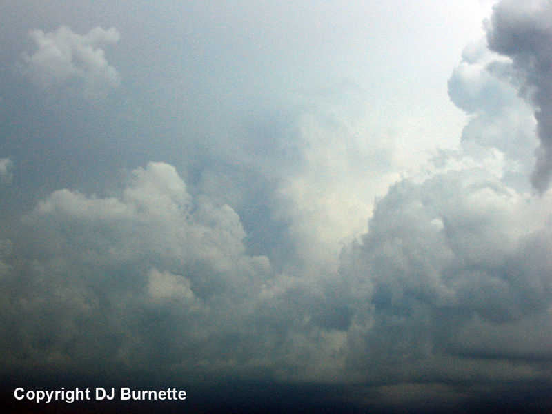
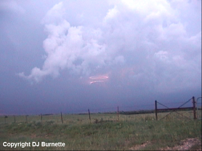
We intercepted the storms on K-42 northeast of Viola, KS. Overall, the bases appeared to be high, but there was decent cloud-to-ground lightning at times (images below; view is northeast of Viola looking west). The radar velocity data presented below shows one of the big threats from this storm was high straight-line winds (car symbol denotes our location).
Wichita, KS Storm Relative Velocity 2347Z
Wichita, KS Base Reflectivity 2351Z
Wichita, KS Storm Relative Velocity 2351Z
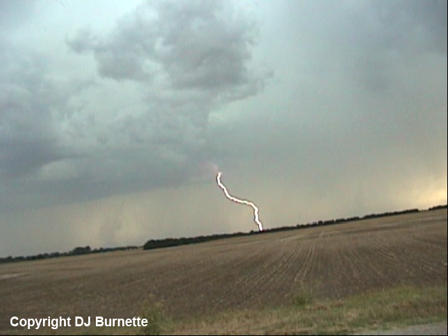
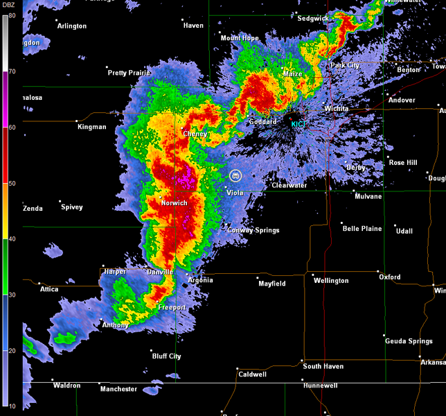
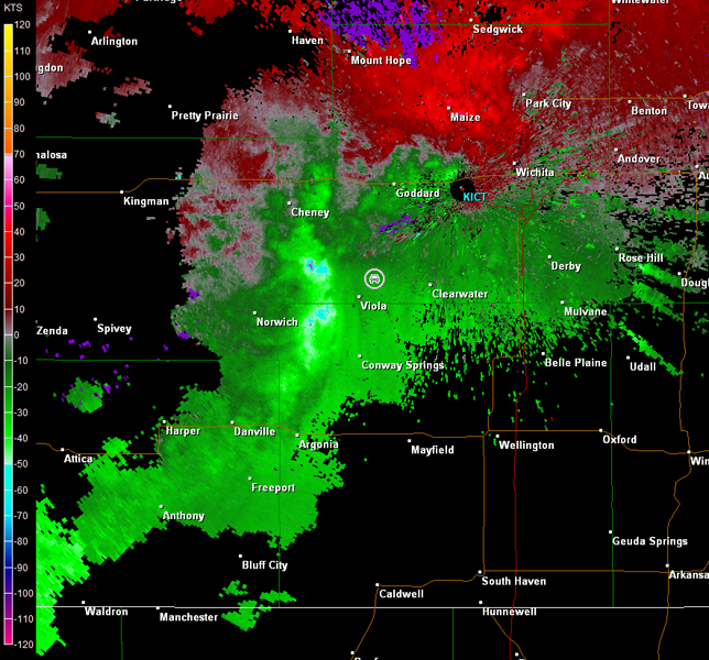
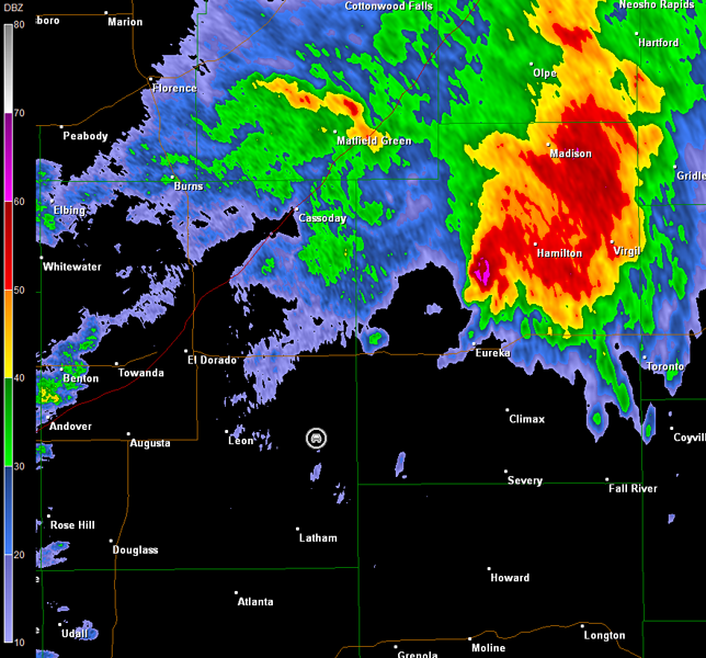
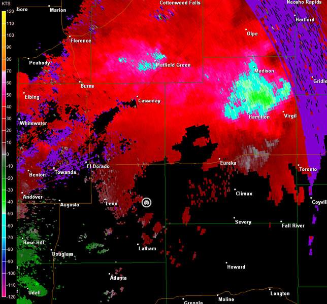
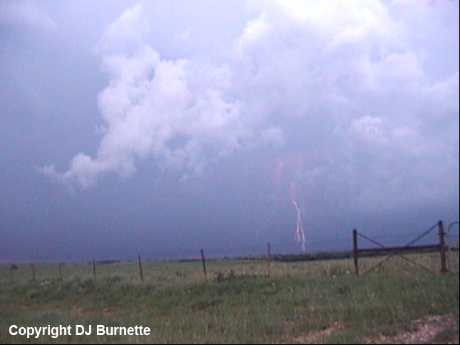
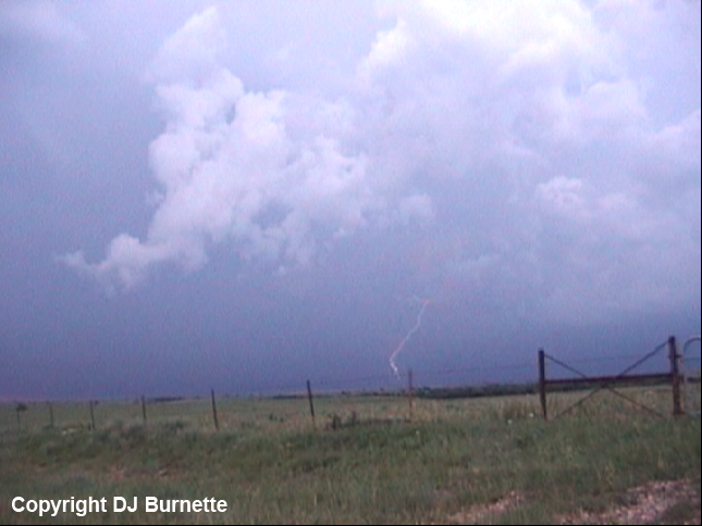
As the storm closed in on our location, we moved to the southern end to watch for any signs of organization. Meanwhile, the strongest winds had "Wichita" written all over them (see radar images below; car symbol denotes our location). Overall, there was no organization on the outflow dominant southern end of the storms (images below; view is south of Conway Springs, KS looking north).
Wichita, KS Storm Relative Velocity 0005Z
Wichita, KS Base Reflectivity 0010Z
Wichita, KS Storm Relative Velocity 0010Z
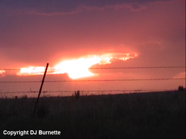
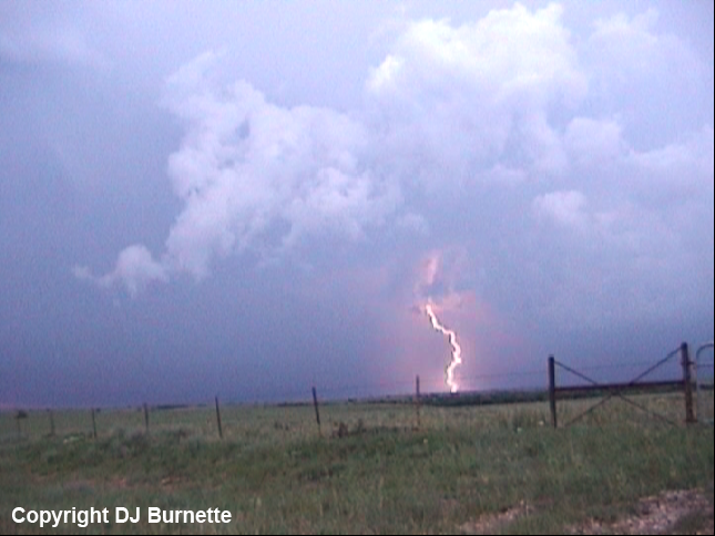
We continued to follow the tail end of the storm in case any organization would materialize, and heard reports of wind damage in downtown Wichita. We got stuck in traffic a couple of times, and this let the storm get away from us a bit. We eventually stopped on U.S. 400 east of Leon, KS to note the lightning and the sunset (images below). Radar images continued to indicate that the storm had high wind potential (images below; car symbol denotes our location).
Wichita, KS Storm Relative Velocity 0142Z
Wichita, KS Base Reflectivity 0146Z
Wichita, KS Storm Relative Velocity 0146Z
While high winds and wind damage continued to be reported from this storm, it was moving into an environment that had become cloudy during the afternoon. This led to a decrease in intensity, as we continued to follow it east on U.S. 400 on our way back to Fayetteville.