Storm Chase Log 24 May 2008
Chasers: Dorian J. Burnette, Steve Boss, Erin Boss, Malcolm Cleaveland, and Brett Floyd...joined in the field later by Andrew Gagnon and Jeff House
Preliminary Destination: southcentral KS...revised to south of Enid, OK in the early afternoon
Note: Images have been decreased in size. Click on an image to view a larger version.
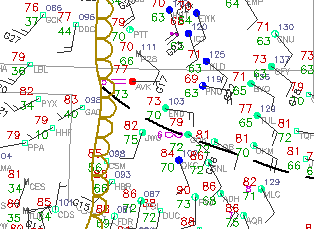
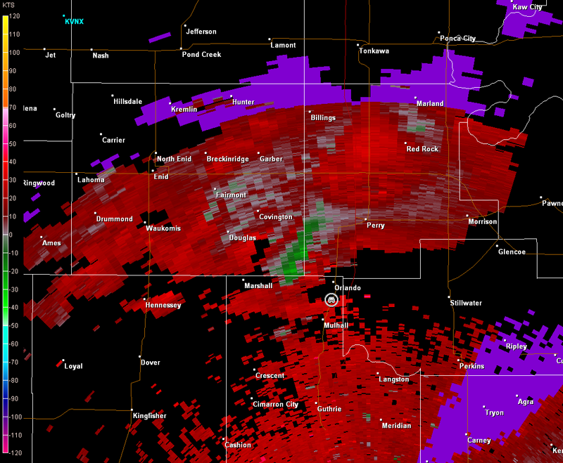
This event was a good example of how residual boundaries from morning thunderstorms can be big players the development of tornadic supercells later in the afternoon. A mesoscale convective complex (MCC) was moving across eastern KS and northeastern OK in the morning. This MCC left an outflow boundary in its wake from northwestern OK southeastward to westcentral, AR. It was possible that this boundary could drift north during the day. Thus, we moved north into southeastern KS through midday in case that occurred. However, by 12 p.m. CDT (17Z), I had discussions with Andrew Gagnon and Jeff House, and conditions were becoming increasingly clear that the outflow boundary was going to remain nearly stationary through the day. The surface map below depicts its location at 12 p.m. (outflow boundary denoted by the black dashed line, dryline denoted by the brown line with semicircles). Note the large temperature contrast on opposite sides of the outflow boundary and the backed (southeasterly) surface winds. It was completely cloudy north of the outflow boundary, but sunny and becoming very unstable to the south of it.
Andrew and Jeff noticed thunderstorms were beginning to develop near Enid, OK, and immediately left for that location. We turned south and moved quickly through Independence, KS, on our way toward northcentral OK. The storms from Enid northward were elevated in the relatively cooler air on the northern side of the outflow boundary. Nonetheless, they were producing massive hail up to baseball in size. Shortly after 1 p.m. CDT (18Z), a thunderstorm initiated near the intersection of the dryline and outflow boundary southwest of Enid. This storm exploded in intensity, quickly becoming a tornadic supercell. We were still a considerable distance away yet, and would not arrive in the area until approximately 4:30 p.m. CDT. Meanwhile, calls from Andrew and Jeff were amazing. This storm was a monster, producing one tornado after another.
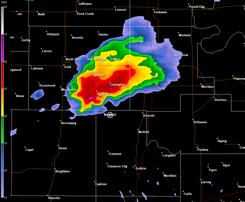
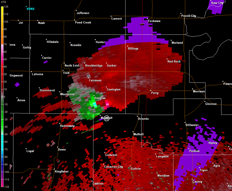
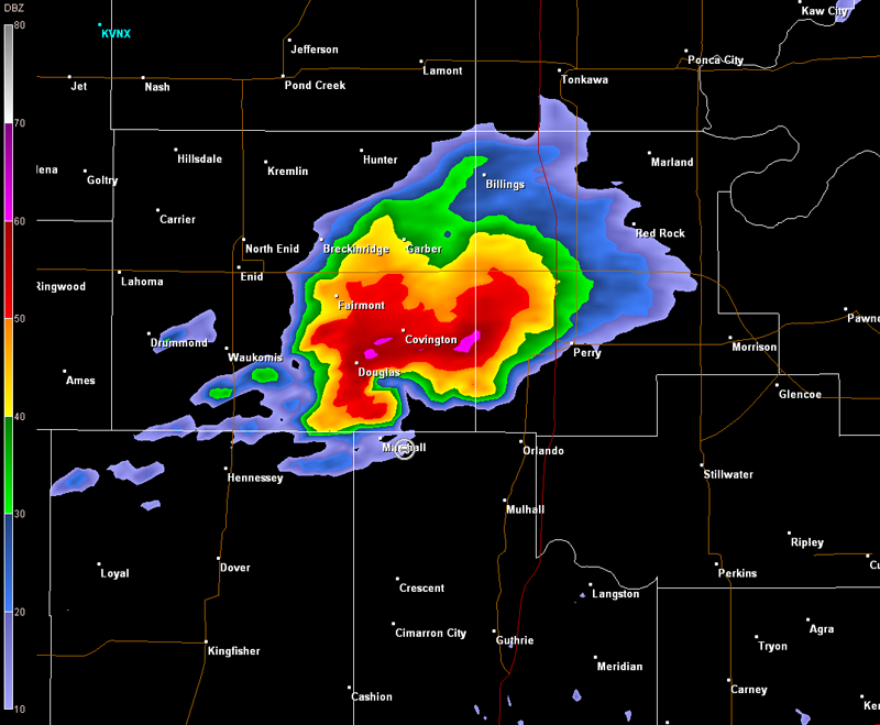
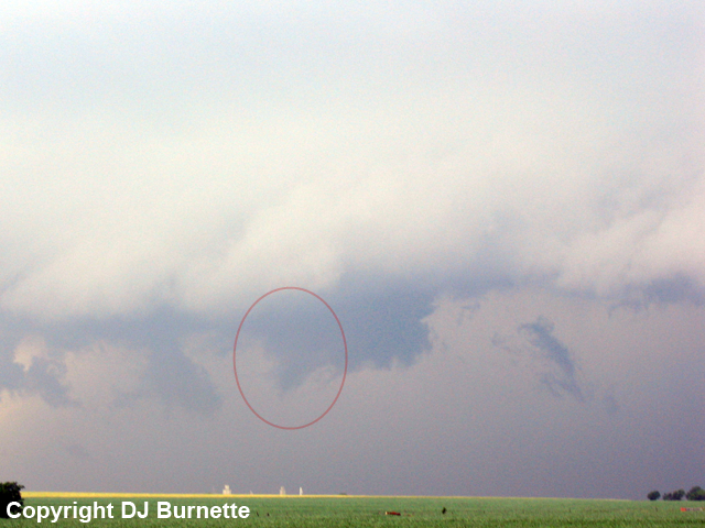
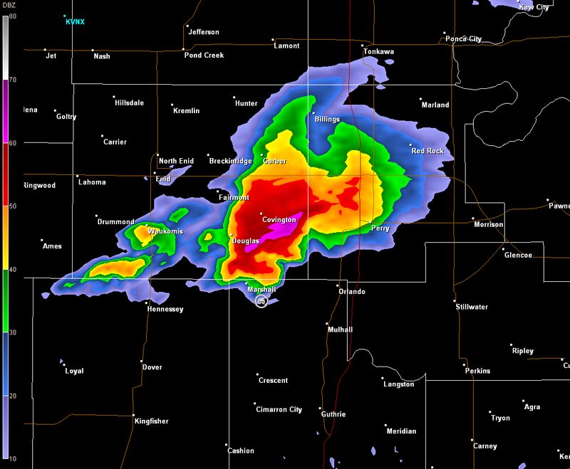
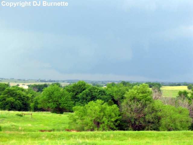
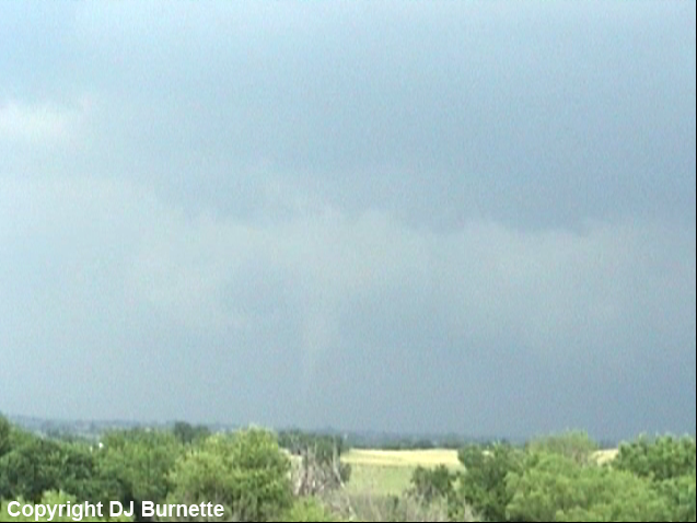
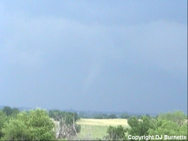
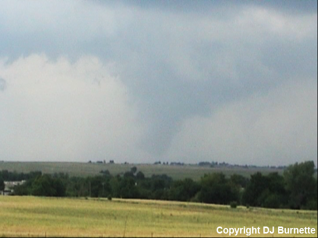
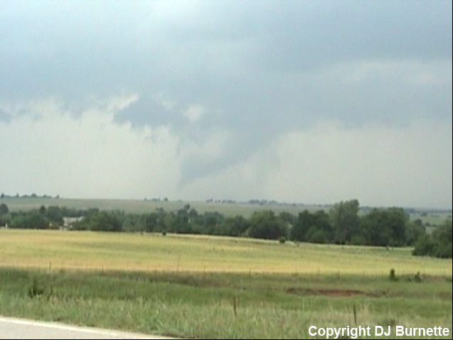
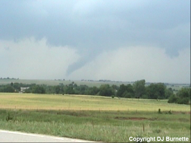
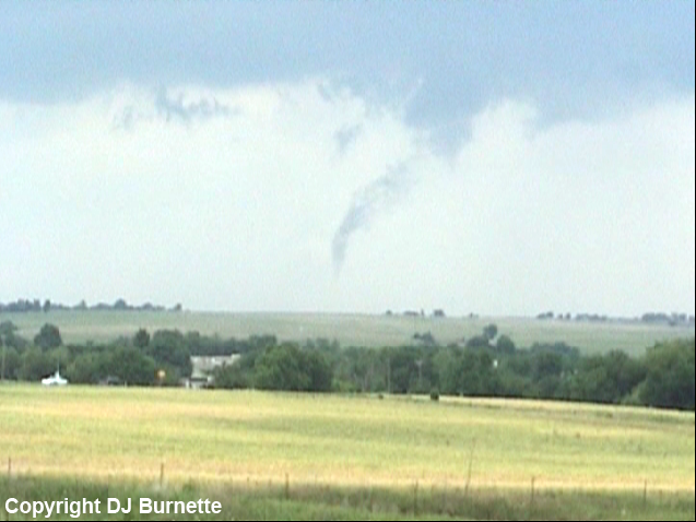
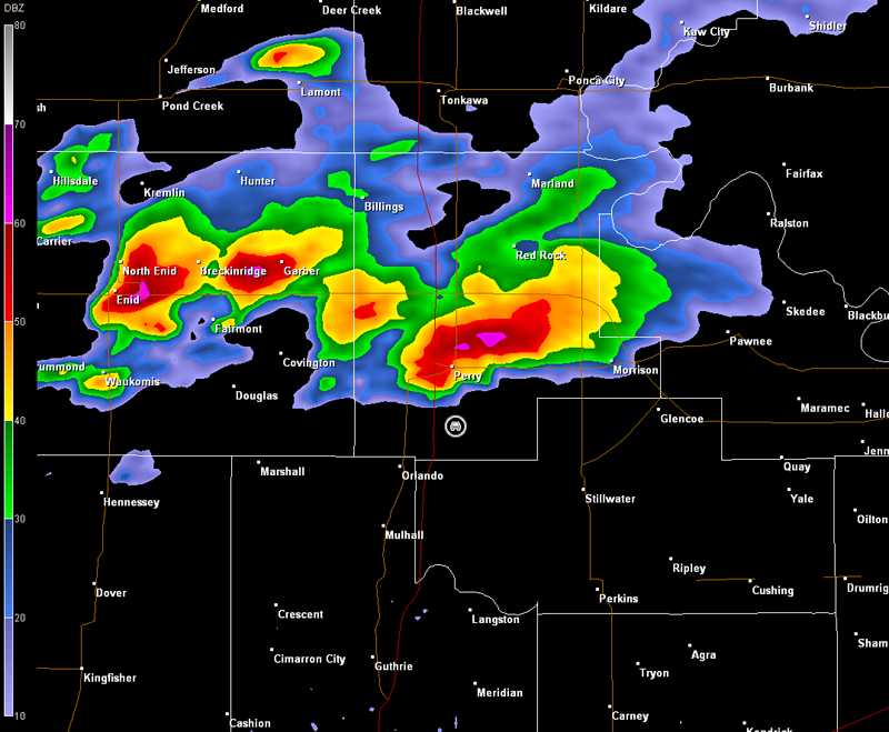
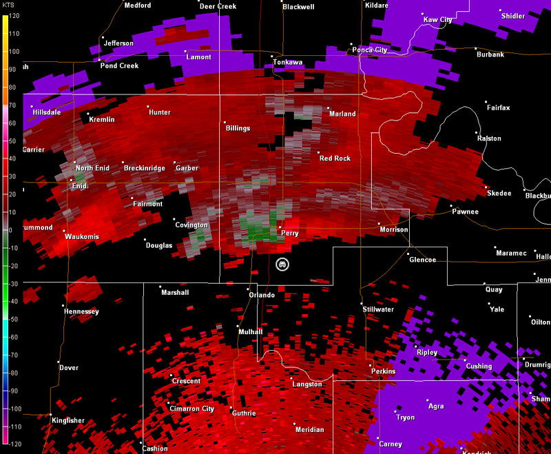
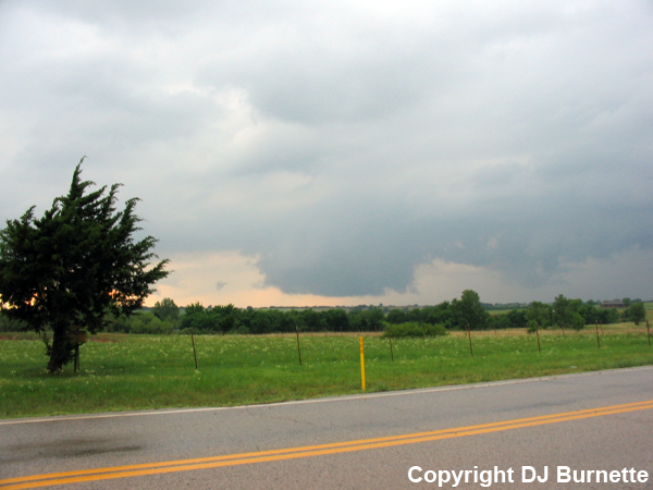
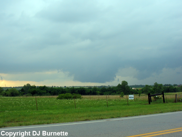
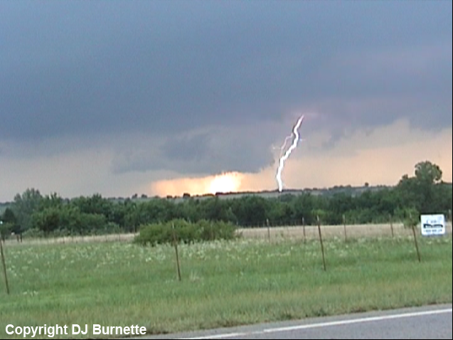
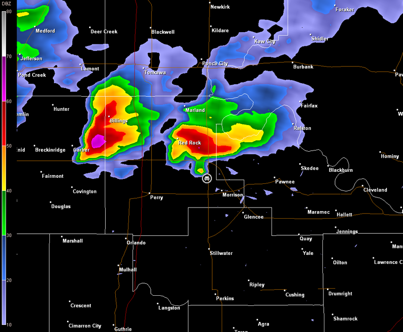
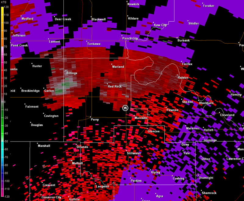
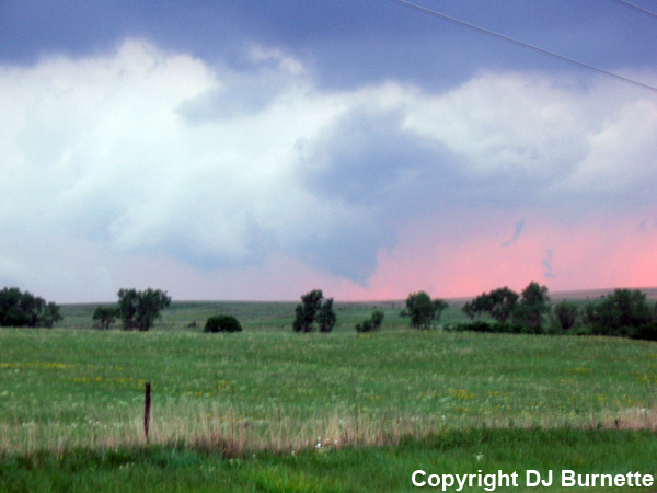
We arrived on the southwestern end of the storm shortly after 4:30 p.m. (2130Z). The main tornado region was wrapped up in rain and hail, and a plethora of chasers did not allow for much northward movement on OK-74. Therefore, we stopped on OK-74 east-southeast of Marshall, OK to observe the storm and noted a brief funnel cloud as we stopped. The storm was teasing us with transitions between inflow and outflow. It did produce another brief funnel cloud though. I snapped my digital camera just a bit late as it was decaying (image below with decaying funnel circled in red, view is east-southeast of Marshall, looking northwest). Radar imagery is included below (car symbol denotes our location).
Norman, OK Storm Relative Velocity 2140Z
Norman, OK Base Reflectivity 2144Z
Norman, OK Storm Relative Velocity 2144Z
Norman, OK Base Reflectivity 2149Z
Norman, OK Storm Relative Velocity 2149Z
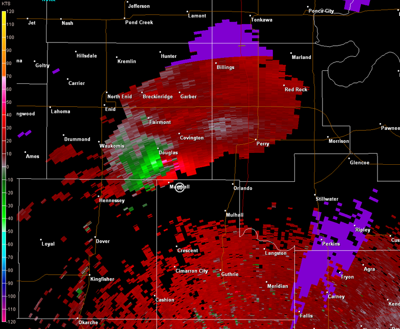
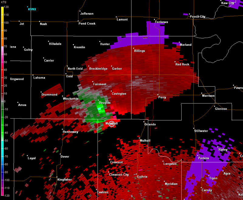
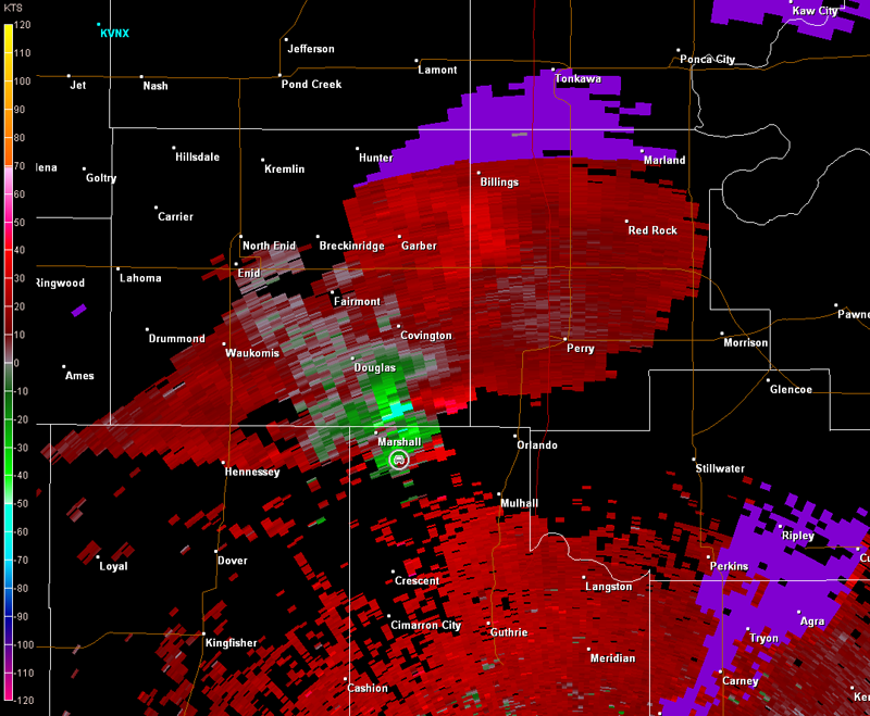
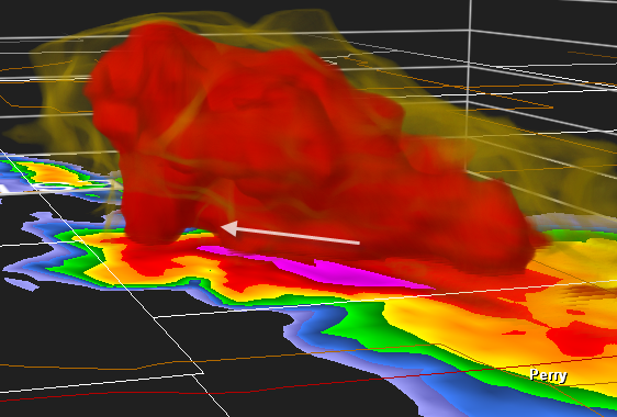
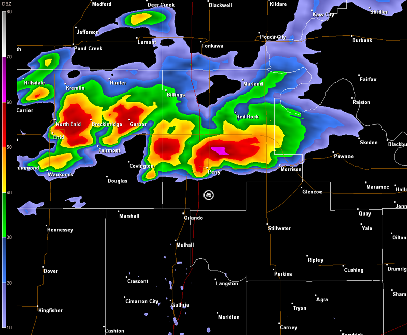
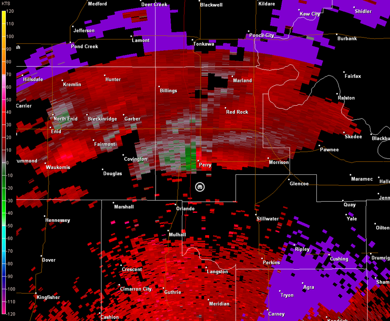
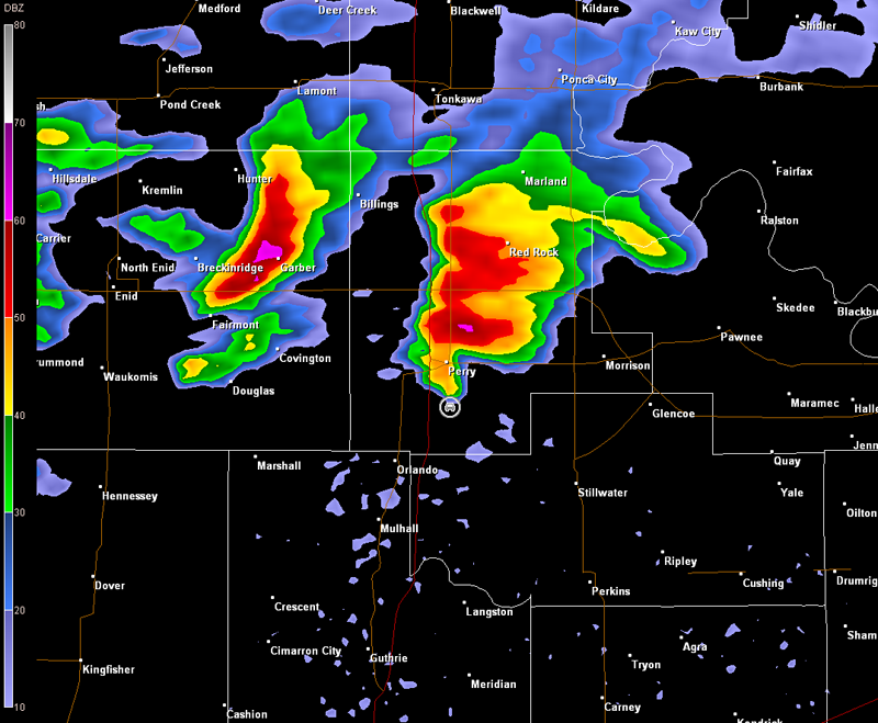
Eventually, we were hit with a bunch of outflow, which was not surprising considering our location relative to the storm (see radar images above, especially 2149Z). We moved back to the south and stopped briefly at the interchange of OK-74 and OK-62/51. At this time, we heard reports of a large tornado on the ground north of our location moving east, but this tornado was wrapped up in rain and hail. Radar images from this period of time are below (car symbol denotes our location). A 3D image of the storm constructed with GR2Analyst is shown below with lesser radar echos removed to see the structure of the storm (Perry, OK, is located in the lower right, view is looking west-northwest from southeast of Perry; arrow points to the approximate location of the large tornado at 2201Z).
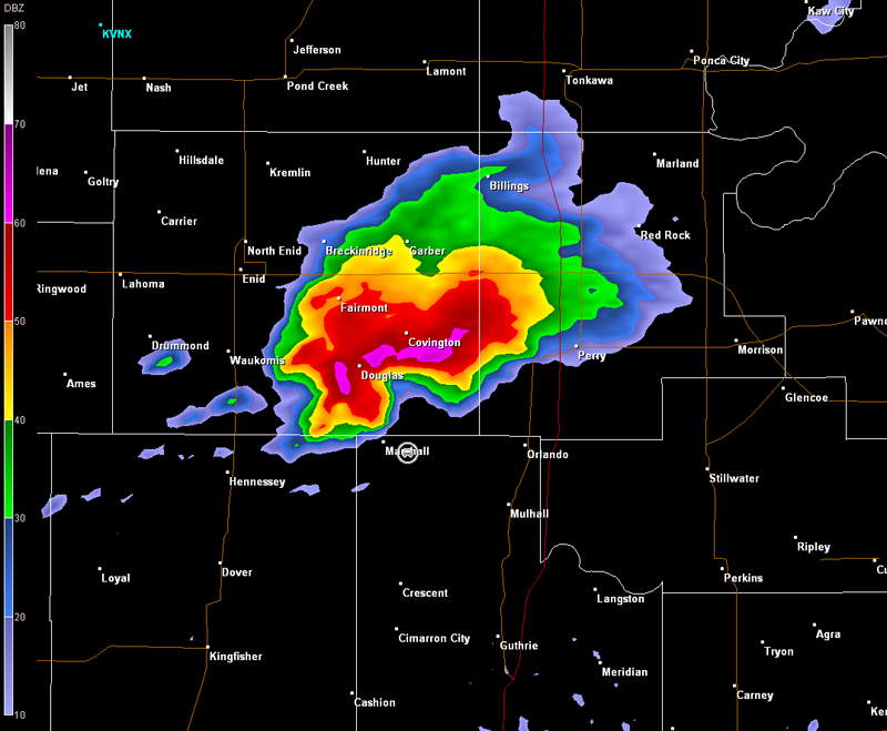
We were not able to get that tornado. However, we were watching what was going on to the southwest of that tornado in vicinity of Marshall (note another appendage to our northwest in the base reflectivity data above). This sort of thing is typical with long-lived, cyclic supercells...as one tornadic circulation occludes, another will develop. We moved east on OK-62/51 to stay out ahead of the storm and also hope to be able to move north a bit as well. We ended up just north of the town of Orlando, OK, off U.S. 77. Radar imagery (which I did have running during the storm chase) showed that we were in hook echo of the storm although the tornadic circulation on radar was not exceptionally tight (radar images below, car symbol denotes our location).
The main thing we observed was lots of rain and hail...no wall clouds. They could have been there though, and just obscured from view. A look at the radar and map showed that the storm had cutoff U.S. 77 farther to the north and the country roads in the area did not go far east before reaching a dead end due to I-35. The lack of good exit options and the proximity of the storm suggested that our location was a bit too close for comfort, especially if the storm would take a hard right turn. We may have been alright there, but I wasn't going to play any games. Thus, I didn't hesitate to have us bail out of there.
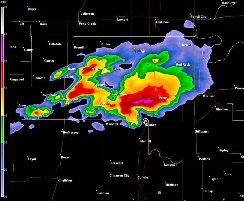
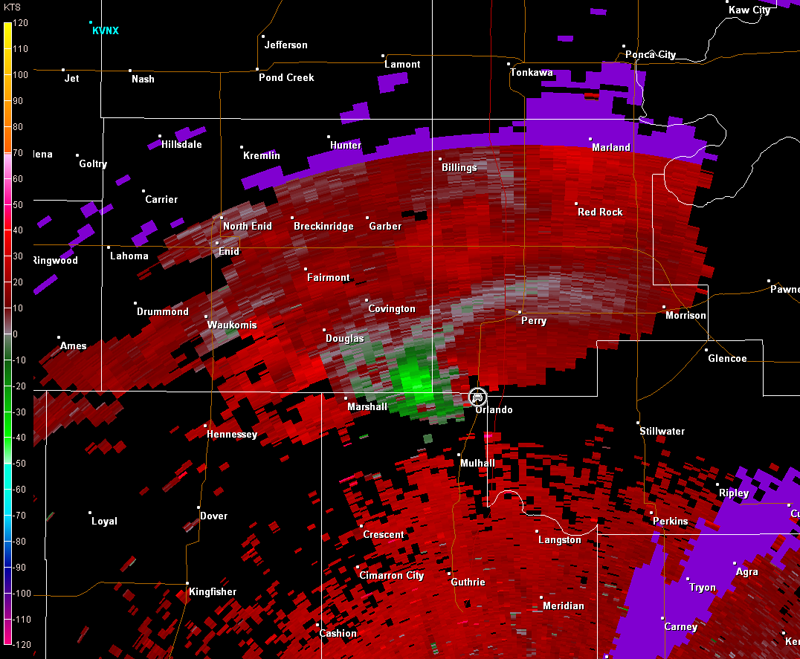
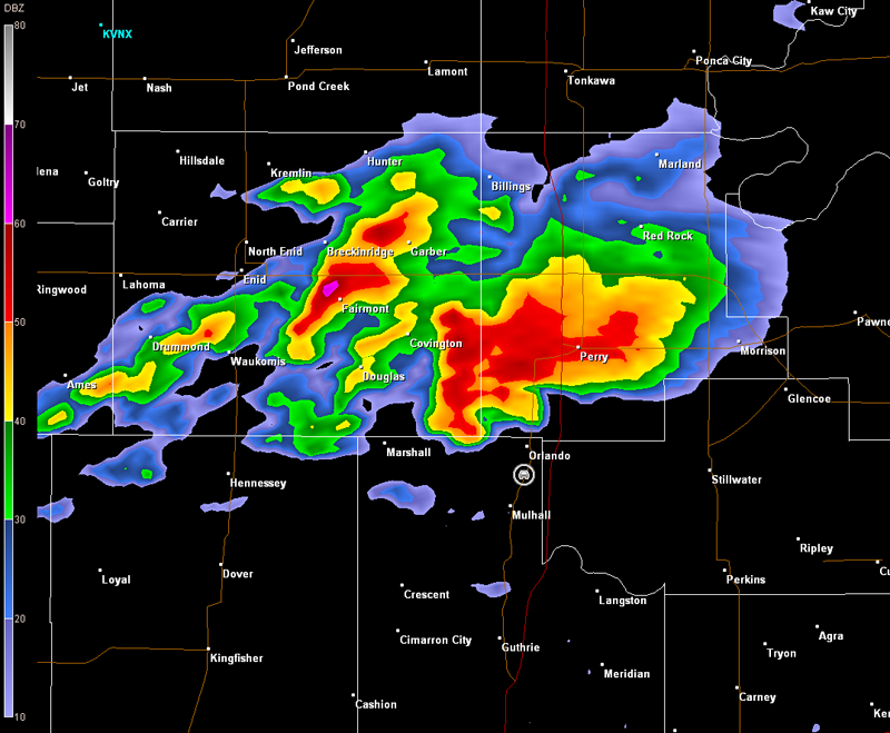
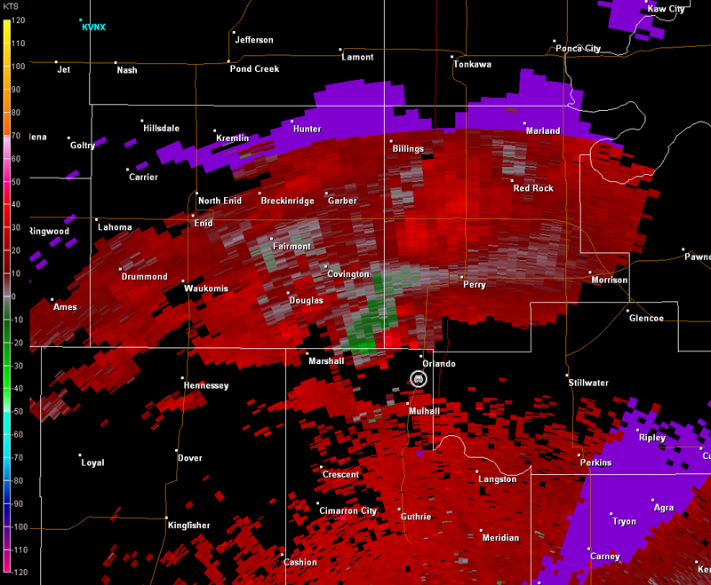
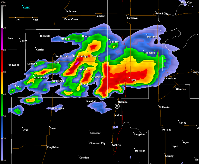
We eventually ended up just east of the U.S. 77 and OK-62/51 interchange observing the storm to our north and northwest along with a plethora of other storm chasers and Oklahoma City TV station helicopters. The radar imagery below shows two appendages in the base reflectivity, which is important in terms of what we observed at this location (radar images below, car symbol denotes our location). Our first few minutes at this location was spent observing a large wall cloud off to the north (first image below, view is south of Orlando, looking north). A short time later, two tornadoes developed, one to our north (second and third images below), the other to our northwest (final images below). Unfortunately, there were contrast issues due to our location.
Norman, OK Storm Relative Velocity 2252Z
Norman, OK Base Reflectivity 2256Z
Norman, OK Storm Relative Velocity 2256Z
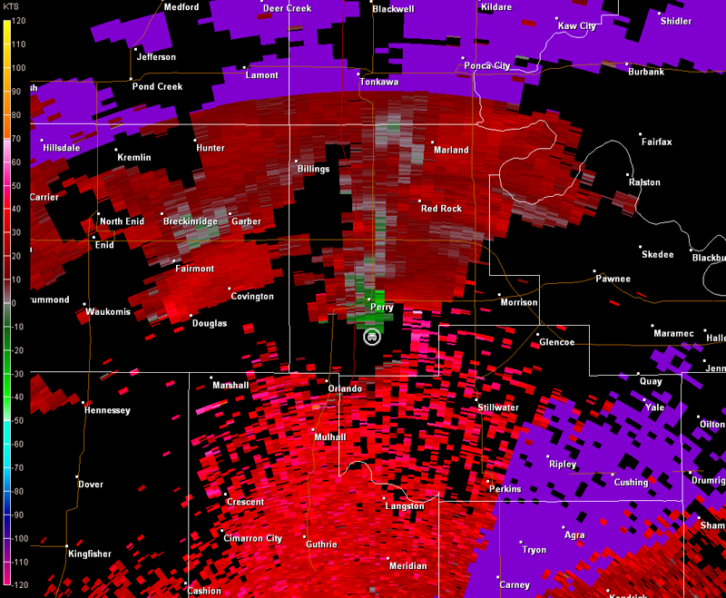
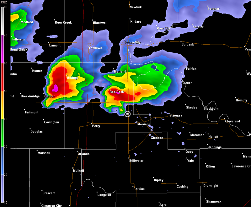
We followed the storm east on OK-62/51 and then north on OK-86 making a few stops along the way. We also ran into Andrew and Jeff who filled us in on their experiences with this storm, including the fact that they lost count how many tornadoes they observed. They continued to chase with us as we followed the storm north on OK-86 toward Perry. We stopped south of Perry/northeast of Orlando, and watched a wall cloud off to our northwest (images below, view is south of Perry, looking norhwest). The storm was still producing off and on wall clouds, and tornado reports were still being received. However, the tornado reports were becoming less frequent. The storm's radar presentation was also beginning to decline, although, the rotation was still decent (images below, car symbol denotes our location).
Norman, OK Storm Relative Velocity 2351Z
Norman, OK Base Reflectivity 2356Z
Norman, OK Storm Relative Velocity 2356Z
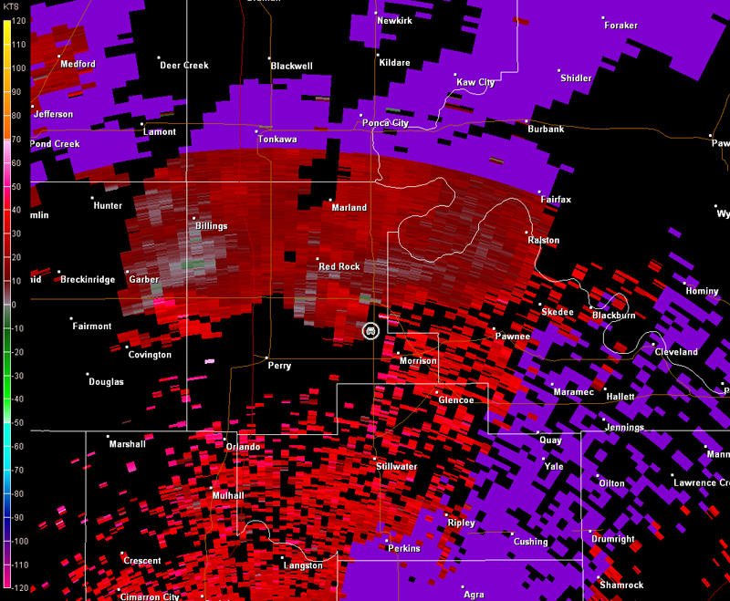
The rotation was becoming more focused in vicinity of Perry (note this in the 2356Z velocity data above). Thus, we began to look for a way around Perry, but alas, the road selection was not good in our immediate vicinity. Sunset was slowly approaching too. We decided the best thing to do was to head south and then east. This would take us out of our way a bit, but it would be the fastest way to get around Perry, which was pretty much cutoff by the storm. Andrew and Jeff decided to call it a day, since they were going in a different direction toward home than we were. We moved a bit farther north on OK-86 to find a good spot to turn around. A potent downburst occurred as we were turning around (image below note the curved rainfoot, view is south of Perry, looking north). Radar data from this time are also below (car symbol denotes our location).
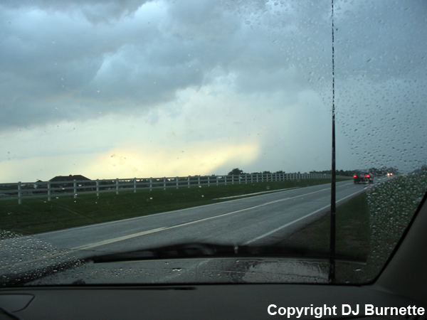
We had to take a big detour, but we did catch back up with the storm on U.S. 177 northwest of Morrison, OK, just as it was about to get too dark to see well. We observed one wall cloud and a possible funnel cloud (image below, view is northwest of Morrison looking northwest), but this quickly dissipated. Radar data from this time are also below (car symbol denotes our location).
Norman, OK Storm Relative Velocity 0112Z
Norman, OK Base Reflectivity 0116Z
Norman, OK Storm Relative Velocity 0116Z
Approximately eight hours since it first developed, this long-lived supercell was finally loosing its tornadic characteristics. Given this and the fact that it was getting quite dark, we began the journey back to Fayetteville. No doubt this was a very interesting and successful chase, but we lost the chance to see a few more tornadoes by going into KS first. I am kicking myself for playing things safe regarding the position of the outflow boundary, and will remember this for next time. The other big thing on this day was the incredible amount of storm chasers. I have never seen that many chasing one storm! Such is the case though when you have a lone, massive tornadic supercell near a large metro area like Oklahoma City, which also happens to house one of the world's best severe storms meteorology schools in Norman. Thanks to Lisa Teachman at KMBC-TV in Kansas City for a morning discussion about the event. Thanks to Andrew Gagnon and Jeff House for discussions before and during this event and to Scott Breit at WeatherData for nowcast information.