Storm Chase Log 1 May 2008
Chasers: Dorian J. Burnette, Andrew Gagnon, Jess Gagnon, Monica Yeamans, and Pete Yeamans
Preliminary Destination: Independence, KS
Note: Images have been decreased in size. Click on an image to view a larger version.
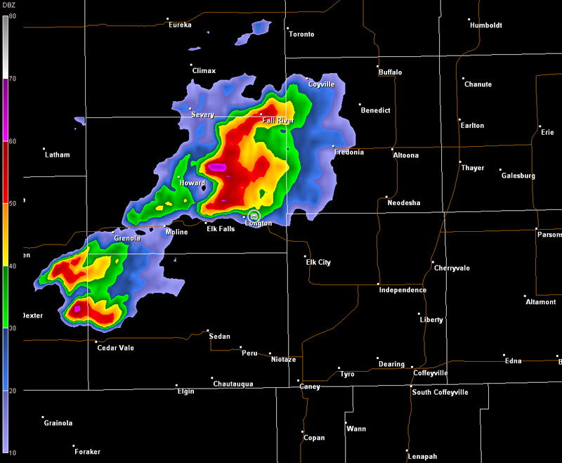
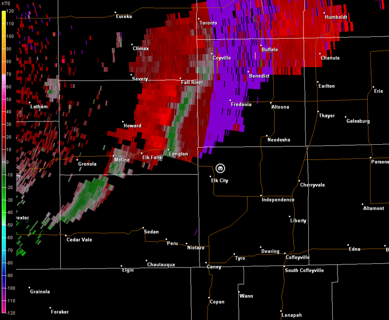
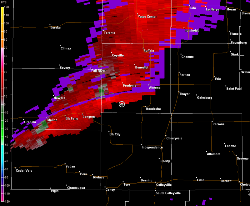
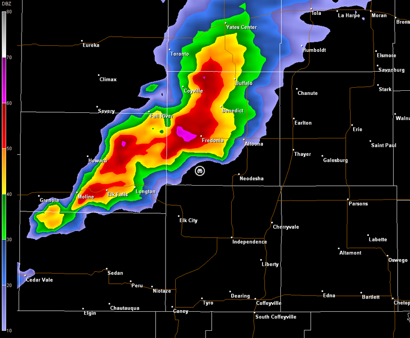
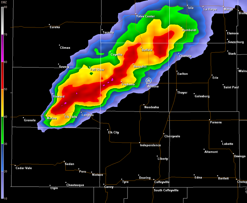
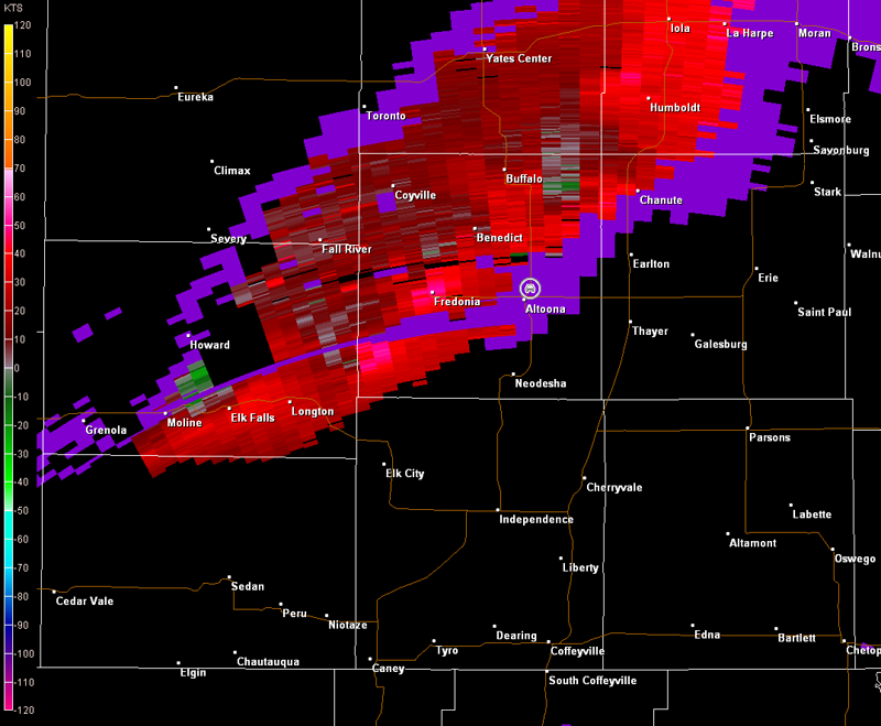
Thunderstorms were already developing by the time I arrived in Independence, KS. These storms were near Longton, KS, west of Independence. Thus, I made a brief stop in Independence to refuel, and then proceeded west toward the developing thunderstorms. I interecepted the thunderstorms near Longton, and picked a spot just east of the town to sit and watch the rain-free base of the storm for any possible organization (image below, view is east of Longton on U.S. 160, looking west). Radar imagery is also included below (car symbol denotes my location).
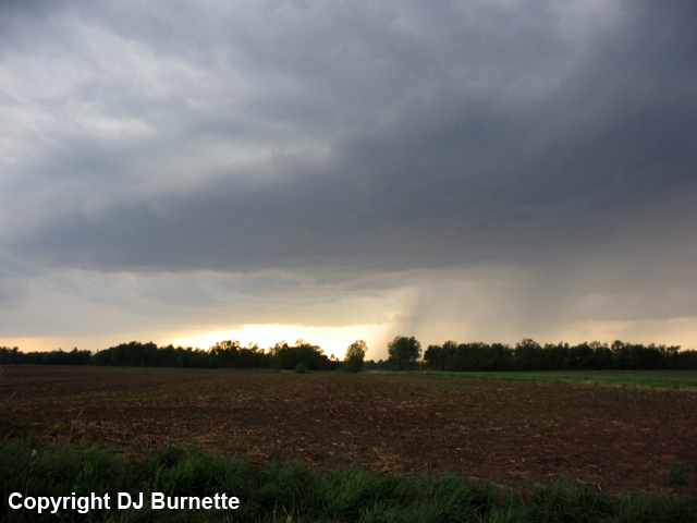
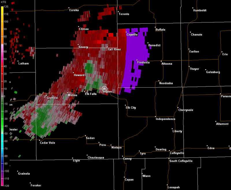
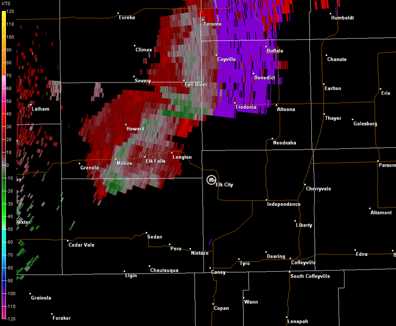
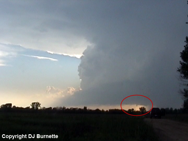
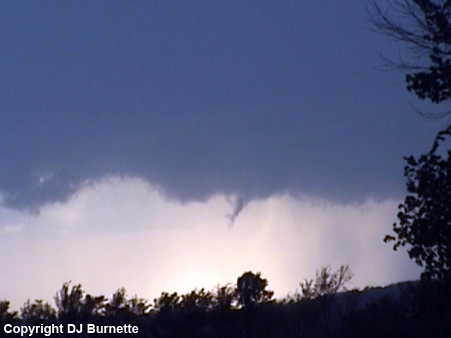
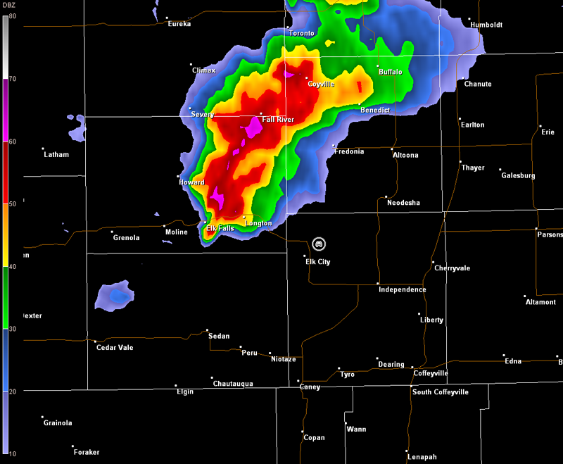
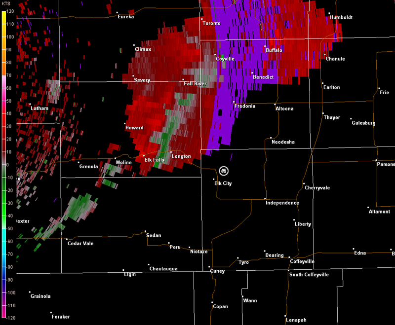
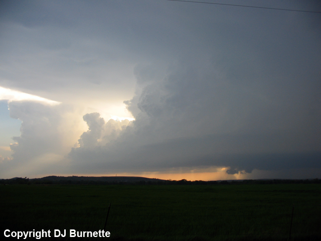
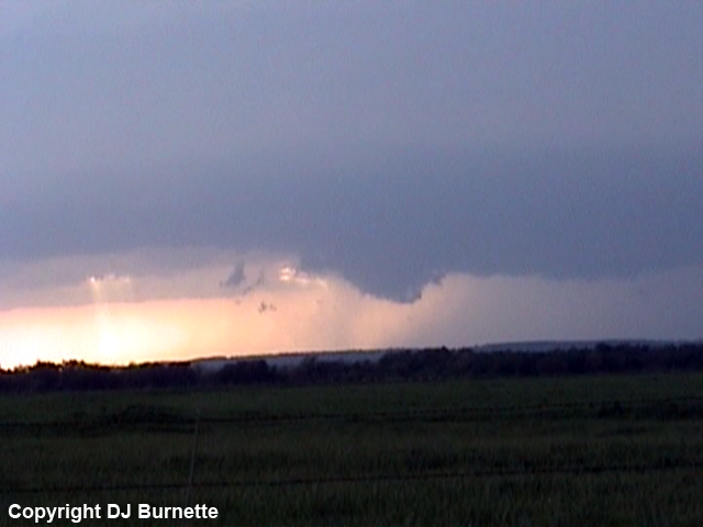
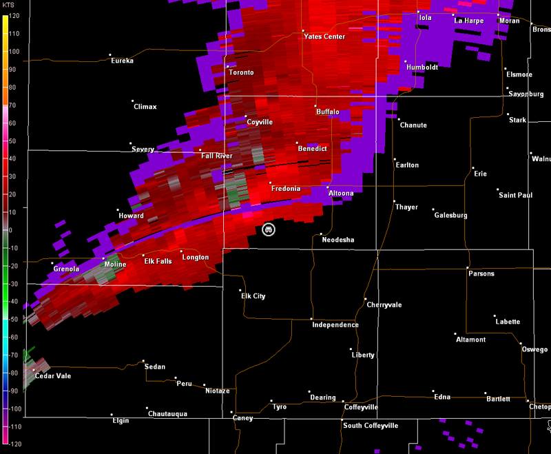
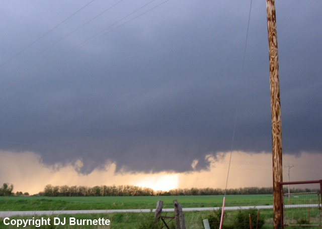
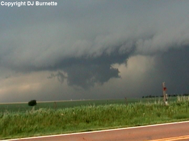
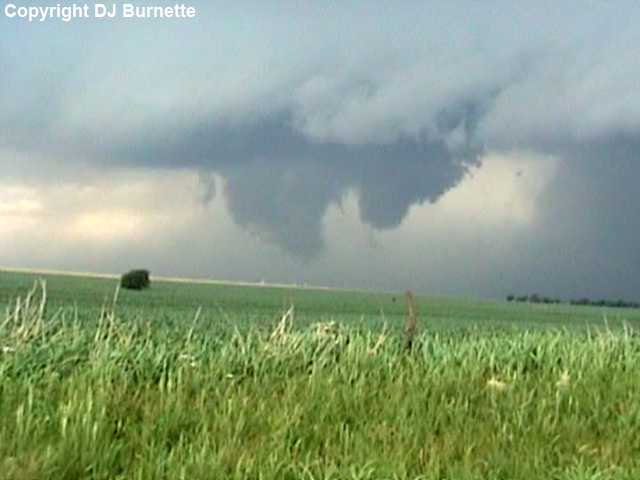
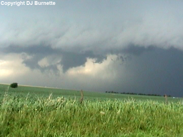
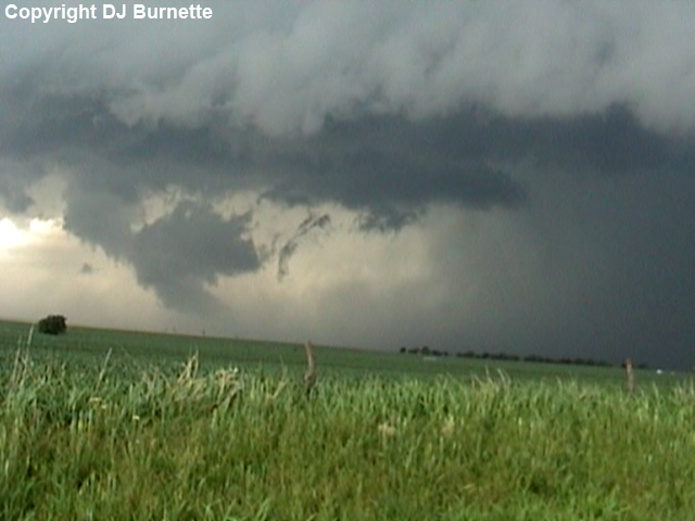
Little organization was observed. Andrew, Jess and her folks joined me in the field a short time later. We kept watch on the rain-free base of this storm, but also noted other development occurring farther to the southwest. We decided to move a bit farther to the east to get a little farther ahead this additional development. We noticed some rapid organization to the new storm as we approached Elk City, KS. We found a good spot just west of the town to sit and watch the storm make several attempts at tornadogenesis (images below, view is approximately one mile west of Elk City, looking west). The trend with the storm at this time was to produce off and on wall clouds (note the circled area in the first image) with the occasional weak funnel (last image below), but these would be short-lived and then fall apart. Links to the radar imagery are also below (car symbol denotes our location).
Wichita, KS Storm Relative Velocity 2325Z
Wichita, KS Base Reflectivity 2330Z
Wichita, KS Storm Relative Velocity 2330Z
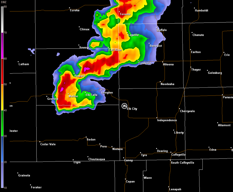
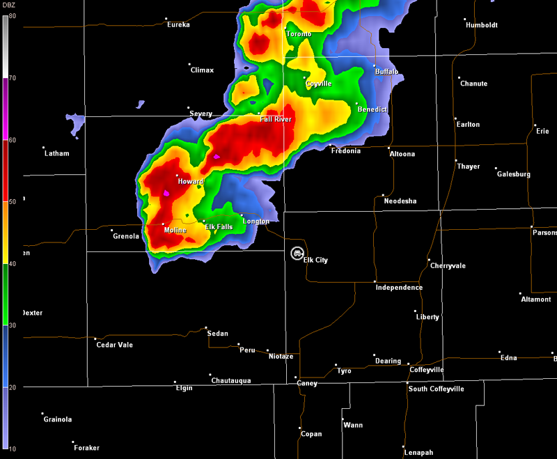
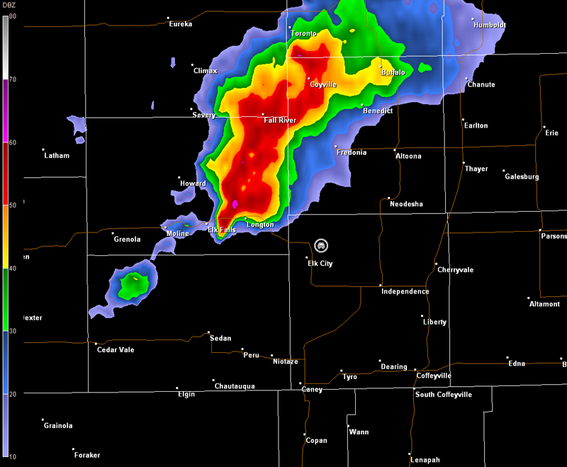
The storm continued to move northeast and our view became obstructed, so we moved east through Elk City and then stopped northeast of the town just off K-39. The storm continued to develop wall clouds off and on to our west. Each wall cloud would be around for a matter of minutes though and then dissipate. No funnels were observed (images below, view is northeast of Elk City near K-39, looking west). Radar imagery is also included below (car symbol denotes our location).
Wichita, KS Storm Relative Velocity 2348Z
Wichita, KS Base Reflectivity 2353Z
Wichita, KS Storm Relative Velocity 2353Z
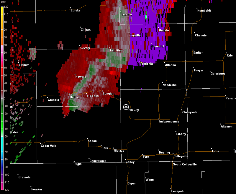
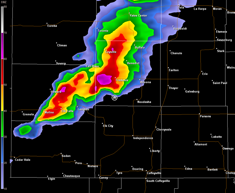
Meanwhile, a tornado warning was issued on the storm with a tornado reported near Longton. We had a clear view of this part of the storm and failed to see any tornado. However, we were quite a bit to the east (see our position relative to Longton in the radar images above), so a weak ground swirl could have easily occurred without us seeing it. I made a call to KSNW-TV in Wichita to let them know what we had observed so far. Dave Freeman informed us about additional tornado reports farther to the north of where we were looking. We continued north on a dirt road running parallel to K-39 and noted another wall cloud with a possible funnel cloud farther to our north toward Buxton and Lafontaine, KS. We joined back up with K-39, and then moved north toward Lafontaine. We caught up with the decent-sized wall cloud north of Lafontaine (first image below, view is north of Lafontaine on K-39, looking west). Some strong rotation appeared briefly with attempts at the development of a funnel cloud (second and third images below, view is north of Lafontaine, looking west). Radar imagery is also included below (note the switch to Tulsa's radar due to the storm's location, car symbol denotes our location). Unfortunately, the velocity data are range folded in a key area of the storm.
Tulsa, OK Storm Relative Velocity 0018Z
Tulsa, OK Base Reflectivity 0022Z
Tulsa, OK Storm Relative Velocity 0022Z
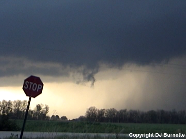
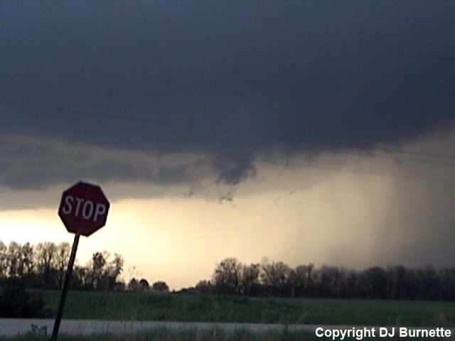
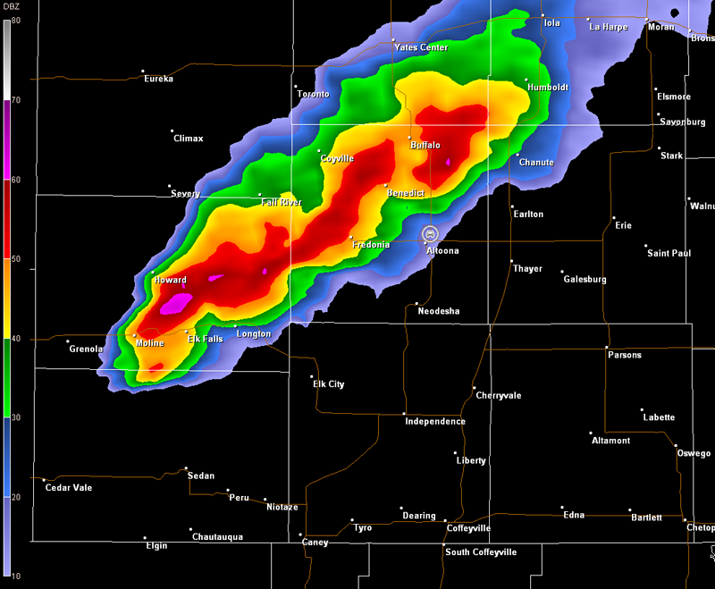
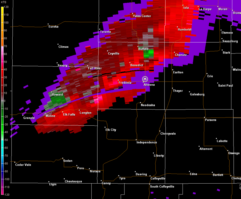
We continued to follow the storm farther north, and made another stop on U.S. 75 north of Altoona, KS. The strongest rotation and brief tornado reports were occurring farther to our north, but this area was completely wrapped in rain and hail (see radar data below, car symbol denotes our location). Thus, we decided against venturing into that mess. We did observe a wall cloud rapidly decaying off to our northwest though (first left image below, view is north of Altoona, looking northwest). However, a downburst was cutting off inflow to this part of the storm (note the rain being forced from the right to left in the images below, view is north of Altoona, looking northwest). The cloud formations could easily be mistaken for something tornadic in the second image from the left. However, no rotation was ever observed, and those formations quickly transformed into a mess of outflow scud clouds (final two images below).
Tulsa, OK Storm Relative Velocity 0100Z
Tulsa, OK Base Reflectivity 0105Z
Tulsa, OK Storm Relative Velocity 0105Z
Darkness was quickly approaching, so we decided to end the chase at this point. The theme for these late-afternoon and early evening thunderstorms in KS was a constant redevelopment to the southwest, which seemed to be interfere with the evolution of supercell storms ongoing farther up the dryline. Perhaps the forcing was just a bit too linear across KS. Moisture could have also been an issue because it was slow to return north in the days leading up to the event. This could have been why supercells would develop wall clouds, but tornado formation was difficult. Conditions were better just a bit to the south across Pawnee and Osage Counties in OK, where larger, longer-lived tornadoes occurred. The moisture supply continued to improve through the evening hours and allowed for the development of a destructive bow-echo to move through Kansas City with reports of tornadoes late in the night. Thanks to Kate Danna at WeatherData for a morning discussion. Thanks to Dave Freeman at KSNW-TV, Rich Sleezer at Emporia State, and Cory Phelps for nowcasting support.