Storm Chase Log 5 May 2007
Chasers: Dorian J. Burnette, Andrew Gagnon, Jess Gagnon, and Jeff House
Preliminary Destination: Woodward, OK
Note: Images have been decreased in size. Click on an image to view a larger version.
I departed Fayetteville, AR shortly after 10 a.m. CDT bound for Woodward, OK. Severe thunderstorms were already going in Kansas with additional development down the dryline into Beaver County, OK, by the time I arrived in Woodward. Andrew, Jess, and Jeff had departed Wichita and were observing the storms just across the KS/OK line. They came down into OK, and I met up with them in Freedom, OK. We then traveled to Alva, OK, for a food stop before deciding whether to stay south or head north. The general trend continued--storms initiated in Beaver County and then became severe as they moved north into KS. Thus, we decided to move north into KS and then west on U.S. 160 toward Coldwater, KS. Unfortunately, the road network was disrupted in and around Greensburg, KS, due to the previous night's killer EF-5 tornado, and that left us with more limited options.
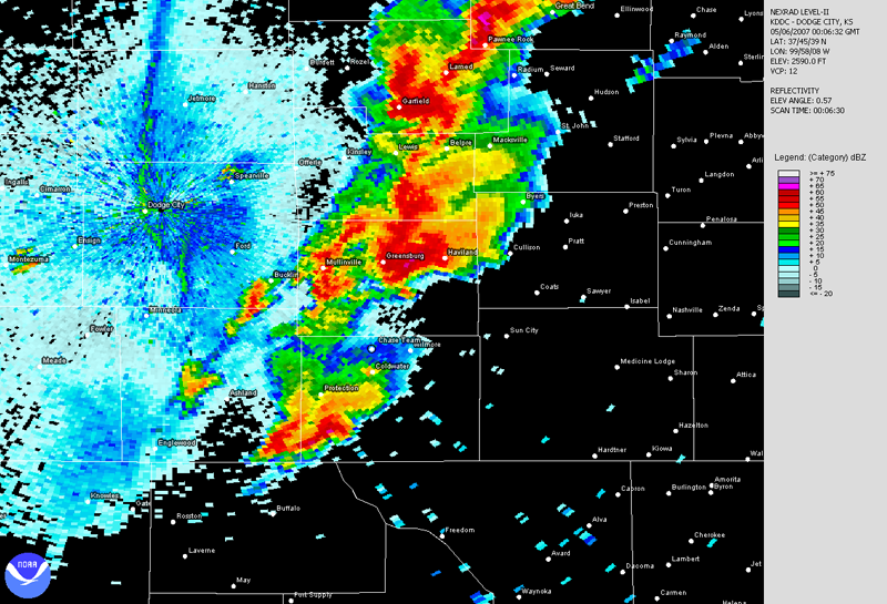
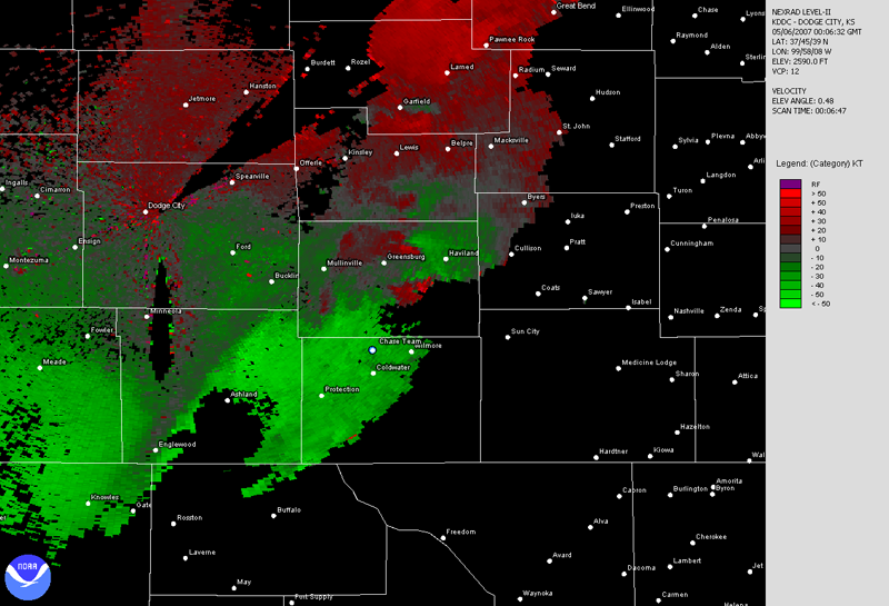
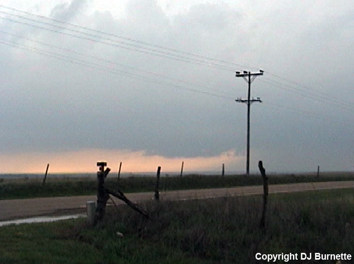
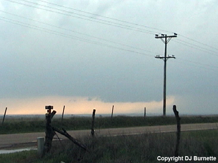
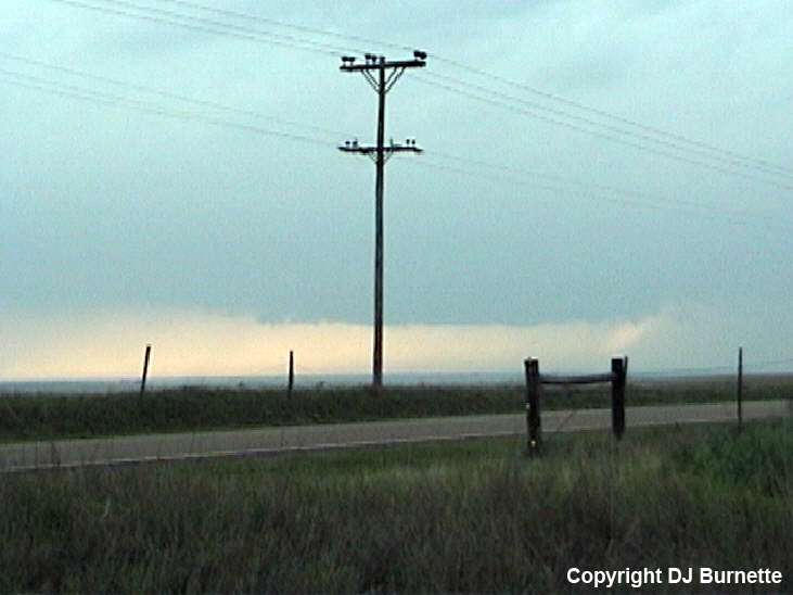
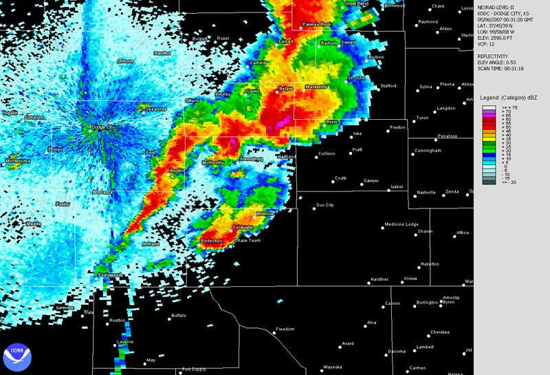
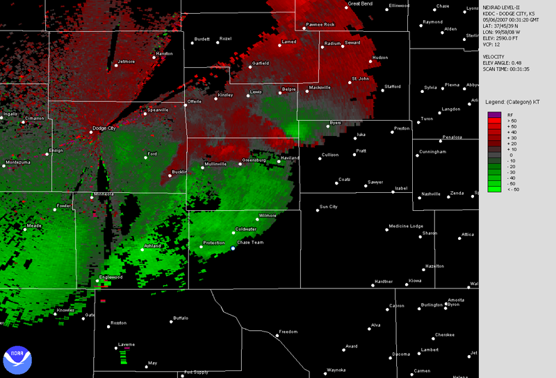
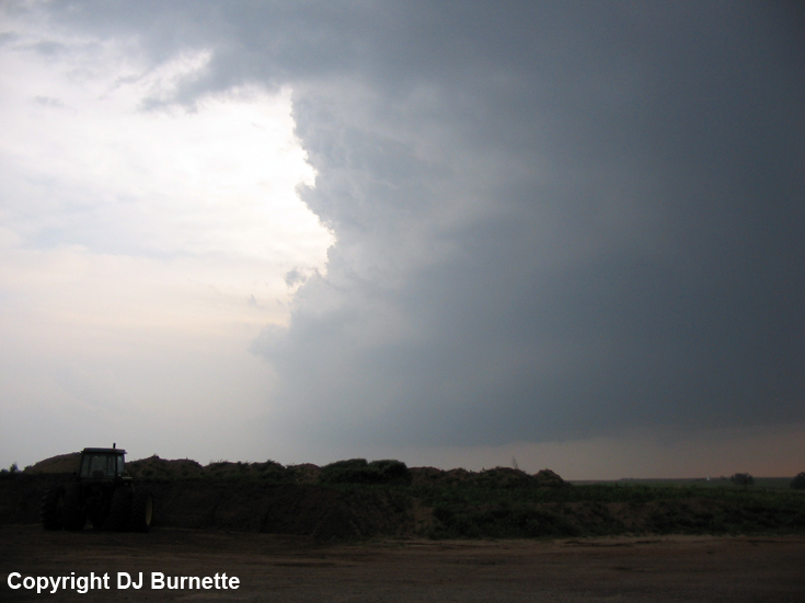
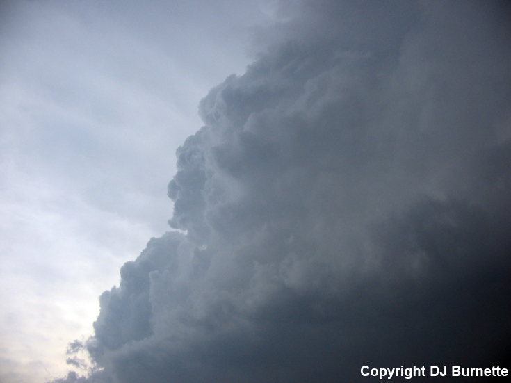
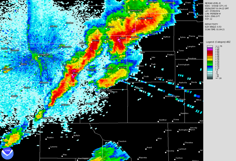
We moved north on U.S. 183 once we arrived on the northside of Coldwater. We stopped about 5 miles north of Coldwater in far northern Comanche County in order to view a wall cloud that had developed off to our northwest (images below; view is about 5 miles north of Coldwater, looking northwest). A rain-foot can also be seen to the right of the wall cloud indicating high straight-line winds. Radar imagery is also included below (blue/white dot denotes our location).
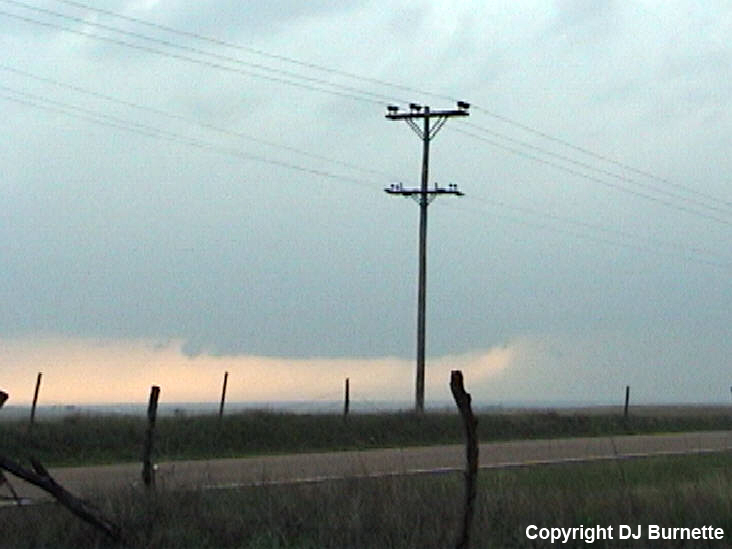
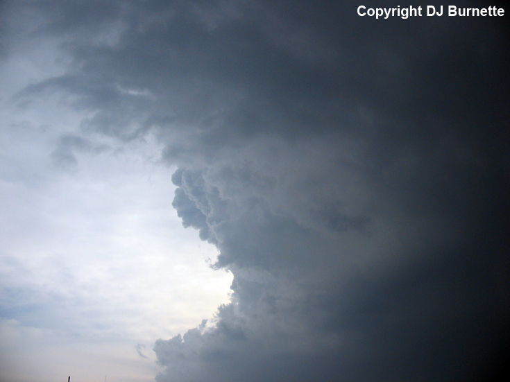
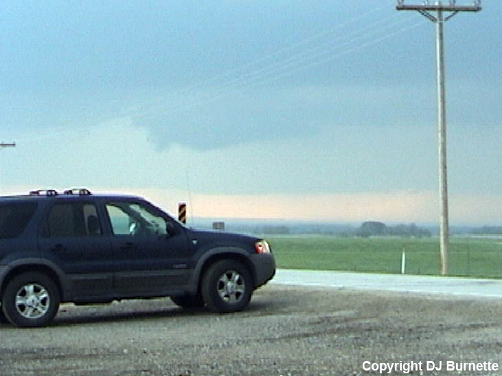
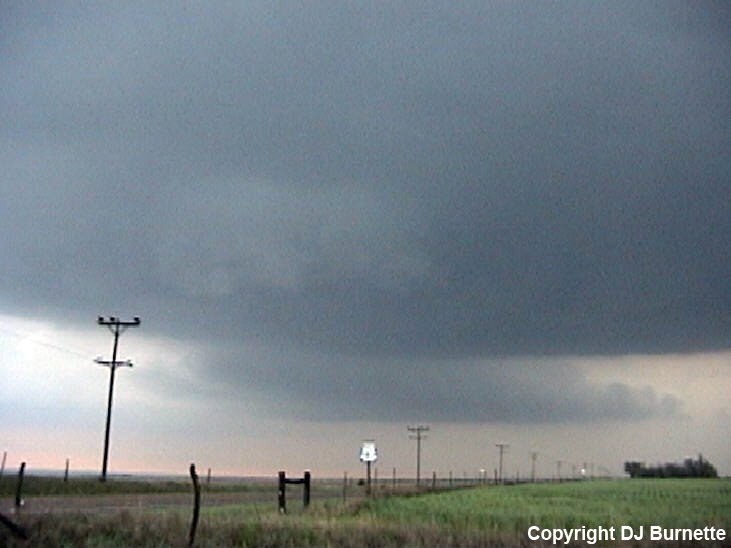
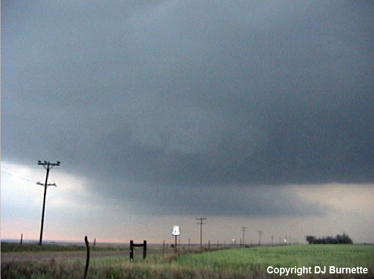
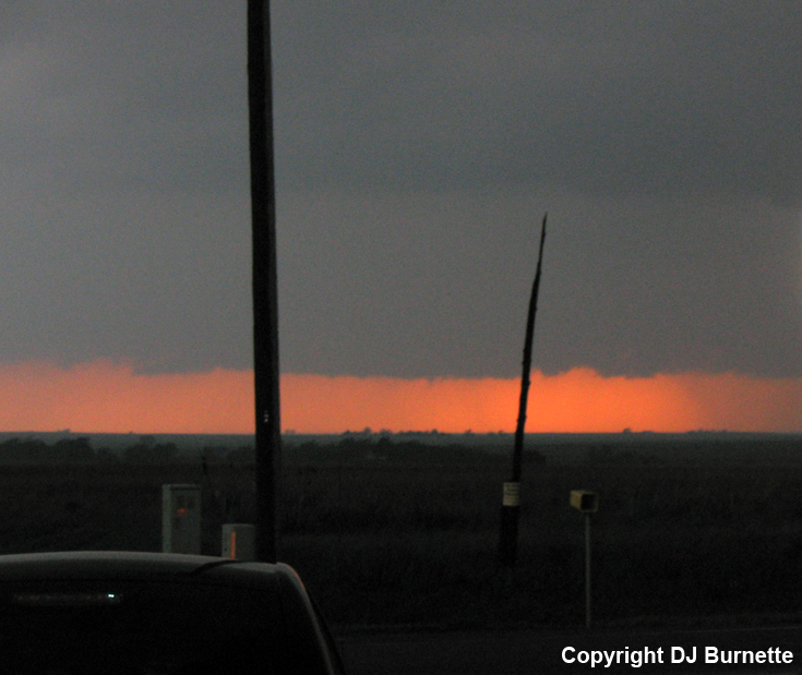
The main tornadic area of the storm was off to our northeast in Kiowa County southeast of Greensburg (see radar data above). We knew that we would be out of luck trying to catch that storm due to road closures in and around Greensburg. Fortunately, the storm crossed U.S. 54 east of Greensburg. We moved south to another storm that had developed in the OK Panhandle and was approaching Coldwater from the southwest. We stopped above 5 miles south of Coldwater at the intersection of U.S. 83 and KS-1 to observe the growing storm to our west (images below; view is 5 miles south of Coldwater, looking west). The storm also produced a weak wall cloud/lowering for a short-time (final image below). Radar images are also included below (blue/white dot denotes our location).
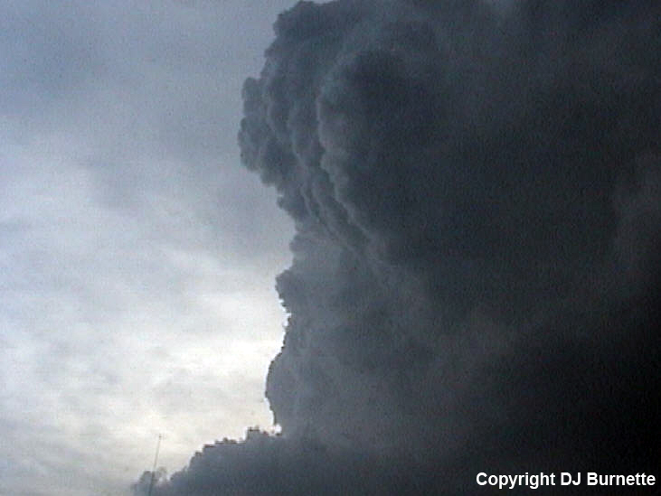
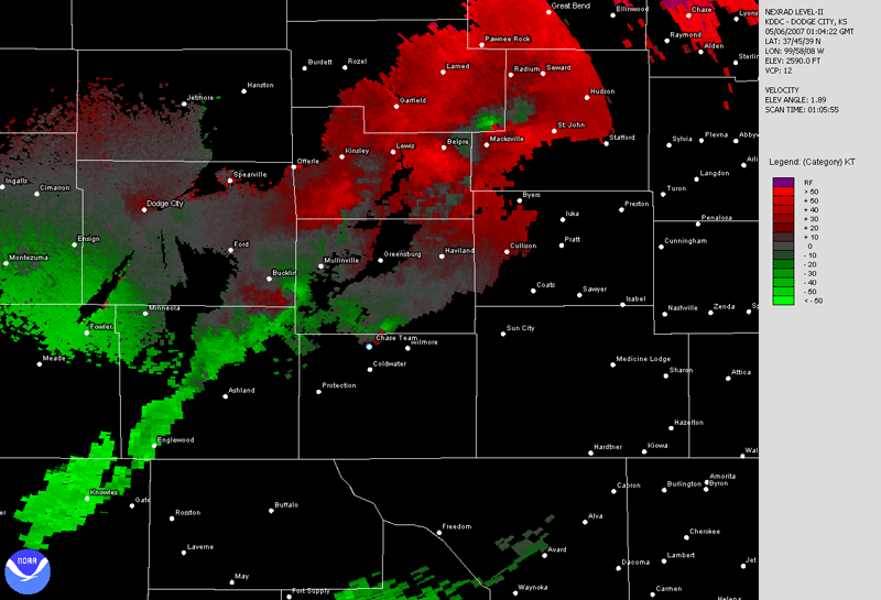
We followed the storm back north through Coldwater and stopped almost underneath its mesocyclone about 5 miles north of Coldwater. Once again, the storm appeared to get its act together again with strong inflow and good rotation observed. A small wall cloud also developed (images below; view is 5 miles north of Coldwater, looking north). Radar images are also included below (blue/white dot denotes our location). Do note that the velocity data are from a slightly higher tilt revealing the mid-level rotation that was real impressive from our location.
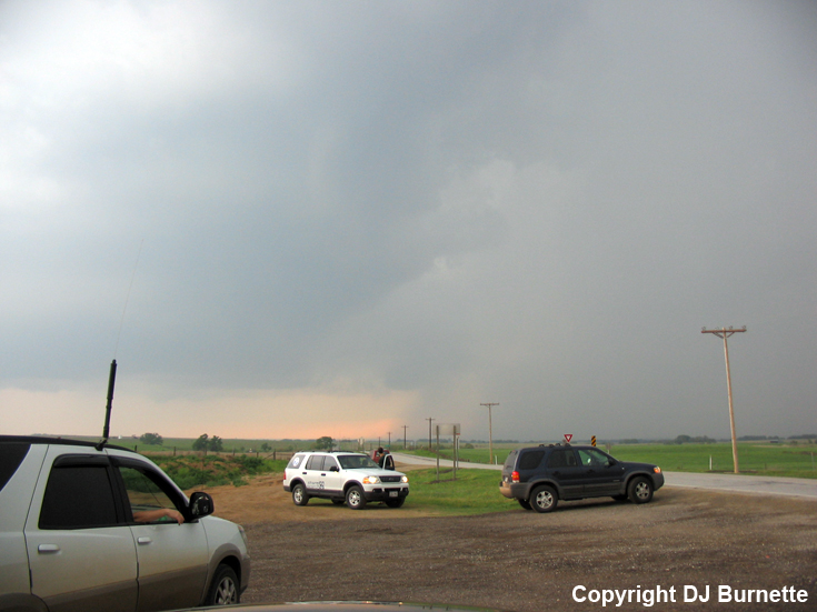
We continued to follow the storm farther north, and made another stop about 10 miles south-southwest of Greensburg in order to watch the storm we were on in addition to others approaching from the west--one of those had a wall cloud with it (image below; view is 10 miles south-southwest of Greensburg, looking west). Radar imagery is also included below (blue/white dot denotes our location).
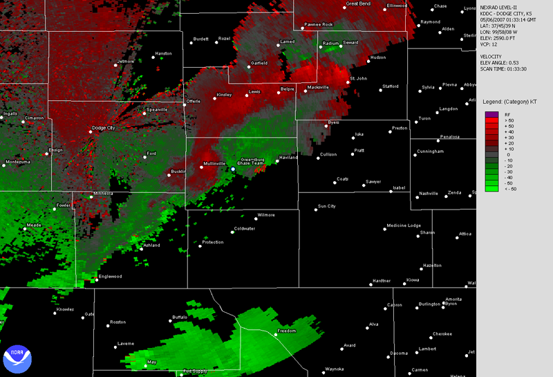
We moved closer to Greensburg on U.S. 183, and ran into the damage path from the previous night's tornado. The road was clear and we therefore proceeded cautiously north monitoring the tail-end of the storm we were on in addition to those coming in from the west. Jeff House spotted a brief funnel cloud to our east. This brief funnel cloud dissipated, but as we continued north on U.S. 183, a very pronounced funnel cloud developed directly in front of us down the highway. Jeff House called WeatherData to inform them, while I made a call to KSNW-TV to report the persistent funnel cloud. A tornado quickly developed just west of Greenburg by about a mile, while Jeff and I were on the phone. We stopped about 2 miles southwest of Greensburg. The tornado was only on the ground for a matter of seconds, and fortunately missed Greensburg and other buildings nearby. I was unable to get any pictures of the tornado since it was short-lived and I didn't have the camera at the right place and right time. Jess Gagnon got video though, and I will post images from that once I obtain them with the Gagnon's permission. Radar images from this time are below (blue/white dot denotes our location).
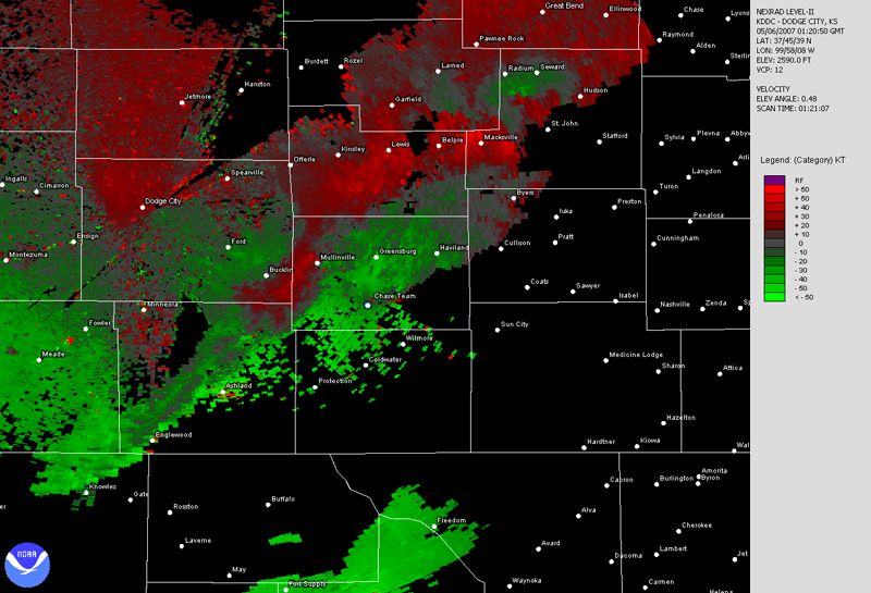
Dodge City, KS Base Velocity 0133Z
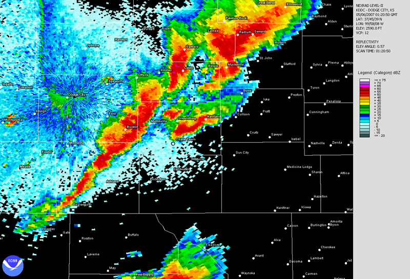
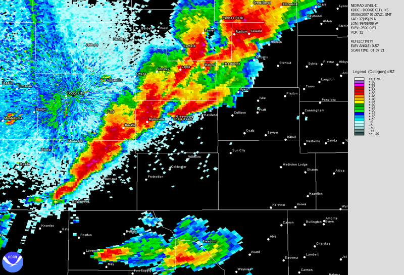
Dodge City, KS Base Reflectivity 0137Z
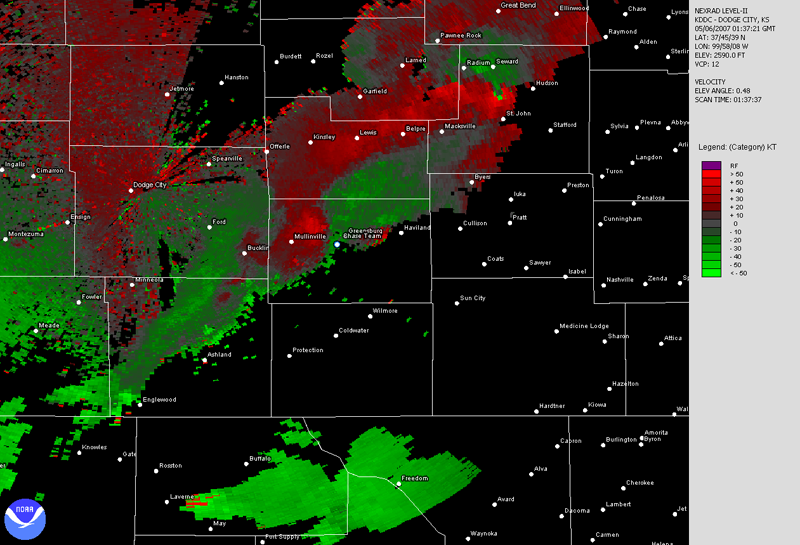
Dodge City, KS Base Velocity 0137Z
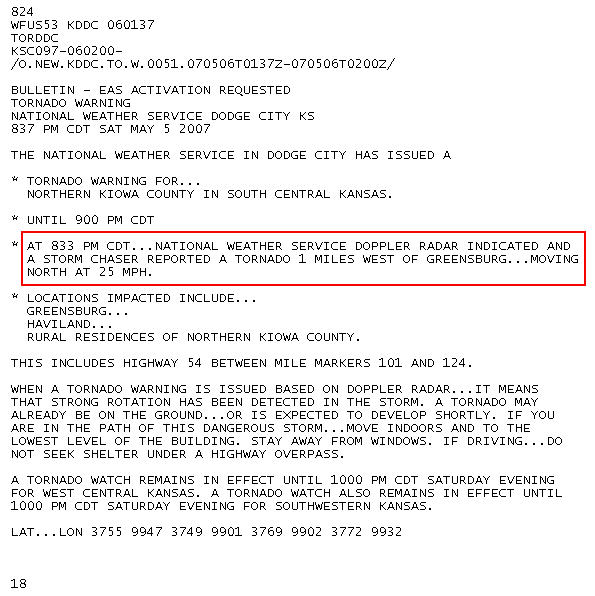
This tornado seems to be the result of a backbuilding storm that collided with the leading edge of other storms moving in from the west. This would explain why the tornado was rather instantaneous and brief. I made two on-air reports from the field on KSNW-TV, who in turn relayed the information to the National Weather Service in Dodge City. No tornado warning was in effect at the time, and this of course shows the value of trained storm spotters in the field. This was the ground-truth the National Weather Service in Dodge City needed, and a tornado warning (see text below) was issued based on our relayed storm report from KSNW-TV.
The storm was moving northeast of Greensburg, but there was no good way around the town. This combined with increasing darkness and more storms moving toward us from the west, we decided to end the chase. Thanks to Kate Danna at WeatherData and Dean Jones at KSNW-TV for morning discussions. Thanks to Scott Breit and Tyler Harmon at WeatherData and Dave Freeman, Andrew Kozak, and Leon Smitherman at KSNW-TV for nowcasting support.