Storm Chase Log 28 March 2007
Chaser: Dorian J. Burnette
Preliminary Destination: Hollis, OK
Note: Images have been decreased in size. Click on an image to view a larger version.
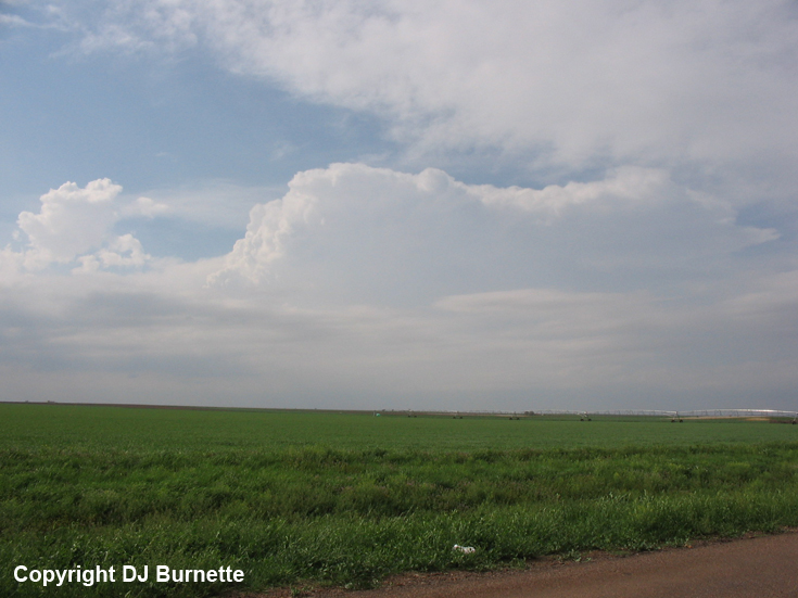
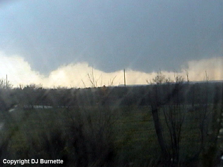
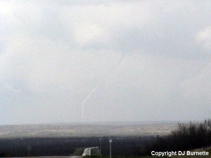
I departed Fayetteville, AR shortly after 9 a.m. CDT, but stopped in Lawton, OK, to check the latest data and have a late lunch. The dryline was still well out to the west near the NM/TX line, but it continued to appear that the thunderstorms would develop ahead of the dryline in the deeper moisture supply. Good instability had already developed from the southeastern TX Panhandle southward into western TX. Thus, preliminary target of Hollis, OK, was maintained, and I arrived in Hollis shortly after 3:30 p.m. CDT. Thunderstorms were developing off to the west. The lead thunderstorm was located just across the TX/OK line (image below; view is west of Hollis looking west). I decided to follow this lead thunderstorm, and moved north on OK-30 out of Hollis. This storm looked less impressive with time though. Meanwhile, there were other thunderstorms farther to the west into the TX Panhandle, so I decided to move west on OK-9 and TX-203 to Wellington, TX, and then south on U.S. 83.
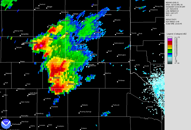
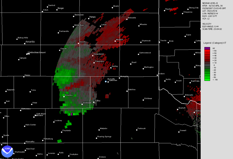
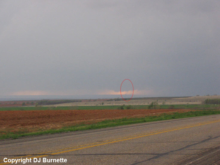
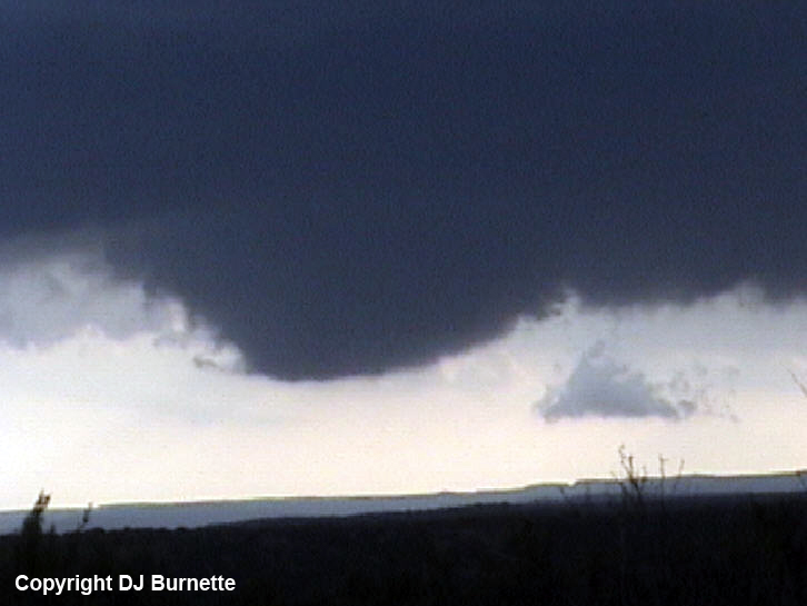
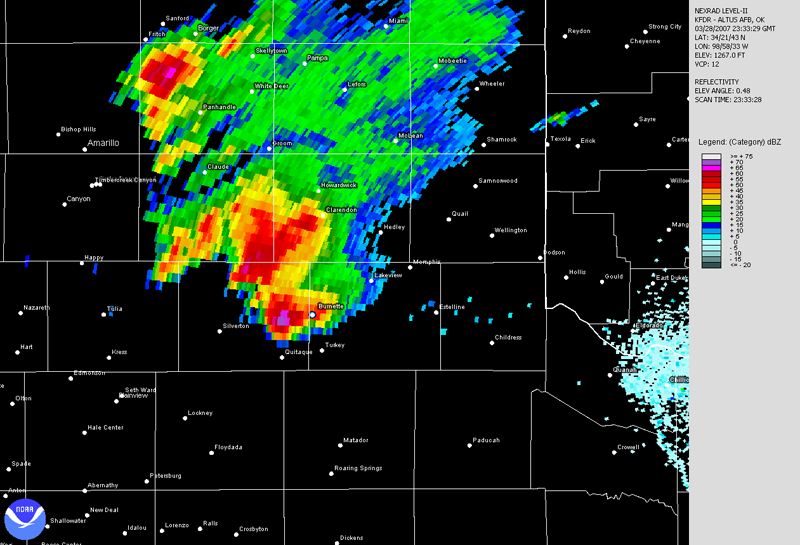
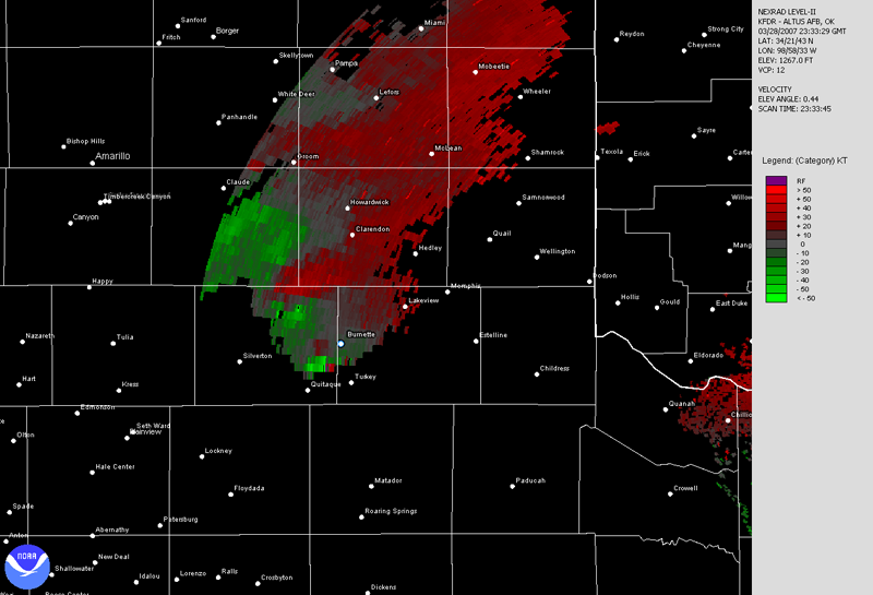
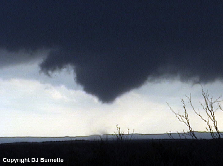
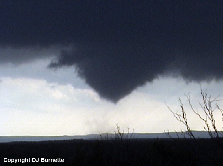
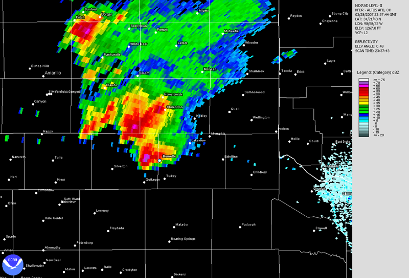
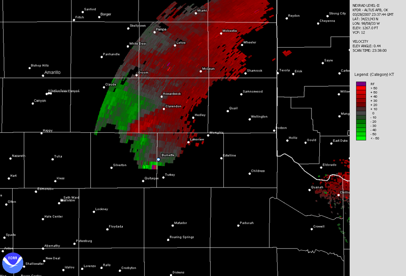
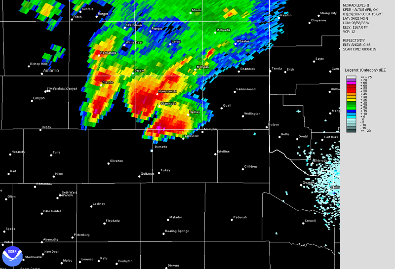
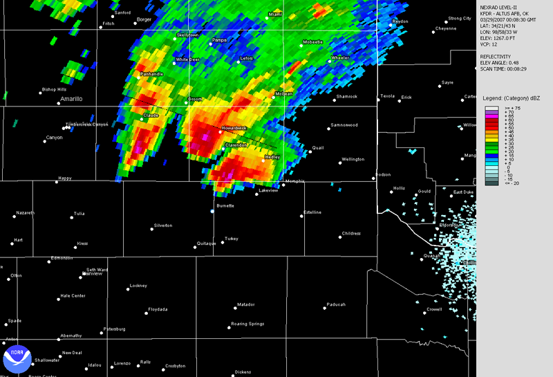
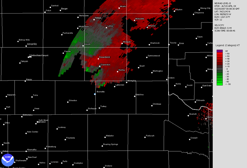
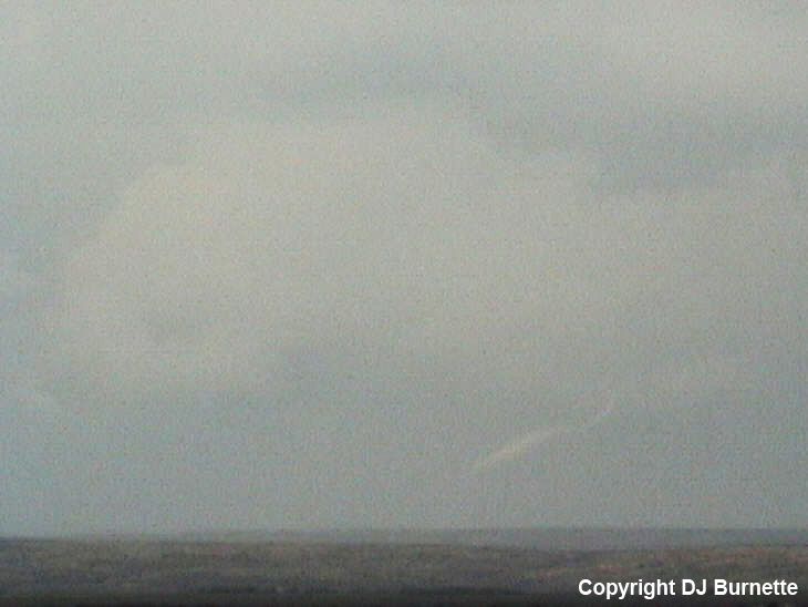
I heard about tornado warnings on NOAA Weather Radio as I was moving south on U.S. 83. Silverton, TX, was one of the towns mentioned in the warning, and after studying the map, I made the plan to move west on TX-256 toward the tornadic thunderstorm. I could finally see the updraft base of the storm once I got west of Lakeview, TX, and cleared some trees. A tornado was already on the ground, and had entered the rope stage. This tornado dissipated by the time I found a good position to pull over. Another weak tornado developed though (image to the below; circle denotes the tornado; view is west of Lakeview looking west-southwest). Immediate calls were made to report the tornadoes. The radar images from this time frame are below with a blue/white dot denoting my location.
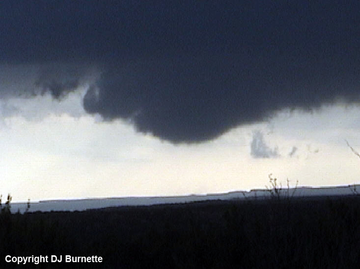
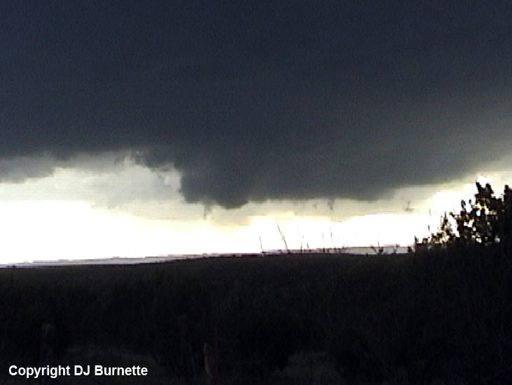
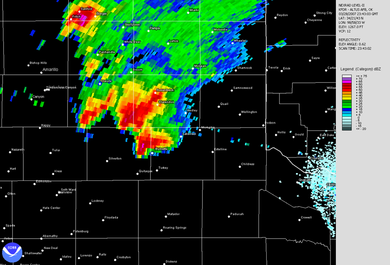
Visibility of the updraft became increasingly restricted as rain associated with another thunderstorm to the south was in between me and the updraft. This southern-most storm immediately caught my attention with a large wall cloud toward Caprock State Park, TX. I quickly moved south on TX-70/256 in order to intercept this southern storm. I stopped where TX-70 splits from TX-256 to photograph the wall cloud (first image below; view is near the TX-70/256 intersection northeast of Caprock State Park looking southwest). The wall cloud was moving toward me with plenty of cloud-to-ground lightning and some hail, so I stayed at the location for only a minute or so before I continued a bit farther to the south on TX-70 to get into a better position. I stopped about 10 miles north-northwest of Turkey, TX, and continued to watch the large wall cloud rapidly rotate (last three images below; view is north-northwest of Turkey looking southwest toward Caprock State Park).
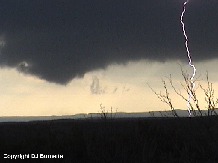
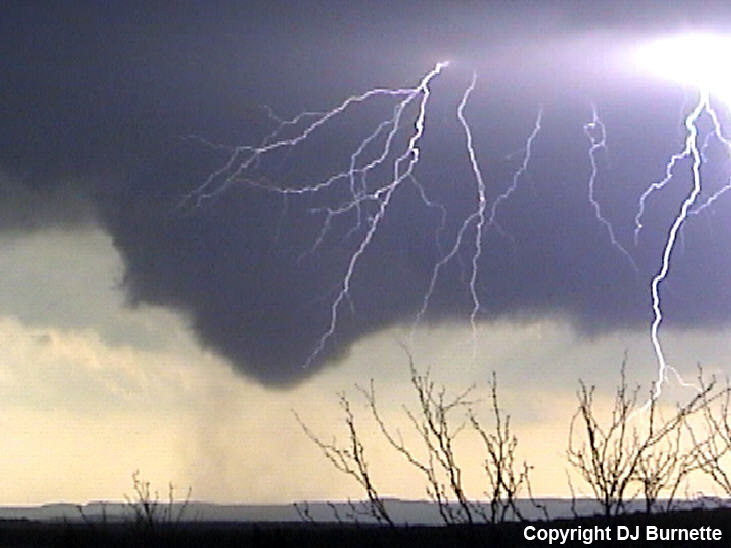
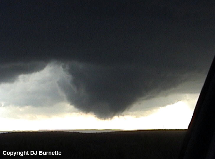
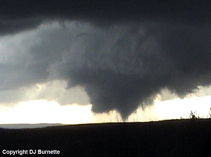
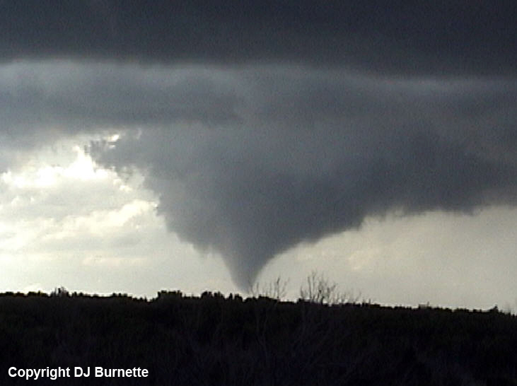
Cloud-to-ground lightning was quite frequent (see video captures of lightning in wall cloud images above and in tornado images below), and that kept me confined to filming the wall cloud from inside the car as the first tornado with this storm developed (images below; view is north-northwest of Turkey looking southwest toward Caprock State Park). Radar imagery is also included below (blue/white dot denotes my location). The radar data are at approximately the same time as tornadogenesis.
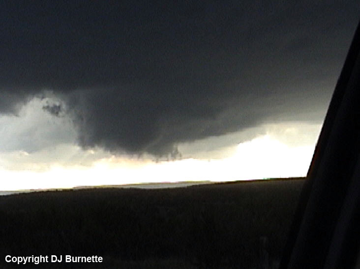
This tornado occurred for approximately 2 minutes. I then remained in the same location (about 10 miles north-northwest of Turkey), as the large wall cloud reorganized (images below; view is north-northwest of Turkey looking southwest toward Caprock State Park).
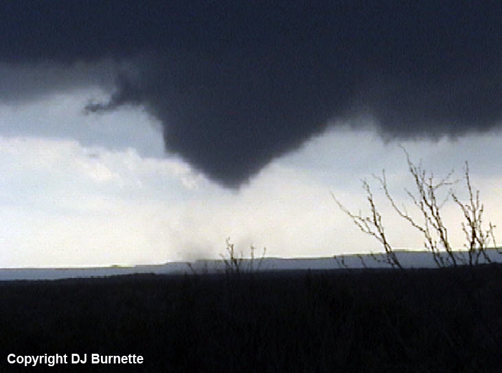
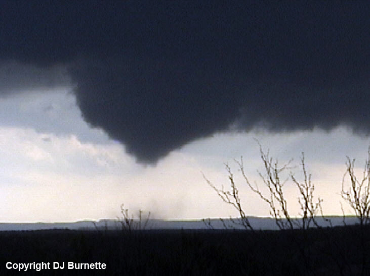
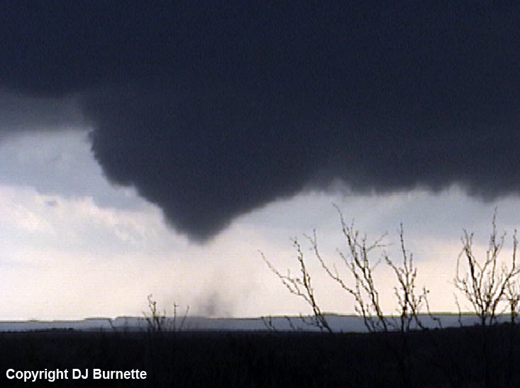
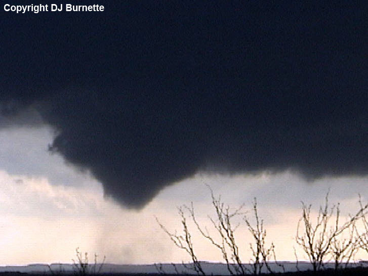
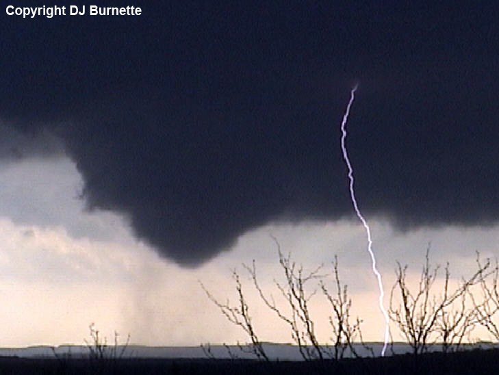
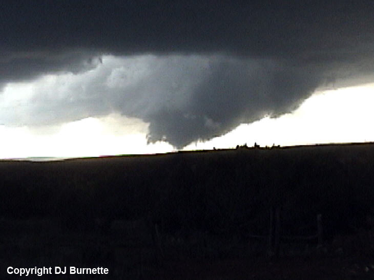
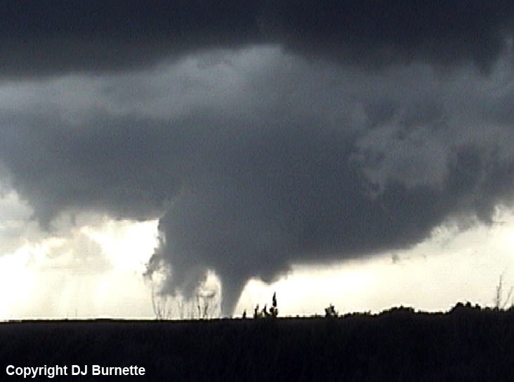
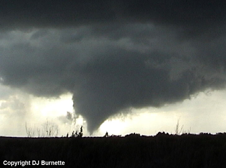
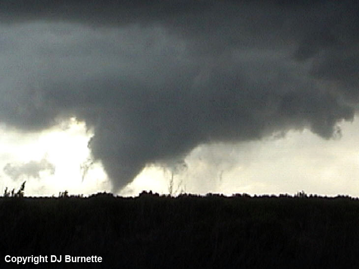
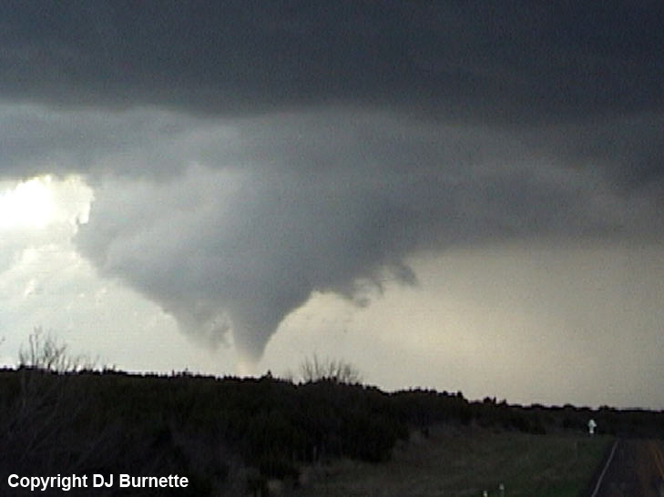
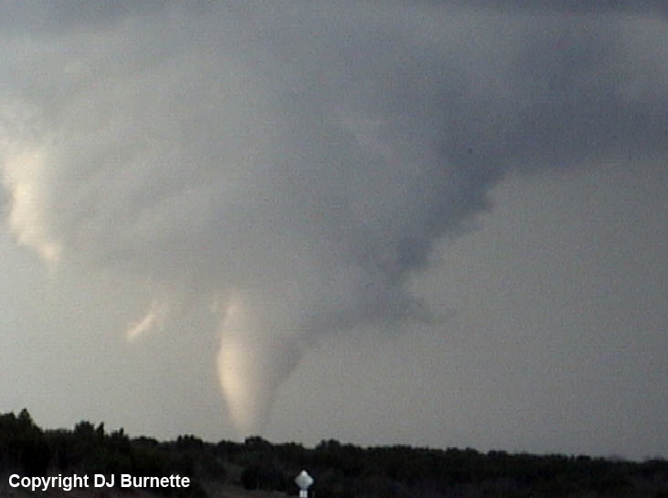
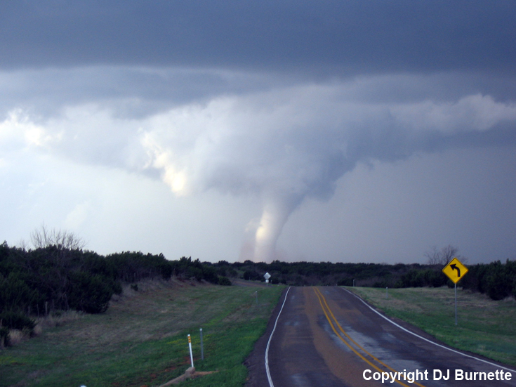
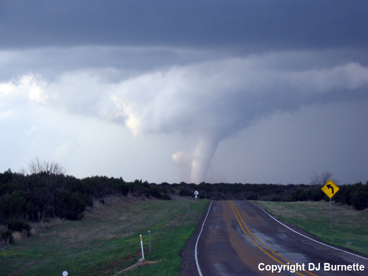
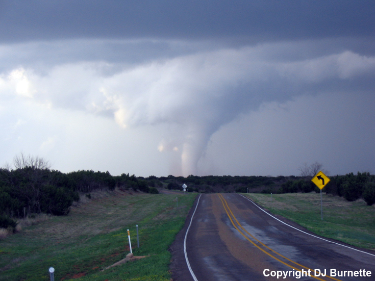
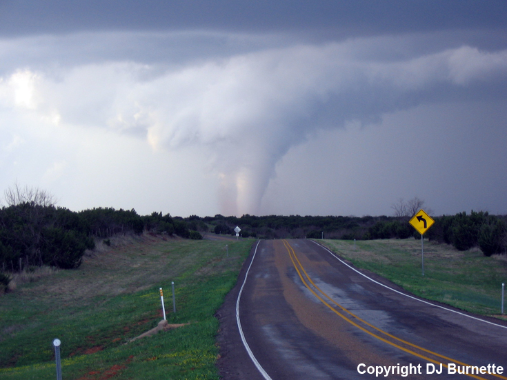
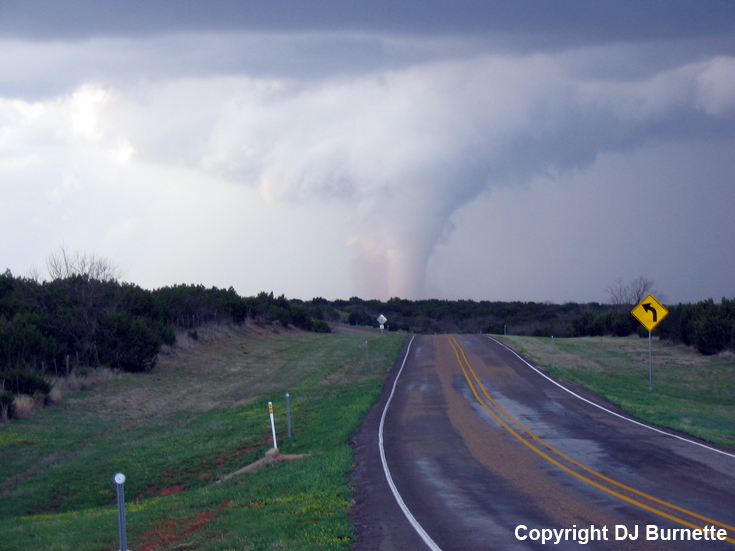
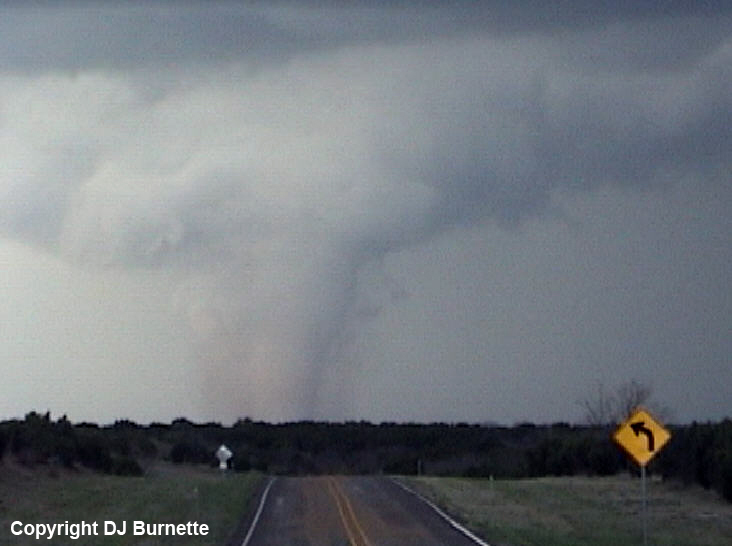
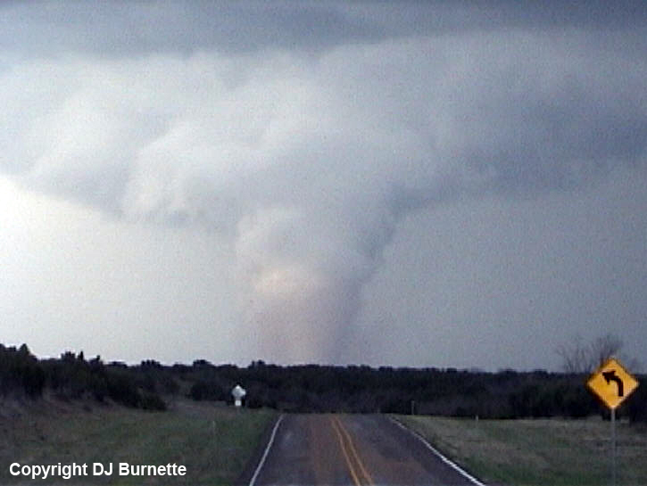
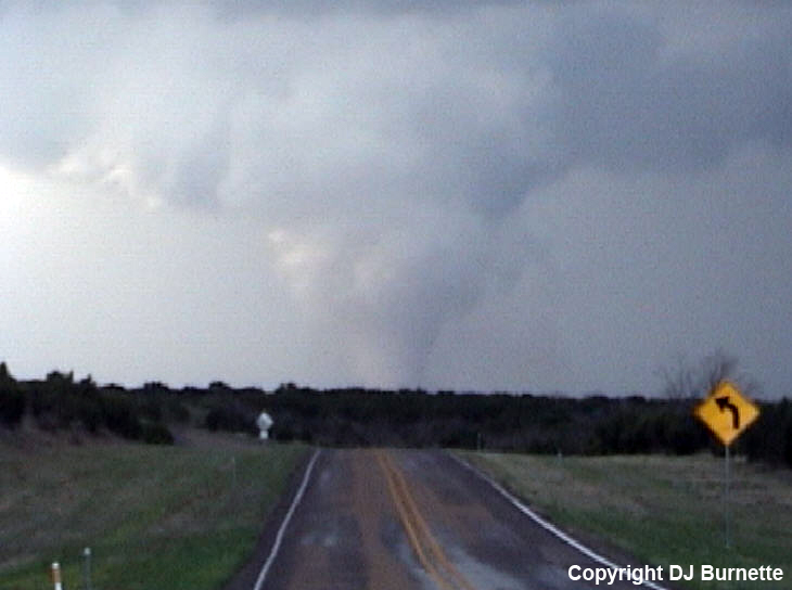
A long-lived tornado developed a short time later about one mile to my west, and immediate calls were made to report this tornado. The set of images below shows the tornado starting to the west and gradually moving off to the north of my location. This tornado was up and down for approximately the first 4 minutes of its life, but these off and on touchdowns were mostly spent on the ground. They were also from the same general circulation. Therefore, I am counting it as a single tornado rather than multiple ones. The last three rows of images below show the tornado as it moves to the north of my location. Radar imagery is included below (blue/white dot denotes my location).
Frederick, OK Base Velocity 2337Z
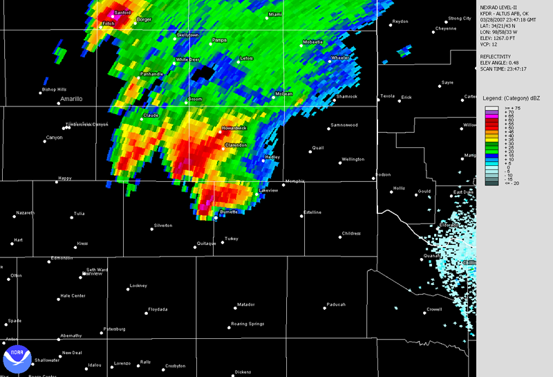
Frederick, OK Base Reflectivity 2343Z
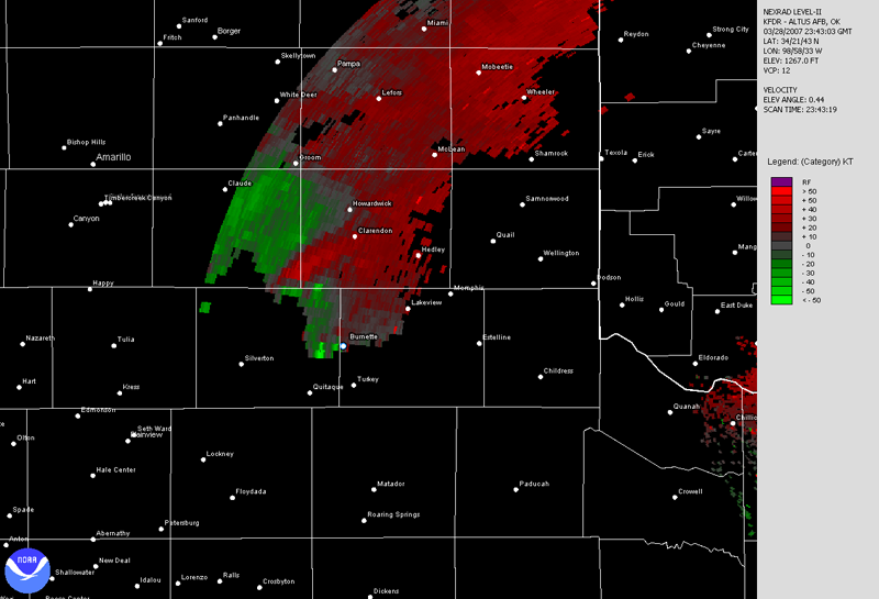
Frederick, OK Base Velocity 2343Z
Frederick, OK Base Reflectivity 2347Z
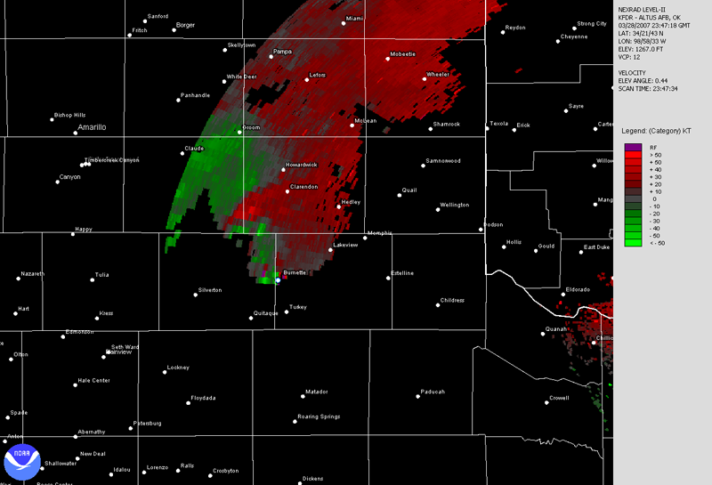
Frederick, OK Base Velocity 2347Z
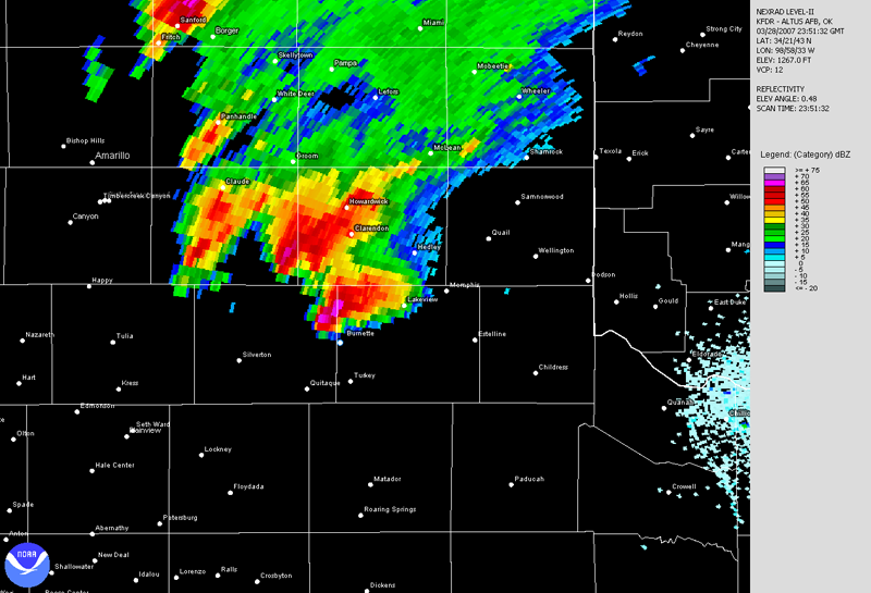
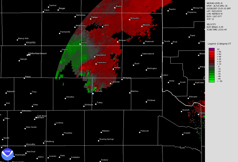
Frederick, OK Base Reflectivity 2351Z
Frederick, OK Base Velocity 2351Z
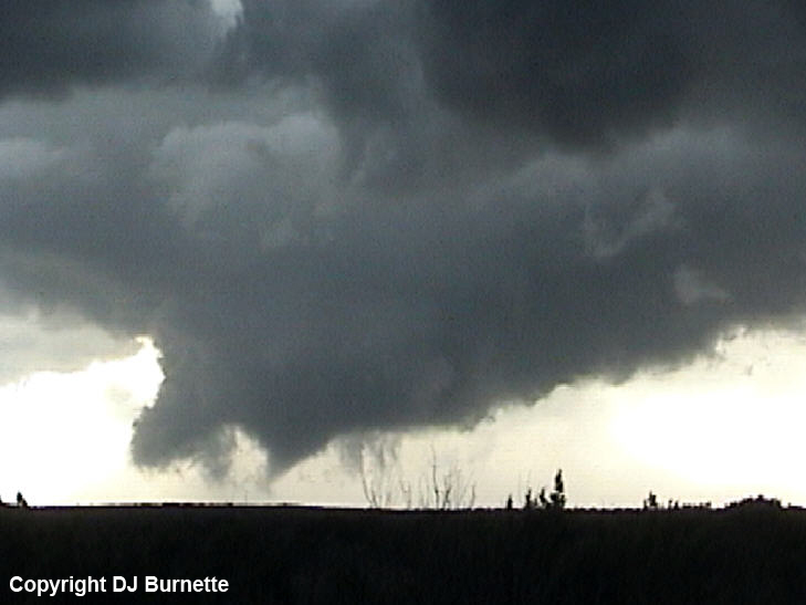
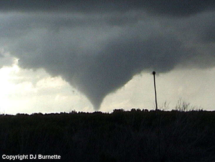
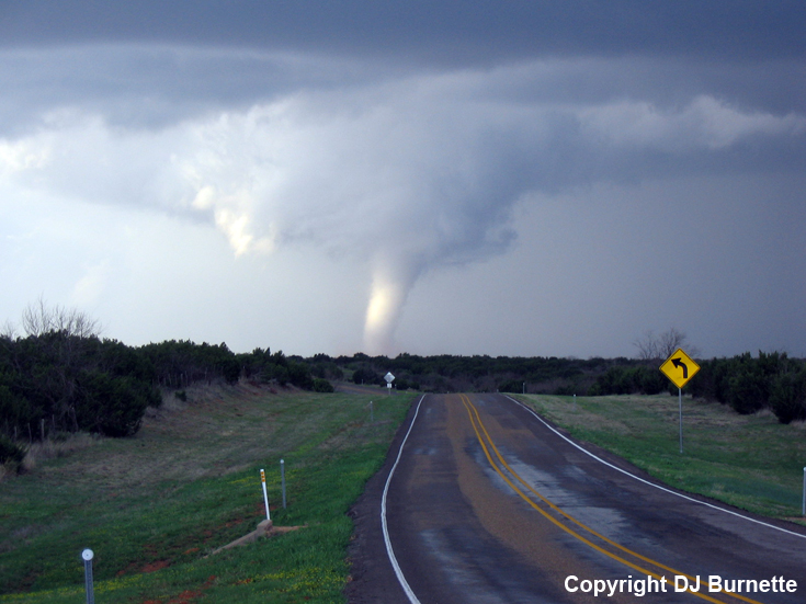
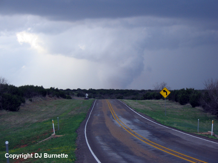
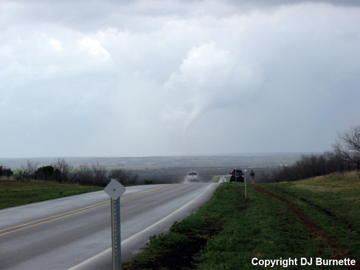
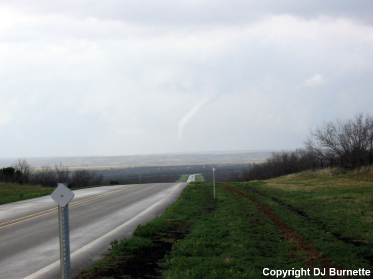
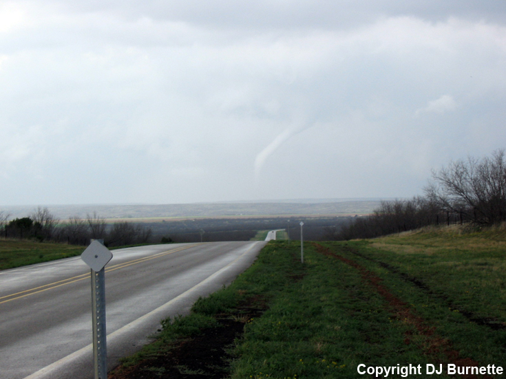
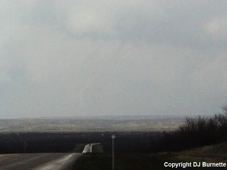
I followed the tornado north on TX-70, as it moved in the general direction of Brice, TX, and evolved toward the rope stage. I stopped on a hilltop on TX-70/256 about 10 miles northeast of Caprock State Park, and watched the tornado rope out. The images are below (view is looking north from the hilltop). Contrast problems arise in the last three images, and have been enhanced some with Photoshop. Links to the radar imagery during this period of time are below (blue/white denotes my location).
Frederick, OK Base Velocity 0004Z
Frederick, OK Base Reflectivity 0008Z
Frederick, OK Base Velocity 0008Z
This tornado lasted for approximately 26 minutes (including the 4 minutes of ups and downs), but fortunately, it did not cause much damage. I continued to watch the remnant wall cloud, as I moved north on TX-70/256. There were a number of cars and police south of Brice, TX, near the intersection of TX-70 and TX-256, and it quickly became apparent that I was going to be held up in that. Thus, I decided to stop the chase, since darkness was approaching and the storm was getting away from me. Thanks to Andrew Gagnon at WeatherData for an early morning discussion and thanks to Guy Pearson and Tyler Dewvall at WeatherData for nowcasting support.