Storm Chase Log 9 May 2006
Chasers: Dorian J. Burnette, Steve Boss, Erin Boss, Sarah Boss, Malcolm Cleaveland, Jeremy Howard, Jo Ann Kvamme, David LaRue, Curt Rom, Clio Rom, and Zoe Rom
Preliminary Destination: Okemah, OK
Note: Images have been decreased in size. Click on an image to view a larger version.
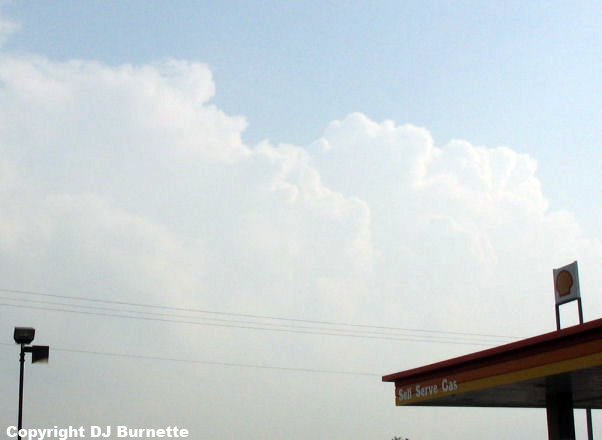
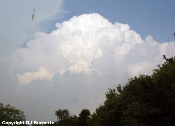
We departed Fayetteville, AR at 1 p.m. CDT, and the closer we got to Okemah, the more towering cumulus clouds were observed. We arrived in Okemah shortly after 4 p.m. We also met up with Jeremy Howard from WeatherData, Inc. We sat in Okemah for about an hour watching towering cumulus clouds to our south, west, and north. The most persistent development was occurring to our south though. East-northeasterly winds were observed at our location which suggested the outflow boundary from morning thunderstorms was located to our south. Development along the outflow boundary just off to our south was becoming more impressive with time (image below; view is looking south-southwest from I-40 and State Highway 27 in Okemah), and shortly after 5 p.m. it was time to move south toward the towers.
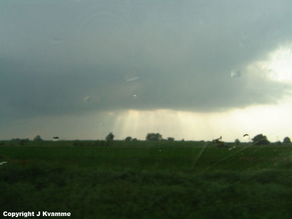
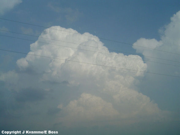
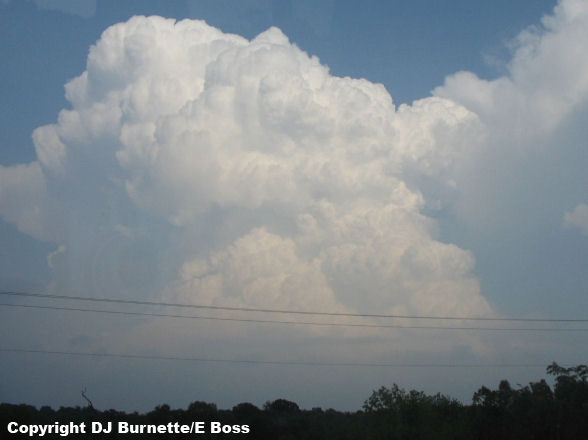
Impressive towers were observed both to our west-southwest and east-southeast. We were closer to those to the west-southwest, so those were the initial focus. We moved south on State Highway 27, then west on State Highway 9, and then south on State Highway 48 toward Holdenville. Towers off to our west were still looking respectable, so we moved west on U.S. 270 and then south on State Highway 56. The closer we got to Sasakwa, the less impressive the storm just to our west was looking (first image below; view is looking west from near Sasakwa). Meanwhile, the storm off to our east was exploding and was not too far away (final three images below; view is looking east from near Sasakwa).
State Highway 56 unfortunately turned back to the west and there were limited country roads that cross the Canadian River. Thus, our first challenge of the day--maneuver through the lame road network. GPS technology greatly assisted in this process and we were able to find a good country road to cut across via Spaulding. We eventually arrived at State Highway 48 near Lake Holdenville and began to move south toward Atwood. We then moved east on State Highway 1 which runs into U.S. 270 at Calvin. We continued on U.S. 270/State Highway 1 toward Stuart.
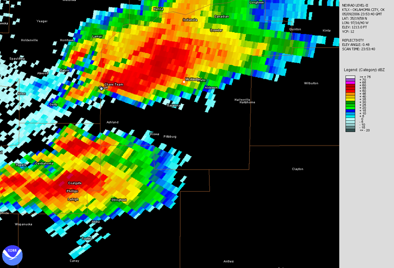
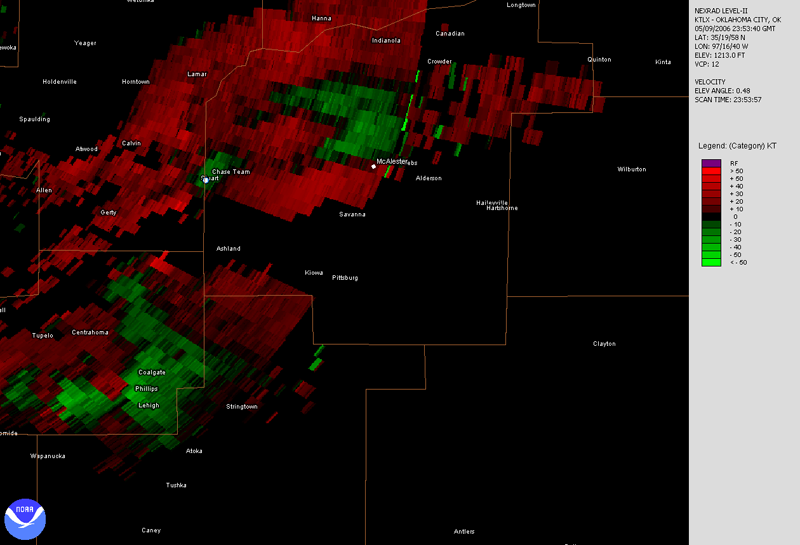
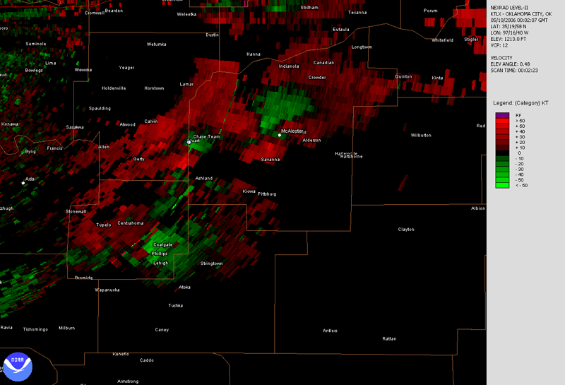
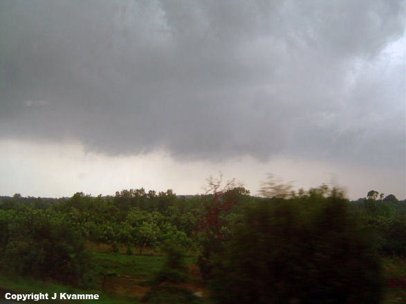
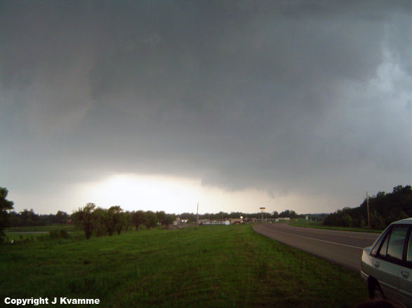
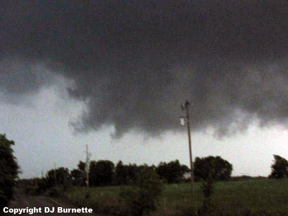
Things then began to get interesting real quick as we moved under the rain-free base of the storm. A tornado warning was issued on the storm, and we did observe the development of a minor wall cloud to our south (left image below; view is west of Stuart looking south). We stopped on U.S. 270 just east of Stuart to watch the storm. We observed good convergence and rotation off the surface, but inflow winds at the surface were weak. Overall wall cloud development was quite ragged (center image below; view is just east of Stuart looking southwest), but the storm was making an attempt at tornadogenesis. Further lowerings were noted off to the southwest of the main updraft too (right image below; view is just east of Stuart looking west). The radar signatures at this time were certainly good (links to radar below with a blue/white dot denoting our location) and the storm was on the outflow boundary. However, there was another storm off to the south that seemed to be impeding some of the best inflow. In addition, the hook echo on our storm materialized as a result of downdraft from the storm to the south being pulled into our storm (per Norman, OK radar loop). Perhaps this interaction with the storm to the south is why a tornado failed to materialize. Yet another experience where we see just how picky tornadoes are with ingredients.
Norman, OK Base Velocity 2353Z
Norman, OK Base Reflectivity 0002Z
Norman, OK Base Velocity 0002Z
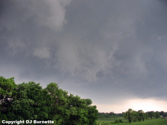
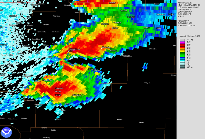
The storm began to transition toward a high-precipitation supercell and started to wrap rain around the main circulation, which was passing off to our south. Rainfall began to increase at our location and it was time to move out of that. Backbuilding of the storm continued as well and the lowerings there were catching our attention. We moved south on State Highway 31A and watched as a large wall cloud developed off to our west (image below; view is south of Stuart looking west).
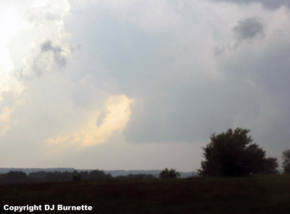
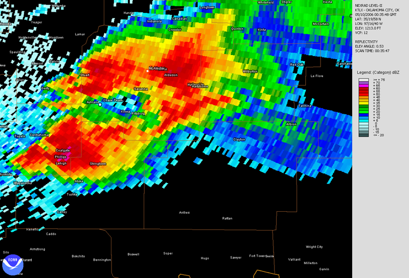
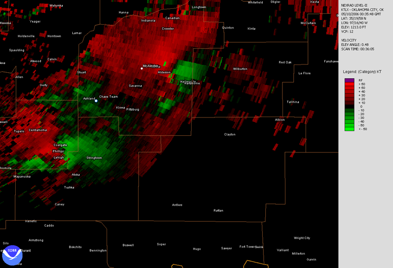
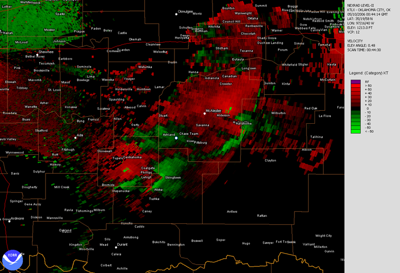
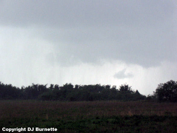
We kept an eye on it as we moved to the south, but it looked less healthy with time. I knew about the storm off to the south and I was very tempted to make a run for it. However, it would have taken some complex maneuvering on country roads to get around the hail core and our storm had the classic radar look to it at the present time. Thus, I decided to have us stay with the storm we were on. We eventually ended up back under the rain-free base east of Ashland, and observed a ragged wall cloud (first image below; view is east of Ashland looking south; image enhanced due to darkness) which eventually became wrapped in rain and dissipated (second image below; view is east-southeast of Ashland looking west). We also observed cool outflow in vicinity of the rain-free base, which was an indication to me that the storm was not healthy. Radar data accompany the images (blue/white dot denoting our location).
Norman, OK Base Velocity 0035Z
Norman, OK Base Reflectivity 0044Z
Norman, OK Base Velocity 0044Z
We then moved over to U.S. 69 in order to try to get around the southern storm prior to dark, since the back end of our storm was dying. This effort proved futile though because 1) the hail core (with the potential for baseball hail) cut-off our route north of Stringtown and 2) darkness was fast approaching. Thus, we decided to call it a day.
Thanks to Andrew Gagnon at WeatherData for an early morning discussion and thanks to Cory Phelps for nowcasting support.