Storm Chase Log 3 July 2005
Chasers: Dorian J. Burnette, Brittany Millspaugh, Andrew Gagnon, and Jess Gagnon
Preliminary Destination: Great Bend, KS
Note: Images have been decreased in size. Click on an image to view a larger version.
We left Wichita around 2 p.m. CDT immediately bound for a lone supercell thunderstorm that was moving toward Great Bend, KS. Once we passed through Sterling, KS, the supercell was rapidly moving toward K-96, which was the highway we were on. We did observe downburst winds from the storm and some rotation, but no tornadoes. I called WeatherData to let them know the observations so far. It was then quite clear that we would never make it to Lyons, KS without being totally engulfed by the storm. Thus, we moved east and then north on country roads in order to get to U.S. 56 highway and be able to look to the west-southwest into the main tornado area (i.e. the hook echo on radar imagery).
Andrew and Jess were not far behind us (they had taken off from Wichita very shortly after Brittany and I did), but the storm quickly cutoff the route we were traveling on, so they kept an eye on conditions farther to the south and noted similar conditions that we observed.
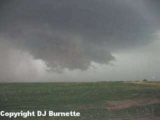
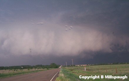
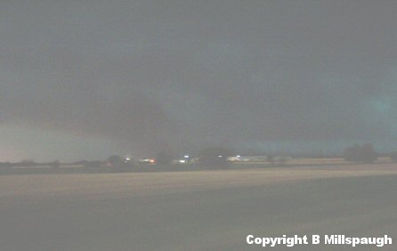
Chasing a high-precipitation supercell thunderstorm from the position of looking into the hook echo is difficult and requires constant movement in order to avoid being hammered by downburst winds and hail (which in this storm's case were 70 to 80 mph winds and baseball-size hail). Thus, our plan was to get into a good position and take pictures, then move farther east and take more pictures, etc. while constantly keeping an eye on the storm for any sudden tornado development. Most of our observations though were in the form of downbursts with an occasional wall cloud that would develop and briefly remain visible before becoming completely rain-wrapped. One of our stops occurred immediately south of Little River, KS and I reported back to KSN to let them know the observations up to this point (images from this location are below with a decaying wall cloud in the first image below; view is south of Little River looking west and southwest).
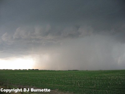
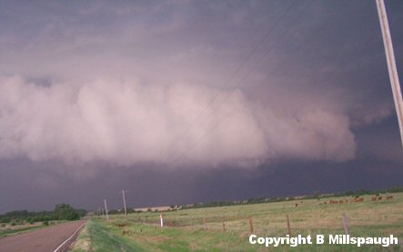
We then moved a bit farther east into western McPherson County and stopped again. A decent wall cloud was noted for a short period of time before it became rain-wrapped. No tornado was ever observed though. The images from this stop are below (view is west of McPherson, KS looking west).
I called KSN back to let them know the latest observations and then we proceeded east into McPherson and then south toward Moundridge, KS. Andrew and Jess caught up with Brittany and I at this time and we all traveled north back toward the storm that was now in vicinity of McPherson and had begun moving more eastward than southeastward. By the time we arrived on its backside again, it appeared to us to be loosing its tornadic potential. A call to WeatherData confirms this. Meanwhile, we also were told of rapid thunderstorm development off to the southwest in Reno County. It was a no-brainer to make the call to move south on I-135 and then east on U.S. 50 toward Reno County.
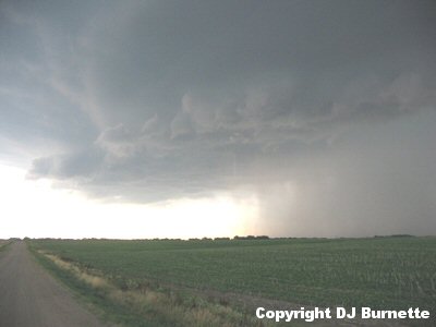
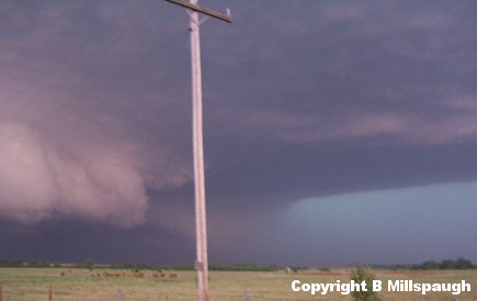
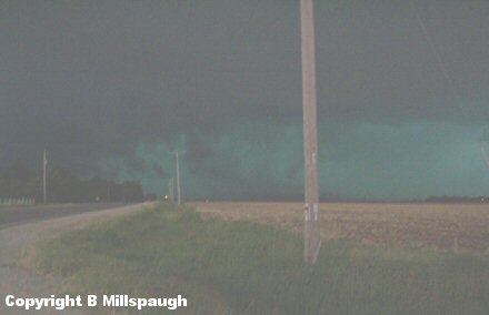
With the main tornado threat well off to the south of U.S. 50 we turned on a paved road out of Burton, KS and moved south to K-96 and then moved west toward Haven, KS. From Haven, we took another paved road south and sat just northeast of Cheney Reservoir. This storm was an absolute beast with inflow winds from our location on the order of 50 to 60 mph (i.e. the storm was creating its own environment). Cloud-to-ground lightning was nasty as well and it was impossible to stand outside without the fear of being hit. Any tornado that was going on in there (which it is hard to believe that there wasn't with such strong inflow winds and massive convergence going on) would likely be totally rain-wrapped. Immediate calls were made to KSN and to WeatherData to let them know of the situation. Images taken during this time are below (view is northeast of Cheney Reservoir and due south of Haven looking west).
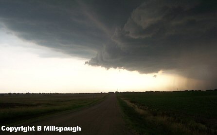
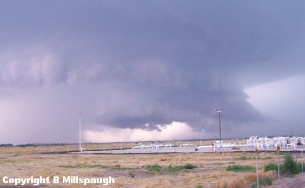
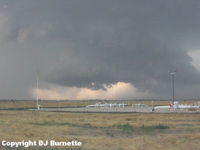
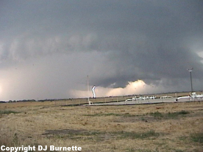
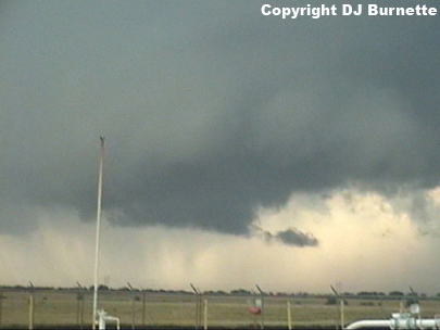
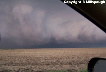
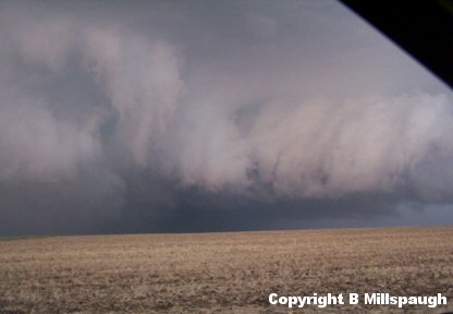
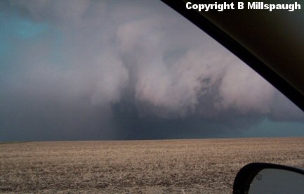
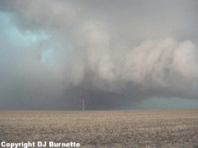
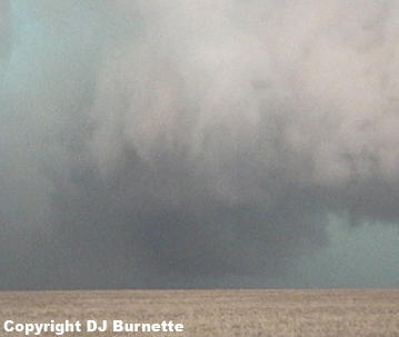
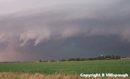
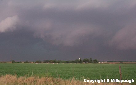
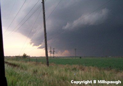
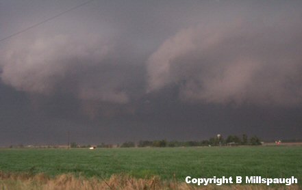
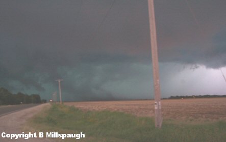
Again we had a high-precipitation supercell to deal with as we moved east and then north to get farther out ahead of it and still be able to look back into the main tornado area. Some of the most incredible storm motion I have ever witnessed occurred at this time. In the images and video below, the mesocyclone is noted on the left side and an inflow band is noted on the right. Significant convergence between the two was occurring. A wall cloud is noted in distance late in the video below and in the image on the far right below. No tornadoes were observed from it while we were watching. It is just remarkable to me that we did not have a larger tornado result from this storm (only ropes were reported). Perhaps there was a tornado larger than a rope in there and no one observed it due to the rain-wrapped nature of the mesocyclone. That said, Rodney Price at WeatherData, Inc. mentioned to me that the LFC (level of free convection) heights were a little high, and this could have been the environmental factor that was lacking. The images from this stop are below with a link to video as well (view is west of Mount Hope and southeast of Haven looking west).
Convergence Video (2 min, 7 sec)
We stayed at that location for as long as we could without getting slammed by hail and high winds, but while we were stopped I was making escape route plans. We then put the plans to use and moved north and then east in order to stay out ahead of the storm. We did run into some hail at this time, but it was not a heavy dosing and most of it was on the order of quarter-size though there could have been a few golfballs in their as well. No time to stop and take a look for certain on the size with the storm bearing down on us.
The storm chased us east and south around Mount Hope and down to Colwich. We stopped just east of Colwich and noted some good downburst winds with the storm and, of course, plenty of cloud-to-ground lightning (images below; view is east of Colwich looking west).
As the storm approached our location we observed a transformer pop, which was not caused by anything going on at our immediate location, but probably due to high winds that were easily viewable off to our west and southwest. Obviously, we chose to move farther to the east and south staying out ahead of the storm. We eventually moved south on 119th St West through the far western sections of Wichita. We noted that the tornado sirens were not sounding despite the fact that this storm had a tornado warning on it and moving into a major city! This was disturbing and illustrates the utter unreliability of those devices. Brittany called KSN to inform them of that problem. The storm, meanwhile, was becoming more outflow dominant all the time with numerous downbursts noted. Some of the tornado reports we heard about during this time are very questionable and were likely microbursts and gustnadoes rather than true tornadoes. We stayed with the storm as it continued to move east-southeast into Wichita and observed numerous downbursts (images below; view is from far west Wichita looking west).
The tornado threat from the storm was clearly diminishing, but the high straight-line wind and hail threats continued. Thus, we decided to seek shelter at the Gagnon's house in Haysville and let the storm move over us. All we observed were modest winds (not even reaching 40 mph), heavy rainfall, and cloud-to-ground lightning.
Thanks to Andrew Gagnon, Wes Etheredge, Scott Bryant, and Mike Doll at WeatherData, Inc. and to Dave Schaffer and Drew Davis at KSNW-TV for morning discussions and nowcasting!