Storm Chase Log 19 April 2003
Chasers: Dorian J. Burnette, Ali Bannwarth, and Cory Phelps
Preliminary Destination: Medford, OK
Note: Images have been decreased in size. Click on an image to view a larger version.
We departed Wichita around 3 p.m. CDT bound for northcentral OK where thunderstorms were increasing in intensity. Severe thunderstorms were occurring in Wichita at the time of departure, but with clouds and cool temperatures, those storms had no chance to become very organized. On our way down the Kansas Turnpike, we heard reports of rotation being observed with storms just south of the KS/OK line. We moved into Caldwell, KS and stopped to gas up, make certain equipment was ready to go, and look at radar data. NEXRAD radar showed a kidney bean shaped storm in western Grant county, OK. Thus, upon departing Caldwell, we moved south on U.S. 81 toward Medford, OK.
We turned west on Highway 11 and moved to the back end of the storm to the west of Medford, OK. We noticed rotation almost immediately, and called Wes Etheredge at WeatherData to receive some feedback. Wes mentioned the storm was the best looking of them all at the moment, but there were others off to the southwest that were showing signs of rotation too. He also mentioned that the storms to our southeast were not impressive at the moment. Thus, we stayed put and watched the storm attempt to become more organized.
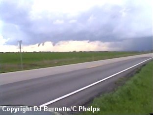
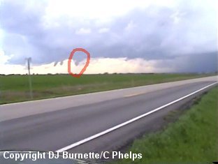
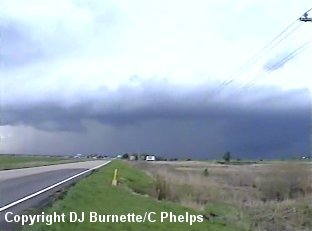
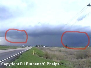
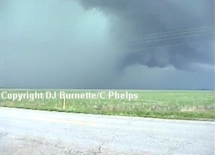
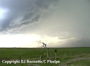
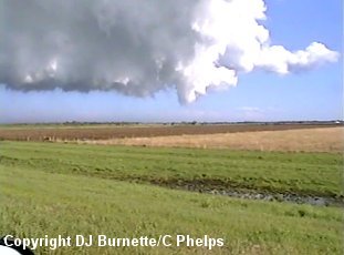
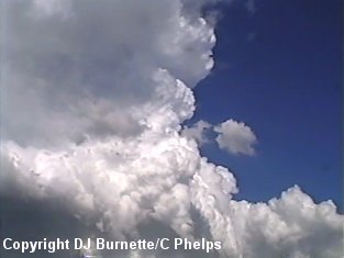
The storm began to look less and less impressive as it continued to move north-northeast into Kansas. Thus, we let it go and moved a little farther to the west toward another supercell. As we approached the storm, a weak tornado was noted along the flanking line. We attempted to capture some video as it lifted, but only managed to get the decaying funnel (images below...red circle denotes the decaying funnel cloud). We also noted a massive wall cloud off to our west-northwest (images below...red circle denotes the wall cloud). We were almost due south of Wakita, OK looking to the west when the video was shot.
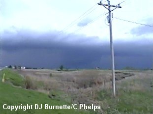
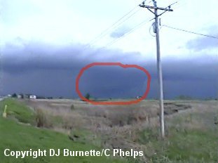
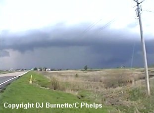
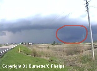
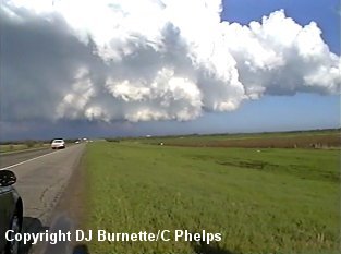
We continued to keep an eye on the storm, and watched another wall cloud attempt to become organized to the southwest of the main wall cloud (images below...red circles denote the wall clouds).
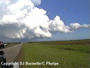
The smaller wall cloud to the southwest quickly became disorganized with the main wall cloud (images below...red circle denotes the wall cloud) becoming the main show.
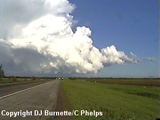
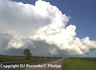
As the storm moved closer to us, a definite hail core was noted by the green skies behind the wall cloud (image below). To the southwest of that, a grumpy looking shelf cloud was noted (image below).
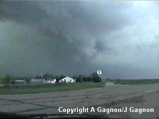
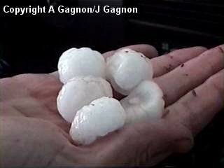
The storm was a definite high-precipitation supercell and turning toward the right of the mean flow. In an attempt to keep an eye on the massive wall cloud, we elected to move back east toward Medford and then north-northeast on U.S. 81. We kept a close eye on the wall cloud, but it was looking less healthy with time. As we were traveling north, the storm decided to let out a big downburst. We moved quickly north-northeast on U.S. 81 in order to miss the core (I go to great lengths to avoid hail). Andrew Gagnon (meteorologist from WeatherData) and his wife, Jess, viewed this storm as it passed over them on U.S. 81. Their images are below and include a dying wall cloud (now nothing more than a Scary Looking Cloud) and the hail they encountered. Andrew mentioned it was up to golfball in size.
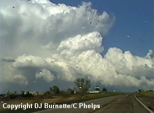
Meanwhile, we continued north on into Caldwell, KS to circle around and take U.S. 177 back south toward Braman, OK in order to keep an eye on the storm. The storm was definitely dying, and we only ran into a little bit of rain and some small hail on our way south. Meanwhile, around the Braman, OK area another storm had developed. It was a low-precipitation supercell with good rotation noted on its back side. After we passed through the town of Braman, OK, we noticed what could be identified as either a cloud of debris or as a fire off to our south near the back end of the storm. Unfortunately, U.S. 177 contains numerous trees that obstructed our view. Thus, we were unsure whether this was a tornado or just a fire, since the "feature" occurred over farmland. Given we did not observe this "feature" once we were in view of the area in question again, it raises the possibility that it was indeed a brief tornado. However, we were uncertain, and as a result, we did not call in a tornado report. Concentrating on the back end of the storm also brought us underneath the core of the low-precipitation supercell. A review of basic low-precipitation supercell knowledge says they will produce hail from what appears to be clear skies. This was indeed the case, as we passed under the storm, hail of quarter to half-dollar size fell in spots. We eventually ended up on Highway 11 east of Blackwell, OK observing the storm, as it began to transition into a classic supercell type. This storm was very persistent with rotation and wall cloud formation, but no tornadoes were ever observed. The images below were taken during this time. The view is east of Blackwell, OK looking east.
We continued to follow the storm to the northeast back into Kansas. As we moved east of Arkansas City on U.S. 166, we noticed the storm appeared to be decreasing in intensity. A call to WeatherData confirms this. Thus, with darkness looming, we decided to head back to Wichita.