Storm Chase Log 10 June 2002
Chasers: Dorian J. Burnette and Cory Phelps
Preliminary Destination: Salina, KS
Note: Images have been decreased in size. Click on an image to view a larger version.
We arrived in Salina around 2 p.m. CDT and stayed there for about an hour watching the latest trends. It quickly became clear that the storms were going to focus farther to the west and southwest of our location. Thus, around 3 p.m. CDT we moved southwest toward Great Bend.
As we moved to the west of Great Bend, we observed a couple of very good looking towers off to our west. As we approached the developing storm, I made a phone call to WeatherData to find out what was going on with the storm. Ken Stramn mentioned that the storm appeared healthy looking and was attempting to organize. Therefore, we continued on our path on into eastern Ness County to view the storm.
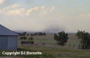
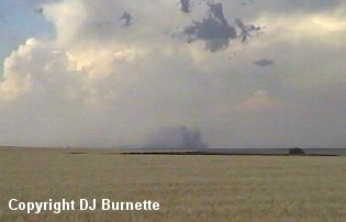
The storm was very healthy by the time we arrived near Bazine, and we pulled off on a dirt road to continue watching the storm. We noticed a tremendous hailcore with the storm in addition to plenty of cloud-to-ground lightning and a developing rain-free base. About 30 minutes later, we could tell the storm was having difficulty, as the tower representing the rain-free base matured and began to rain with no new cumulus development noted to the southwest of the mature part of the storm. We also were watching towers attempting to develop to our north near Hays. Those towers were having trouble too. However, skies continued to darken to our south toward Dodge City, and that was beginning to peak our interest. A call to both KSN and WeatherData confirmed the storm we are on was dying. They also mentioned that our dying storm was one of only two storms in the state at the moment. The one to the south was looking far better, and we decided to move west toward U.S. 283 and then southward on U.S. 283 toward Dodge City. On our way to the west toward U.S. 283, the storm we were on collasped with 80 mph downburst winds. We stopped briefly to film the downburst (images below). The view is looking north toward K-96 between Bazine and Ness City.
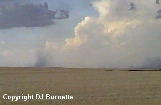
As we approached U.S. 283, we heard of a tornado warning for the part of the storm to the south of Dodge City near Minneola. After we passed through Jetmore, I made a phone call to KSN, as all we could see was dark skies in front of us. Dave Schaffer mentioned we would probably have to do some core punching if we continued southward. At around the same time, we observed outflow winds moving toward us. I mentioned to Dave Schaffer what we were observing in front of us (a good downburst signature from the field), and that it would probably be best if we moved east and then south to circle around the storm instead of going through or near the core.
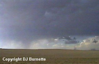
We meandered around on country roads and had some intermittent rain on us. We eventually arrived at U.S. 50 east of Dodge City. We continued on to the south and eventually passed around the town of Ford. At this time, I made another phone call to KSN and Dave Schaffer mentioned that the storm still looked very impressive and told us to be on the lookout for a massive hailcore with baseballs. He also mentioned that the storm was turning more toward the right and moving southeast toward Protection and Coldwater. We were having trouble seeing the storm. Dave reassurred us it was there and was a high-precipitation supercell (probably the reason we were having trouble seeing it).
We stopped briefly at Zeek's One Stop in Bucklin. We have stopped there before (Storm Chase Log 29 May 2001). The sack from that chase was still up on the "wall of fame." Cory and I signed another one and then moved south on K-39 out of Bucklin toward Sitka. The storm was not looking very impressive to us at all. We stopped and watched the storm for about 15 minutes, but it appeared to be in the dissipating stage at that time. A call to KSN and WeatherData confirms that the storm was dying. With that being the case, we decided to head back toward Wichita.