Storm Chase Log 22 May 2002
Chasers: Dorian J. Burnette, Archie Losey, and Cory Phelps
Preliminary Destination: Hays, KS
Note: Images have been decreased in size. Click on an image to view a larger version.
We arrived in Hays shortly after 3 p.m. CDT in case the storms would develop early. Instead, it took until 6 p.m. magic for the storms to fully develop. Shortly after 6 p.m. CDT, we saw a decent tower developing to the west of Hays, and decided to move northward along U.S. 183 toward the towers.
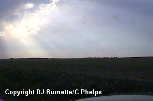
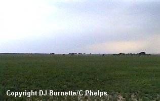
We pulled off on a dirt road north of Hays observing the towers off to our northwest (image above). We continued to follow the towers off to the north on dirt roads parallel to U.S. 183. We ran into some occasional rain with the storm, but nothing more than that. I made phone calls to WeatherData and KSN to let them know we were on a storm north of Hays. They both mentioned that it did not look very impressive at the moment. We continued to follow the storm north and stopped on occasion to let the rain lighten up and observe what was going on around us. During one of the stops, Wes Etheredge called my cell phone to let me know that the storm to the northeast of me had blown up all of a sudden and was now capable of tornadoes. He also mentioned that the storm we were on was also organizing. Thus, we decided to continued to follow the storm we on to the northeast.
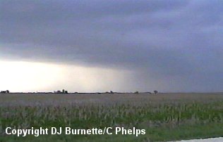
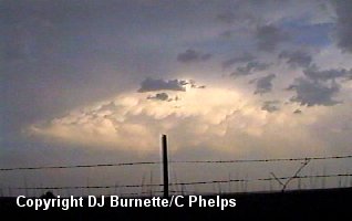
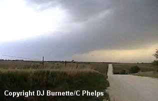
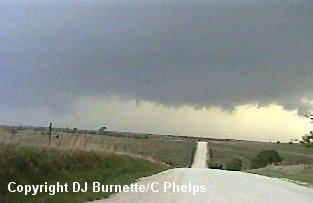
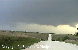
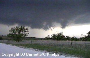
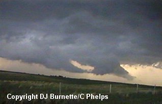
Eventually, we ended up near U.S. 183 south of Plainville under the rain-free base of the storm (image above). Nothing much was noted with the storm at this point with the exception of some rain and hail. There was a severe thunderstorm warning out on the storm by this time. We continued to follow the storm northeast, and ended up south of Codell observing a wall cloud and rain-free base (images below). The view is looking north toward Codell.
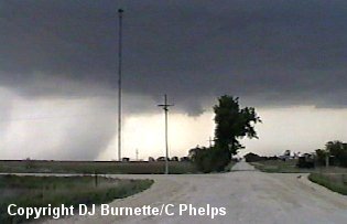
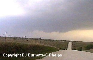
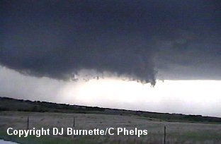
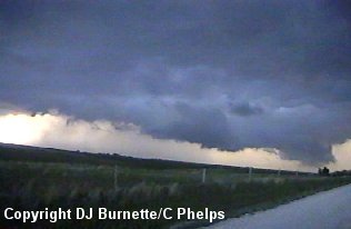
We followed the wall cloud east on K-18 east of Codell than then pulled off to continue to view the wall cloud (images below). The view is looking north-northeast toward Laton.
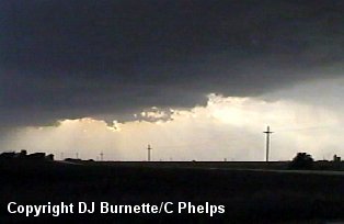
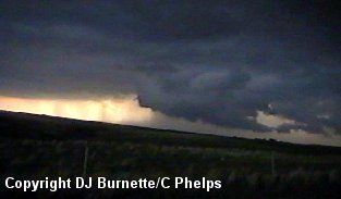
Eventually, the wall cloud began to dissipate. We then continued to follow the storm to the east on K-18 and stopped on a main road northeast of Natoma. The storm was loosing organization, but we noted two other storms around us. One contained some lowerings off to our west (toward Codell) and the other was directly to south (toward Hays). We had not heard of any severe thunderstorm warnings for the storm off to our south (image below), but there were severe thunderstorm warnings for the storm to our west (image below). Thus, we were probably going to head toward the storm to the west, but I call WeatherData just to make certain the thought is valid.
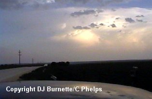
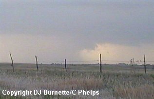
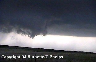
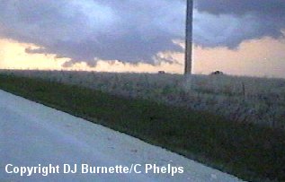
Wes Etheredge mentioned that the storm to the south was just raining and that was it, but the storm to the west was showing some rotation. Thus, we continued our way to the west, and ended up observing an ever-growing wall cloud. The following set of images is from this stop. We were located northeast of Codell and north of Natoma in extreme western Osborne County. The wall cloud pictures are looking west-northwest and the mammatus image is looking at the dying storm to our south.
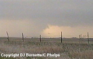
I made a phone call to KSN during this time to report wall cloud organization. Eventually, the storm was too close for comfort, so we moved farther to the east. Once we stopped, we noticed that the wall cloud had become increasingly massive. A funnel cloud developed during this stop, but nothing ever came of it. The following set of images are from this time. We were still north of Natoma and looking to the north-northwest.
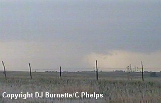
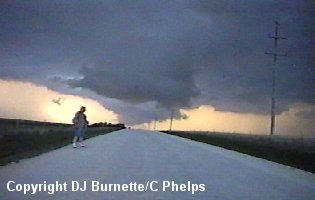
We eventually ended up back to the east on the main road leading northeast of Natoma watching the storm continue to produce off and on wall clouds. No further funnel clouds were ever observed. The following set of images were taken at this time. We were north-northeast of Natoma and looking to the north. The guy in the center of the bottom three pictures is Archie Losey.
Darkness quickly came upon us, but just before we packed everything up to leave, we were greeted by the Osborne County Sherriff. We mentioned to him what we had observed so far and he was very appreciative. I must say that I have ran into the most pleasant law enforcement officials on my storm chases so far. Hopefully, the "yahoos" will not take this good thing and turn it completely around.