Storm Chase Log 6 May 2002
Chasers: Dorian J. Burnette, Joseph Crane, Greg Hutchinson, and Cory Phelps
Preliminary Destination: Marion, KS
Note: Images have been decreased in size. Click on an image to view a larger version.
We looked at the latest data at Emporia State University, and after talking some things out, we decided to head westward on U.S. 50 and then up U.S. 77 toward Marion. We stopped at a Pizza Hut on U.S. 56 on the northside of Marion to eat as we watched a growing storm tower off to the west.
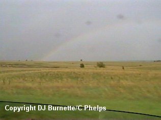
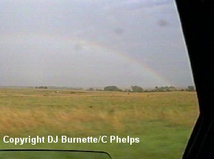
Eventually, the storm turned severe and we moved westward on U.S. 56 and then northward on K-15 into Durham following the backside of the storm. On our way toward Durham, we passed through some decent rainfall and some penny size hail. We also saw a beautiful double rainbow off to our east (images below).
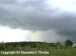
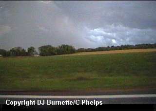
We stopped in Durham to allow the rain to subside. I made a call to KSN and Dave Schaffer mentioned the storm was pulsing up and down and had some golfball hail with it off to our north, but that was it at the moment. As the storm continued to move northeastward, we followed it on into Dickinson County. Finally, a rain-free base developed and we pulled off on a dirt road north of Elmo to view the storm (images below). The view is looking north toward Abline.
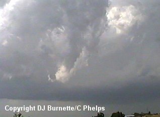
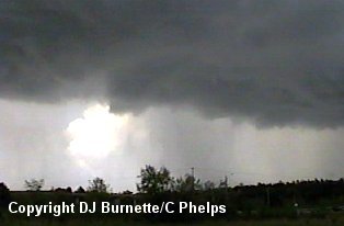
The storm was still having trouble, and began to look less impressive with time. I made a phone call to WeatherData and Wes Etheredge mentioned the storm was still pulsing up and down. We decided not to give up on it just yet and continued to watch it. About 15 minutes later, the storm began to show signs of increasing in strength once again. It was well off to our northeast, so we decided to move northward on K-15 to Abline and then eastward on I-70 toward Junction City. On our way we hear of law enforcement reports of a possible funnel cloud northwest of Junction City. Eventually we caught up to the rain-free base of the storm at the junction of I-70 and U.S. 77. We pulled off there to continue to watch the storm. We noted plenty of SLCs (Scary Looking Clouds), but nothing dramatic (images below). The view is looking north toward the I-70 and U.S. 77 interchange.
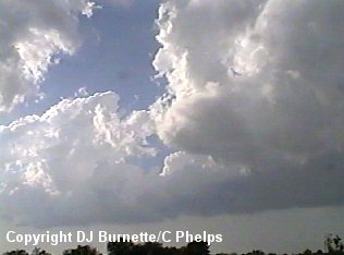
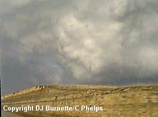
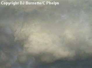
I made a phone call to KSN to let them know where we were and what we were seeing. Dave Schaffer mentioned there was a new thunderstorm developing to our south gaining in intensity. I then called WeatherData to for their opinion of the storm. Wes Etheredge mentions that the one we are on looked the best on the radar. The other things this storm had going for it were due east winds out ahead of it and an outflow boundary it could run in to. Given all of that, we continued to follow the storm eastward on I-70 and let the development to the southwest go for now. As we continued eastward on I-70 we ran into a little bit of hail from the storm near Fort Riley and had to pull off the road and wait for the hail to slacken off a bit. It was only a couple of minutes before the hail slackened off and sunshine returned to illuminate some incredible SLCs as we continued eastward on I-70 (images below).
We pulled off on a exit east of Junction City to keep an eye on the storm. The storm just was not doing anything with the exception of some hail. I made another phone call to WeatherData, and Wes Etheredge was just as confused as we were. He mentioned the storm was not looking very impressive any longer, and that the storm to our southwest was still trying to strengthen. Therefore, we decided to let the storm we were on go and move back westward on I-70 toward U.S. 77 and then move southward on U.S. 77 toward Herington.
The storm was fully developed by the time we approached the northside of Herington, and it was blocking our path from going any farther to the south. I made a phone call to WeatherData and Ken Stramn mentioned that the National Weather Service had just issued a tornado warning on the storm (radar indicated). U.S. 77 would lead us into the hailcore of the storm, and punching hailcores is not in my best interest when storm chasing. Thus, we moved westward on K-4 in order to move around the storm. We took some pictures of the storm as we moved to the west toward the town of Hope (images below), but we were way out of position to see anything other than a lot of rain and lightning.
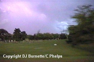
We got on a decent paved road south of Hope and moved southward on it. We were now in a position to view the backside of the storm. We saw some occasional lowerings, but nothing dramatic. However, it was also becoming quite dark, and our view was hindered quite a bit by the darkness. We eventually ended up southwest of Herington photographing lightning off to our northeast.