Storm Chase Log 11 April 2002
Chasers: Dorian J. Burnette, Greg Hutchinson, Adam Kennedy, Cory Phelps, and Andy Verbil
Preliminary Destination: Kingman, KS
Note: Images have been decreased in size. Click on an image to view a larger version.
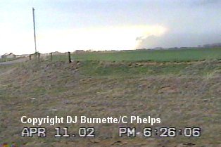
We never made it to our preliminary destination. We made our first stop in Goddard, and began to look at the Internet in addition to fueling up. We noticed a decent tower up to our north and at first we were going to move toward it, but then out of nowhere new development occurred directly to our west toward Pretty Prairie and Castleton. Given the explosive development, we did not hesitate one second and began to move into a position where we could observe this developing storm. Shortly before 5 p.m. CDT, we pulled off on a dirt road a couple of miles north of Cheney Lake to view the storm to our west and northwest. At this time, I made a telephone call to KSN and Dave Freeman mentioned that the storm was going up fast and looking very impressive.
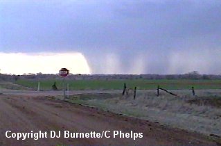
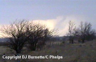
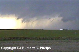
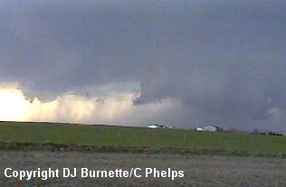
We continued to observe the storm from our location and noted an increase in rainfall and lightning. We also captured a downburst. The storm was now severe with severe thunderstorm warnings being issued. The first set of images below are from this point in time. The view is looking west-northwest between Pretty Prairie and Castleton.
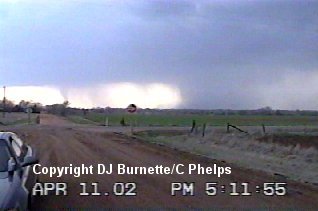
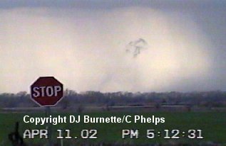
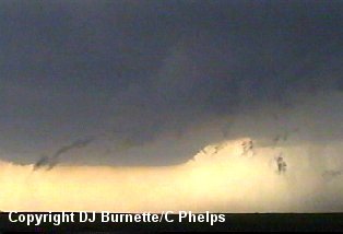
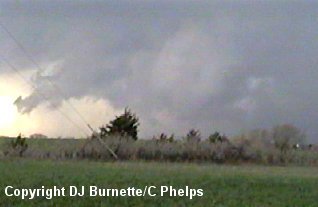
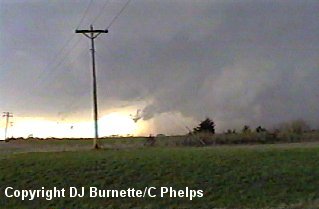
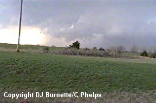
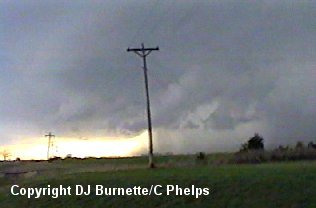
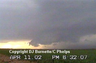
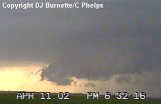
The rain-free base continued to develop to the southwest and our view became blocked by trees. It also began to rain at our location. Little did we know that the storm was making a hard right turn toward us at the time. With our view of the rain-free base becoming restricted, we began to head southward back toward Cheney Lake in order to reposition and view the back end of the storm. It was now approximately 5:25 p.m. CDT, and the storm had only been a storm for a short while. It seemed reasonable that it would be about another 10 minutes or so before interesting things would begin to occur. Unfortunately, this was not the case and Cory Phelps noticed the Pretty Prairie tornado on the ground as we were moving southward. We immediately stopped in order to grab pictures before it dissipated (images below). The view is looking west-southwest toward Pretty Prairie.
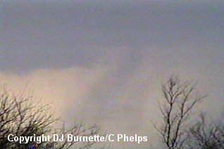
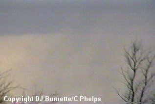
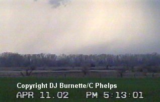
The tornado continued for about 30 seconds to 1 minute. Once it dissipated, we continued down the road in order to get into better telephone reception so I could call the report into KSN. It is important to note that the tornado was not associated with the main updraft of the storm. Instead, it was along the flanking line. Tornadoes are not rare along flanking lines, and this is a prime reason why you cannot concentrate on just one area of the thunderstorm.
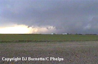
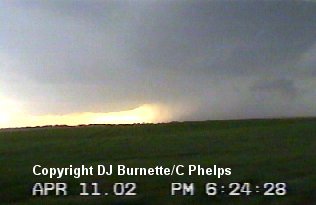
The call-in to KSN was an on-air live report. Once I got off the air, we continued southward on K-251 and stopped just north of U.S. 54 in order to take more pictures of the storm. A couple of wall clouds were observed, and I made another live on-air report with KSN at this time. The images below are from this time. The view is looking northwest toward Cheney Lake.
The storm was continuing to move in our direction, so we had to move southward every 5 minutes or so to stay out ahead of it. Each time we moved south, another on-air report with KSN was made and more pictures were taken. The images below are from these stops on K-251. The view is looking west between Cheney and Norwich.
We continued to track the storm to the west and southwest toward the town of Harper, but began to notice that it was decreasing in strength. After a stop in the town of Harper and with darkness upon us, we decided to head back toward home.