Storm Chase Log 13 June 2001
Chasers: Dorian J. Burnette, Greg Hutchinson, and Cory Phelps
Preliminary Destination: Salina, KS
Note: Images have been decreased in size. Click on an image to view a larger version.
All sorts of bad luck occurred on this chase! First of all, while we were in route to Salina, the front passenger side tire on my car blows out. Thankfully this occurred just before the McPherson exit on the I-135 (near a Wal-Mart), and no storms had developed yet. Thus, we were able to take a little break and look at conditions on the Internet while a new tire was put on the car.
Eventually the tire was fixed and we were back on the road to Salina. We stopped to look at the data on the Internet once we arrived in Salina. The visible satellite imagery showed a line of towering cumulus from west of Salina southwestward into southwest Kansas. I had moved the target chase area out of southern Kansas and into northern Kansas earlier that day due to strong surface winds (gusting over 40 mph) in southern Kansas. Strong surface winds can and do inhibit initial development. After a phone call to KSN, we elected to continue on the storms in northern Kansas and let the ones in the southern part of the state go due to strong surface winds. This was one thing we got right during the storm chase, as the storms in southern Kansas never did become organized and development in that area ceased a couple of hours later.
We moved westward out of Salina on I-70 toward the towering cumulus clouds. Eventually, we ended up on dirt roads west of Minneapolis looking at a rapidly developing thunderstorm off to our north. We continued to move north on dirt roads, and had an encounter with wildlife...a jackrabbit "raced" down a dirt road for a few yards. That was probably the highlight of the chase! Anyway, we eventually found out we had no chance of catching the storm to the north if we remained on dirt roads. Thus, it was time to locate a decent highway to move farther northward toward the storm at a faster speed. We eventually moved eastward on U.S. 24 toward U.S. 81, and then took U.S. 81 northward to Concordia.
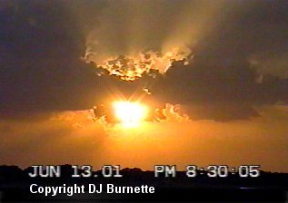
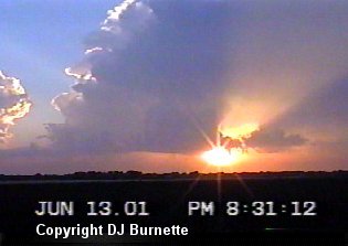
Once we arrived in Concordia, I made a phone call to KSN. The storm we were on was looking rather good from out viewpoint (severe thunderstorm warnings were now being issued), but KSN mentioned there was another storm rapidly developing off to out southwest back toward I-70. The severe weather theory about the tornadic potential of the most southern storm kept going through my mind. With some reluctance, we decided to move back to the southwest toward the new development to the west of Minneapolis. Once we arrived at that storm, it was quite clear it was beginning to have trouble, as the flanking line was gradually dissolving. Meanwhile, the storm we were on up until Concorida began to produce tornadoes once it arrived at the Kansas/Nebraska line. Tornadoes were reported in Thayer County, Nebraska. Meanwhile, the storm we were on died an ugly death about an hour later. Before doing so, I was able to capture a decent sunset (images below).
The lesson from this storm chase is clear...never abandon a good storm you are on for new development off on the south end until that new development becomes a severe thunderstorm.