Storm Chase Log 1 June 2001
Chaser: Dorian J. Burnette
Preliminary Destination: southeast of Newton, KS
Note: Images have been decreased in size. Click on an image to view a larger version.
This is what I will call a "reaction chase." I had a feeling thunderstorms were going to develop across southcentral Kansas, the question was just when would that happen. I decided to wait until the last minute and see if things would actually be able to break the cap. When I heard of a tornado warning for McPherson County with the storm moving southeastward, I decided it was time to head out to intercept the thing.
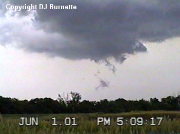
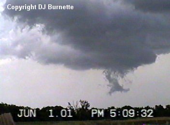
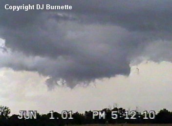
I started out heading westward on K-254. Once I came upon the junction of K-254 and Butler Road (a.k.a. Andover Road), I turned onto Butler Road and headed northward. At this time I began to see a large wall cloud well off in the distance. I decided to head west on the next dirt road and then take Greenwich Road northward. As I passed by Furley, KS, I took some pictures of the large wall cloud off to my north-northwest (images below).
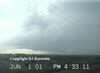
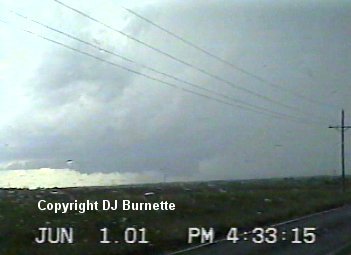
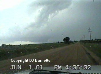
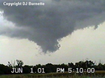
I continued to head north and east on dirt roads to get to a point where I could just sit and watch this thing. There was also another non-severe thunderstorm off to my west-southwest. So I made certain to get into a spot where I would be in between the tornadic storm and the non-severe storm. I found that spot on a dirt road southwest of the town of Elbing, KS just west of the Butler/Harvey County line. The big story with this storm was monster barks and no bite. As I observed the storm, the first large wall cloud dissipated and a new one formed. There were times when funnel clouds were observed. I also was able to photograph a complete sequence of wall development, maturity (with a funnel cloud), and disspiation (images in sequence below). Do note the amount of time in which all of this took place (approximately 3 minutes). This is a prime example of how fast changing the severe thunderstorm environment can be.
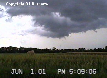
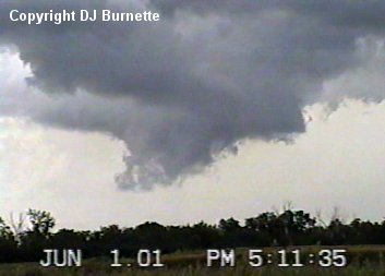
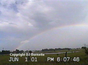
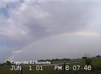
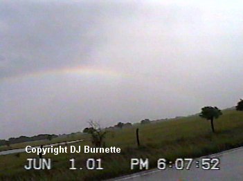
This was the storm's last try at tornadogenesis. The other interesting thing I noted from watching this storm was the fact that I saw very little cloud-to-ground lightning. The little cloud-to-ground lightning that I did observe was well away from the wall cloud. I did follow the storm for a short distance on into northwestern Butler County, but seeing nothing to concern me any, I decided to turn around and head back to the west where a couple of other thunderstorms were developing. No warnings were being issued on these storms, as they were mainly heavy rainers. I went through one of them, and as I came out of it into bright sunshine, I knew that there would probably be a very nice rainbow off to my east. I stopped at K-196 and Greenwich Road to view and photograph the rainbow (images below).
After photographing the rainbow, I continued south on Greenwich Road to K-254. From there I went east to Butler Road and then south to Andover. On the way, I hear of no more severe thunderstorm reports with the exception of thunderstorms that are way out west toward Dodge City. With that being the case, I decided to call it good and head back towards home.